The 50 Greatest Walks of the World - Barry Stone (2016)
22. WEST HIGHLAND WAY
East Dunbartonshire to Highland, Scotland
Distance: 153 km
Grade: Easy
Time: 8 days
Scotland’s first and still most popular long distance trail begins in Milngavie to the north of Glasgow and finishes at Fort William at the base of Ben Nevis, a total of 153 km. It was first thought of in the 1930s and brought to fruition in 1980, hastened by the success of the Pennine Way. Conceived as a south to north trail, this is the direction most choose to walk, seduced by some beguiling detours along the way due to its proximity to so many of Scotland’s most alluring peaks such as Ben Lomond and Ben Nevis. It is a walk of contrasts - contrasts in landscapes, geology, flora and fauna - and everywhere there are traces of human habitation - trails that were once ancient droving roads, or roads built in an effort to contain Jacobite clansmen - roads that have been followed by contemporary ribbons of bitumen or are estate drives or forestry roads, and yet only rarely does the presence of passing automobiles impinge on the sense of being ‘in the wild’.
The West Highland Way doesn’t just pass through places, it passes through history. The lands of the Earls of Lennox, a fiefdom of sorts in the 1300s that was distinct from the seven Provinces of Scotland; Breadalbane with its Neolithic chambered cairns, its cup-and-ring carved stones and thousands of cup-marked rocks, standing stones and stone circles of the late Neolithic and Middle Bronze Ages; and Lochaber, with its wealth of castle ruins and that engineering marvel of the early 19th century, the 97-km-long Caledonian Canal, linking Scotland’s east coast at Inverness with the west coast at Corpach north of Fort William on Loch Linnhe.
The trail is a fabulous introduction to everything Scottish. It skirts the shoreline of Loch Lomond, Great Britain’s largest expanse of inland water, the considered boundary between the lowlands of central Scotland and the highlands to the north. It passes under the craggy summit of Ben Lomond (974 m), Scotland’s most southerly Munro. It crosses Rannoch Moor, a world of blanket bogs and lochans, of grouse and red deer. A Special Area of Conservation, Rannoch Moor is one of Europe’s last unspoiled wildernesses and while walking here brings with it a rare sense of tranquillity and isolation, poor weather can turn it into a quagmire underfoot. But what would any walk in these parts be without muddied boots?
It is also a trail that is best walked in its entirety, if you are able to afford the time to do so, so as to fully appreciate more closely its highlights such as Buachaille Etive Mor, an unassailable-looking summit and one of Scotland’s most photographed Munros. There is the gorgeous U-shaped Glen Coe (Scotland’s most beautiful glen?) formed by Ice Age glaciers and surrounded on three sides by spectacular, wild, precipitous mountains. The Devil’s Staircase, a trail over the Aonach Eagach is climbed and then followed by a descent to Loch Leven, a full circuit of which is possible after years of planning on what is now the Loch Leven Heritage Trail. The Lairig, once the main route south from Fort William but long since bypassed, is now a rather desolate, dramatic passage with Glen Nevis on one side, Loch Leven on the other, and the Mamore Mountains and Ben Nevis - Scotland’s highest peak at 1,344 m - filling the horizon before you. Once past Glen Nevis, home to Steall Falls (Scotland’s second-highest waterfall with a 120-m drop), you come to the settlement of Fort William, itself a crossroads of several great trails, and the end of your traverse.
And its practicalities? Walking south to north means you’ll have the sun at your back, and the wind and rain either behind you or to your left instead of hitting you in your face. As to when to go, while July and August are the warmest months they are not necessarily the driest which is why it’s worth considering the ‘compromise’ period of May/June when you’re less likely to get wet, and it is a time when visibility can be exceptional, and the temperatures can be pleasantly warm-ish, even if higher elevations might have lingering snow lines. In May/June there is also less demand on accommodation, which is surprisingly plentiful considering how isolated walking the trail can feel. There are various B&Bs, three hostels (Rowardennan, Crianlarich and Glen Nevis), bunkhouses, private hostels, campgrounds, even wigwams - simple wooden shelters capable of sleeping up to six people and found mostly on private farms.
WEST HIGHLAND WAY
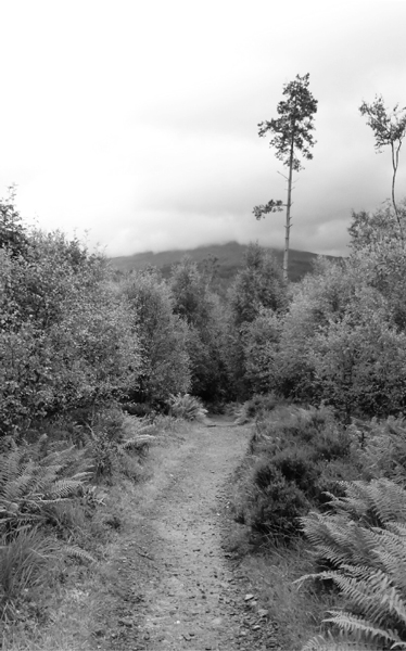
Photo: Martin Thoma
Naturally once in Fort William the choices of where to lay one’s head take a turn for the better - the Victorian charm of Ashburn House and the five-star comforts of Crolinnhe B&B with its extensive gardens come to mind. Or maybe not? Maybe, now that you’re sitting beside the bronze sculpture of a weary walker at the end of the High Street that marks the trail’s official start/end point, your appetite sufficiently whetted for highland walking, your thoughts might turn to the trail that starts here - the 117-km trail to Inverness, the Great Glen Way?