The 50 Greatest Walks of the World - Barry Stone (2016)
21. MORAY COAST TRAIL
Moray, Scotland
Distance: 70 km
Grade: Easy
Time: 3 days
Blessed with a variety of topography and wildlife that would be the envy of many a British coastal trail, from seals, otters and osprey to wildfowl and the always present Moray Firth dolphins, the Moray Coast Trail can begin or end at the town of Findhorn, or further afield though slightly inland at Forres, utilising a well-maintained bicycle trail. Forres is one of Scotland’s oldest towns, and from there all the way to the charming fishing village of Cullen, with its expansive sandy beach and ruins of Findlater Castle, you’ll have views over the vastness of the Moray Firth and the North Sea with its collection of skerries and coves visible from an exposed coastline that offers little sanctuary should the weather turn nasty. So don’t forget to pack the waterproofs.
This three-day trail is a delightful mix of beaches, coastal paths, virtually car-free roads, and old rail lines and ridges, and while you are never too far from civilisation in a region with a rich tapestry of human settlement, this mostly level trail with only a few steepish climbs still manages to possess an overwhelming sense of quiet - even of wilderness.
Entirely covered by public right of access and presuming you travel west to east, you can begin at Forres - the accepted site of Duncan’s castle from Shakespeare’s Macbeth - and head for the coast at Findhorn (or take a bus for this section if pressed for time). Look out for red squirrels as you pass through Roseisle Forest on your way to Burghead, the first of numerous old fishing villages to come.
Leaving Burghead you pass the Diageo maltings plant before joining an old rail line that follows the coast to the town of Cummingston and on to Hopeman and its array of colourful beach huts. A grassy section of rising coastline then descends to the lovely and oft-deserted Clashach Cove, with its interesting backdrop of cliffs which are all that remains of an ancient fossilised dune system incorporating some nicely exposed fossilised footprints of early reptiles if you pause long enough to look for them. It’s then up and along a ridge above Covesea Quarry (look for nesting fulmars in its sandstone cliffs) and a glimpse of Covesea Lighthouse ahead before another ascent takes you up and around a sandy bay from which you descend on to a stretched-out arc of a beach and a cup of tea at Covesea’s Tee Shack Cafe.
MORAY COAST TRAIL
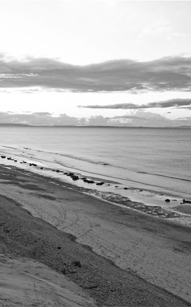
Photo: Lawsonstu
Working your way towards Covesea lighthouse you soon have a gorgeous, uninterrupted walk along 2 km of sandy beach before reaching the village of Lossiemouth, with its charming harbour at the mouth of the River Lossie. You then cross the Spynie Canal to Seatown, better known in days gone by as Dogwall because of the dogfish skins that were hung out to dry around its harbour. The dune system here is particularly interesting, a man-made collection of sandy hills that have been encouraged to accumulate thanks to the clever placement of old railway carriages, and which protect the town from fierce North Sea storms. If you’re walking here in late spring or early summer you’re likely to pass nesting terns as well as the remnants of gun emplacements and even tank traps, now mostly hidden in gorse bushes, built in the 1940s to deter a German invasion that never came.
After just over two hours’ walking on from Lossiemouth you’ll enter a military firing range where a red flag, if it is flying, means the range is active and you’ll have to leave the coastal path and take an alternative route via Binn Hill before joining up with the path again on the far side of the range. (Firing dates can be confirmed ahead of time by contacting the Binn Hill Range Warden.) Assuming you negotiate the range without incident you’ll then pass through a barren area near the town of Kingston made all but lifeless over a thirty year period beginning in the mid-1930s when shingle was mined to make concrete. The mine closed in the 1970s, however, and since then life has returned with skylarks, plovers, and assorted species of butterfly as well as native plants and grasses gaining an increasingly impressive foothold. Walk on through Kingston and continue to Garmouth, near the mouth of the River Spey and a town with an impressive royal connection. It was here on 23 June 1650 that King James II signed the Solemn League and Covenant, the agreement between Scottish Covenanters and English Parliamentarians guaranteeing Scottish support in the fight against Irish Catholic ‘papists’.
Crossing the Spey over an old railway bridge that once groaned under the weight of locomotives, such as the Great North of Scotland Railway’s No 49 Gordon Highlander, you merge with the Speyside Way, one of Scotland’s four official Long Distance Routes. The trail takes you to Spey Bay where you might be fortunate enough to spot its colony of bottlenose dolphins before continuing on the waymarked trail through a pine forest and on to a farm track, returning to the old rail line and joining a sealed road that will take you back to the coast and into Portgordon, established as a fishing village by Alexander Gordon, the 4th Duke of Gordon, in 1797.
At Portgordon the trail returns to the coast where it’s only 2 km to the fishing village of Buckie and a brief stint on the A942 before circling Cluny Harbour and returning to the A942 to Portessie and Strathlene Sands. A nice walk along a rocky foreshore is followed by a small ascent to a ridgeline (keep the Strathlene golf course to your right) before descending once more to the coast and the inlet near Findochty, with its nicely protected harbour and disused lighthouse. If you decide to linger here you won’t be disappointed: its surrounding cliffs are home to a myriad of seabirds, the area is honeycombed with various caves and inlets, and the remains of Findochty Castle are worth exploring.
A cycle path takes you from Sandy Creek on the eastern side of Findochty up to the ridges around Tronach Head and on to Cliff Terrace on the outskirts of clifftop-dwelling Portknockie, founded in 1677 with the old town’s collection of north-south aligning single-storey stone houses forming the centrepiece of the ‘Portknockie Experience’ - a guided historic walk. Now essentially a residential community, the present harbour dates to 1890 and the town has managed to retain a modest fishing fleet. Leaving Portknockie you look down on Bow Fiddle Rock, an offshore wave-cut natural arch that looks like the hull of an upturned navy destroyer and is a roosting place for seagulls and cormorants, before descending to the beach with views to the Whale’s Moo, an impressive sea cave, and Preacher’s Cave, used as a secret meeting place by the Free Church after its break with the Church of Scotland in the 1840s.
From here you round the promontory and the broad sweep of Cullen Bay comes into view. Make for the clubhouse of the local golf course and climb the stairs into the huddled enclave of Cullen Seatown and from there into the township of Cullen itself, walking under the famous Cullen Viaducts on the way. While in Cullen make sure you take the 9-km return walk to the 14th-century ruins of Findlater Castle, perched on a quartz-encrusted promontory to the east of town. The ruins can be accessed via a narrow path leading down from the headland but care is needed on the descent, and the ruins themselves are in a somewhat parlous state.
And whether you’re starting or finishing in Cullen, don’t leave town without trying their local Cullen Skink, that most wonderful of northeastern Scottish everyday dishes comprising smoked haddock, onions and mashed potatoes in a thick milky, fishy soup not unlike a good north eastern United States clam chowder. Usually served as a starter, it also sits nicely in a thermos, and so makes a heart-warming walking companion on those cool, Moray Firth days.