Moon Guatemala (Moon Handbooks) - Al Argueta (2015)
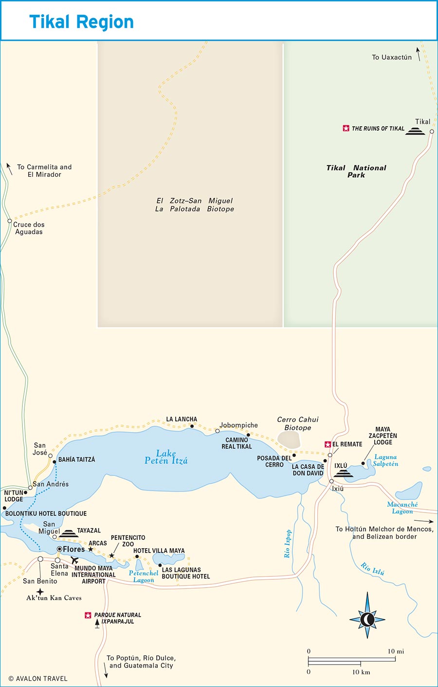
Petén
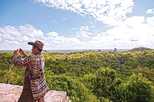
atop Tikal’s Temple IV.
Guatemala’s northernmost department conjures images of a remote wilderness, dense forests, and lost Mayan cities.
Today, that image is only partly true, as much of the Ohio-sized Petén has been cleared by settlers for subsistence agriculture and cattle ranching. In an attempt to save the remaining forest and the still unexcavated Mayan ruins they harbor, roughly a third of Petén has been protected since 1990 in the form of several national parks collectively known as the Maya Biosphere Reserve. It is one of the largest remaining continuous tracts of tropical forest in Central America. Recreational opportunities inside and outside the reserve are boundless and the region is slowly becoming a magnet for adventure and ecotourism, thanks in large part to the filming of Survivor Guatemala here in 2005.
Among the attractions are the enigmatic Mayan ruins of Tikal, one of the largest cities ever populated by the Mayans and certainly a must-see for any visitor to the area. Not only are the restored ruins impressive, to say the least, but the abundant wildlife found in the lush rainforests protected within the adjacent national park makes this a prime spot for birders and wildlife enthusiasts. Along the paved road to Tikal, you’ll pass the spectacular Lake Petén Itzá, one of Guatemala’s largest, surrounded by jungles and characterized by its luminescent turquoise-blue waters. The village of El Remate has sprung up along the highway and is quickly becoming a destination unto itself with a number of very comfortable accommodations and plenty of activities for the outdoor enthusiast. Many travelers now spend an extra day here after exploring the ruins.
Southeast of Tikal, the remote ruins of Yaxhá, overlooking the site’s namesake lagoon, remain a remote jungle outpost despite their prime-time TV fame, and you can still have the place all to yourself on a typical afternoon. But that probably won’t last too much longer.
Petén is without a doubt the cradle of Mayan civilization, as it lays claim to some of the oldest known Mayan sites along with the earliest evidence of the writing and royal dynastic rule characterizing the civilization that flourished here. At the remote site of El Mirador, on the northern fringes of Petén near the Mexican border, you can gaze in awe at the massive temple pyramids of El Tigre and La Danta, which were erected centuries earlier than most other well-known Mayan sites but nonetheless show much the same level of sophistication. All of these sites are harbored within the Maya Biosphere Reserve and its seemingly interminable expanses of mostly undisturbed tropical forests. Hikers will appreciate the numerous opportunities for trekking to remote Mayan ruins along jungle paths, creating the potential for adventures not unlike those of the early explorers.
Highlights
Look for S to find recommended sights, activities, dining, and lodging.
S Parque Natural Ixpanpajul: The hanging bridges and nature trail here provide a toucan’s-eye view of the Petén forests (click here).
S El Remate: Once a sleepy lakeside fishing village, El Remate provides access to beautiful Lake Petén Itzá and a variety of recreational opportunities such as kayaking, swimming, bird-watching, and horseback riding (click here).
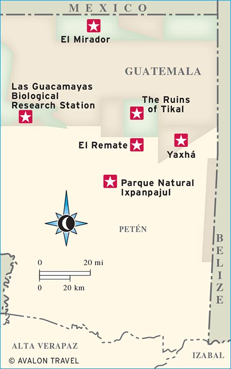
S The Ruins of Tikal: No trip to Guatemala would be complete without a visit to the enigmatic ruins of one of the largest cities ever built and inhabited by the Maya (click here).
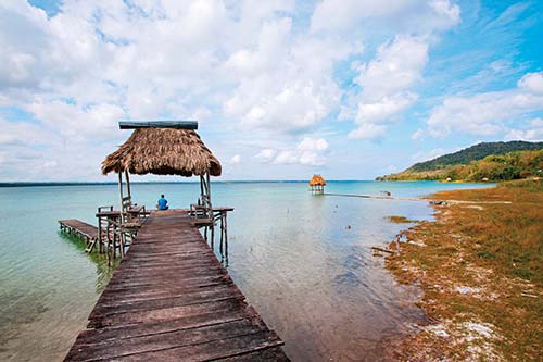
S Yaxhá: Featured in Survivor Guatemala, the ruins of Yaxhá enjoy a spectacular location beside the site’s namesake lagoon and provide commanding views of the surrounding forests (click here).
S El Mirador: Deep in the northern recesses of the Maya Biosphere Reserve, the ruins of El Mirador offer world-class adventure in an arduous two-day journey through swampy forests (click here).
S Las Guacamayas Biological Research Station: Observe nesting scarlet macaws with the knowledge that the money you spend is going directly toward their survival (click here).
HISTORY
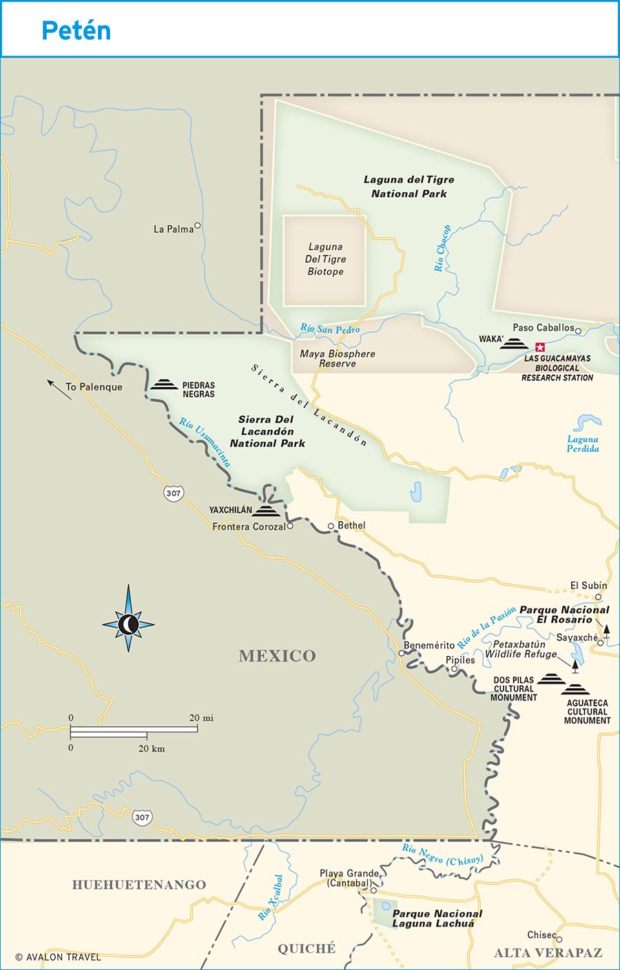
During colonial times, Petén remained a backwater, the only Spanish settlement being the island city of Flores, a pleasant town of pastel-colored houses that remains the region’s main tourist services hub. In 1840, Guatemalan President Rafael Carrera dispatched a small platoon of soldiers to officially claim the Petén region as part of the country. Mexico decided the territory was not worth the trouble of contesting. The region has been a backwater ever since, officially the poorest of Guatemala’s departments, which is especially evident to travelers coming in from Belize along an unpaved highway lined with cattle ranches and simple thatched-roof huts.
Petén harbors 550,000 of Guatemala’s inhabitants, making it the country’s most sparsely populated region, though its rate of population increase from immigration is the highest in the country. Much of this unprecedented growth is the product of an ill-conceived 1960s government program to colonize Petén, meant as a safety valve to relieve pressures for land reform. A battle is being waged to save this valuable natural and cultural heritage, and visitors to Guatemala’s northern parks can derive some satisfaction from the knowledge that their visit lends importance, justification, and the financial means for the continued preservation of what remains.
PLANNING YOUR TIME
Petén is one of Guatemala’s most fascinating regions, particularly for lovers of archaeology and outdoor activities. The parks encompassing the Maya Biosphere Reserve could keep you busy for weeks, in addition to the requisite visit to Tikal National Park. Some people make day trips to Tikal, coming across the border from Belize or flying in from Guatemala City. This will certainly serve only to whet your appetite for more Petén explorations. Visitors on one of these short stints should at least consider spending the night at Tikal or nearby Lake Petén Itzá. Another increasingly popular destination is the archaeological site of Yaxhá, site of Survivor Guatemala. There is a comfortable jungle lodge right on the shores of Yaxhá Lagoon where you can spend the night, a good idea if you want to take in all that this site has to offer, given its remote location.
El Mirador, deep in the jungle near the Mexican border, involves an arduous journey of two days from the nearest village but is well worth it for the opportunity to visit one of the largest and earliest Mayan cities in existence. The tallest, and some of the largest, manufactured pre-Columbian structures can also be found here in the form of the massive La Danta and El Tigre pyramids, with bases the size of three football fields. A typical round-trip itinerary to El Mirador takes 5-7 days, depending on how long you want to stay at the ruins and if you want to stop at other nearby sites on the way back.
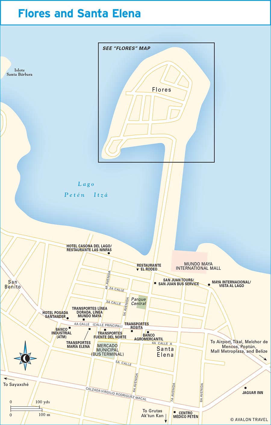
The most natural starting point and hub for any in-depth Petén explorations is the island city of Flores, with its pretty pastel-colored houses and quiet streets; it’s unlike any other town in Guatemala. Its sister city of Santa Elena, on the mainland shores of Lake Petén Itzá, is an equally logical choice for a base, though it’s not nearly as attractive. Many conservation organizations and adventure travel outfitters are based in Flores/Santa Elena. Air and ground service connects Flores/Santa Elena to most of Petén, other parts of Guatemala, and Belize.

Poptún and Vicinity
The small town of Poptún is unremarkable in and of itself, but there are a number of good recreational opportunities in the vicinity. Travelers coming from Guatemala City often break up their journey with a stay in Poptún’s landmark Finca Ixobel. In the vicinity of Poptún are numerous caves, jungle rivers, and forests easily explored with help from area lodges.
POPTÚN
Halfway between Río Dulce and Flores, Poptún has always been a favorite stopping point, particularly before the road to Flores was paved and travelers needed to split up the grueling journey on a rutted dirt road. Nestled in the foothills of the Maya Mountains, which extend into neighboring Belize, the area is unlike the rest of Petén in that it is cooler by virtue of its altitude at more than 600 meters (2,000 feet) and features a largely pine-forested, karst landscape. There are many relatively unexplored Mayan sites here as well as some small expanses of tropical forest, which have survived the expansion of the agricultural frontier to which most of southern Petén has succumbed. A military base once operated in this area, but it has been closed down since the 1996 peace accords, as elsewhere in Guatemala.
Recreation
Poptún’s wonderful setting at a comfortably higher altitude and its pine-studded, karst landscape make exploring this part of Guatemala a delight. You can choose from, among others, treks to remote Mayan sites, jungle hikes, caving, or tubing down lazy stretches of jungle river. All of these activities can be arranged at area lodges, particularly Finca Ixobel (on the road from Río Dulce, tel. 5410-4307, www.fincaixobel.com), which pioneered ecotourism in this neck of the woods and is always interested in new offerings. You can choose from a number of caves, which can take two hours, a half day, or a full day of exploring. The full-day trip takes you to Cueva del Río, an underground river with rapids and waterfalls where you can swim and leap into the river in total darkness. There are also trips twice a day to Ixobel Cave, with its rim stone walls, stalactites, and stalagmites a 45-minute walk from the farm. Just 25 minutes’ walk from Finca Ixobel, Echo Cave offers a fun adventure exploring the cave’s hidden chambers and caverns, and it is a good option if you have only two hours’ time.
Horseback riding is also available at the Finca Ixobel with trips lasting as little as two hours or as much as two days ($53). A full day of horseback riding costs $23.
Finca Ixobel also runs a number of excellent multiday jungle adventures lasting a minimum of three days, with a two-person minimum. The treks take you to remote Mayan sites such as Ixcún, a replica of the caves of Naj Tunich, and waterfalls on the Río Mopán. All trips are on horseback.
Naj Tunich
The Naj Tunich caves have long been a local attraction and were even featured in the August 1981 issue of National Geographic. The caves, which are more than one kilometer long, are famous for their intricate murals and hieroglyphic text. Naj Tunich appears to have been one of the most highly revered sites in the Mayan world, and it is known that several of the glyphs were painted by scribes from such faraway cities as Calakmul, in present-day Mexico.
The caves were defaced some years ago, and the site was closed to visitors. A replica of the caves showcasing some of the best of the Naj Tunich cave paintings is located just 400 meters from the original caves. Check with the staff at Finca Ixobel (tel. 5892-3188, www.fincaixobel.com) for details.
Inner tubing on the Machaquilá River from Finca Ixobel ($25, including lunch and transportation) is possible in June and July, when the water is high enough but before the summer rains are in full swing.
Accommodations and Food
There is at least one good place to stay in Poptún proper, though you are probably better off staying at one of the local, highly recommended jungle lodges. Should you get stuck in town, Hotel Posada de los Castellanos (tel. 7927-7222, corner of 4a Calle and 7a Avenida, $10 d) is your best bet with basic, clean rooms with fan and private hot-water bath. For eating, La Fonda Ixobel (Avenida 15 de Septiembre, tel. 7927-7363) has tasty baked goods, sandwiches, and meat dishes. There’s also a full bar.
Services
Banrural (5a Calle, 8:30am-5pm Mon.-Fri., 9am-1pm Sat.) has a MasterCard ATM and changes U.S. dollars and American Express travelers checks.
Getting There
The Poptún area is accessible via several buses and minivans leaving Flores daily at half-hour intervals during daylight hours. Línea Dorada (Avenida 15 de Septiembre 9-71 Zona 2, tel. 7924-8434, www.lineadorada.com.gt, $15-30 one-way) has buses from Guatemala City (10am and 9pm daily), stopping in Río Dulce and Poptún along the way. Buses arrive and depart on Playa Sur in Flores.
Buses heading north from Guatemala City via Río Dulce also come this way and stop at Finca Ixobel, Poptún, and Machaquilá.
NEAR POPTÚN
Finca Ixobel
Just south of Poptún, on the road from Río Dulce, S Finca Ixobel (tel. 5410-4307, www.fincaixobel.com, $3-49) has long drawn travelers coming overland to Petén for its wonderful accommodations and excellent food at moderate prices in an attractive jungle setting. Its wide-ranging activities allow guests the chance to explore myriad attractions nestled in the surrounding cool pine forests and rolling green hills. There are accommodations to suit every taste and budget, including hammocks ($3), clean, comfortable dorms for $6 per person, double rooms with shared bath for $18, and rooms with private bath for $41 d. There are more luxurious bungalows and a suite for $41 and $49 d. The latest addition to Finca Ixobel’s offerings is a series of tree houses set amid spacious grounds. Some have electricity; others are candlelit. Prices range from $18 d with candlelight to $32 d with electricity. Only one of the so-called tree houses is actually in a tree, but all are attractive, quite comfortable, and set above the ground.
The restaurant here serves delicious, inexpensive meals, largely using ingredients grown in the finca’s vegetable garden. Breakfast and lunch are à la carte, while dinner is served buffet style ($5-10). Breakfast items include homemade yogurt and granola, pancakes, and eggs, with plenty of vegetarian options for lunch and dinner. There is also a bar set beside a swimming pond where you can chill out in a hammock or play a game of “Twister” with your new friends and fellow travelers.
Any bus traveling the Río Dulce-Flores Highway will drop you off at the turnoff to Finca Ixobel. From there, it’s just a short 15-minute walk to the lodge. You can arrange minibus transport to Flores and book bus tickets to Guatemala City from Finca Ixobel. Minibuses go by every half hour 8am-5pm and cost $7 one-way. Transport to Guatemala City on Linea Dorada bus lines ranges $13-20 one-way. If you are arriving at Finca Ixobel after nightfall, your best bet is to go to La Fonda Ixobel in Poptún town and get a cab from there to the farm.
DOLORES
At first glance, Dolores, north of Poptún, appears to be just another roadside town in rural Petén. But closer inspection reveals it harbors a decent archaeology museum and several lesser-known Mayan sites in its vicinity. Set on a hill in the heart of town, Museo Regional del Sureste de Petén (museodolores@mcd.gob.gt, 8am-5pm daily, $4) holds an impressive collection of artifacts and stone sculptures excavated from sites in the southeastern portion of the Petén lowlands. The displays are well presented and include descriptions in Spanish and English. Most of the items on display are ceramic pottery. There are wonderful views of the town and its jungle surroundings from the museum’s courtyard.

sculpture at Museo Regional del Sureste de Petén
Ixcún and Ixtontón
Ixcún is a large Mayan site showing signs of occupation from Preclassic times on through the Postclassic period. It is believed to have been the most important of four cities located in the upper Mopán Valley and subservient to the larger kingdom of Caracol, lying 35 kilometers northeast in present-day Belize. Ixcún is just 6 kilometers north of Dolores via a rough dirt road. It’s about an hour’s walk, or you can take a cab for $5. The site itself occupies about 16 square kilometers and includes a ball court, palaces, stepped pyramids, and several stelae (including the second-largest stela in the Mayan world). Most of the site remains unexcavated, consisting of overgrown temple mounds, and was most recently excavated by the Atlas Arqueológico de Guatemala, which runs the Museo Regional. It enjoys a peaceful park-like setting, with a splendid jungle location. The Mopán River flows just 4 kilometers from here. There are ranger facilities and a covered pavilion for camping. Admission is $4 and it’s open 8am-5pm.
Ixtontón is a smaller Mayan site that once rivaled Ixcún. It’s along the banks of the Mopán River, 2 kilometers east of Dolores and about 6 kilometers from Ixcún. Although it wasn’t officially discovered until 1985, it had already been looted of artifacts prior to that. Only two of its stelae survived and are on display in the Museo Regional.
Flores
In the heart of Petén, the twin towns of Flores and Santa Elena are often referred to simply and collectively as “Flores.” The latter is actually limited to a small island on Lake Petén Itzá connected to Santa Elena, on the mainland, by a causeway. Flores is a pleasant island town unlike any other in Guatemala with pastel-colored houses and quiet streets. Santa Elena is a bit noisier and more chaotic because of its prominence as Petén’s main commercial center. Farther west, Santa Elena runs into the downright ugly town of San Benito.
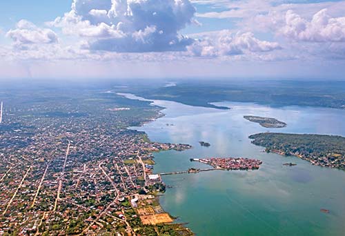
aerial view of Flores and Santa Elena
Flores is the natural starting point for a visit to Petén’s wild interior, as it is the region’s transportation and services hub. Many NGOs are based here, and the quiet streets are lined with a variety of shops, restaurants, and comfortable lodgings. While Flores is excellent from a logistical standpoint and entirely attractive, it has been somewhat displaced in recent years by the emergence of El Remate, a lakeside town on the road to Tikal that is convenient for travelers to and from Belize. Still, there are a number of local attractions that make spending at least one day in the Flores area worthwhile, and at last visit the town seemed to be enjoying a bit of a resurgence.
History
Flores started out as the Mayan site of Tayasal, home to the Itzá people and one of the last Mayan strongholds. It is thought that Tayasal was founded by a group of displaced Maya from Chichén Itzá, in present-day Mexico, sometime between the 13th and 15th centuries. The Itzá held out for quite a while in their remote island outpost deep in the Petén jungle. Spain’s relative lack of interest in the hot, steamy lowlands of Petén inevitably allowed them to continue life largely unhindered by the Spanish. In 1525, Hernán Cortés stopped by on his way to Honduras and had a peaceful meeting with the Itzá king Canek, also leaving behind a lame horse. A statue of it was made when it died, and Spanish friars visiting the region in 1618 would find it being worshipped by the Itzá. The friars destroyed the idol, which probably explains why the next round of visitors, a military expedition in 1622, was captured and sacrificed.
Tayasal finally came under Spanish rule in 1697 at the command of Martín de Ursúa. As was the custom, the Spanish conquerors destroyed the city’s temples, pyramids, and artwork, leaving no trace behind. Today, the small Flores town plaza, church, and government buildings sit on the highest point in the city atop what was once Tayasal’s ceremonial plaza.
To the north, across the small finger of Lake Petén Itzá in which Flores lies, are the remains of the Mayan site of Tayazal. It dates to the Classic period, long before the arrival of the Itzá.
SIGHTS
As nothing remains of the original settlement, there is very little to see in terms of historical sights on the island. The quaint plaza contains a small church and government buildings flanked on one side by a basketball court. Flores itself is very different from any other town in Guatemala, and a leisurely stroll around the island will allow you enough time to take in the funky pastel architecture and the quiet streets. One addition to Flores’s infrastructure is the malecón, or waterfront walkway, spanning the entire island. Parts of the malecón are prone to periodic flooding due to rising lake levels.
CINCAP (Centro de Información sobre la Naturaleza, Cultura, y Artesanía de Petén, tel. 7926-0718, 10am-noon and 2pm-8pm Mon.-Fri.) is housed in the Castillo de Arismendi on the north side of the park. It serves as an information center on Petén’s culture and natural history and holds a small gift shop.
If you’re really into caves and won’t have time to explore the areas of southern Petén or Las Verapaces, you might want to check out Ak’tun Kan (8am-5pm daily, $1.50), also known as the cueva de la serpiente for the large snake said to inhabit it. To get there, follow 7a Avenida south out of Santa Elena until you get to the power plant. Turn left to get to its east side, and continue south another kilometer. A tuk-tuk can also take you there for just a few quetzales. There’s a museum on a small island just across the main boat hub next to Raíces restaurant, though it’s not particularly impressive.
ENTERTAINMENT
Like many small towns in Guatemala, Flores tends to shut down after dark. Though the restaurants mentioned here are perfectly fine for stopping in for a drink, you may find yourself drinking alone. Depending on the season, it can get very quiet here, and some places may even shut their doors well before their posted 1am closing time. On weekends, locals like to party, and if you are up for it, you can certainly mingle with them at any of a number of establishments. Just follow the sound of music.
Aside from being a fine restaurant, La Luna (corner of Calle 30 de Junio and Calle 10 de Noviembre, tel. 7867-5443, noon to midnight Mon.-Sat.) has a pretty swanky bar where you can enjoy the very atmospheric old building in which it’s housed under a whirring ceiling fan. Right on the lake, Raíces Bar and Grill (tel. 7867-5743, 2pm-10pm Sun.-Thurs., 2pm-1am Fri.-Sat.) is a great place to catch the sunset while you enjoy your favorite cocktail. Also in this neck of the woods is Don Camarón (11:30am-11pm daily), a seafood restaurant and bar with chill lakeside vibes and good beats on the stereo. It’s a nice place to enjoy some fried shrimp and a cold beer while enjoying the lake breezes. A classy addition to the island’s bar offerings is Cantina El Remolino (corner of Calle 10 de Noviembre and Avenida La Reforma, inside Hotel Isla de Flores; tel. 7867-5176, www.hotelisladeflores.com, 2pm-11pm daily), housed in a wonderfully restored old hotel that evokes feelings of Havana or Panama City’s restored Casco Antiguo. Its second-floor rooftop terrace affords Sky Bar (Calle Unión, tel. 5522-0318, 5pm-1am daily) some of the best sunset views around. It’s a fun, friendly place with great cocktails. There are tasty pizzas for when you get hungry.
SHOPPING
There are several handicrafts stores lining Calle Centroamérica, on the south side of the island. For more modern needs, there are two shopping malls nearby. Mundo Maya International Mall, just across the way in Santa Elena and immediately east of the causeway, has a modern selection of shops, a large grocery store and a movie theater. Burger King and Pollo Campero outlets are adjacent.
Metroplaza (9am-8pm daily) lies across the road from Mundo Maya International Airport and has a Pizza Hut, electronics stores, a travel agency, and a pharmacy among its stores.
RECREATION
You can rent kayaks and mountain bikes at Re-Cicle Rentals (Playa Sur, tel. 4770-4908, 8am-6pm Tues.-Sun.) for $26 for a 24-hour rental, $20 for a full day (business hours) or $4 per hour. The Ramada Tikal (Playa Sur, tel. 7867-5549, www.ramadatikal.com) just down the street also rents both for $5 per hour for guests and nonguests.
The other main recreational option involves lake tours offered by various boat operators congregating at the embarcaderos opposite Hotel Santana and on Playa Sur. Direct colectivo boats ($1) can take you across the lake to the town of San Miguel and leave from a dock next to Posada de Don José on the north end of the island. The lake tours can be had for $20-25 and include a trip to the lakeshore opposite the island’s northwest corner to Petencito Zoo, the Mayan ruins of Tayazal, and ARCAS, a wildlife rescue center.
Guide Companies
Flores makes a natural starting point for trips into the wilderness because of its central location within Petén and its proximity to roads leading from here in all directions. The following recommended outfitters can hook you up with one day or multiday adventures to Petén’s increasingly popular parks and archaeological sites.
Highly recommended, The Mayan Adventure (tel. 5830-2060 www.the-mayan-adventure.com) is run by the owners of Café Yaxhá, who are very knowledgeable about the region. Trip options include the usual sites such as Tikal and Yaxhá, but also some lesser-known communities they work with. They can also organize trips to El Mirador, which is no easy task. Tikal Connection (Mundo Maya International Airport, tel. 5575-4335, www.tikalcnx.com) works with local communities to involve them in the business of sustainable tourism in and around several of Petén’s protected areas. Tikal Connection offers multiday treks from the site of El Zotz to Tikal, rigorous journeys to El Mirador, and the “Scarlet Macaw Trail,” in Laguna del Tigre National Park near the Mayan site of Waka’.
Martsam Tours and Travel (Calle 30 de Junio in the lobby of Capitán Tortuga restaurant, tel. 7926-0346 or 7832-2742, www.traveltoursguatemala.com) has an excellent reputation and offers a variety of trips throughout Petén. In addition to El Zotz-Tikal, Waka’, and El Mirador, it offers day trips to Tikal and multiday adventures involving hikes from Tikal to Yaxhá, stopping in Nakum along the way.
ACCOMMODATIONS
For the best value in town head to Flores’s hostel, S Los Amigos (Calle Central next to ProPetén, tel. 7867-5075, www.amigoshostel.com). This backpacker’s paradise features a restaurant/bar, security lockers, broadband Internet, and laundry service among its well-rounded list of amenities. The friendly Guatemalan and Dutch owners can also help you plan your travels to other parts of Guatemala. For the ultimate in affordable lodging, you can sleep in a hammock for $5. Other options include dorm beds ($7), private rooms with shared bath ($20 d) or with private bath ($39 d). Best of all, the showers are nice and hot.
On Calle 30 de Junio, a good choice in the budget category is friendly Green World Hotel (tel. 7867-5662, $26 d), offering basic but pleasant rooms with hot-water private bathroom, ceiling fan, and comfortable beds. The clean rooms are painted a pleasant light green, evoking tranquility and space. Some upstairs rooms have balconies with lake views for the same price, and there are nice chill spaces upstairs and downstairs. Hotel Petén (Calle 30 de Junio, tel. 7867-5203 or 2366-2841, www.hotelesdepeten.com, $56-60 d depending on season) is said to be the island’s oldest hotel, dating to 1960. You have a choice of air-conditioning and/or ceiling fan in its smallish but comfortable rooms with private bath and cable TV, some of which have balconies overlooking the lake. A small swimming pool and a dining room are on the ground floor just opposite the lobby. One of my perennial favorites is sister property SLa Casona de la Isla (Calle 30 de Junio, tel. 7867-5200 or 2366-2841, www.hotelesdepeten.com, $60-65 d depending on season), an attractive lakeside house painted in bright yellow and orange hues housing 26 rooms with air-conditioning, cable TV, and private bath. There is a nice outdoor swimming pool, around which the rooms are centered, as well as a whirlpool. The hotel’s Isla Bonita restaurant and bar serves three delicious meals a day at reasonable prices.
Casazul (Calle Unión, tel. 7867-5451 or 2366-2841, $46-50 d depending on season) has pleasant rooms with air-conditioning, cable TV, private bath, and minifridge housed in a pretty blue house, as its name would indicate. It has a nice balcony with wonderful lake views. Nearby, S Flores Hotel Boutique (Calle Fraternidad, tel. 7867-5768, www.floreshotelboutique.com, $127 d) is a great option for those seeking space, privacy, and apartment-like sleeping arrangements. The large suites have fully furnished living rooms and fully stocked kitchens. The four units share a garden patio with a nice fountain, and there’s an upstairs patio with a hammock and tables where you can enjoy breakfast or an afternoon cocktail.
An excellent value is Hotel Casa Amelia (Calle Unión, tel. 7867-5430, www.hotelcasamelia.com, $53 d). It offers attractive, spotless double rooms with original decor incorporating burlap bags for curtains, wooden furnishings, firm beds, ceiling fans, air-conditioning, and large hot-water bathrooms. Six of the 12 rooms have nice lake views. All have large cable TVs. There’s a nice restaurant with very decent food served on an airy patio fronting the malecón.
An impressive makeover has transformed the once-lackluster S Hotel Isla de Flores (Corner of Calle 10 de Noviembre and Avenida La Reforma, tel. 7867-5176, www.hotelisladeflores.com, $78-90 d) into Flores’s most fabulous property. I’m a big fan of the architecture and the tasteful use of color throughout. The restoration was done keeping in mind the island’s history and architectural heritage. Room amenities include a/c, ceiling fan, and flat-screen cable TV. There are street or lake views from the rooms’ blue-shuttered windows. The more expensive suites have minibars and in-room coffeemaker, a nice touch you won’t often find in Guatemala. There’s a rooftop swimming pool and lounge area, though the pool is somewhat on the small side. The lobby has a cool restaurant, a very nice little gift shop, and a fun streetside bar.

the restaurant inside Hotel Isla de Flores
The island’s sole chain hotel is the confusingly named Ramada Tikal (Playa Sur, tel. 7867-5549, www.ramadatikal.com, $109 d with breakfast buffet), near the causeway as you come into town on the shore facing Santa Elena. The multistory property is a large building that seems somewhat out of place in mostly low-rise Flores. Rooms include all the usual comforts of its price range such as private bath, air-conditioning, cable TV, and attractive furnishings. There is a good restaurant and bar with an outdoor patio fronting the lake. There are two swimming pools, one of which is under cover. Wireless Internet is freely available in the lobby. Nice extras include a fitness center and kayaks and bikes for rent.
Santa Elena
There’s really no reason to stay in Santa Elena unless everything on the island of Flores is booked for some reason. That being said, there are several pleasant accommodations along the lakeshore with wonderful views of Flores. Among the budget accommodations is the Jaguar Inn (Calzada Virgilio Rodriguez Macal 8-79, tel. 7926-2411, www.jaguartikal.com, $40-54 d), where tastefully decorated rooms are centered around a courtyard and the helpful staff can assist you plan your onward travel. They have free airport and/or bus station transfers. The owners also have a hotel at Tikal National Park by the same name.
Along the lakeshore, as you approach town from the airport, is the Maya Internacional (Calle Litoral del lago, Zona 1, tel. 2223-5000 central reservations or 7926-2083 direct, www.villasdeguatemala.com, $70-100), with 24 standard rooms and two junior suites. The rooms differ in newness and decor, so be sure to check them out before committing. The more tastefully decorated rooms have balconies overlooking the lake, tiled floors, ceiling fans, air-conditioning, and cable TV. The lodge’s Vista al Lago Restaurant offers gorgeous lake views and a varied menu. A swimming pool, wireless Internet, and lovely open-air palapa lobby round out the list of features. The property’s proximity to a shopping mall and the airport may or may not suit you.
Farther along the lakeshore near the causeway connecting Santa Elena to Flores are a number of newer options, including the 62-room Petén Espléndido (tel. 2360-8140, www.petenesplendido.com, $90 d), with the feel is that of a U.S. chain hotel with all the usual amenities. The standout in this part of town is the S Hotel Casona del Lago (tel. 7952-8700 or 2366-2841, www.hotelesdepeten.com, $90-100 d), a beautiful blue house that could just as easily fit in to the seaside landscape of Cape May, New Jersey. The large, bright rooms have spacious bathrooms, tasteful decor, and the usual comforts, including cable TV. Some have lake views; all are centered around a pretty swimming pool with a whirlpool. The hotel’s Restaurante Las Ninfas serves varied international cuisine for breakfast, lunch, and dinner in a pleasant dining room overlooking the pool and lake. The lobby is decorated with classic photos from Petén’s past dating to the 1920s, 1930s, and 1940s, along with some more modern scenes.
FOOD
Flores has a small grocery store. La Colmena (corner Calle 30 de Junio and Avenida 10 de Septiembre, tel. 7926-1268) has a variety of local and imported favorites. It also takes credit cards. There is also a minimart (with an ATM machine) across the street from Capitán Tortuga restaurant on Calle 30 de Junio. The larger La Torre grocery store is across the causeway in Santa Elena’s Mundo Maya Mall.
Cafés and Light Meals
Flores has no shortage of coffee shops and cafés, most of which offer something different and equally pleasing, depending on what you’re in the mood for.
El Café Chilero (Cool Beans Café) (Calle 15 de Septiembre, tel. 5571-9240, 8am-10pm daily except Tues.) has a wide assortment of hot and cold coffee beverages using gourmet beans from a very well-known coffee farm in Alta Verapaz. It also serves smoothies and light meals in a relaxing jungle garden atmosphere and makes a great place for breakfast.
If you’re looking for inspiration before an adventure to one of Petén’s numerous archaeological sites, head to S Café Arqueológico Yaxhá (Avenida 15 de Septiembre, tel. 5830-2060 or 4934-6353, www.cafeyaxha.com, 7am-10pm daily), where you can dine in a pleasant atmosphere featuring colorful Guatemalan tablecloths and photo montages of various Mayan sites, including Tikal, Yaxhá, and Nakum. Although it does a variety of dishes, including steak, chicken, seafood, pasta, and even curry, it specializes in what it calls “pre-Columbian” fare (a variety of Petén-Yucatec dishes), which are highly original and recommended.
For street tacos, check out Taco Taco (adjacent to Hotel Santana, lunch and dinner on weekends, $2-3), where you can enjoy your food in a festive Mexican atmosphere.
Steakhouses
On the island’s western shore is S Raíces Bar and Grill (tel. 7867-5743, 2pm-10pm Sun.-Thurs., 2pm-1am Fri.-Sat., $10-20), serving large portions of grilled steak, chicken, and fish with scrumptious side dishes in a hip semioutdoor setting featuring a deck built over the lake. If you’re lucky, you might catch a thunderstorm here during the rainy season for a spectacular lakeside lightning show. Alternatively, it makes a great place for a sunset cocktail. Order the kebabs and share with a friend.
Continental
Housed in a tastefully decorated old building festooned with overhanging bougainvillea blossoms and painted in bright shades of green and blue, the finest restaurant in Flores is undoubtedly S La Luna (corner of Calle 30 de Junio and Calle 10 de Noviembre, tel. 7867-5443, noon to midnight Mon-Sat., $6-14). Culinary highlights include stuffed peppers, steak in a black pepper cream sauce, boneless chicken breast in wine sauce, pastas, and vegetarian dishes, including falafel. Also on Calle 30 de Junio is Capitán Tortuga (tel. 7867-5089, www.capitantortuga.com, 7am-10pm daily). The spacious dining room housed under a large palapa structure has lake views, and you can enjoy pasta, tacos, sandwiches, chicken quesadillas, grilled meats, and tasty pizzas in addition to a fully stocked bar. For snacks, try the burritos for about $5. Across the street is S La Albahaca (tel. 7867-5449, 6pm-11pm Tues.-Sun.), a cozy little place with a quiet atmosphere serving delicious fish, beef, and chicken recipes as well as scrumptious homemade pasta and home-baked bread at reasonable prices. There is a nice assortment of Chilean wines.
On the southern end of Avenida 15 de Septiembre, La Danta (tel. 7867-5707, www.ladantarestaurante.com, noon-10pm Tues.-Sun., $5-15) prides itself in delicious fusion cuisine made from fresh ingredients and flavors gleaned from the area’s Mayan heritage. They also have tasty crepes for dessert.
There are a number of good choices along Calle Unión, on the island’s northwest corner. La Villa del Chef (tel. 4211-3849, noon-11pm daily, $4-15) serves a wide variety of sandwiches, pasta, chicken, and seafood dishes in an attractive lakeside atmosphere atop a small wooden deck. The parrillada petenera ($13) is a good option for sharing, and their new specialty is a tasty, locally sourced rabbit burger. Just down the street, S Terrazzo Ristorante & Bar (tel. 7867-5479, 7:30am-10pm Mon.-Sat., $5-12) is one of Flores’s finest restaurant offerings. The owners have plenty of restaurant experience, having worked as chefs in some of the country’s best restaurants. There are delicious panini, pastas, tagliatelle, oven-baked fish fillet in potato, as well as smoothies and a full bar. The ambience is also quite pleasant, set in an airy second-floor terrace overlooking the lake. Chill music plays on the stereo. Also in this area is San Telmo Bistro Bar (Calle Unión, tel. 7867-5751, 7am-11pm daily), which scores big points for originality with a varied menu and whimsical decor. It’s a hippy-esque kind of place with New Age music on the stereo. There are pizzas, panini, veggie burgers, meat, seafood, Asian noodle dishes, falafel, smoothies, and even kombucha on the menu.
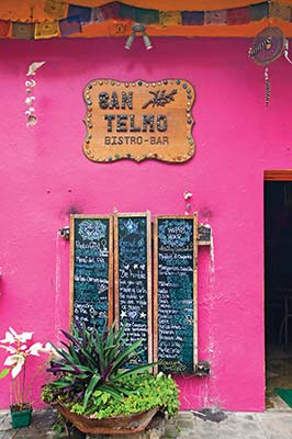
San Telmo Bistro Bar
INFORMATION AND SERVICES
Tourist Information
INGUAT has a desk at the airport arrivals area, where staff can answer your questions and help you get your bearings. There is also an office in Flores on Calle Centroamérica (tel. 2421-2957, 8am-4pm Mon.-Fri.). Another option for getting tourist information is Café Arqueológico Yaxhá (Avenida 15 de Septiembre, tel. 5830-2060, www.cafeyaxha.com, 7am-10pm daily). Its German owner knows a lot about the local Mayan sites and has even authored a guidebook to the Mayan region in his native tongue. It’s a great place to learn about Petén’s archaeological sites and is often a meeting place for folks working on archaeological digs or environmental projects.
Money
The only bank in Flores is Banrural, about a block east of the plaza. There’s an ATM inside the minimart across from Capitán Tortuga restaurant on Calle 30 de Junio.
In Santa Elena, three blocks up 6a Avenida from the Flores causeway on the corner of 4a Calle is Banco Agromercantil with a MasterCard ATM. Three blocks west, also on 4a Calle, is Banco Industrial, with a Visa ATM.
Laundry
The Laundry Room, on Calle Central next to ProPetén, is a full-service laundry place. There’s also Lavandería Petenchel, on Calle Centroamérica, and Lavandería Amelia, behind CINCAP.
Emergency and Medical Services
For the police, dial 7926-1365. The closest hospital is Hospital San Benito (tel. 7926-1459).
Volunteer Work
Volunteer opportunities are available with several of the NGOs working in town. Among the options is the opportunity to volunteer at the Las Guacamayas Biological Research Station (tel. 7867-5296, www.propeten.org) in Laguna del Tigre National Park. Another option is working with the local Wildlife Rescue and Conservation Association, or ARCAS (tel. 5208-0968, www.arcasguatemala.com), at its site on the other end of the lake opposite Flores’s north shore.
Spanish School
Dos Mundos Spanish School (Calle Fraternidad, tel. 5830-2060, www.thespanishschooltikal.com) offers 30 hours of language instruction for $170 per week, plus a $35 enrollment fee. Accommodations options with host family, including meals, start at $100 per week.
GETTING THERE
Air
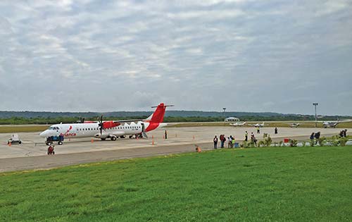
Flights arrive at Mundo Maya International Airport (FRS), a few kilometers outside of Santa Elena east on the road to Tikal. In 2008, the airport underwent a substantial renovation and the facilities are vastly improved (including badly needed air-conditioning). Most flights to the Flores/Santa Elena airport arrive from Guatemala City, with two daily on Avianca (tel. 800/400-8222, www.avianca.com) and a handful of smaller local carriers, among them TAG (www.tag.com.gt). From Belize City, Tropic Air (tel. 800/422-3435, www.tropicair.com) flies to Flores daily. Among the flights to/from Guatemala City, Avianca operates larger, 68-seat ATR-72 turboprop aircraft. TAG’s airplanes are substantially smaller. Flights between Guatemala City and Flores are usually in the vicinity of $275 for a round-trip flight.
The only direct service to FRS from the United States, a Saturday-only flight via Houston on Continental Express, was dropped in November 2006 after 18 months in operation. Flights to Cancún, Mexico, were rather inexplicably dropped by Avianca, leaving a potentially large market without air service.
Bus
Linea Dorada (tel. 7926-1788, www.lineadorada.com.gt, $15-30 one-way) has buses from Guatemala City at 10am and 9pm daily, stopping in Río Dulce and Poptún along the way. There are also daily buses to and from Belize City ($28 one-way), leaving at 7am. Buses arrive and depart from the main bus terminal along 4a Calle in Santa Elena as well as from another office on Playa Sur in Flores (tel. 7926-3649).
You’ll find minibuses to Melchor de Mencos, Poptún, and Sayaxché west of the market in Santa Elena on 4a Calle. Buses and minibuses to San José and San Andrés ($2, 40 minutes) leave from 5a Calle, west of the market.
Fuente del Norte (www.grupofuentedelnorte.com) buses make the trip to Belize City daily at 5am. The trip costs $28 one-way. There are 15 daily departures to Guatemala City.
GETTING AROUND
Taxis and Tuk-Tuks
You’ll find taxis at the larger hotels in Santa Elena and at the Mundo Maya International Airport. A taxi from the airport to Flores should cost no more than $3. More popular and much less expensive are the tuk-tuks (Asian-style motorized rickshaws) you’ll find seemingly everywhere. Short trips of about a kilometer or two within the Flores and Santa Elena area on tuk-tuks are usually in the range of $1.
Mundo Maya International Airport
Shuttle Buses
Shuttle buses and minivans ply the road between Flores and Tikal. Onca Travel Agency (Calle Unión, Flores; tel. 5930-1661, oncatravel.wix.com/onca, $20 pp) has hourly shuttles beginning at 4:30am until 10am. Another option with similar scheduling is Crasborn Travel (tel. 4637-2411 or 5589-9249, www.crasborntravel.com). Their Tikal sunrise tour leaves at 3am. Colectivo buses also ply the road between Flores and Tikal. If arriving at the airport, your best bet is to negotiate a ride with a bus taking a tour group (if not booked in advance) or go across the street to the shopping mall, where roadside pickup on cheap colectivo buses is facilitated. Once-frequent colectivo buses leaving straight for Tikal from the airport seem to have disappeared with fewer flights flying into FRS utilizing smaller aircraft.
Car Rentals
You’ll find several options at the airport upon your arrival. Among them are a few local operations I can’t bring myself to recommend. Stick with Hertz (tel. 3274-4424 Mundo Maya International Airport or 800/654-3001 U.S., www.rentautos.com.gt).
NEAR FLORES AND SANTA ELENA
There are a variety of attractions in and around Flores and Santa Elena that work well if you have a day or half a day while awaiting connecting flights or onward travel. Several of these attractions—ARCAS, Petencito Zoo, and Tayazal—are a five-minute boat ride across the lake from Flores’s north shore near the village of San Miguel. A road also goes this way along the shoreline and is useful in this discussion for orientation only, as most visitors find themselves catching a boat when heading out in this direction. You can take in 2-3 of these destinations as part of a lake tour leaving from Flores, which should cost between $20 and $25. Colectivo boats ($1) leave from a dock beside Calle Fraternidad, on the north shore of Flores, as they fill up.
S Parque Natural Ixpanpajul
Covering an area of nine square kilometers and conveniently just off the highway toward Guatemala City, the main attraction at Parque Natural Ixpanpajul (tel. 2336-0576 or 4062-9812, www.ixpanpajul.com, 7am-6pm daily) is a series of six suspension bridges built over the forest canopy, giving you a toucan’s-eye view of the forest. The trip along the forest trail takes a little more than an hour and includes a stop at a lookout point to take in the astounding view from the top of the mountain. Other activities include a Tarzan Canopy Tour (zipline), Spot Lighting (nighttime wildlife-viewing), horseback riding, mountain biking, tractor rides, and ATV rentals. You can tour the hanging bridges (Skyway) for $22 per adult or $13 per child. You also have a choice of mountain biking, tractor rides, or horseback riding, ranging from $5 to $25. Packages allow you to combine the Skyway with the Tarzan Canopy Tour and/or the Spot Lighting tour for a full day of adventure.
There is a campsite on the premises ($5) and you can rent tents ($10) and other equipment, but you have to book at least one of the main activities. There are also accommodations consisting of comfortable cabins with bunk beds and private bathrooms sleeping up to five people. The park can provide transportation from Flores or Tikal if you call in advance. A taxi from Flores should cost about $7.
Cooperativa Nuevo Horizonte
Seventeen kilometers south of Santa Elena on the road to Guatemala City lies Cooperativa Nuevo Horizonte (www.coopnuevohorizonte.org/en), a community of returned refugees and former combatants from the Guatemalan civil war. The cooperative was formed in 1998, when the community was resettled near the town of Santa Ana following the 1996 peace accords.
Nuevo Horizonte offers a fascinating glimpse into Guatemala’s sociopolitics. Although each family retains individual ownership of a house and farm plot, the pasturelands, a 250-acre forest preserve, a lake, and plantations of pineapple, pine, and lime trees are collectively owned. The co-op provides free day care, primary and secondary education, adult vocational training, and operates a pharmacy and clinic. The community also keeps two pickups and a minivan for anyone’s use. Additional infrastructure includes a welding shop and two corn mills. In an effort to minimize dependence on outside sources, the community maintains its own seed bank.
Many of the community’s residents lived in the Petén rainforests during the war years, on the run from Guatemalan government forces. In time, the jungle became a source of food, shelter, and safety, and these experiences provided insights into uses for medicinal plants and food.
Among the cooperative’s initiatives is community-based tourism. They are happy to show you around the village and share their stories, and also take great pride in their forest preserve and reforestation program. Rustic cabins and meals from the community are available for visitors.
Las Lagunas Boutique Hotel
As you head east along the road from the airport to Tikal, a dirt road turnoff cuts north toward the Petenchel Lagoon. Just two kilometers down the road you’ll find S Las Lagunas Boutique Hotel (Carretera a San Miguel, tel. 7790-0300, www.laslagunashotel.com, $325-375 d), an absolutely beautiful place on the edge of Quexil lagoon. The very comfortable wooden bungalows are set over the water and include some nice extras like large soaking hot tubs. There’s an infinity-edge swimming pool with an adjacent bar for cooling off. The restaurant inside the main building serves delicious international cuisine prepared by its Dutch chef. There’s a collection of pre-Hispanic artifacts on display in a room with some interesting taxidermy in addition to a nice gift shop with local crafts. You can tour the property’s expansive, 200-acre private reserve, including an island in the lagoon inhabited by playful spider monkeys. Other activities include kayaking, bird-watching, and four-wheeling.
a room at Las Lagunas Boutique Hotel
Hotel Villa Maya
About four kilometers in, along the road to San Miguel, is the excellent Hotel Villa Maya (tel. 2223-5000, www.villasdeguatemala.com, $85 d), with its 56 comfortable, tastefully decorated rooms equipped with air-conditioning, hot water, and balconies overlooking the placid lagoon. There are also a swimming pool and an excellent restaurant. It’s a bit out of the way, but the exclusive feel of this jungle outpost only adds to its allure.
Petencito Zoo
Farther west along this same road leading to the village of San Miguel is Petencito Zoo (8am-5pm, $5), housing a collection of local wildlife, including jaguars, monkeys, and macaws. The concrete waterslides (only recommended for the intrepid and/or foolhardy) were closed at last visit. It’s not my favorite place in these parts and part of me wonders if it should be shut down, as it has a derelict feel to it these days. Come here only if you have lots of time to spare.
ARCAS
Continuing west, the road again connects the larger Lake Petén Itzá to ARCAS (tel. 5208-0968, www.arcasguatemala.com), the Wildlife Rescue and Conservation Association, where an animal rehabilitation center harbors animals captured from poachers, including jaguars, macaws, monkeys, and coatis. Although the animal rehabilitation area is not open to outsiders, an Environmental Education and Interpretation Center caters to the casual visitor. There is a nature trail showcasing a variety of medicinal plants, a beach, a bird observation platform, and an area for observing animals that cannot be reintroduced to the wild. Captive breeding programs for scarlet macaw populations have been very successful, and they are also a key player in the fight to save emblematic species such jaguars and spider monkeys.
Tayazal
Not to be confused with Tayasal, which once occupied the same territory as present-day Flores, the remains of this small site of Tayazal can be found up a hill near the village of San Miguel. Although the ruins themselves are not overly impressive, there is a wonderful lookout, known as a mirador, built into a tree atop a temple mound from where you have an exceptional view of Flores. The lookout is about two kilometers outside of town. Follow the signs for the “mirador.”
Lake Petén Itzá
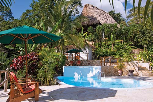
Once a pit stop for travel between Flores and Tikal, Lake Petén Itzá is quickly becoming a destination in its own right. The area around El Remate is home to some of Petén’s fanciest accommodations, the 72-room Camino Real Tikal and the smaller, more rustic, but exclusive, La Lancha. Other luxury options have sprouted up elsewhere along the lakeshore in recent years, including the very classy Bolontiku Hotel Boutique. There are also simpler accommodations, allowing you to take in the serene beauty of this large lake without busting your budget.
On the western shores of the lake, the towns of San Andrés and San José offer pleasant lakeside atmosphere and are an excellent place to learn Spanish or just get away. Language instruction here is combined with the opportunity to experience Petén’s rich ecology and even contribute to its preservation while helping to meet the needs of local people. The Itzá culture has largely survived the onslaught of modernity, and its people are more than willing to share their proud heritage with visitors.
SAN ANDRÉS AND SAN JOSÉ
The road from Flores heads west before cutting north along the lakeside to the small town of San Andrés on its shores. You’ll find the people here and in neighboring San José extremely friendly and laid-back. Many of the villagers still make their living from harvesting forest products such as chicle, allspice, and xate palm. The NGOs have been particularly active here since the creation of the Maya Biosphere Reserve and have found the communities very amenable to their conservation goals. The creation of a Spanish school was done in partnership with Conservation International several years ago, providing a viable alternative for income along the lines of sustainable development. The successful model has been emulated elsewhere, and there are now four Spanish schools operating in this area. They offer a unique alternative to more typical language school destinations, where a large presence of foreigners sometimes works against the immersion experience.
Although the towns are accessible from Flores by boat, the high cost of motorboat fuel and the ease of access from the road have made this a less popular option for getting here. Still, boats sometimes leave from the boat dock near Hotel Santana, and this is still the best option if you’re staying at the wonderful Ni’tun Lodge near San Andrés.
San Andrés
Most travelers in these parts are almost certainly studying Spanish or helping out with one of the local NGOs in conservation or community development projects. Rates at all the area schools are comparable, somewhere between $150 and $175 per week, including 20 hours of one-on-one instruction and room and board with a local host family. The original San Andrés language school, Eco-Escuela de Español (tel. 3099-4846, www.ecoescuelaespanol.org), is still going strong and is the area’s largest.
For comfortable budget accommodations in San Andrés, head to Villa Benjamin (Barrio Buena Vista, tel. 5099-9474 or 4500-8930, www.villa-benjamin.com, $25-45 d). There are clean, comfortable rooms with private bath and balconies overlooking the lake. There’s also a restaurant on an airy terrace.
Three kilometers east of San Andrés along the road from Flores and then a few kilometers down a rugged dirt road accessible only by four-wheel-drive vehicles, is charmingly rustic S Ni’tun Lodge (tel. 5201-0759 or 5414-5780, www.nitun.com, $144-176 d). Its somewhat rustic yet comfortable cabins are made from stone, stick, and mortar and set on a hill overlooking the lakeshore. Inside you’ll find wooden tree-trunk floors and typically Guatemalan accents, including Mayan blankets, rugs, and wooden furniture. All rooms have private hot-water bathroom. Room rates include breakfast. Gourmet meals, including a choice between 2-3 main courses, cost $25-30 for lunch or dinner. Live-in chef Lorena takes great pride in her culinary prowess and serves up some of the lake’s best cuisine. Most of the lodge’s high-end clientele arrives by boat from Flores on all-inclusive packages, which you can book directly through the lodge. The lodge’s creator and live-in manager, Bernie, has explored Petén extensively and is also the inspiration behind Monkey Eco Tours (tel. 5201-0759 or 5414-5780, www.nitun.com), which can take you to many of Petén’s remoter sites in relative comfort and style with accordingly expensive prices. A five-day trek to El Mirador, for example, costs $185 per person per day for a five- or six-day trip with 4-6 people.
a room at Ni’tun Lodge
The area’s newest accommodations are also its most elegant. S Bolontiku Hotel Boutique (tel. 7963-0909, www.bolontikuhotel.com, $216-260 d) enjoys a splendid location overlooking the lake. The beautiful rooms are tastefully decorated with fine fabrics that work well with the sylvan surroundings. Amenities include air-conditioning, minibar, and safe deposit boxes. There is a gourmet restaurant facing a large swimming pool with lovely views of Lake Petén Itzá. Recreational options include stand-up paddleboarding, kayaking, pedal boating, and a sunset boat tour.
arriving by boat at Bolontiku Hotel Boutique
San José
San José is a surprisingly pleasant town complete with a municipal recreation area on the lakeshore. Its somewhat steep streets meander into the surrounding hillside, affording stunning views of the pretty bay below. Adding to the town’s intrigue is a Mayan cultural revival of the Itzá people. You’ll see signs in this Mayan dialect around town. A community organization, the Bio Itzá, has its own language school and also manages a private forest preserve north of town along the fringes of El Zotz-San Miguel La Palotada Biotope.
According to local lore, the Itzá people came to San José from the Yucatán site of Chichén Itzá, led by the mythical figure Taitzá along a pathway known as the Camino Real 100 years before the arrival of the Spanish in the New World. Another unique aspect of the local culture is the town’s two main annual fiestas. The first of these takes place between March 10 and 19 and includes a parade and fireworks, capped off by an unusual costumed dance in which a young girl and a horse skip together through the town streets. The second annual festival takes place on October 31 and November 1. It begins with a solemn Mass in the town’s Catholic church, which houses three skulls in a glass case thought to belong to Spanish missionaries or the town’s founders, depending on whom you believe. One of these skulls is removed from its resting place and put on the church altar during the service; it is then carried through town on a velvet pillow by black-clad devotees, followed closely by children in traditional village costume and townsfolk. The procession stops along the way in several homes, where cane liquor, along with traditional food, are consumed and prayers and chants are offered. At the end, the skull is returned to its glass case in the town church, where it remains on display throughout the year.
The first of the town’s two Spanish schools, Escuela Bio Itzá (tel. 7928-8056, bioitza@yahoo.com), works with the Bio Itzá’s women’s cooperative, which runs a botanical garden for the production of natural products such as soap. San José’s other language school is the more recently established Mundo Maya Ecological Spanish School (tel. 4663-3856, www.mundomaya.edu.gt). They offer homestays with a local family or accommodations in their student guesthouse.
For food, there’s pleasant El Búngalo serving reasonably priced Guatemalan fare right at the lakeside.
For accommodations, there’s splendid S Bahía Taitzá (along the road into town in Barrio El Porvenir, tel. 7928-8125 or 5402-1961, www.taitza.com, $55 d), set along the lakeshore on one of Lake Petén Itzá’s prettiest beaches. Its eight comfortable rooms are housed in a large building. All have high wooden ceilings and come equipped with fans, tiled floors, comfortable beds, and private hot-water baths. A patio out front offers nice views of the manicured lawns toward the lake. There are lakeside hammocks and a restaurant and bar serving good food and wonderful cocktails.
S EL REMATE
El Remate starts about one kilometer past the turnoff to Yaxhá and the Belize border on the road from Santa Elena to Tikal. Once considered a stopping point along this road, El Remate has come into its own in recent years and has begun to pull its fair share of the Petén travel market. Its proximity to Tikal, fabulous lakeside setting, and variety of accommodations make it a wonderful alternative to staying at Tikal or Flores, or better yet, a destination unto itself worthy of at least one night’s stay.
Sights
The turnoff for the road heading west toward Belize, about two kilometers south of El Remate, was once known as “El Cruce,” though the small settlement here is now known as Ixlú. Just off the road, about 200 meters down a signed path, are the ruins of Ixlú on the shores of Laguna Salpetén. There is a basic campsite where you can rent canoes to take on the lake, but there is otherwise little else to do. A small information center can be found under a thatched-roof shelter by the road, with toilets and a map of the site.
Along the shores of Lake Petén Itzá, three kilometers down a dirt road heading west from the main Tikal-bound branch, is the Biotopo Cerro Cahuí (7am-4pm daily, $5). This 650-hectare mountainside park is particularly good for bird-watching and was initially set aside for the protection of Petén’s ocellated turkey. It encompasses part of the lake’s watershed and ranges in elevation 100-360 meters above sea level. You’ll find several lowland rainforest species of birds, including toucans, parrots, and trogons. Two trails (2.75 miles or 3.75 miles long) take you up the hill into the surrounding forest to lookout points where there are wonderful views of the lake below. Maps and information are available at the entrance kiosk. A swimming dock near the entrance juts to a splendidly clear expanse of turquoise water and is a great place for a swim.
Shopping
El Remate is also a great place to pick up local crafts, consisting of some very attractive wood carvings made from fallen logs and providing a sustainable alternative to wide-scale forest destruction for agriculture. You’ll find several handicrafts shops on the main strip along the road to Tikal.
Recreation
Bird-watching tours with knowledgeable, English-speaking local guides can be arranged from La Casa de Don David (tel. 7928-8469 or 5306-2190, www.lacasadedondavid.com) and cost between $40 and $75 for a 3- to 6-hour tour. In addition to Biotopo Cerro Cahuí, trips are available across the lake to roosting sites and other birding areas up the Río Ixpop and Río Ixlú.
Most of the area lodges can arrange horseback riding to Ixlú and Laguna Salpetén for about $20 per person. Casa Mobego (tel. 5909-6999) does walking tours to Laguna Salpetén for $10 per person and rents double kayaks for about $4 for one hour or $8 for four. Casa de Doña Tonita (tel. 5701-7114) also rents kayaks for about $2 an hour and mountain bikes for $5 a day. Alternatively, La Casa de Don David can arrange almost anything you can think of and also sells discount tickets to area canopy tours.
There are some wonderful swimming docks around the lake, the best of these at Restaurante El Muelle along the main road, in front of the Cerro Cahuí Biotope, and in front of Casa Mobego.
Accommodations
You’ll find plenty of accommodations along the town’s main drag beside the northbound Tikal road as well as along the dirt road diverting west that hugs the lakeshore.
On the dirt road running alongside the Lake Petén Itzá shore toward Cerro Cahuí Biotope are a number of very pleasant budget accommodations set far off from the noise of the main highway. Hostal Casa Mobego (tel. 7909-6999) is a popular place, also known as Casa Roja. Rooms with shared bath are housed in attractive stone and wood cottages; beds on a concrete base with squishy foam mattress and mosquito netting cost $7 per person. There is a nicely decorated main house where breakfast is served ($5) and dinner ($7) can be arranged with a bit of notice. There’s also a book exchange, kayaks for rent, and the staff can arrange minibus transportation anywhere you may need to go.
Farther down the road as you approach the entrance to Cerro Cahuí is Hotel y Restaurante Mon Ami (tel. 3010-0284 or 4919-1690, www.hotelmonami.com), with a variety of accommodations from a six-bed dormitory with shared bath at $10 per person to bungalows with private hot-water bath costing $20-26 d. The lodge is owned by ecologist Santiago Billy, a pioneer of Petén’s environmental movement who has fought for many years for the preservation of the Maya Biosphere Reserve. Near the entrance to the Biotopo Cerro Cahuí preserve, my favorite of El Remate’s hotels is S Posada del Cerro (tel. 5376-8722, www.posadadelcerro.com, $13 pp in dorm, $40-64 d). It’s an excellent value and a great place to get away from it all. The comfortably rustic rooms lack nothing in style; some feature cool stonework, while others have angled thatched-roof ceilings. There are also more modern apartments with full kitchens available. There’s a small restaurant where guests can enjoy meals or simply hang out under the palapa roof. The lake is right in front of the property. and there’s a nice swimming area.
Also in this area is the Hotel Gringo Perdido (tel. 2334-2305, www.hotelgringoperdido.com, $90 d), which started several years ago as a budget accommodation but has gradually worked its way into pricier domains. Rates include a tasty four-course dinner and breakfast. The lodge’s setting is right on the lakeshore within the boundaries of the Cerro Cahuí preserve. The rooms have private baths and are semi-open with roll-up blinds and private patio. There’s mosquito netting. A newer concept is the boutique hotel S Piramide Paraiso (tel. 2334-2305, www.hotelgringoperdido.com), on the adjacent grounds, where stylish and spacious villas housed in more modern concrete constructions with hardwood and Mayan textile accents go for $200 d, breakfast and dinner included. The rooms also have ceiling fans, air-conditioning, and plasma TVs.
Along the main street is the friendly Hotel y Restaurant Sun Breeze (tel. 7928-8044 or 5898-2665), where clean, simple double rooms with mosquito netting and fans go for $20 with shared-bath accommodations or $25 with private bathrooms. The helpful staff can do your laundry and also arrange reasonably priced transport or guided tours to area attractions such as Tikal and Yaxhá. Also on the main Flores-Tikal highway, midway through town, you’ll find El Muelle (Km. 30, tel. 5581-8087, www.hotelelmuelle.com, $50-60 d) along with its namesake dock on the lake. The comfortable rooms are housed in an airy wooden building, and there’s a nice swimming pool to cool off in. Charming S La Mansión del Pájaro Serpiente (tel. 5702-9434, www.30minutesfromtikal.com, $44-55 d) is another fine choice. Owned by a Guatemalan American family, the lodge sits along the main road to Tikal at the southbound entrance to El Remate. Set on a hillside overlooking the lake are 11 stylish guest rooms housed in stone and thatched-roof exteriors with Guatemalan furnishings and stone, tile, and hardwood accents; they have fans or air-conditioning and private hot-water bathrooms inside. The restaurant serves three meals a day, and there is a swimming pool amid the tropical landscape.
the hotel El Muelle’s namesake dock
Along the lakeside road toward Cerro Cahuí, at the junction with the road leading to Tikal, is S La Casa de Don David (tel. 5306-2190, www.lacasadedondavid.com, $46-56), a highly recommended establishment owned by a native Floridian transplanted to Guatemala in the late 1970s. His friendly wife and daughter help run the lodge, consisting of 15 rooms with private hot-water bathrooms set amid nicely landscaped grounds that include a ceiba tree. Eleven of the rooms have air-conditioning; all have fans. Rates account for slightly noisier double rooms with fans or a/c and shared or private bath under the restaurant to quieter double rooms with air-conditioning set farther back from the main house. All prices include one free meal per day (breakfast or dinner). The restaurant serves delicious international dishes ranging $5-10 for lunch or dinner. The friendly staff can help you book transportation to virtually anywhere and can answer your travel questions. You can also snag discounted tickets for area canopy tours at the attractive gift shop in the main lobby. The hotel’s very informative website is well worth checking out before visiting Petén.
Straight out of a West Texas cowboy’s dream is Palomino Ranch Hotel (tel. 3075-4189, www.hotelpalominoranch.com, $50 d), with quirky antiques and cool Western-inspired decor that’s tastefully done. There’s even an old jukebox. Rooms are housed in a large hacienda-style building centered round a swimming pool and have hot water and air-conditioning. The lodge organizes horseback-riding trips to area attractions, and there is sometimes a horse show in the large pen. The lodge is on the Cerro Cahuí road about 500 meters from the junction with the main Tikal-bound highway.
Lake Petén Itzá is not without a large resort. The Camino Real Tikal (tel. 7926-0204 or 2410-5299, www.caminorealtikal.com.gt, $120 d) is a 72-room complex that has been in operation for over 25 years. The Camino Real has all the comforts you would expect from an international resort chain. The modern rooms are housed in concrete structures topped with thatched-roof exteriors. There are two restaurants, a bar, a coffee shop, and a swimming pool. Recreational activities available to guests include sailing, kayaking, and sailboarding. A large ship does lake tours on weekends, and transfers from the Mundo Maya International Airport can be arranged before arrival via a free shuttle service. Discounted accommodation packages are often available by calling directly or booking via a travel agency.
For Petén’s ultimate in rustic jungle luxe, head to fabulous S La Lancha (tel. 7928-8331 Guatemala or 855/670-4817 U.S., www.coppolaresorts.com/lalancha), farther west along the lakeshore in the village of Jobompiche. Part of movie director Francis Ford Coppola’s impressive portfolio of properties, including two other hotels in Belize, La Lancha is Petén’s best-kept secret. Its 10 comfortable rooms are housed in lake-view casitas ($259 d) or rainforest casitas ($179 d). All rooms have exquisite Guatemalan fabrics and Balinese hardwood furniture. The rooms’ wooden decks are graced with hammocks in which you can lounge the day away watching the sky’s reflection on placid Lake Petén Itzá or order drinks from the bar via your in-room “shell phone.” Outdoor patios are shared with the unit next door. Rates include a continental breakfast, and the restaurant serves gourmet Guatemalan dishes for lunch and dinner for about $25 per person.
the pool at Francis Ford Coppola’s hotel, La Lancha
There is a swimming pool, but if you wish to cool off in the lake, a short downhill walk leads to the water’s edge. Kayaks and mountain bikes are available for exploring at your leisure, and you can book day trips to Tikal. Other activities include sightseeing in El Remate and Flores, fishing on the lake, and bird-watching at Cerro Cahuí.
Food
Most of the hotels have their own restaurant. There are also a number of more-than-adequate restaurants in El Remate. Along the road to Tikal, El Muelle (tel. 5514-9785, all meals daily) serves daily specials for about $10. The menu is heavy on meat dishes and lake fish, but it also serves pasta, vegetarian fare, and a wide assortment of desserts. The atmosphere is quite pleasant with views of the lake and the establishment’s attractive namesake dock from which you can take a refreshing plunge into the turquoise waters. There is also a small gift shop selling books, wood carvings, and other knickknacks. Nearby is La Piazza (tel. 5956-4103, 5am-9pm daily), a well-established place with a covered, open-air dining room where tasty sandwiches and pasta dishes are served.
Along the road fringing the lake shore, you’ll come across S Las Orquídeas (tel. 5701-9022, lasorquideasremate@yahoo.com, 6am-10pm Tues.-Sun.), serving decent pizza, pasta, and sandwiches. Just down the road, Mon Ami (tel. 3010-0284, all meals daily) serves tasty French and Guatemalan fare.
For a splurge, head to S La Lancha (tel. 7928-8331, all meals daily) for gourmet Guatemalan cuisine for about $25 per person for lunch and dinner. You can enjoy an assortment of flavors from the Francis Ford Coppola wineries or your favorite drink from the bar while dining in an airy palapa-style building high above the lake. It’s housed in its namesake lodge west of El Remate in Jobompiche.

La Lancha’s bar
Getting There and Around
El Remate is extremely easy to get to and from, as there is plenty of traffic heading up and down the road between Tikal and Flores. A local transport cooperative also operates minivans for trips to local attractions. Check with Hotel y Restaurant Sun Breeze (tel. 7928-8044 or 5898-2665) for availability and prices.
East to Belize
The road heading east to Belize is (mostly) paved nowadays. There are some interesting sites along the way, the most important being the ruins of Yaxhá, 11 kilometers north from the main road. (The ruins are covered in the section on The Maya Biosphere Reserve, of which the site is a part.) Encouragingly, some of the lagoons and surrounding forest just north of this road are being opened to ecotourism by forward-thinking entrepreneurs, thus providing an alternative to the ecological destruction that has characterized the traditional northward advance of the agricultural frontier into protected lands.
LAGUNA SALPETÉN
Just one kilometer from the Ixlú turnoff (where there is a small settlement by the same name) on the road heading east to Belize is Laguna Salpetén. Although most of the forest around this beautiful emerald-colored lagoon was cleared for agriculture long ago, a small patch remains on a spit of land jutting into the body of water. This is also the well-chosen location of Maya Zacpetén Lodge (tel. 7823-5843, mayazacpetenjunglelodge.com, $140 d). The rooms are housed in comfortable concrete cottages with thatched-roof exteriors. Activities include bird-watching, hiking the jungle trails, horseback riding, boat tours of the lagoon, and nighttime crocodile sighting. Access is via a lake-bound turnoff from the main road heading east to Belize and then a short boat ride across the lagoon.
HOLTÚN
This small, unrestored Mayan site lies 30 kilometers from Ixlú and then a 20-minute walk south from the main road. It features small temple mounds and is really suitable only for the die-hard fan of Mayan ruins.
MELCHOR DE MENCOS
This small border town sits on the edge of the Río Mopán and is fairly pleasant as far as border towns go. The border crossing with Belize is fairly straightforward, though you’ll probably be asked to pay the local equivalent of about $1.50 to exit or arrive in Guatemala, which is technically illegal. Some travelers have asked for a receipt in an attempt to dissuade the collection of the token bribe, but border officials sometimes issue you a deposit stub stamped with an official-looking immigration seal. The account most likely belongs to the bribe’s collector.
Many people cross the border from Belize on day trips to Tikal or Yaxhá from one of the Belize jungle lodges. Daily shuttle vans make the trip to the border from Flores continuing to Belize City, and there is also public transport to the border from the bus depot in Santa Elena.
On the Belize side, there are buses leaving from the border every half hour. You can also take a taxi ride three kilometers to Benque Viejo del Carmen, the first sizable settlement, from where there are more frequent services. Another 13 kilometers east is San Ignacio, a pleasant town with much to see and do.
Accommodations and Food
There is little reason to linger here, as at most border crossings in Guatemala, but there are at least two serviceable hotels should you need to spend the night here. Right at the border overlooking the Río Mopán is the aptly named Río Mopán Lodge (tel. 7926-5196, $25 d). Its Swiss owner organizes various nature tours to local attractions—including remote archaeological sites such as Holmul—and is a great source for local information. Other activities include canoeing or tubing on the river. The lodge has a restaurant specializing in Mediterranean food. Another option is Hotel La Cabaña (Barrio El Centro, tel. 7926-5205, $40 d), with comfortable rooms including air-conditioning, private hot-water bathrooms, and cable TV. There are also a swimming pool and a restaurant serving local and international dishes. Aside from a few snack and drink stands on the road leading to the border crossing, these two hotels are your best (and really, your only) options for food.
Tikal National Park
Tikal National Park, the oldest and best known of Guatemala’s national parks, was created in 1956. It encompasses 575 square kilometers (222 square miles) of primary tropical forest and protects a vast array of wildlife, as well as harboring the remains of one of the Mayan civilization’s greatest cities. Tikal is understandably high on the list of priorities for any visitor to Guatemala and shouldn’t be missed, as it affords the unique opportunity to combine a visit to a site of mammoth historical importance both in terms of natural and human heritage. Owing to its singular importance in the spheres of natural and human history, UNESCO declared Tikal National Park a World Heritage Site in 1979.
Tikal’s towering Temple I dominates the city’s Great Plaza and is an icon for Guatemala itself, much like the Eiffel Tower and Paris. Perhaps not as readily apparent, Tikal National Park also represents the ongoing effort to protect what remains of Petén’s tropical forest ecosystem. The park is at the edge, geographically speaking, of the Maya Biosphere Reserve, but at the very heart and soul of what conservationists and archaeologists are trying to protect. The conservation of Petén’s rich archaeological and natural treasures has the potential to provide a livelihood to a growing population of Peteneros long after any perceived benefits from clearing the forests for short-term gain. The lessons learned from Tikal’s 50-plus-year existence can help conservationists better manage newer parks deeper inside the forest reserve, which will eventually be open to increasing numbers of visitors. Whatever the approach to managing these newer parks, what is certain is that Petén’s vast wealth as the heartland of the Mayan civilization remains largely untapped.
If you are fortunate enough to visit Tikal, go home with the knowledge that you have been afforded a glimpse into the vast wilderness that remains mostly untouched north of this complex. In the forests beyond Tikal are countless other sites, some still undiscovered, which deserve as much protection and require the vigilance of international travelers and activists to ensure their continued preservation.
HISTORY
Tikal was settled somewhere between 900 and 700 BC on a site undoubtedly selected because of its position above seasonal swamps that characterize much of the terrain in this part of Petén, as well as the availability of flint for trade and the manufacture of tools and weapons. It remained little more than a small settlement for at least 200 years. By 500 BC the first stone temple was erected and later used as the basis for the large Preclassic pyramid dominating the complex now known as El Mundo Perdido. Tikal continued its steady progress during the late Preclassic period, sometime around 200 BC, with the construction of ceremonial buildings found in the North Acropolis and the completion of the pyramid at El Mundo Perdido.
Classic Period
By the time of Christ, Tikal’s Great Plaza had begun to take shape and by the Early Classic period, around AD 250, Tikal was an important religious, commercial, and cultural center with a sprawling population. King Yax Ehb’ Xoc established his dynasty at this time, one which was recognized by the 33 subsequent rulers of Tikal until recorded history at the site goes silent in AD 869.
The history of Tikal is closely tied to the emergence of Teotihuacán, a powerful city-state to the north in central Mexico, which it should be noted was completely non-Mayan in origin. Its influence began to be felt during the middle of the 4th century AD, when Teotihuacán dispatched a warrior by the name of Siyak K’ak’ (Born of Fire) to aid Tikal in its war against the neighboring city of Uaxactún. Siyak K’ak’ introduced the use of the atlatl, a wooden sling that allowed Tikal’s warriors to defeat their enemy by firing arrows without having to engage in hand-to-hand combat. The aid from the north, according to recorded texts chronicling the execution of Tikal’s Jaguar Paw I, amounted to a military takeover with the installation of Yax Nuun Ayin I (Curl Nose or First Crocodile), of Teotihuacán royalty, who later married into Tikal’s dynasty.
With Teotihuacán hegemony now firmly established, Tikal dominated central Petén for most of the next 500 years. It grew to become one of the richest and most powerful Mayan city-states, aided by its dominance of strategic lowland trade routes. Tikal’s influence reached as far south as Copán and as far west as Yaxchilán.
At the same time, the city-state of Calakmul, just north of the Guatemalan border in present-day Mexico, began its assent toward regional dominance. As the power and influence of Teotihuacán waned in the 5th century AD, Calakmul emerged as a geopolitical force to be reckoned with, incorporating a number of vassal states surrounding Tikal and contesting its dominion over the Mayan lowlands. A key alliance was forged between Calakmul and Caracol, in present-day Belize. Tikal launched a preemptive strike against Caracol in AD 556. With backing from Calakmul, Caracol launched a counterattack on Tikal in AD 562; the latter suffered a crushing defeat. Desecration of Tikal’s stelae and ritual burials, in addition to the destruction of many of its written records, followed.
After this defeat, Tikal underwent a 130-year hiatus from erecting inscribed monuments, though it has recently been discovered that Temple V was constructed during this period. Mayanists now believe Tikal was never completely broken, despite defeat at the hands of its bitter rival.

view of Tikal from Temple V
Height of Power and Decline
Tikal reemerged as a dominant power beginning in AD 682 under the new leadership of Hasaw Chan K’awil (Heavenly Standard Bearer), whose 52-year reign was marked by the definitive defeat of Calakmul in AD 695 with reassertion of control over regional satellite cities such as Río Azul and Waka’ as well as a frenzy of new temple construction. The six great temples dominating Tikal’s ceremonial center were reconstructed between AD 670 and 810 by Hasaw Chan K’awil and his successors.
At the height of the Classic period, Tikal covered an area of about 30 square kilometers and had a population of at least 100,000, though some Mayanists believe it may have been much greater.
By the beginning of the 9th century AD, conditions worsened for many city-states across the Mayan lowlands with the Classic Mayan collapse in full swing. Tikal was no exception. The city-state’s last inscription is recorded on Stela 24, which dates to AD 869. Tikal, like Petén’s other Mayan cities, was completely abandoned by the late 10th century. The city would be reclaimed by the jungle and largely forgotten until its rediscovery in the late 17th century.
Rediscovery
The Itzá who occupied the present-day island of Flores probably knew about Tikal and may have worshipped here. Spanish missionary friars passing through Petén after the conquest mention the existence of cities buried beneath the jungle, but it wasn’t until 1848 that the Guatemalan government commissioned explorers Modesto Méndez and Ambrosio Tut to visit the site. The pair brought along an artist, Eusebio Lara, to record their discoveries. In 1877, Swiss explorer Dr. Gustav Bernoulli visited Tikal and removed the carved wooden lintels from Temples I and IV. He shipped them to Basel, where they remain on display at the Museum für Völkerkunde.
Scientific study of the site would begin in 1881 with the arrival of British archaeologist Alfred P. Maudslay. His work was subsequently continued by Teobert Maler, Alfred M. Tozzer, and R. E. Merwin, among others. The inscriptions at Tikal owe their decipherment to the work of Sylvanus G. Morley. In the mid-1950s, an airstrip was built, making access to the site much easier. The University of Pennsylvania carried out excavations between 1956 and 1969, along with Guatemala’s Institute of Anthropology and History. With help from Spanish Cooperation, Temples I and V have been restored as part of a project begun in 1991.
A relatively small part of Tikal has been officially discovered and excavated. New discoveries await, along with new information that will undoubtedly continue to shed light on the turbulent history of the Mayan civilization. Among the more recent discoveries are the 1996 unearthing of a stela from AD 468 in the Great Plaza and the location of Temple V inscriptions challenging the notion of Tikal’s 130-year hiatus after its defeat against Calakmul.
FLORA AND FAUNA
Tikal’s abundant wildlife is most active early and late in the day, with birds and forest creatures more easily seen at these times. The summit of Temple IV, Tikal’s highest structure, is a particularly popular place at sunrise and sunset. From your position high above the forest canopy, you can watch the sun dip below (or rise above) the horizon of unbroken tropical forest as far as the eye can see, while the chatter of myriad birds and forest creatures permeates the air. The roof combs of the Great Plaza pyramids pop out from the jungle canopy as toucans dart from tree to tree with their curious yellow beaks, like bananas with big black wings. More than 400 species of birds have been recorded at Tikal. The Birds of Tikal, by Frank Smythe, is a useful guide in this regard.
Other animals you may come across during your visit include coatis, which you should refrain from feeding. If you spend the night here, don’t be afraid if you awake to the raucousness of a howling roar emanating from the forest. Sometimes confused with wildcats by first-time visitors, the sounds come from the locally abundant howler monkeys. During your explorations in Tikal, you will probably come across the smaller and ever-more-playful spider monkeys, which swing from tree to tree in the forest surrounding the ruins.
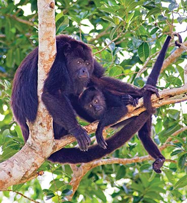
Howler monkeys are a frequent sight at Tikal National Park.
Among the park’s most fascinating creatures are jaguars. Recent studies done over a two-month span have revealed the confirmed existence of seven of these large spotted cats within the national park’s boundaries, and it is thought that at least nine roam its 575-square-kilometer (222-square-mile) confines.
EXPLORING THE PARK
Many visitors come to Tikal on day trips from Belize, Flores, and Guatemala City. While a day at the ruins is adequate for seeing some of the archaeological highlights, staying at the park allows you to enjoy its equally splendid natural setting. After the crowds have departed, you’ll be free to wander about the ruins unhurried, and at times you may feel as if you have the site all to yourself. The sunset from the top of Temple IV is truly inspiring, but is now only an option in the winter months when the sun sets earlier as park rangers make sure everyone is out by 6pm. For movie buffs, the view from Tikal’s Temple IV can be appreciated in Star Wars: Episode IV, as the site of the rebels’ secret base. The Great Plaza also made an appearance in the movie 2012.
The park’s main gate is found along the road from Flores and El Remate, where there’s a checkpoint. From here, it’s another 17 kilometers to the main entrance, parking lot, and visitors center. Entrance to the park costs $19 ($3.50 for Guatemalan nationals) and is collected at the booth just opposite the parking lot. The park is open 6am-6pm daily. If you arrive after 3pm, your ticket should be stamped with the next day’s date, allowing you to enter the ruins the next day at no additional cost. Tickets are checked at a second booth on the trail between the first gate and the entrance to the ruins proper, opposite an oft-photographed ceiba tree gracing the side of the road. There are no ATMs at the park and entrance fees must be paid in cash.
The visitors center is at the main entrance to the park on your left. There are a scale model of the site, the Museo Lítico, an overpriced eatery, and a few small shops selling books, souvenirs, snacks, and sundries, including bug spray and sunscreen. Nearby are the park campsite, police substation, and a post office. The Museo Tikal is farther along, near the airstrip next to the hotels.
The park website is www.tikalpark.com and has lots of very useful information for planning your visit. A modern center for research and conservation of cultural heritage was built opposite the visitors center with a donation from Japan.
Guided Tours
Guided tours of Tikal are best arranged with one of the recommended Flores travel agencies, though you can also hire the services of a certified freelance guide at the visitors center near the park entrance for $50 for up to four people, plus $5 for each additional person.
S THE RUINS OF TIKAL
There is plenty to explore in this vast Mayan city that once harbored thousands of people, and you could easily spend several days here taking it all in. The ruins in evidence today are representative of the latter years of Tikal’s existence, as the Maya built on top of existing temples and palaces. Most of the major structures you’ll see were built after the time of Tikal’s resurgence in the late 7th century.
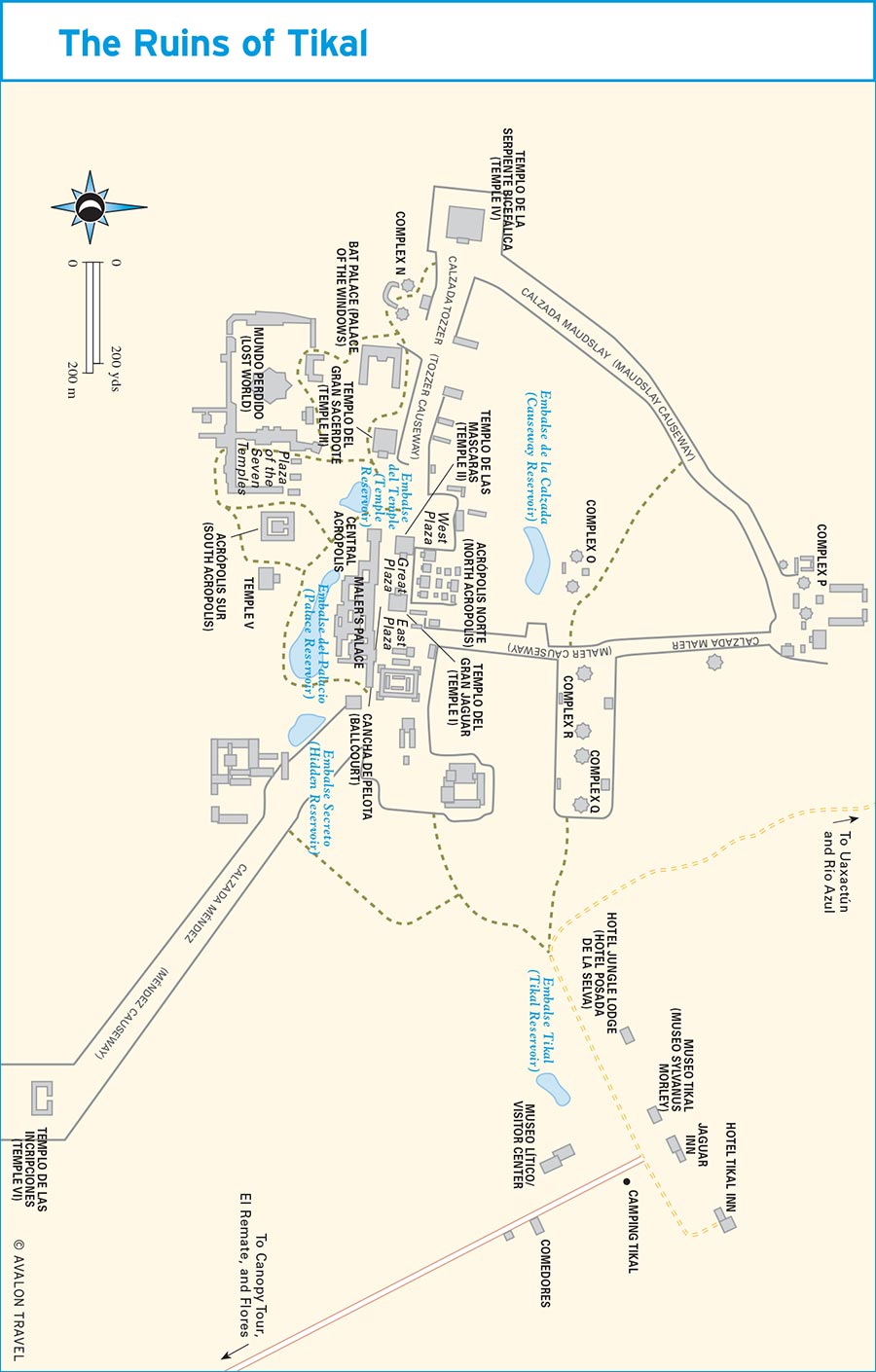
The Great Plaza
Most visitors to Tikal head straight from the park entrance to the Great Plaza, and if you are crunched for time, this is probably the best approach. A path from the ticket control booth leads you to the plaza in about 20 minutes. You’ll gain an appreciation for the site’s elevated setting as you walk uphill toward the heart of the ceremonial center. The view from the back of Temple I as you approach the Great Plaza is always impressive at first sight, as it gives you an idea of the sheer size of the monuments erected by the Maya. Tourist brochures and posters can never adequately convey just how large and impressive Tikal’s temples are.
The path continues alongside the temple, and you are at once greeted by the magnificent Temple II, which faces Temple I, as you enter the large, grassy plaza. Also known as “El Gran Jaguar” (The Great Jaguar), Temple I rises to a height of 44 meters (144 feet). The imposing structure was erected to honor Hasaw Chan K’awil (Heavenly Standard Bearer), the ruler who successfully led Tikal to victory against Calakmul. It was built to harbor his remains and was completed shortly after his death in AD 721 by son and successor Yik’in Chan K’awil, probably with instructions from his father.
The tomb was situated at the temple’s core and contained the ruler’s remains surrounded by jade, stingray spines, seashells, and pearls, which were typical of Mayan burials. It was believed the instruments would aid the person in his journey into the underworld. This journey is depicted on a bone fragment, also found in the tomb, showing a royal figure in a canoe rowed by mythical animal figures. Tikal’s museum harbors a reconstruction of the tomb, known as Tumba 116. Carried off to a museum in Basel, Switzerland, is the door lintel found at the top of the pyramid depicting a jaguar from which the temple gets its name.
Balam: Jaguars in Guatemala
Among the most beautiful and highly revered rainforest animals both in ancient and modern times is the jaguar (Panthera onca), which inhabits Mexico, Central America, and parts of South America. It is one of the big cats, along with the leopard, lion, and tiger, and the third largest of these. Jaguars are similar to leopards, though their spots present different arrangements (jaguars have spots within spots, or rosettes, and are larger). Jaguars are also stockier in build. They inhabit mostly forested lands but will also range across grasslands and open terrain. Also notable is their love of water and ability to swim. These gorgeous jungle cats are largely solitary and known for their hunting skills. They will attack cattle in areas fringing jungle zones and have been known to attack jungle camps to stalk human prey, usually children. Their powerful jaws are capable of puncturing tortoise shells.
Perhaps for these reasons, the Maya had great respect and reverence for the jaguar, which they called balam. Jaguars were a symbol of power and strength and were believed to act as mediums for communication between the living and the dead. Kings were often given names incorporating the word balam, which they viewed as their companions in the spiritual world and protectors of the royal household. Rulers wearing jaguar pelts and man-jaguar figures frequently appear in pre-Columbian art. The jaguar was the patron deity of Tikal and is featured in a royal burial scene depicted on a human bone fragment found in the burial tomb of Hasaw Chan K’awil (Heavenly Standard Bearer) in which the ruler travels to the underworld in a canoe rowed by mythical animal figures.
Ranges for female jaguars are in the vicinity of 25-40 square kilometers, with the range of males being roughly twice as much and encompassing that of 2-3 females. Male jaguars’ ranges do not overlap. For this reason, attempts to conserve existing numbers of jaguars require large expanses of territory such as that found in Guatemala’s Maya Biosphere Reserve. The reserve also adjoins reserves in neighboring Mexico and Belize as part of a vast biological corridor. An estimated 550-650 jaguars remain in the Maya Biosphere Reserve.
Scientists have been studying jaguars in the Maya Biosphere Reserve and are trying to get a more accurate estimate of their remaining numbers in addition to a greater understanding of their behavioral patterns. Within the Laguna del Tigre National Park, biologists have been using radio collars to track five jaguars and a puma in the area surrounding the site of Waka’ in an effort to determine migration patterns along an important biological corridor connecting this area with Mirador-Dos Lagunas-Río Azul National Park. It is not uncommon to see jaguar prints on the muddy trails in the vicinity of Waka’. Ironically, in 2006, a camera crew visiting the park to film a program on scarlet macaws for Guatemalan TV channel Guatevisión was unable to find any macaws but did manage to get a jaguar sighting on tape. Recent video monitoring along 15 stations in the central core of Tikal National Park detected seven jaguars during a two-month period. The Sierra del Lacandón National Park is also believed to harbor large numbers of these jungle cats.
Luckily, you don’t need to go traipsing through the jungle with a saucer of milk if you want to see a jaguar, though chances are it will see you first. Guatemala City’s excellent zoo has jaguars, as does Petén’s ARCAS wildlife rescue center. A jaguar cub was born in Guatemala City’s zoo as recently as 2003. Several zoos in the United States have partnered with facilities in Central America to breed jaguars in captivity. In California, Sacramento’s zoo welcomed the arrival of Tina, a Guatemalan jaguar, and Mulac, a male jaguar from Belize, in 2002.
As part of a larger regional initiative along with Mexico and Belize known as Selva Maya, local conservation group Defensores de la Naturaleza and Fundación Monte Carlo Verde launched the SalvaBalam campaign in 2006 aimed at increasing public awareness of the jaguar’s plight and raising funds for continued study of these fascinating creatures. The project is still active, but is now part of Defensores de la Naturaleza (www.defensores.org.gt).
It was once possible to climb Temple I, but this has not been allowed for several years now. The view from the top was truly spectacular, with Temple II in the foreground and the roof combs of Temples III and IV protruding from the jungle behind it. The structure was closed to climbers partly because of damage caused by a chain aiding in this activity, though the death of at least two visitors after tumbling down its steep steps certainly put the final nail in the coffin. The view from the top was popular in tourism posters and brochures from the early 1980s, and you can still sometimes see them in unexpected places.
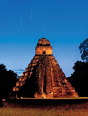
Temple I at sunrise
Across the plaza stands the slightly smaller Temple II, built to honor Hasaw Chan K’awil’s wife, Lady 12 Macaw. Also known as the Temple of the Masks for the large, severely eroded masks flanking its central staircase, it is thought to predate Temple I by a few years. About 10 years ago, a staircase was constructed on its side to allow access to the top, though you could once climb directly up its central staircase. The view from the top is still as good as ever, with a frontal view of Temple I and the North Acropolis off to the side. Temple II probably once stood at the same height as its counterpart when its roof comb was intact, though its restored height is 38 meters (125 feet).
The North Acropolis
Occupying the Great Plaza’s northern end is the aptly named North Acropolis, its foundations dating as far back as 100 BC, though the 12 temples sitting atop this large structure are part of a later rebuilding effort dating to AD 250. Some of these earlier structures can be seen today thanks to a tunnel excavated by archaeologists that provides a glimpse of two giant masks from Early Classic times guarding the entrance to a still-buried temple. The remains of Yax Nuun Ayin I, the first of Tikal’s rulers under Teotihuacán hegemony, were found buried here in 1959 and revealed many details of Teotihuacán influence, including ceramics and the dreaded atlatl.
Some much-eroded stelae line the front of the North Acropolis. These depicted Tikal’s ruling elite, and many have been subjected to ritual defacement at the hands of invaders from neighboring states such as Calakmul.
The Central Acropolis
Commonly referred to as palaces, this complex of interconnecting rooms and stairways built around courtyards probably housed administrative offices and residences for Tikal’s elite, though their exact use is uncertain. The Central Acropolis occupies the south end of the Great Plaza. It is known that the configuration of the various rooms was altered frequently, lending credence to the idea that it served as a royal dwelling place for the ruling elite. One part of the acropolis housed archaeologist Teobert Maler in 1895 and 1904, subsequently coming to be known as Maler’s Palace.
The West Plaza and Temple III
The West Plaza, or Plaza Oeste, lies north of Temple II. Its main features include the presence of a large Late Classic temple on its north end and the unrestored Temple III, across the Tozzer Causeway, to the southwest. Temple III, which is 60 meters high, gives you a good idea of what Tikal’s temples looked like to the early explorers when they were still covered in jungle vegetation. That’s about all you’ll be able to admire of it, as it is closed to visitors.
Some believe Temple III was built to honor the last of Tikal’s great rulers, Dark Sun, and he may in fact be the figure depicted in the structure’s badly eroded lintels. Behind the temple is a large palace complex. One of them, known as the Bat Palace, has been restored. It is also known as Palacio de las Ventanas.
Temple IV and Complex N
Continuing along the Tozzer Causeway, which is one of the original elevated walkways connecting various parts of the city, you’ll come across Complex N on the left. Complex N is a twin-temple complex of the variety frequently constructed by Tikal’s Late Classic rulers, supposedly to commemorate the passing of a katun, or 20-year cycle in the Mayan calendar. Found here is the beautifully carved Stela 16, showing Hasaw Chan K’awil in a plumed headdress. The complex was built in AD 711 to mark the 14th katun of baktun 9, a baktun being 400 years. Altar 5, also found here, depicts Hasaw victoriously presiding over sacrificial skull and bones with a lord from one of Calakmul’s former vassal states. The corresponding text also mentions the death of Lady 12 Macaw, Hasaw’s wife.
Farther along, you’ll come to the colossal Temple IV, the tallest of Tikal’s temples at 65 meters (212 feet). Like the Great Plaza’s temples, it was completed in AD 741 by Yik’in Chan K’awil and may have served as his burial monument, though there is no concrete evidence as of yet. In addition to offering the best views of the site from its summit, it is also known as the origin of some excellent lintels depicting a victorious king surrounded by glyphs. As in the case of the lintels from Temple I, you’ll now have to travel to Basel if you want to see the originals. A replica of Lintel 3 is in Guatemala City’s archaeology museum.
The climb to the top of the temple up a series of wooden ladders attached to its side can be described as simply breathtaking, both for the effort required and for the spectacular views of the forest on all sides. The base of the temple is currently being restored and affords the opportunity to more fully appreciate the massive scale of these impressive constructions.
Temple V and the South Acropolis
The South Acropolis, due south of the Great Plaza, is the site of some excavations that are just beginning to unravel its significance. Its top layers are from Late Classic times, much like elsewhere in Tikal. Temple V lies just east of the South Acropolis. Standing to a height of 58 meters, it may be the original of Tikal’s six temples dating to AD 600. A wooden staircase providing access to the somewhat cramped area below the roof comb and an interesting side view of the Great Plaza was closed during my last visit.
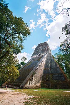
Temple V
Plaza of the Seven Temples
This small plaza can be found to the west of the South Acropolis and contains a series of seven temples arranged in a straight line dating to Preclassic times. There is a triple ball court on the plaza’s north side similar to a larger one just south of Temple I. It’s one of the least visited areas and yet one of the most visually interesting.
The Lost World Complex
Known in Spanish as El Mundo Perdido, this complex is strikingly different from the rest of the site owing to its Preclassic origins, which may help to shed light on Tikal’s early history. The area is dominated by the presence of a 32-meter pyramid, its foundation dating as far back as 500 BC, when it served as an astronomical observatory similar to the one found at Uaxactún. The structure now in evidence marks the top of four layers of construction. There are fabulous views of the Great Plaza and Temple IV from the top, though the stone central staircase on the temple’s steep face can be slippery after it rains. Exercise due caution.
Temple of the Inscriptions (Temple VI)
The most remote of Tikal’s temples, Temple VI lies about one kilometer southeast of the Central Acropolis along the Mendez Causeway, where it stands all by itself. Rediscovered in 1957, this temple is unique because it contains inscriptions much like the temples found at Quiriguá and Copán but unlike Tikal’s other temples. On the back side of the temple’s 12-meter roof comb are a series of 180 glyphs, barely visible today, charting the history of Tikal’s ruling dynasty AD 200-766. They also chart Tikal’s early history as far back as 1139 BC, which the Maya probably guessed at. Still, ceramic evidence at Tikal has corroborated other dates found at the site. The temple is most likely the work of Yik’in Chan K’awil. Stela 21 and Altar 9 adorn the front of the temple at its base and date to AD 736.
The temple’s relative isolation makes it an excellent location for spotting wildlife. Robberies, none of them recent, have been reported here. That said, you should probably not wander off to these parts unaccompanied.
Complexes Q and R
Two other areas deserve mention in this discussion of Tikal’s archaeological highlights. You’ll find them shortly after entering the park, on a path bearing right after passing the ticket control booth. Complex Q and Complex R comprise two sets of Tikal’s twin-temple complexes built by Yax Ain II to commemorate the passing of a katun. One of the pyramids at Complex Q has been restored with its corresponding stelae repositioned in front of it. The best of these, Stela 22, can be seen at the Museo Lítico and depicts Yax Ain II’s ascension to the throne. The temple here dates to AD 771.
Farther west, as you approach the Maler Causeway, is Complex R, another twin-pyramid complex dating to AD 790.
MUSEUMS
Tikal’s two museums are oddly in different parts of the park. The first of these is the Museo Lítico (9am-noon and 1pm-4:30pm Mon.-Fri., 9am-4pm Sat. and Sun., $2.50 for both museums), housing stelae and carved stones from the archaeological site with a scale model outside showing what the city probably looked like around AD 800. There are some interesting photos taken by explorers Alfred Maudslay and Teobert Maler showing Tikal’s temples overgrown by a tangle of jungle vines and branches as they looked when they were first discovered.
The Museo Tikal (also known as Sylvanus G. Morley Museum, 9am-5pm Mon.-Fri., 9am-4pm Sat. and Sun., $2.50), across the way next to the Jaguar Inn, has some interesting exhibits, including the burial tomb of Hasaw Chan K’awil found inside Temple I. Some of the ceramics from this museum have been moved to the newly completed Center for Conservation and Investigation of Cultural Heritage, across from the visitors center.
RECREATION
In addition to exploring the ruins, there are a variety of recreational opportunities in and around Tikal National Park.
Canopy Tour
You have a choice of two zipline trajectories between raised platforms in the jungle at Canopy Tours Tikal (tel. 5615-4988 or 4262-0813, www.tikalcanopy.com, 7am-5pm daily, $30, at the national park entrance). The first of these includes 11 platforms with ziplines ranging in length 75-150 meters while you dangle 25 meters over the forest floor. The second, more adrenaline-inducing option, includes ziplines up to 200 meters long hovering 40 meters above the safety of ground level. There are also 400 meters of hanging bridges for a more leisurely look at the forest canopy, or there’s horseback riding if you prefer to explore from the ground level.
Bird-Watching
Specialty tours for bird-watchers can be arranged by contacting La Casa de Don David (tel. 7928-8469 or 5306-2190, www.lacasadedondavid.com) in El Remate. The lodge’s knowledgeable staff can connect you with good English-speaking local guides who know the park and its birds. Another recommended outfitter is Guatemala City-based Cayaya Birding (tel. 5308-5160, www.cayaya-birding.com).
ACCOMMODATIONS
Lodging at Tikal National Park is limited by law to three lodges and a campground. An increasing amount of competition from accommodations at nearby El Remate has spurred the Tikal hotels toward higher standards while keeping prices relatively reasonable. There are few places in the world where you can stay in a comfortable jungle lodge inside a national park just minutes away from a UNESCO World Heritage Site. That being said, the Tikal hotels do feel somewhat overpriced in terms of what you get for your money.
Electricity at the park is sporadic, with accommodations and other facilities having to limit the hours during which this convenience is available. Power is usually turned on in the morning for 2-3 hours and then again in the evening shortly after sunset for another three hours. If you need to use a computer provided by one of these facilities for checking email or need to recharge camera batteries or cell phones, you should plan accordingly. If you absolutely need a fan to cool your room while you sleep overnight in the humid Petén jungle, you may want to stay outside the park, as ceiling fans go silent once the electricity turns off. It can get very hot here, even at night. None of the lodges have air-conditioning. More recently, the Jaguar Inn has begun providing electricity round-the-clock and this seals the deal for many a traveler.
Beware if booking online, as at least two of the three lodges have lower-priced accommodations mysteriously missing from their online price lists. If you call the hotels looking for one of the less expensive shared-bath rooms, you’ll most likely need to ask for one specifically, as they’ll automatically try to sell you one of their premium rooms.
Coming from the ruins, the first place you’ll come across is the Jungle Lodge (tel. 2476-8775, www.junglelodgetikal.com, $45-100 d), offering decent bungalows with private hot-water baths, ceiling fans, and two double beds as well as a few very basic, less expensive rooms with shared bathrooms. All are set amid a pleasant tropical garden atmosphere and there is a swimming pool. The restaurant here serves breakfast ($7), lunch, and dinner ($8-12). Be advised the lodge is closed every year during September. As you head toward the old airstrip just past the museums, you’ll reach the friendly Jaguar Inn (tel. 7926-2411, www.jaguartikal.com), where you can choose from nine comfortable bungalows with small front patios with hammock ($80 d), a dormitory ($13 pp), hammocks with mosquito netting ($5), or camping in a supplied tent ($15 pp). The restaurant here is a safe bet, serving adequate portions of good food (though the service can be very slow). Dinner is about $10. There are laptops available for Internet surfing and checking email ($5/hour). The electricity here stays on round-the-clock, thanks to a generator. Next door, Tikal Inn (tel. 7926-0065, www.tikalinn.com, $45-100 d) gets consistent praise for its good service and large, comfortable rooms centered round the swimming pool just behind the hotel’s restaurant. You can choose from standard rooms or pricier, more private bungalows; all have ceiling fan and private bath. The restaurant serves three meals a day.
Tikal’s campground is opposite the visitors center with a spacious grassy area for tents as well as palapa structures for stringing hammocks. There are showering stalls among the bathroom facilities. Hammocks and mosquito netting are available for rent ($10), and a two-person tent costs $14 for the night.
FOOD
Your best bet for food is at one of the three on-site lodges, but there are a number of comedores here serving basic yet passable fare in adequate portions for about $7 for a full meal and a drink. The menus are virtually indistinguishable from one another and are heavy on local staples such as beans, eggs, and tortillas but also feature some international fare like burgers and pasta. The comedores are across from the visitors center on the right-hand side as you enter the park from the main road. They include Comedor Tikal, Restaurant Imperio Maya, and Comedor Ixim K’ua, all of which open early for breakfast and close at 9pm daily. El Meson (tel. 7952-8700, lunch only) is a simple, open-air, thatched-roof eatery that serves tasty set menus that include soup, chicken or beef, rice, vegetables, and fruit. It’s located at the end of a short trail to the right of the main entrance to the park (if you’re coming from the parking lot). The trail is a few meters past the oft-photographed ceiba tree at the junction with the road leading to Uaxactún.
You can get your morning coffee fix right at the visitors center at Caffé Ital-Espresso. Its Italian owner uses some fine Guatemalan beans for his espresso beverages. There are also sandwiches to go.
As for the hotel restaurants, the large dining room at the Jungle Lodge is a popular stop for lunch with tour groups. As such, it tends to offer dependable set-menu lunches of meat or chicken dishes accompanied by rice and salad for about $9. Dinner options include a varied assortment of meat dishes, pasta, and sandwiches. The Jaguar Inn caters largely to the international backpacker crowd and makes a particularly decent place for good-value dinners, including tasty pastas and desserts. The Tikal Inn gets props for its hearty breakfasts with good, strong coffee.
GETTING THERE
Most people arrive here from Flores, El Remate, or Belize. See the corresponding sections for information on how to get here. Minibuses leave Tikal from the airstrip fairly frequently, particularly after about noon, heading south toward El Remate, Ixlú, and Flores. Change buses at Ixlú if you’re heading east to Belize. If all else fails, a taxi to Flores should cost about $50.
The Maya Biosphere Reserve
The largest protected tropical forest in North America, this 1.7 million-hectare (4.3 million-acre) reserve is Guatemala’s last chance for preserving a significant part of the forests that once covered all of Petén. It is gradually gaining notoriety among international travelers for its vast expanses of tropical forest and the remote Mayan ruins that lie buried within. It is hoped that ecotourism here will take hold as a major industry, providing jobs and a viable alternative to ecological destruction, as in neighboring protected areas in Belize and Costa Rica. A cursory glance at a map of Guatemala reveals that the northern third of Petén is a sparsely populated region harboring an unusually high concentration of Mayan sites, remote jungle wetlands, rivers, and lagoons. Those with a strong sense of adventure will find plenty to see and do in one of Central America’s last ecological frontiers.
Although the biosphere reserve has been in existence since 1990, many of the parks that compose it remain little more than “paper parks,” as the government entities charged with enforcing protection of these areas are woefully underfunded and understaffed. Several of the parks are now being administered jointly between Guatemala’s National Protected Areas Council (CONAP) and local conservation organizations. Foreign NGOs have also joined the battle to preserve the Maya Biosphere for future generations against seemingly insurmountable odds. Threatening the continued existence of this unique area are traditional factors common to tropical forests in developing countries, including the expansion of the agricultural frontier by land-hungry peasants and changes in land use such as cattle grazing. But there are also more sinister forces at work here, and the reserve is under serious assault by wildlife and timber poachers, both from within Guatemala and neighboring Mexico, as well as from the activities of drug smugglers occupying large extensions of the park to move their product.
Guatemalan authorities have stepped up their efforts to regain control of this vast wilderness area, and it should be noted that not all of the above-mentioned forces are in operation throughout the park. There are many areas within this vast biosphere reserve that are easily and safely explored, combining the splendors of some of the Mayan civilization’s most spectacular ruins with the wonders of a largely intact tropical forest all around. In some cases, these are not so easily accessible, but the rewards for those putting forth the effort to reach some of Guatemala’s least-visited attractions are well worth it.
Among the highlights of the reserve are the Mirador-Dos Lagunas-Río Azul National Park, which is home to the largest manufactured pre-Columbian structures in the Americas, found at El Mirador, and at least 25 other smaller Mayan sites. Some, such as Wakná, have been discovered only as recently as 1998, and many more undoubtedly await discovery. At the site of San Bartolo, archaeologists uncovered the earliest evidence of Mayan writing in a wall mural discovered in 2001. The area is also home to the last remaining undisturbed tropical forests in Guatemala and is being considered for special protection as the Mirador Basin National Park.
Much of the western part of the reserve, particularly Laguna del Tigre National Park, has unfortunately been lost due to population pressures. Still, the area around the Mayan site of Waka’ (also known as El Perú or Waka’-Perú) remains well preserved and is the home of a biological research station and a project to help conserve Petén’s last remaining populations of scarlet macaws.
The Maya Biosphere was also featured on U.S. television with the filming of Survivor Guatemala at the Mayan ruins of Yaxhá. The spectacular ruined city is rivaled in magnificence only by Tikal and El Mirador, and its splendid setting next to a tropical lagoon complete with hungry crocodiles is second to none.
Survivor Guatemala certainly catapulted Guatemala and Yaxhá into the collective consciousness, and many people believe it is just a matter of time before the treasures hidden in the Petén forest gain greater notoriety and become an engine for the preservation of this incredible but often-overlooked adventure-travel destination.
UAXACTÚN
The remote site of Uaxactún lies just 23 kilometers north of Tikal on an unpaved road through the jungle passable by four-wheel-drive vehicle. The Wrigley Company once had a busy chicle extraction operation here, complete with an airstrip. Today the airstrip lies in disuse, with the ruins and small community built around it. Many of Uaxactún’s residents make their living from gathering forest products such as chicle, allspice, and xate palm leaves. In 2000, Guatemala’s Protected Areas Council (CONAP) granted the community a sustainable forestry concession to selectively harvest timber from surrounding multiple-use zones of the Maya Biosphere Reserve. While it’s yet to be seen how sustainable it is in practice, the logging concession has already been partially nullified in areas approaching the subsequently created Mirador Basin archaeological zone and could be completely eliminated with the eventual creation of a proposed Mirador Basin National Park. Locals also guide visits from here to remote sites such as Río Azul and El Zotz, which may be their best hope for earning income without harming the fragile tropical forest ecosystem they inhabit.
chicle tapping in Uaxactún
The ruins themselves might seem a bit unimpressive after a visit to their better-known neighbor to the south, as they are smaller and not nearly as well preserved, though Uaxactún’s main claim to fame is the presence of a fairly elaborate astronomical observatory. Sylvanus G. Morley is credited with rediscovering Uaxactún in 1916. Its original name has subsequently been deciphered as Siaan K’aan (Born in Heaven), though Morley is said to have chosen the name Uaxatún (Eight Stone) as a reference to a stone dating to the 8th baktun in the Mayan calendar, then the earliest-known Mayan inscription. It is also speculated that his choice of name was a play on words for “Washington,” the U.S. capital and home of the Carnegie Institute that funded his explorations. Morley’s initial investigations focused on the site’s inscriptions. Uaxatún’s structures would have to await being mapped and more closely inspected until the arrival of Frans Blom in 1924. The Carnegie Institute excavated the site between 1926 and 1937.
History
Uaxactún is a Middle Preclassic site dating to about 600 BC that came into its own in the Late Preclassic sometime between 350 BC and AD 250 with the appearance of its first ceremonial plazas in the areas now known as Groups A and E. Its earliest stelae date to around AD 328. More complex architecture and several other plazas also make their appearance at this time.
The Murals of San Bartolo
Fascinating discoveries at the newly famous site of San Bartolo have rocked the world of Mayan scholars, completely shattering long-held beliefs about the origin of elaborate Mayan art and writing that narrates the stories of ruling monarchies. It is now clear that Preclassic Mayan societies had achieved a degree of sophistication in art, writing, and government once thought to have been attained only several centuries later. San Bartolo, deep in the jungle near Río Azul, has yielded the earliest known Mayan mural and the oldest known Mayan burial tomb. The murals are impressive not only for their early date (AD 100-200), but also for their quality. The best-known Mayan murals, at the site of Bonampak (Mexico), date to the late 8th century AD. San Bartolo’s location, while no longer secret, is known only to a few in the archaeological community. Visitors are not welcome, but there are plans to make a replica of the murals available to tourists in the future. The Mayan site of San Bartolo encompasses more than 100 structures, among them temple pyramids (at least two of which are more than 25 meters high), a palace, and ball court, and is still being excavated.
The mural was discovered in 2001 by Harvard University’s William Saturno when, in search of shade from the midday sun, he ducked into a trench hacked by looters under an unexcavated pyramid. What followed were two years of planning the painstaking excavation, and the mural depicting creation mythology was reclaimed from the soil beneath the temple structure. It is similar to one found in the Dresden Codex, one of three Mayan books to survive the wide-scale destruction of ancient Mayan texts by Spanish priests in the 16th century (the other two are the Madrid Codex and the Paris Codex).
Among the themes depicted are the establishment of order to the world, the latter portrayed as upheld by trees with roots leading to the underworld and branches holding up the sky. Stationed at each tree are four deities providing a blood sacrifice and an offering.
In another section, the mural shows the maize god setting up the tree at the center of the world and crowning himself king. This section of the panel traces the maize god’s birth, death, and resurrection. In the final scene, a historic coronation of an actual Mayan king is depicted with his name and title written in hieroglyphics.
Project iconographer Karl Taube believes the writing style differs from that evidenced in later periods of Mayan history, but it is nonetheless sophisticated. He also points to the appearance of similar scenes in the Dresden Codex. Saturno speculates the king depicted in the mural likely claimed the right to rule from the gods themselves and not merely from lineage, as did kings in later times.
The second major discovery is the tomb of an early Mayan king dating to 150 BC found in 2005 by Guatemalan archaeologist Mónica Pellecer Alecio about a mile away from the mural, also under a small temple pyramid. The find provides further evidence of early monarchic rule.
A full-length feature on these amazing discoveries can be found in the January 2006 edition of National Geographic magazine and online at www.sanbartolo.org.
After the decline of El Mirador in the 2nd century AD, Uaxactún and Tikal became embroiled in a great political and military rivalry for local supremacy until the site was conquered by Tikal in AD 378. Tikal was aided in its takeover of Uaxactún by its newly formed alliance with Teotihuacán and the introduction of a spear-throwing apparatus imported from the central Mexican city-state. Uaxactún remained a subordinate state for the remainder of its history.
The Ruins
The most impressive set of ruins lies a 15-minute walk southeast of the airstrip and is called Group E. A series of small, partially restored temples, Structures E-I, E-II, and E-III, are arranged side by side, going north to south, and designed as an astronomical observatory. The structures are arranged in such a manner as to coincide with the sunrise on key dates. When viewed from the top of nearby Temple E-VII-Sub, the sun rises over E-1 on the summer solstice and over the southernmost E-III on the winter solstice. Temple E-VII-Sub’s foundations date to about 2000 BC, and there are some much-deteriorated jaguar and snake heads flanking the temple’s side.
Northeast of the airstrip are Groups A and B, which were less carefully excavated but include several altars and stelae found mostly fallen among the remains of the larger temple palaces.
Accommodations and Food
Lodging and dining options in Uaxactún are extremely basic, as it is a remote forest community literally in the middle of nowhere. The settlement’s best accommodations are at Campamento El Chiclero (tel. 7926-1095, $8 pp) on the north end of the airstrip with 10 basic rooms with shared bath and mosquito-netted windows. You can also camp or string a hammock here for $4. The restaurant serves large portions of good, basic food ($5 per meal), and there is a small on-site museum (free) with local artifacts. The friendly owners can arrange trips to some of the remoter places in the biosphere reserve, including El Zotz, Río Azul, Naachtun, and El Mirador. A less expensive alternative is Aldana’s Lodge, just off the street leading to Groups A and B, where simple thatched-roof cabanas are $7 per person, or you can camp for $4 per person. Aldana’s can also arrange visits to area sites.
You can eat at your choice of three simple comedores in town: Comedor Uaxactún, Comedor La Bendición, and Comedor Imperial Okanarin.
Getting There
A Pinita bus leaves Santa Elena at 1pm daily, stopping in Tikal at about 3pm. From there it’s about 1.5 hours to Uaxactún. These times are not set in stone, as with most schedules in Guatemala, and the bus can arrive in Uaxactún as late as 6pm sometimes. The return trip to Santa Elena leaves Uaxactún at 6am. (There is sometimes a minivan leaving Uaxactún for Tikal at 8am with the inbound minivan from Tikal arriving at 6pm, but it’s sporadic and doesn’t always operate.)
If you’re driving, be aware that the road is passable only in a four-wheel-drive vehicle at any time of year. If you’re unable to fill your gas tank in Flores, the last gas station en route is at Ixlú, south of El Remate.
YAXHÁ-NAKUM-NARANJO NATURAL MONUMENT
This park encompasses the Mayan sites of Yaxhá, Topoxté, Nakum, and El Naranjo. Most prominent of these is Yaxhá, which gained international fame in 2005 with the filming of Survivor Guatemala. The park was closed for two months, during which time contestants lived among the ruins eating corn, plotting ways not to get voted off, and fighting off mosquitoes. Only El Mirador and Tikal are bigger than Yaxhá, and its isolated setting on a limestone ridge overlooking the lagoons of Yaxhá and Sacnab is simply splendid. Despite its TV fame, you can still wander the site with nary another visitor in sight. Don’t even think of swimming in the lakes here, as they have a healthy population of rather large crocodiles.
S Yaxhá
The relative lack of inscribed monuments found at Yaxhá (8am-5pm daily, $10 admission includes entrance to Nakum) has made tracking its history a bit of a challenge, though it appears it was a major player during the Classic period. It is believed Yaxhá was locked into an ongoing power struggle during much of this time with its smaller neighbor, Naranjo, about 20 kilometers northeast. Yaxhá’s sphere of influence was almost certainly limited by the proximity of Tikal, and the architecture here shows many similarities to that of the latter site. Naranjo eventually overran Yaxhá in AD 799. Spanish friars passed through here in 1618, and Austrian explorer Teobert Maler visited in 1904. Much of the site remained unexcavated until recently. A German-Guatemalan effort is conducting the site’s ongoing excavation and restoration.
Yaxhá’s highest structure is Structure 216, offering wonderful views of the lagoons and forests from its summit. Watchers of Survivor Guatemala will probably recognize the temple from numerous aerial shots shown during the program’s run. It features a broad central staircase and rises to a height of about 30 meters. Access is via a wooden staircase built into the temple’s side.
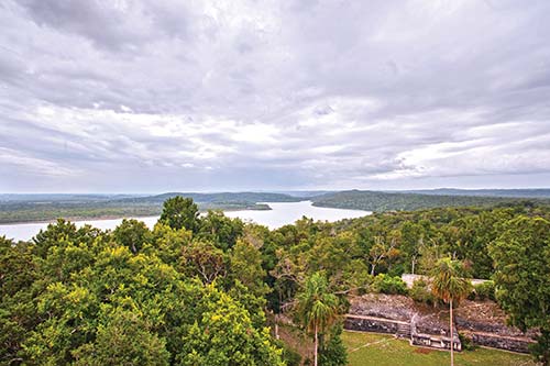
view of Yaxhá from atop Structure 216
The temples at Yaxhá appear constructed from a very light-colored limestone markedly different from the stones used elsewhere in the Mayan world, giving the ruins a very different feel. You’ll find the ruins spread out over nine plazas with 500 mapped structures, including temples, ball courts, and palaces. Other highlights include the recently restored North Acropolis, surrounded by three temples, two of which are fairly large. A path known as Calzada Blom leads almost one kilometer north from here to the Maler Group, a complex featuring twin temples facing each other across a plaza similar to the setup at Tikal. A number of weathered stelae and the broken remains of a large circular altar further adorn the complex. Another great location affording wonderful views closer to the heart of the ruined city is the top of an unnamed astronomical observation pyramid between Plaza F and Structure 116.
The parking lot and restrooms are on the east side of the park near Plaza C, along with a small museum. There are two boat docks here, one below the parking lot and one at the western end of the site.
You can camp for free at Campamento Yaxhá, a designated lakeside campsite below the ruins proper. A more comfortable option is the friendly Campamento Ecológico El Sombrero (tel. 7926-5229, www.ecosombreroinicio.tripod.com), about 200 meters from the main road before you come to the park entry post. Its 13 comfortable rooms are housed in thatched-roof bungalows fronting the lake. There’s a dock, but it’s not recommended for swimming because of the crocodiles. A restaurant serves adequate food, with the variety of menu items on offer heavily dependent on whether or not there’s a group staying at the lodge. The lodge arranges boat trips to Topoxté and guided tours of Yaxhá.
A series of roads leads to Yaxhá. About 31 kilometers east of Ixlú, on the road toward the Belize border, a well-marked turnoff leads a further 11 kilometers north to the Yaxhá guard post, where you pay admission and sign in to the park. It’s another three kilometers from here to the actual ruins of Yaxhá. The road is in good condition, even during the rainy season. If traveling by bus, you can get off at the junction to Yaxhá and hitch a ride with an occasional passing pickup truck or fellow travelers. There is some traffic along this route because of the presence of the small village of La Máquina, about two kilometers from the park guard post.
Several of the Flores tour operators now do Yaxhá with certain frequency. You can also get a minivan from El Remate to the site, but expect to pay about $60 round-trip. Try to find people to share the ride.
Topoxté
This smaller site is situated on an island close to the southwest shore of Yaxhá Lagoon near the Reserva Natural Privada Yaxhá and dates to Preclassic times, though the structures in evidence are mostly from the Late Postclassic period. Plazas and temples are being restored, though nothing is of the scale found at Yaxhá. Topoxté was one of the last strongholds of the Itzá people.
The site was surveyed on several different occasions throughout the 20th century starting in 1904, though restoration and preservation would have to wait until the early 1990s. The most notable structure here is Temple Pyramid C, the only Postclassic building remaining in Petén. Similar to structures in the Yucatán and Guatemala’s highlands, it has three levels crowned by a portal supported by two pillars.
The only feasible way of getting here is to catch a boat ride from Campamento Ecológico El Sombrero or via boats docked at Yaxhá.
Nakum
North of Yaxhá on a road suitable only for dry-season driving is the Late Classic site of Nakum, now being excavated. Near the site lies the marshy swampland of Bajo La Justa, which was under intense cultivation during Mayan times. You’ll pass through it on your way there. Nakum features the usual assortment of pyramids, plazas, and temples, though there are some unique arches found here along with stelae dating from AD 771-849. Noted archaeologist Alfred Tozzer passed though here in 1909-1910, working for the Peabody Museum; he recorded his findings in a work titled, A Preliminary Study of the Prehistoric Ruins of Nakum, Guatemala.

on the road from Yaxhá to Nakum
MIRADOR-DOS LAGUNAS-RÍO AZUL NATIONAL PARK
This vast wilderness area encompasses the ruins of El Mirador, one of the earliest and largest Mayan cities to emerge from Petén’s jungles, as well as several other Preclassic Mayan sites. It abuts Mexico’s Calakmul Biosphere Reserve to the north, which protects another important archaeological site and a large tract of forest in its vicinity. The protected status along the southern border of Guatemala’s northern neighbor, and the lack of road access, have allowed this park to remain a largely untrammeled wilderness. Access is difficult and best attempted during the dry season, as seasonal flooding of swamps known as bajos turns forest paths into knee-deep mud for much of the year. The other major Mayan site giving its name to this park is Río Azul, which lies deep in the jungle near the western border with Belize.
Archaeologists and environmentalists are lobbying for the creation of the Mirador Basin National Park, and the Guatemalan government has shown interest in preserving this wilderness area harboring Mayan ruins of at least equal importance to that of Tikal.
S El Mirador
This massive city, rediscovered in 1926 and photographed from the air in 1930, but only recently the focus of ongoing excavations, holds great promise both as a tourism destination rivaling the magnitude of Tikal and as an important piece in the puzzle concerning the advancements of Preclassic Mayan society. El Mirador flourished between 200 BC and AD 150 (about 1,000 years before Tikal) and has revealed a greater level of sophistication than once thought concerning early Mayan society. It is thought to have been home to 80,000 people at the height of its occupation. Its sheer size and the earliness of its development have earned it accolades, such as the “Cradle of Mayan Civilization.”
The site sits on a series of limestone hills at an altitude of just over 240 meters (800 feet) and occupies about 16 square kilometers. El Mirador’s dominating feature is the presence of two large pyramid complexes, El Tigre and La Danta, running east to west and facing each other. The architecture is characterized by triadic structures composed of one large temple pyramid flanked on either side by two smaller pyramids, a pattern that is repeated elsewhere in the Preclassic sites of the Mirador basin.
The base of the El Tigre Complex is as large as three football fields, while the large temple dominating the structure reaches 55 meters (180 feet) in height. The lower flanking pyramids contain gigantic stucco jaguar masks.
The city’s Central Acropolis takes the form of a narrow plaza bordered on one side by a series of small buildings. Moving south from the El Tigre Complex, you come to the Monos Complex, another triadic structure named after the howler monkeys tending to congregate in this area.
The colossal La Danta Complex lies to the east of the main plaza and Central Acropolis. Although technically lower than El Tigre, it rises to a height of 70 meters (230 feet) thanks to its elevated location on a hillside, making it the tallest structure in the Mayan world. Its base is equally impressive. There are jaguar and vulture heads built into the sides of the smaller temples here and the spectacular views from the top of the pyramid afford views of nearby Mayan sites, including Nakbé and Calakmul.
Other interesting site features include the León Pyramid, at the northern edge of the city, and Structure 34—a Preclassic building with the oldest known Mayan standing wall.
The Mirador Basin Project
Deep in the untouched forests of northern Petén in what archaeologists call the Mirador Basin, far from the throngs of tourists at other Mayan sites, lie the overgrown remains of the most fascinating cities ever built in Preclassic times. The Mirador Basin, as defined by its geographical characteristics, is an elevated basin dominated by low-lying swamps known as bajos surrounded by karst limestone hills to the south, east, and west, forming a triangular trench covering roughly 2,100 square kilometers. Some of its sites, including El Mirador and Nakbé, are being excavated and have yielded many clues concerning the advanced nature of early Mayan civilization. As the excavations continue to bring fascinating new discoveries, archaeologists, conservationists, and local residents remain at odds about how best to preserve the remaining Petén forests and the important monuments they harbor.
At the heart of the controversy is the proposal for a Mirador Basin National Park, spearheaded by UCLA’s Dr. Richard Hansen, who heads the excavation project at El Mirador. The park would stretch clear to the Mexican border at its northernmost points, encompassing parts of Mirador-Dos Lagunas-Río Azul National Park. At its southern tip, it would stretch all the way down to El Zotz-San Miguel La Palotada Biotope. The area is home to Petén’s last remaining expanses of well-preserved forests.
Hansen envisions a large national park guarded by armed rangers similar to those of the U.S. National Park Service. There would be several luxurious ecolodges, visitors centers, an airstrip, a narrow-gauge railroad, and hiking trails linking the various restored Mayan sites within the basin. The proposed park would be roughly four times the size of Tikal National Park and would be largely based upon the same management model. Hansen sees the potential to accommodate up to 80,000 visitors per year.
Hansen’s plans, though well-intentioned, have met substantial opposition from local communities and Petén’s powerful environmental groups, who have spent many years and millions of dollars developing relationships with local communities to encourage the sustainable extraction of forest products. The sustainable forestry programs have received support from The Nature Conservancy and the U.S. Agency for International Development, among others.
Some believe the communities could receive greater economic benefit from sustainable forestry than from working as staff in tourist hotels and restaurants. The community of Uaxactún, for example, was awarded a sustainable forestry concession in 2000 by CONAP, and villagers there have made a living from collecting forest products for decades.
Although the park itself will supposedly be without roads, new infrastructure would have to be built to make the region more accessible to visitors, raising the specter of a much-talked-about road connecting Tikal to Mexico’s Calakmul. Along these lines, Mexico has been insisting on the construction of a road from Chetumal to Tikal in an attempt to integrate the two countries’ archaeological sites as part of the Plan Puebla-Panama, an idea vehemently opposed by local conservationists because it would bisect some of the best-conserved areas of the Maya Biosphere Reserve.
For more information on the Mirador Basin project, check out the FARES website at www.miradorbasin.com.
Excavations are being done under the direction of UCLA’s Dr. Richard Hansen, who has led a larger project aiming to protect the entire Mirador basin as an ecoarchaeological preserve. The preservation of its delicate monuments is being aided by technological advances, including housing structures under polycarbonate roofs designed by Hansen and his associates, so as to protect them from rain and ultraviolet light.
In 2009, Hansen and Guatemalan authorities unveiled the discovery of a frieze at El Mirador depicting a scene from a Mayan sacred book, the Popol Vuh, in which the mythical “Hero Twins” visit the underworld. According to Hansen, the frieze lends further credence to the Popol Vuh’s creation myth and its authenticity as a Mayan document, despite its first translation well into the Christian era in the 1700s. The frieze took three months to excavate and was found while archaeologists were looking for water reservoirs at the site.
GETTING TO EL MIRADOR
Getting to El Mirador is not an easy task, though you wouldn’t know it judging by the readiness of certain Flores tour operators to book you on a trip even at the height of the rainy season. The trek to El Mirador is not for the faint of heart and should not be attempted July-November, when the mud is knee-deep throughout most of the trail. In the worst of places, a rope is tied to the end of a tree and trekkers must pull themselves through shoulder-deep mud. This is, after all, a tropical forest and the terrain is characterized by swamplands. Add to this the incessant buzz of hungry mosquitoes, extreme heat and humidity, and you start to realize why so few people make it to this remote site. Your best bet is to attempt the trek at the height of the dry season between February and April. Mel Gibson has visited on several occasions. He arrives by helicopter.
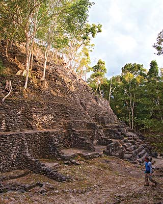
the La Danta Complex at El Mirador
Treks begin in the village of Carmelita, inside the biosphere reserve at the end of the line for the road from Flores. Carmelita consists of a small cluster of houses grouped alongside the road with a few basic services such as a comedor, a small general store, and simple accommodations. The journey usually lasts five days. The first night is spent at El Tintal, and the next day is a grueling hike that puts you at El Mirador close to nightfall. You spend two nights at the ruins before the two-day hike back to Carmelita. Trip prices vary, but expect to pay about $250 per person for two people. Some outfitters do the trip in seven days, allowing more time at El Mirador and stopping en route at Nakbé and Wakná. Mules carry the supplies, but you can also rent additional mules or horses for riding. This is particularly recommended if you make the journey in the wet season. Expect to pay an extra $13 per day for riding horses.
Be very careful in your selection of an outfitter to get you to El Mirador. The community of Carmelita, with help from NGOs, has trained and licensed guides to take visitors on the hike as part of a sustainable tourism initiative contributing to the ecologically friendly livelihood of local residents. While it’s a nice idea in theory, it may not always be the best way to go. Not all of the local guides have the same skills or experience in running the trek, and you run the risk of getting one of these lesser-experienced guides if you book your trip directly through the community. The task invariably falls on whoever is available to take you at that particular time. Further complicating the scenario is the presence of “gypsy” guides falsely claiming to be part of the local tourism committee.
That being said, you can save some money by taking public transport to Carmelita and then hooking up with the local Comité de Turismo Comunitario—Cooperativa Carmelita (tel. 7861-2639 or 7861-2640, www.turismocooperativacarmelita.com, expedicionmirador@yahoo.com). The trip should cost about $250 per person for two people. Book at least a few days in advance, as the supplies and food must be brought in from Flores and the guides must go into town to get them. If you do go this route, make sure the guide buys adequate amounts of food for the duration of the trip. A common complaint is that food runs low halfway through the trek. You should also verify that there is enough water. Have the guide unpack all the supplies and show you exactly what you’re taking. Don’t hesitate to tell the guide if the food supply is inadequate for the trip’s duration. In the worst of cases, you might buy a chicken to eat from the guards at the site, though it won’t be cheap and there’s no guarantee they’ll have one to sell to you.
A final consideration if booking directly through the community is that the guide will want money up front so as to buy food and supplies. This may or may not be an inconvenience to you, but it bears mentioning nonetheless. The more established Flores tour operators take credit cards and arrange everything for you in advance.
This leads us to your second option, that of booking the trip from Flores through one of several recommended outfitters. Although any Flores travel agency will claim to offer the trip, the quality of the service often differs, and you run the risk of getting set up with an inferior guide at premium prices. These outfitters may or may not contract the services of the local Carmelita guides. Matthias, one of the friendly owners of Los Amigos Hostel (tel. 7867-5075, www.amigoshostel.com) in Flores, organizes trips using local guides for $225 per person for two people and says he is happy with his current selection of guides after much trial and error. On the high end of the spectrum (and highly recommended) is Monkey Eco Tours (tel. 5201-0759 or 5414-5780, www.nitun.com, $185 per person per day for a five- or six-day trip with 4-6 people), with multiday treks done in style and with wonderful camp cuisine.

picnic lunch on a tour with Monkey Eco Tours
Lost and Found: The Mystery of Site Q
For much of the 20th century, looters worked Petén’s remote sites undisturbed, raiding tombs and extracting precious artifacts before archaeologists had a chance to study and document them. At the height of the looting, in the 1960s, archaeologists marveled at a series of magnificent glyphs making their way into a number of private collections and museums from an unknown site. Archaeologists dubbed the pieces’ origin “Site Q” and the search to find the mysterious producer of the wonderful glyphs was on.
The glyphs made repeated references to a place deciphered as kan, or “snake head,” which was eventually deduced to be Calakmul, and recorded several events in its history. It was once thought that this might be Site Q, but the badly eroded stelae at Calakmul were not of the same high-quality limestone.
The identity of Site Q would remain a mystery for more than four decades. The mystery first began to unravel in 1997 when an expedition headed by Ian Graham of Harvard University and David Stuart, now at the University of Texas at Austin, found evidence at remote La Corona leading them to suggest the possibility that it was Site Q. Then, in 2005, a 1 by 0.5 meter limestone panel containing 144 hieroglyphs was unearthed when an anthropologist working at the site followed a looter’s trench into a small chamber.
Marcello A. Canuto, of Yale University, made the amazing discovery, which matches the Site Q pieces geologically. The translated text of the La Corona glyph panel, meanwhile, is consistent with the writings on the other Site Q pieces.
Although archaeologists are satisfied with finally putting to rest one of the longest-running searches for a lost Mayan city, they still have some unanswered questions. Among the Site Q glyph panels in private collections is one known as the “Dallas panel,” which archaeologists believe was cut from a throne room. No such room has yet been found at La Corona.
Part of the Guatemalan government’s plan to bring more visitors to El Mirador has involved the construction of visitor facilities. These include two new tent platforms, a kitchen, eating area, hammock lounge, showers, and toilets. Facilities at Carmelita have likewise been improved with a visitor information center, a gift shop selling maps and souvenirs, and toilets.
The most expensive option (but also the easiest) is to make like a celebrity and take a helicopter. This isn’t as difficult to arrange as you might think, now that at least one recommended outfitter has begun offering these trips on a fairly regular basis. Guatemala City-based Expedición Extrema (tel. 5655-3916 or 3003-2866, info.expedicion@gmail.com) coordinates overnight chopper rides to El Mirador for about $2,000 per person, including transport from Guatemala City with a pit stop in Flores, camping and park entrance fees, and guided hikes around the site and nearby complexes. The fee does not include food, beverages, or overnight camping equipment such as tent, sleeping bag, and sleeping pad. Trips operate with a five-person minimum and are subject to favorable weather conditions. They often post future dates for this and other trips on their Facebook page.
Nakbé, El Tintal, and Wakná
Part of the proposed Mirador Basin park, the smaller sites of Nakbé, El Tintal, and Wakná are important links in the chain unveiling the mysteries of early Mayan civilization. Nakbé is thought to be the earliest of Petén’s Mayan cities with settlement as early as 1000 BC and several thousand inhabitants by 400 BC. Its layout is much like that of El Mirador, with triadic temple structures in two groups separated by a causeway. Its tallest structure, the Western Temple, reaches a height of just under 46 meters (150 feet), making it about as tall as Tikal’s Temple I. It was completed in 500 BC. A large stucco mask has also been unearthed here, on the side of one of the temples, much like at El Mirador. The excavations here, under the direction of Richard Hansen, are still in their early stages, but more finds are sure to follow.
On the trek to El Mirador, 21 kilometers south, you’ll pass by the site of El Tintal, which is also similar in construction to the larger city to the north. It has been badly looted, and the temples here remain unrestored. There are excellent views of the surrounding forest from the top of its highest temple, including a glimpse of El Mirador far off in the distance. It’s sure to motivate you to continue the second leg of the journey. Trekkers usually camp here the first night en route to El Mirador.
Rediscovered by Landsat imagery as recently as 1998, Wakná is another Preclassic site buried under the forest cover of the Mirador Basin. A ground crew led by Dr. Hansen confirmed the site’s existence but unfortunately also found evidence of looting. A deep trench had been dug into a tomb allowing looters to cart off the priceless artifacts found therein. Hansen’s plans to restore and protect the Mirador Basin’s sites may prevent further plunder of Wakná and other sites within the proposed park.
LAGUNA DEL TIGRE NATIONAL PARK
This vast park on the northwestern corner of Petén encompasses important wetlands, the largest in Central America. It also contains the only remaining populations of scarlet macaws in Guatemala, which are being protected via ongoing conservation efforts at a biological research station. Oil drilling, present before the park’s creation, continues in the western part of the reserve, despite protests from environmental groups and their having been declared a violation of the park’s intended use. In 2006, the Guatemalan government granted further oil exploration concessions in the park’s multiple-use zone.
Visitors to this park should limit their activities to those centered around the Scarlet Macaw Biological Research Station and the site of Waka’, as the security conditions and the loss of much of the local habitat prevent me from recommending more in-depth explorations of this wild frontier.
Within the larger national park is the Biotopo Laguna del Tigre Río-Escondido, which has two biological stations open to researchers. It has been badly fragmented by seasonal forest fires and the encroachment of communities illegally settled inside park boundaries.
Sights
Unlike other parts of Petén, Laguna del Tigre has not been widely explored for the presence of archaeological sites or in terms of its biological diversity. Among the few archaeological discoveries is the site of Waka’, now being excavated by archaeologists from Southern Methodist University under the direction of David Freidel and Héctor Escobedo. Waka’ has yielded some amazing finds, including the 2004 discovery of the royal burial tomb of a queen dating to about AD 620. The find is especially significant because there are only a handful of known tombs pertaining to women in the entire Mayan world. The location of yet another royal tomb was announced in May 2006.
Waka’ is thought to have been an important commercial and political center because of its location on a tributary of the Río San Pedro, giving it direct access to the sites of central Petén, the Southern Highlands, and Mexico. It flourished between AD 400 and 800, apparently coming under the dominion of Calakmul in its protracted power struggle with Tikal. It was later invaded by a resurgent Tikal in AD 743. There are several well-preserved stelae here, including Stela 16, which tells of the visit of a Tikal-bound Teotihuacán warrior in AD 378.
Nearby, the rediscovery of La Corona has solved the decades-old mystery of the location of a long-sought Mayan city. The limited amount of exploration in this part of Petén inevitably leads you to wonder what else may be lying undiscovered in this vast park of wetlands and jungle.
Saving Guatemala’s Scarlet Macaws
Among Petén’s most beautiful creatures are the brightly colored scarlet macaws that once roamed freely throughout Petén. You’ll probably run into these large parrots throughout your travels in Guatemala; they are popular pets in hotel courtyards on account of their colorful red, blue, and yellow plumage—including two beautiful red tail feathers—in addition to their boisterous squawking and ability to mimic human speech. Unfortunately, their populations have been decimated by habitat loss and wildlife poaching for the international pet trade. Still, there remain pockets where macaws continue to nest, and local scientists have taken it upon themselves to help protect what’s left of Guatemala’s dwindling numbers of these exotic birds.
In the dense forests that still surround the site of Waka’, biologists from several agencies working in Petén, including ProPetén (www.propeten.org) and Wildlife Conservation Society (www.wcs.org), have established protected nesting grounds. There are 21 nests in hollow forest trees and additional “artificial” nests are being created. The latter involve creating hollowed-out tree trunks, which are then placed high in the treetops. Biologists report success with this new method. Like most parrots, scarlet macaws lay 2-4 white eggs in a tree cavity, with their young hatching after about 25 days. The hatchlings fly about 105 days later and leave their parents as late as one year.
The nests at Waka’ enjoy year-round protection by a joint military-police force charged with safeguarding Guatemala’s natural resources.
Volunteers are welcome at the site, giving visitors an exciting opportunity to help out in the conservation of Guatemala’s exotic creatures while helping to fund the biological station’s efforts.

The park enjoys on-site protection by armed guards that are part of a joint task force involving the Civilian National Police (PNC) and SEPRONA, a specially trained unit of the military created to guard and protect nature preserves. You will see the guards at the site’s ranger station, about a 25-minute walk from the riverbank. You are welcome to camp here. Many travelers visit Waka’ as part of a tour known as the Scarlet Macaw Trail, which can be booked from a number of travel agencies in Flores and costs anywhere between $200 and $300 per person. The duration of the trip, as well as the places to visit, can be adjusted to suit your preferences. Most visitors combine the site of Waka’ with hikes into the surrounding pristine forests to see the nesting sites of scarlet macaws, which local scientists here are working to protect.
S Las Guacamayas Biological Research Station
Las Guacamayas Biological Research Station (tel. 7867-5048 or 5699-3669, www.lasguacamayas.org) is owned by ProPetén and welcomes visitors. The biological station sits amid verdant jungle on the shores of the Río San Pedro, a 20-minute boat ride from the village of Paso Caballos. It is one of the best places in Petén to combine wildlife-viewing and rainforest trekking while staying in relative comfort, offering easy access to the ruins of Waka’ and the surrounding forests. The current facility is the second incarnation of the biological station; the first was burned to the ground by angry villagers from Paso Caballos in the 1990s. ProPetén has since worked on strengthening ties to local communities and educating them about conservation.
There are basic dorm rooms with somewhat stiff mattresses, shared bath, mosquito netting, and screened-in rooms accommodating up to 20 people. For extended stays, try packing a sleeping pad for extra cushioning. Nice views of the river and a series of nature trails round out the list of amenities. The shortest trail leads to an observation tower, where you have a sweeping view of the Río San Pedro and the wetlands of Laguna del Tigre National Park west to the foothills of the Sierra del Lacandón. There is a six-kilometer-long network of trails.
In the evening, you can go out on the river in search of crocodiles with the station’s staff. Bird-watching is available in the mornings. There are observation platforms inside the site of Waka’ where the scarlet macaw project operates. The staff may offer photo safaris whereby you can watch and photograph macaws from a platform sometime in the near future. The best time to visit for a glimpse at nesting macaws is during February and March, though the macaws can usually be seen between November and April.
A two-day, three-night package including meals, accommodation, round-trip transport from Flores, bird-watching, and a tour of El Perú costs about $300 each for two people. There are different itineraries, all with a certain amount of flexibility, which can be tailored to particular interests such as archaeology or bird-watching, for example. Some travelers extend their stay to include a hike to the impressive cliffs of Buena Vista, which stand out from the surrounding jungle and afford wonderful views from the top.
Volunteers are also welcome at the biological station. During one of my last visits, two Spanish women were busy on a two-week tour of duty recollecting animal droppings for scientific investigation as to the health of local populations of certain species. Volunteers provide their own food and pay an average of $10 per day. The station prefers a two-week minimum commitment. Other activities you may be asked to assist with include wildlife monitoring and trail building and maintenance.
Getting There
Access to the park and, more specifically, Waka’, is via a dirt road heading northwest from Flores to the village of Paso Caballos (two hours). From there, it’s a 20-minute motorboat ride up the Río Sacluc to the biological station and another five minutes to the entrance to Waka’.

the crater of 12,000-foot Agua Volcano