Insight Guides: Pocket St Lucia - Insight Guides (2016)
WHERE TO GO
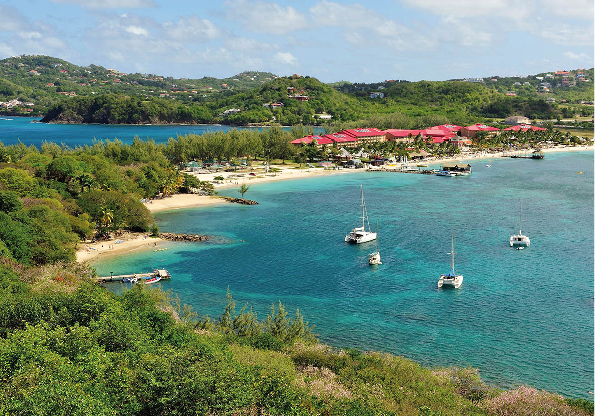
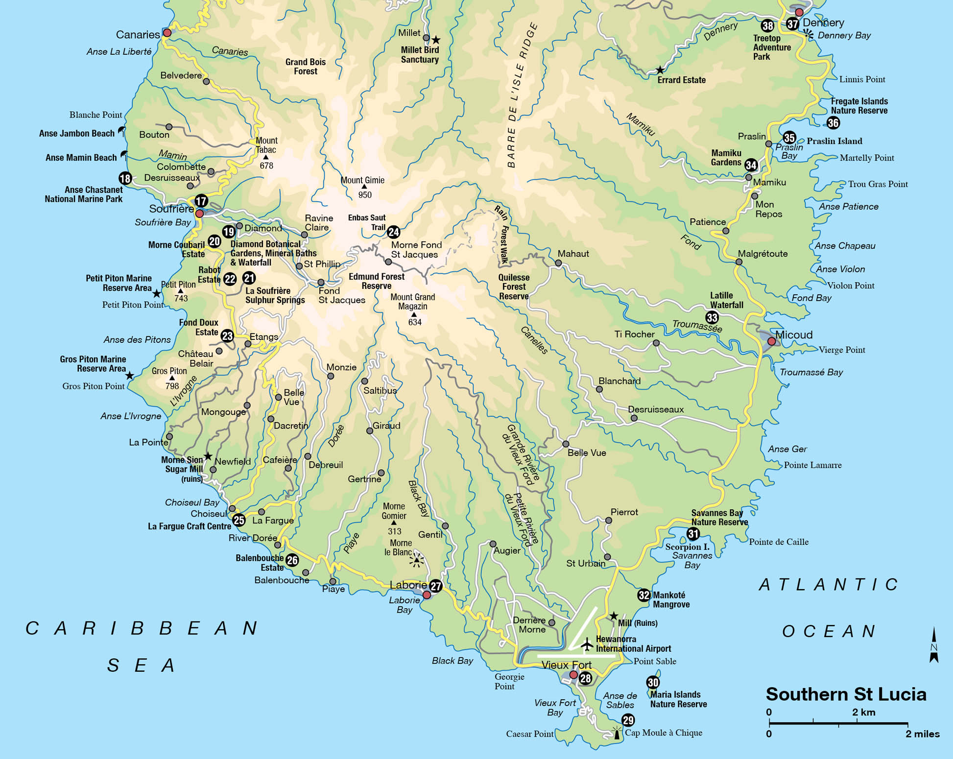
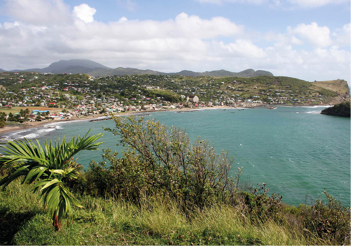
The majority of places to stay in St Lucia are concentrated in two areas: in the northwest at Rodney Bay and in the southwest around Soufrière. The former is the place to go for beach activities, marina and nightlife. The latter has spectacular views of the Pitons, surrounded by rainforest, with equally beautiful underwater life. There are lots of excursions on offer from the north to visit attractions in the south overland or by sea, but fewer going the other way. It is feasible to drive around most of the island in a day, stopping along the way to visit a few attractions, take photos and find somewhere pleasant for lunch. Hiring a driver is more relaxing than driving yourself on mountain roads, with the benefit of learning more about the island from a knowledgeable guide.
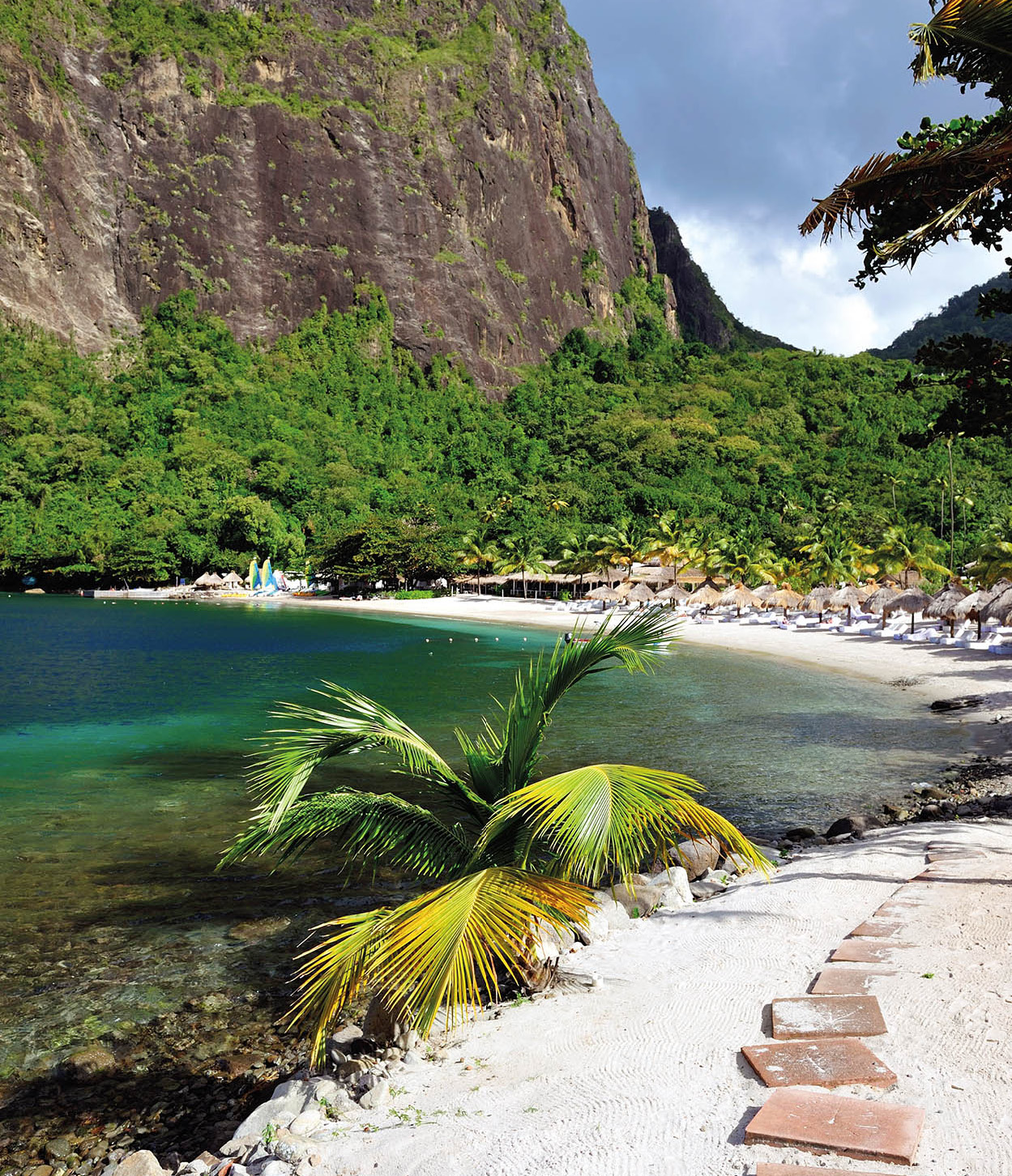
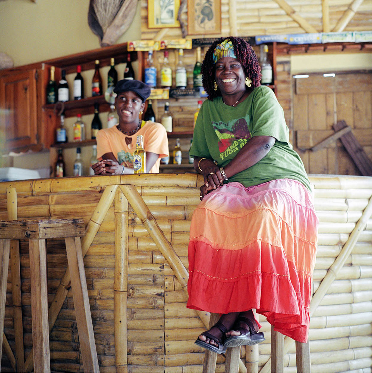
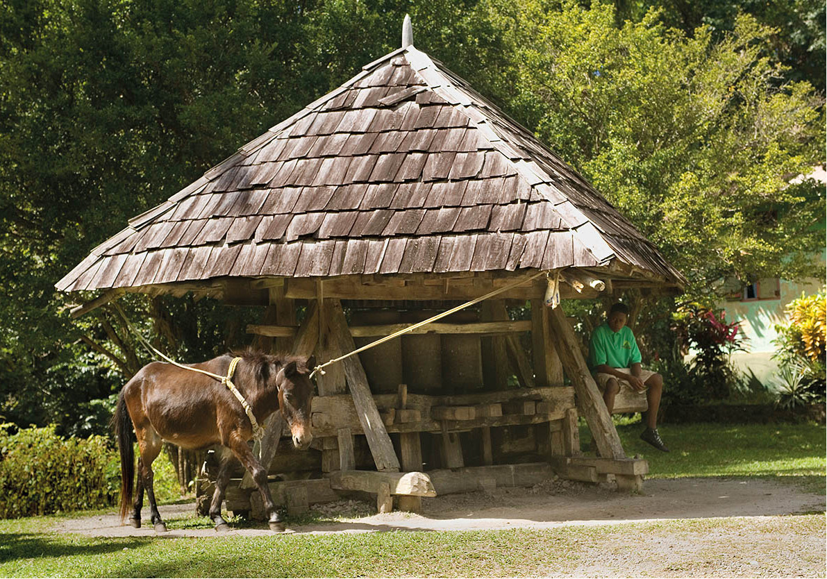
St Lucia is home to many luxury resorts, as here at Piton Bay
iStock
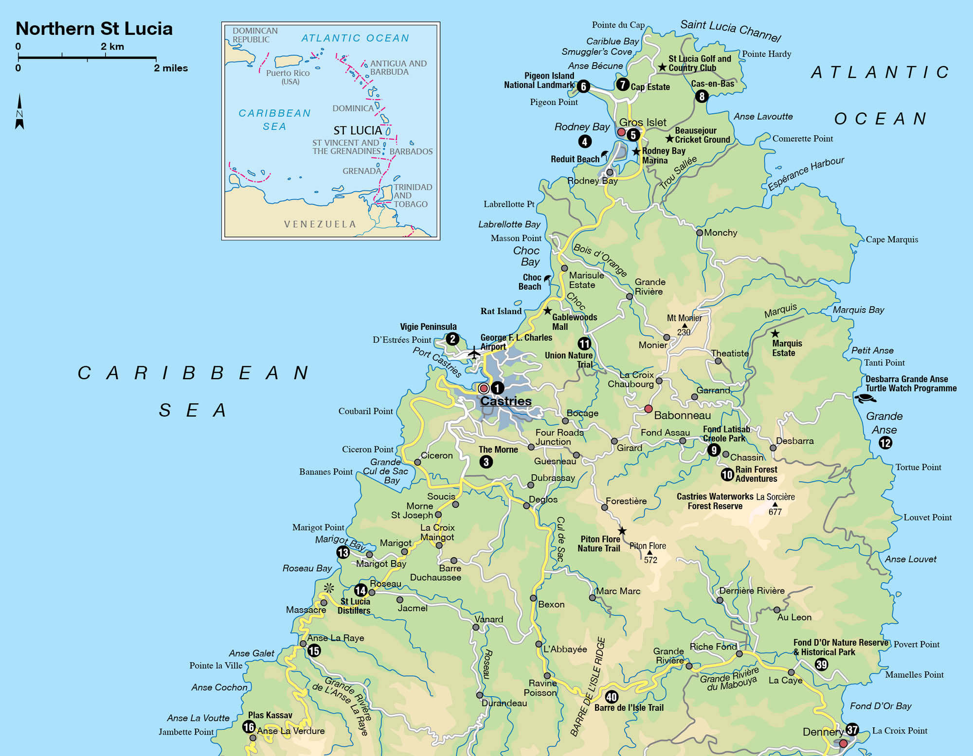
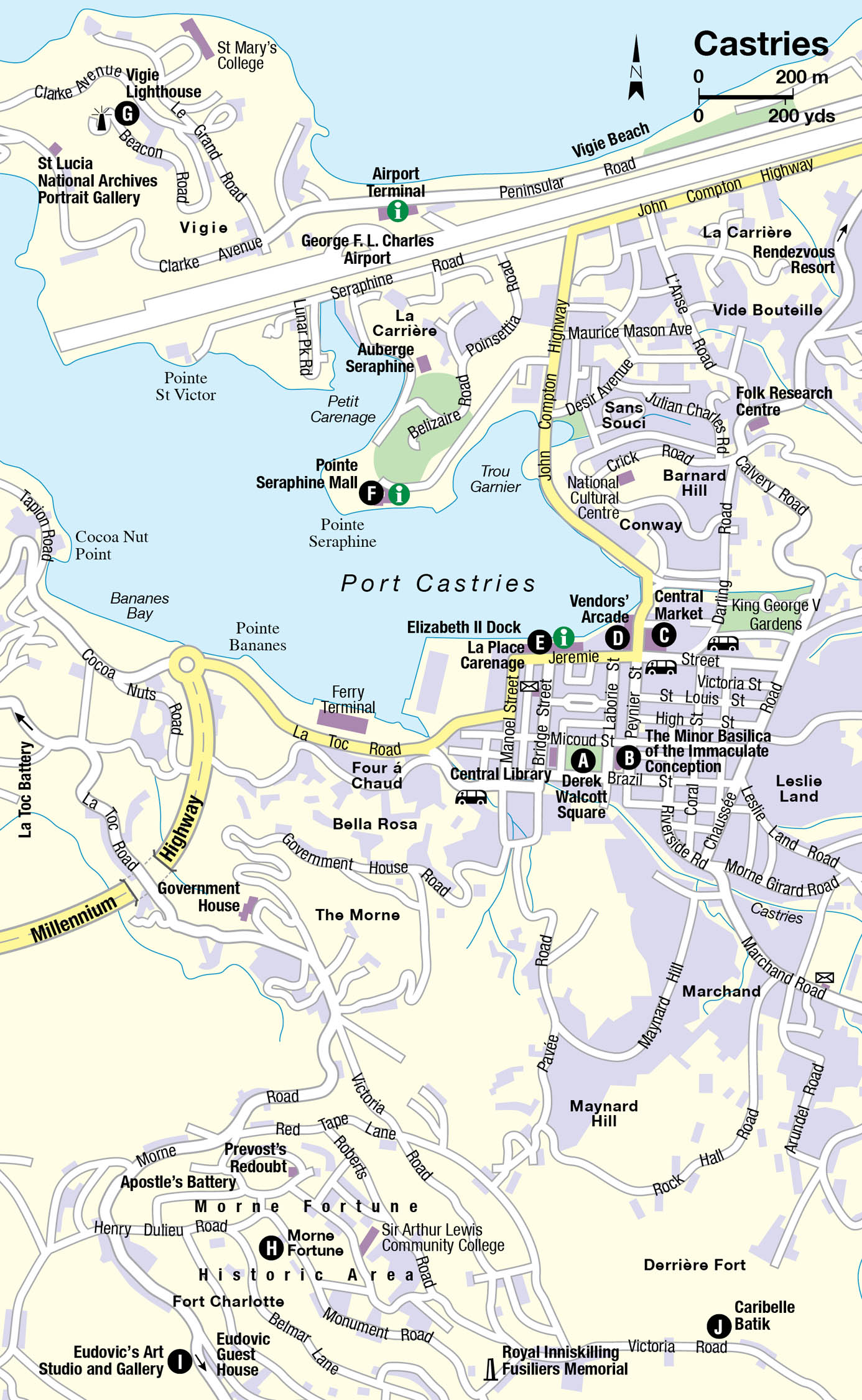
CASTRIES AND ENVIRONS
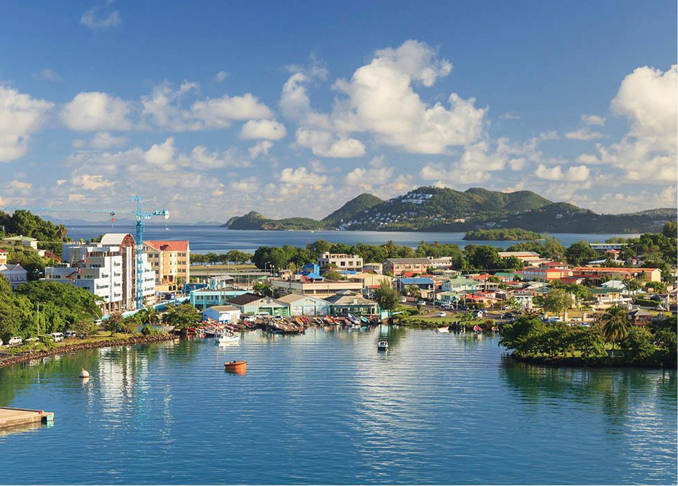
St Lucia’s capital, Castries 1 [map], which lies on the western side of the island, has a population of 67,000. It has been razed by fire and rebuilt four times over the years, leaving few old buildings with historic or architectural value. Much of the town is made up of nondescript modern buildings, but Castries still has character and vibrancy, especially on Saturday when the market is awash with local people doing their weekly shopping and curious tourists enjoying the atmosphere and searching for souvenirs. If there are cruise ships in port, then Castries bulges at the seams.
The Port of Castries is a busy working harbour where container ships can be seen unloading their contents on to the dock at the North Wharf, adjacent to the Place Carenage duty-free shopping mall. When cruise ships are in the harbour they dominate all other vessels and even the surrounding buildings. Fishing boats painted the colours of the rainbow can be seen dodging the big ships to get in and out of their harbour in Trou Garnier, while yachts sail in and out of Petit Carenage.
A tour of Castries is best negotiated on foot, as the central area is compact, but a taxi is recommended when you explore the sights such as Morne Fortune on the southern outskirts. Buses are also readily available.
Castries’ waterfront
iStock
The town centre
Derek Walcott Square A [map] sits at the heart of the capital bordered by Brazil, Laborie, Micoud and Bourbon streets. This well-kept, small green space scattered with a few mature trees, was called Place d’Armes in the 18th century, when it was the site of public executions around the time of the French Revolution. By the late 20th century, the square had undergone two name changes: it was called Columbus Square until 1993, when it was renamed in honour of Castries-born poet and playwright Derek Walcott, who won the Nobel Prize for Literature in 1992.
A local staple
Cassava is a root vegetable grown throughout St Lucia. The plant is peeled and grated and the juice extracted, before it is dried to produce farine (a fine flour), which is used to make bread or porridge.
A tall samaan tree with branches laden with epiphytes is believed to be more than 400 years old and offers some shady relief from the tropical sun. A paved pathway runs through the middle linking a memorial obelisk and plaque to the bandstand at the opposite end. The memorial at the west side of the square honours the memory of St Lucians who fought and died in both World Wars. ‘Jazz on the Square’ is a popular event that attracts visitors and locals who gather here for a daily dose of free music during the St Lucia Jazz Festival, held in May. Office workers often use the bandstand and benches here during their lunch hour. At the centre of the square is a fountain and a little way back towards the bandstand are busts of the island’s two Nobel Prize winners: Derek Walcott and economist Sir Arthur Lewis.
Honourable St Lucian
Born in Castries in 1930, Derek Walcott OBE OCC trained as a painter and writer and studied at the University of the West Indies in Jamaica. In 1953 he moved to Trinidad where, in 1959, he founded the Trinidad Theatre Workshop. In 1981 he set up the Boston Playwrights Theatre at Boston University, where he worked as Professor of Literature. Since 2010 he has been Professor of Poetry at the University of Essex in the UK, although he spends much of his time in St Lucia. He has published many collections of poems, an autobiography in verse, Another Life, critical works and over 20 plays. His works include the epic narrative poem, Omeros (1990), which contributed to him winning the Nobel Prize for Literature in 1992. In 2011 he won the TS Eliot Prize for his book of poetry, White Egrets (2010). His twin, Roderick, was also a playwright, poet and artist, and their childhood home on Grass Street has been declared a heritage site.
On the corner of Laborie and Micoud streets is the Roman Catholic cathedral The Minor Basilica of the Immaculate Conception B [map] (open daily unless Mass is in progress). This has been the site of several churches dating back to the 18th century, but the current building was not completed until 1931. The cathedral’s exterior is shabby, but inside there are enough beautiful dark wood pews to seat around 2,000, intricately carved columns and arches, and a stone altar flanked by displays of votive candles, which can also be found near the cathedral’s side altars. Yellow light floods the building via decorative windows in the ceiling, which is adorned with a depiction of Catholic saints. Renowned St Lucian artist, Dunstan St Omer, painted the murals on the cathedral walls in 1985 in preparation for a visit by Pope John Paul II the following year. The beautiful paintings reveal the Stations of the Cross with characters inspired by local people. In 2005, St Omer and his son, Giovanni, created 12 magnificent stained glass windows that were installed on either side of the cathedral.
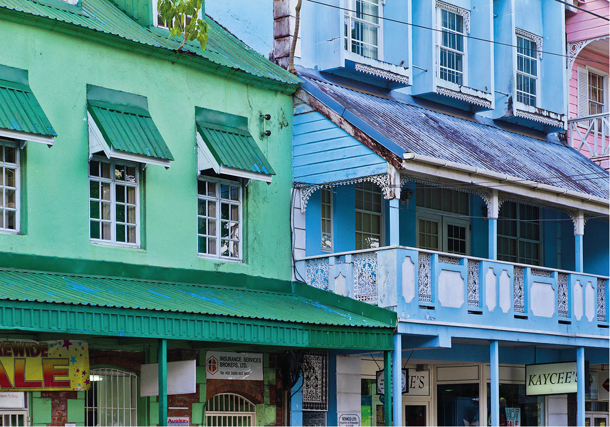
As you leave the cathedral on Laborie Street, to your left is Brazil Street, which has several buildings dating back to the late 19th century. Though fading, the wooden structures retain some lovely gingerbread fretwork detail on their balconies. These and the buildings behind were the only ones of their kind to survive Castries’ last great fire in 1948.
One of the only other places to escape the flames in 1948 was the old Central Market C [map] situated north of Jeremie Street towards John Compton Highway. Built of iron in 1894, the original market shelter is where you will find the town clock and a modern annexe. Vendors from rural areas sell local produce, such as fruit, vegetables, cassava, cocoa sticks, pepper sauces, spices and basketwork.
Across the road on Peynier Street is the Vendors’ Arcade D [map], which backs on to the waterfront; you can find an array of souvenirs and gifts including inexpensive, colourful T-shirts, beach wraps and some very good basketwork, in both traditional and modern styles.
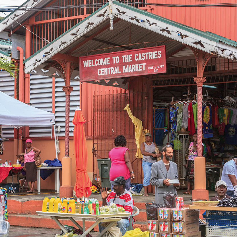
Castries Central Market is the best place to find crafts and food
iStock
Head west from the Arcade along Jeremie Street to La Place Carenage E [map] (Mon-Fri 9am-5pm, Sat 9am-2pm, also Sun if a cruise ship is in town), the duty-free shopping mall, with a selection of shops selling crafts and souvenirs, boutiques and art galleries. The mall also has a small interpretative facility, the Desmond Skeete Animation Centre, which has displays of ancient Amerindian artefacts and an audio tour. Heading west along La Toc Road you come to the ferry terminal, from where the L’Express des Iles ferry operates a regular and fast service to Martinique, Dominica, Guadeloupe and the outer French islands.
Vigie peninsula 2 [map]
Across the harbour and reached by a regular water taxi service is the large, upscale Pointe Seraphine F [map] duty-free shopping mall (Mon-Sat 9am-5pm, also Sun if a cruise ship is in town), busy at the weekend and even more so when a cruise ship is anchored at the dock next door. Take the inexpensive ferry to cross the water or jump in a taxi for the short drive around the harbour. The walk from here to Castries centre isn’t that long, but it can seem so, especially in the heat. On the Vigie peninsula is the George F.L. Charles Airport (formerly known as Vigie Airport), a small landing strip for Caribbean inter-island and domestic flights. As you round the corner to join Peninsular Road, with the airport runway on your left, you will see the raised white tombstones and monuments in the small military cemetery created for the men of the West India Regiment. Vigie Beach runs alongside the road on the right. The entire peninsula was once a military stronghold and the barracks and other 19th century military buildings have been restored.
19th-century, colonial style, wooden buildings overlooking Derek Walcott Square
iStock
Vigie Lighthouse G [map] stands at the end of Beacon Road on the peninsula, on the northern side of the city harbour. The light from the red lantern at the top of the 11m (36ft) white tower, built in 1914, can be seen about 50km (30 miles) out to sea. The lighthouse overlooks military barracks, 18th-century ruins and other historic buildings managed by the National Trust. From here on a clear day there are spectacular views of the southern and northern coasts, and Martinique.
The Morne 3 [map]
The historic Morne area is accessible from the southern end of the centre of Castries. On the way up is the studio and shop of Bagshaws of St Lucia (Mon-Fri 8.30am-4pm; tours Sat-Sun by appointment; tel: 758-452 6039). The factory uses traditional silk-screen methods to produce colourful prints on fabric, with motifs inspired by island flora and fauna. Tours provide a lively explanation of the printing process and details about Bagshaws. The company also has shopping outlets at La Carenage and Pointe Seraphine in Castries, and another at Hewanorra Airport.
Next door, Bagshaws have restored La Toc Battery (tours by appointment; tel: 758-452 6039), a fine example of a 19th-century battlement with wonderful views and a pretty garden. Built by the British, La Toc has cannons, underground tunnels and munitions storage rooms where valuable artefacts can be seen. There is also a display of some 900 old bottles and other artefacts, found by scuba divers in Castries’ harbour.
On top of the hill is the 29-hectare (72-acre) Morne Fortune Historic Area H [map], where you will find the old military buildings of Fort Charlotte. The French began building the original fortress in 1768, choosing 260m (850ft) high Morne Fortune because of its unmatched vantage point of the harbour. When they took control of St Lucia in 1814, the British continued the work and strengthened the fortifications. It was they who named it Fort Charlotte. The fort remained an important defensive base until early in the 20th century. The military barracks and other buildings have been restored and converted. Some now house the Sir Arthur Lewis Community College, named after the island’s first Nobel Prize winner, who is buried here. Nearby are the ruins of Apostle’s Battery, with a large mounted cannon, built in 1890 to support the fortress, as well as the lookout point at Prevost’s Redoubt, a French construction dating from 1782.
Sir Arthur Lewis
St Lucia is proud to have produced two Nobel Laureates, the first of whom, Sir Arthur Lewis (1915-1991), was awarded his prize for Economics in 1979 for his theories on development economics.
At the southern boundaries of the fort complex is the Royal Inniskilling Fusiliers Memorial, a monument to the soldiers who battled for this position against the Brigands and the French in 1796. The monument also marks one of the best viewpoints on the Morne, affording stunning coastal views to Pigeon Island in the north and as far as the Pitons on the west coast.
While in the area, it is worth visiting the Goodlands workshop of the St Lucian sculptor and woodcarver Vincent Joseph Eudovic and his artistic family. At Eudovic’s Art Studio and Gallery I [map] (Mon-Fri 7.30am-4.30pm, Sat-Sun until 3pm; tel: 758-452 2747; http://eudovicart.com) woodcarvers produce smooth abstract carvings. The works are made from the ancient roots and stumps of the laurier canelle, laurier mabouey, teak, mahogany and red and white cedar.
Howelton House, the home of Caribelle Batik J [map] (Mon-Fri 8am-4pm, Sat 8am-noon, Sun if a cruise ship is in port; tel: 758-452 3785; http://caribellebatikstlucia.com), is a fine example of Victorian architecture with a Caribbean twist. The pretty building on Old Victoria Road has been carefully restored and houses a batik studio and print shop, which uses Indonesian techniques to create vibrant designs on British and sea-island cotton. The fabric, printed with images of St Lucia’s flora and fauna, such as colourful heliconia, is then made into clothing, wall hangings and souvenirs.
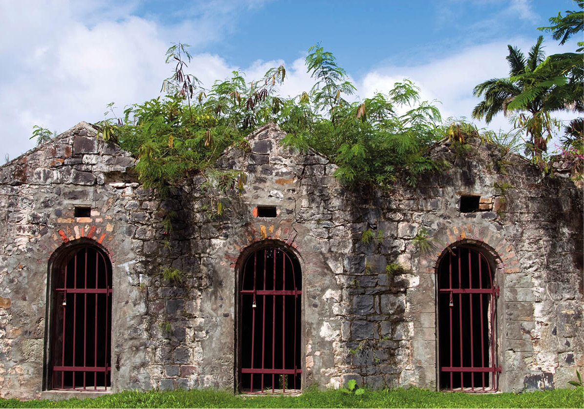
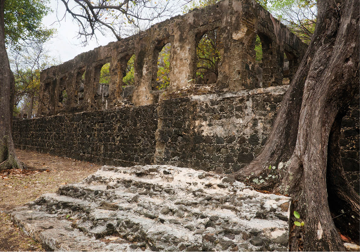
The Powder Magazine and Guard Cells were built by the French in 1763-5, making them the oldest existing buildings on Morne Fortuné
iStock
RODNEY BAY AND THE NORTH
The coastal region to the north of Castries is the island’s foremost resort area with sheltered bays on the western, Caribbean side, a range of hotels, fishing communities, a marina, shopping malls, vibrant nightlife and historic landmarks. West of the highway, several hotels and restaurants nestle in the curve of Choc Bay and along Choc Beach, which is lapped by the calm waters of the Caribbean. Further north, in Bois d’Orange, residences and a hotel are scattered around the hill overlooking Labrellotte Bay.
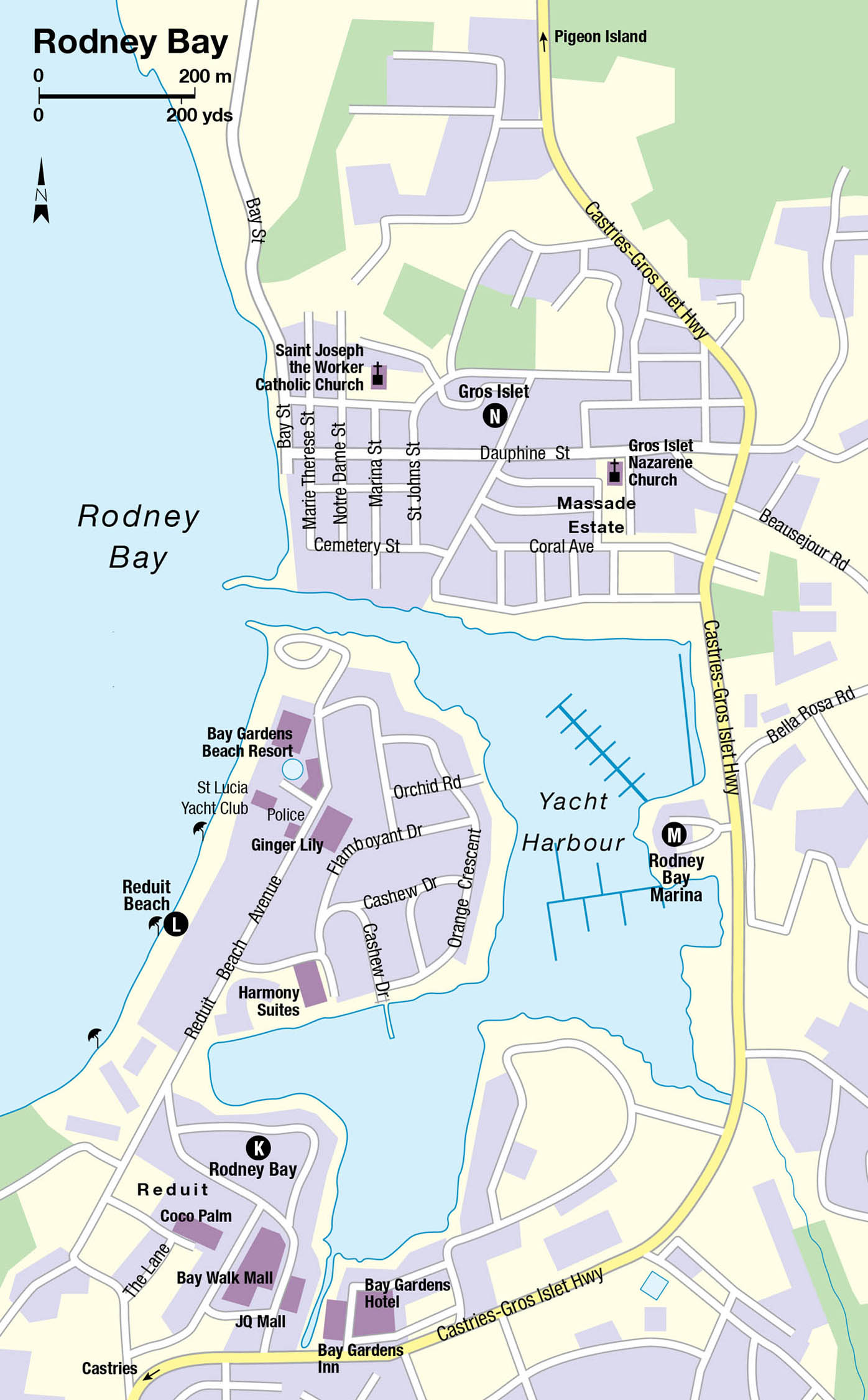
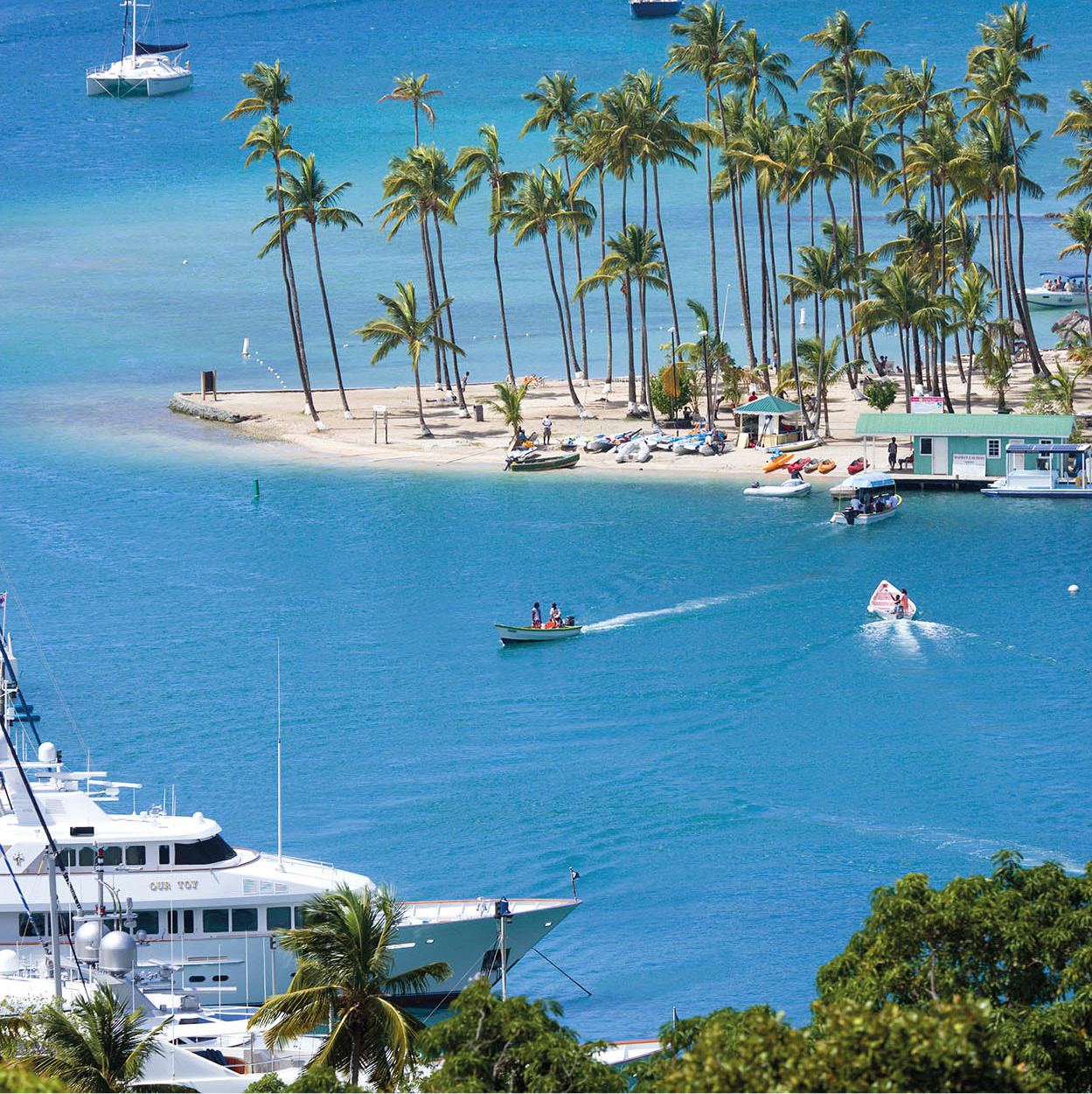
Rodney Bay 4 [map]
Taking a left turn off the Castries-Gros Islet highway at the Bay Walk Mall on the left-hand side of the road will lead you to Rodney Bay K [map] village, where there is a bank with an ATM, lively bars, restaurants and small hotels. This is the hip strip for nightlife in St Lucia, being close to hotels, with food outlets serving simple sandwiches, pizza, steak, seafood and French, Indian, Italian and Caribbean cuisine. The hotels also organise entertainment such as crab racing, fire eaters, steel bands or jazz groups and several restaurants have live music on certain nights. The shopping in Rodney Bay is the best on the island. The Bay Walk Mall has a range of shops and a casino. There is a supermarket there and in the older JQ Mall on the other side of the road and plenty of opportunities for sailors to provision their yachts.
Rodney Bay as seen from the hilltop of Pigeon Island National Park
iStock
At the end of the road is Reduit Beach L [map], one of the best stretches of sand on the island. The crescent-shaped beach extends as far as Pigeon Island (for more information, click here) further north, although it is not possible to walk the length of it because of shipping access to Rodney Bay marina and The Landings yacht harbour. There are lots of hotels here but there is public access to the beach, where visitors can rent watersports equipment, sun loungers and umbrellas. In high season, when the hotels are full, and at weekends, when local people visit the beach, it can become crowded, but there is usually enough space for everyone. If you are looking for tranquillity, come on a weekday in the off season. Licensed vendors work this beach, but if you are not interested in what they have to sell, a polite ‘no thank you’ is usually all it takes to discourage them.
Why Rodney Bay?
Rodney Bay is named after Admiral George Brydges Rodney, who claimed St Lucia for the British in 1762 and later established a naval base at nearby Pigeon Island, from where he set sail to intercept and defeat the French navy on its way to attack Jamaica in 1782.
Rodney Bay Marina M [map] and its harbour were created by digging out a mangrove swamp. The popular marina is well equipped and is considered to be among the Caribbean’s best. The Atlantic Rally for Cruisers (ARC) is a big winter event. Yachts from all over the world take part in this annual transatlantic rally, setting sail in November from Las Palmas in Gran Canaria to Rodney Bay in St Lucia. The 2,700-nautical mile journey takes anything from 12 to 24 days, and festivities around the marina continue as long as it takes for the vessels to reach their destination.
Gros Islet 5 [map]
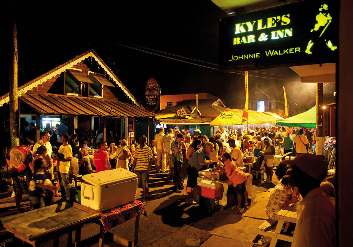
Gros Islet N [map] (pronounced grows ee-lay), just north of the marina, is a small fishing village that during the week is an antidote to the pace of the busy harbour. However, most visitors come to Gros Islet for the Friday Night Jump-up, a popular street party when tourists and locals converge on the area. Food and snack vendors line the usually quiet streets, bars and restaurants fling open their doors and sound systems flood the air with the beat of reggae, calypso and soca. This is a good place to enjoy tasty St Lucian dishes, such as locally caught fried fish, chicken or conch, then work off the calories by dancing the night away in the crowded street. Things don’t hot up until after 10pm and festivities go on into the small hours. Generally it is pretty safe at the Jump-up, with police, uniformed and plain clothed, on duty, but keep your wits about you and always travel in a group.
Revellers at Gros Islet’s Friday Night Jump-up
Alamy
Pigeon Island
Around the bay from Gros Islet is the Pigeon Island National Landmark 6 [map] (daily 9am-5pm; interpretative centre closed on Sun; entrance fee). This was once a separate island, accessible only by boat, but was joined to the mainland by a man-made causeway, completed in 1972, on which a few large resorts have been built. The resorts have claimed part of the sand for guests, but there is still a good stretch open to everyone. There is a small parking area and you can buy snacks from the vendors who trade close to the beach’s public access point.
Operated by the St Lucia National Trust, Pigeon Island is of significant archaeological and historical importance. The hilly land that spans 18 hectares (45 acres) is thought to have been inhabited by Amerindians, who used the island’s caves for shelter and grew staple crops such as sweet potatoes and cassava (manioc). In the 1550s, the pirate Jambe de Bois (Peg leg) also sheltered in the caves.
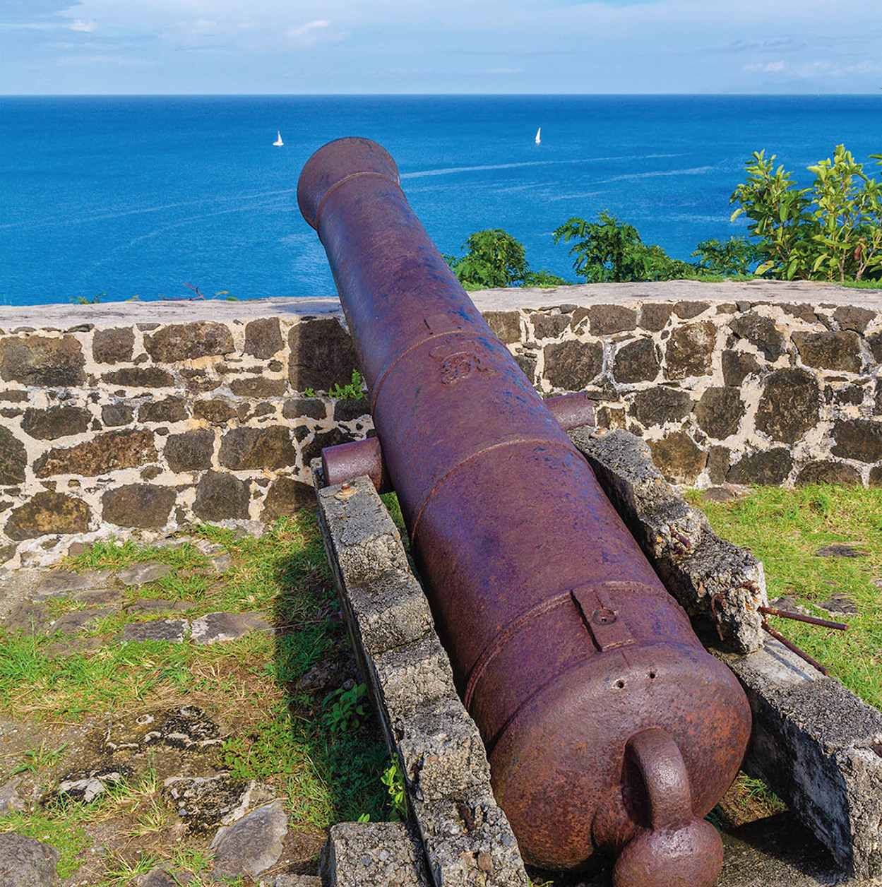
Later the site played its part during the 18th- and 19th-century squabbles between European imperialist powers over control of St Lucia. The island’s strategic position and usefulness as a lookout made it a popular choice as a military base. Admiral Rodney established a naval outpost here in 1780. He sailed from this point to defeat the French forces two years later at the Battle of the Saints, which took place off the Iles des Saintes between Guadeloupe and Dominica. The Brigands (for more information, click here) captured the island and took control of the fortifications in 1795, forcing the British to abandon St Lucia for a while, but it was retaken in 1798. From 1842 it was used as a quarantine centre, but abandoned by 1904.
Cannon at Pigeon Island National Park
iStock
By the early 20th century, Pigeon Island was leased to Napoleon Olivierre from St Vincent, who ran a whaling station. Later, in 1937, the island was leased to Josset Agnes Hutchinson, an actress with the D’Oyly Carte Opera company. There was a hiatus during World War II when the US established a communications station and a naval air station. In 1947 Hutchinson returned to her house in the south of the island (now a ruin), opening a beachfront restaurant, which attracted a colourful yachting crowd. She finally gave up the lease in 1970 and returned home to Britain in 1976.
Passing through the gates of the park you will be faced with a useful map of the area. The path to the right leads to the ruins of the Officers’ Kitchen and a little further up the hill is the renovated Officers’ Mess, which houses the small Interpretative Centre. Artefacts and historical displays explain the history and natural environment of Pigeon Island, but it is past its best.
The Officers’ Mess is also home to the St Lucia National Trust (daily 8am-4pm; tel: 758-452 5005; www.slunatrust.org). The trust was established in 1975 as the result of a campaign to save the Pigeon Island Landmark from being used for a housing development. Its aim is to preserve the natural and cultural heritage of St Lucia, including areas of outstanding natural beauty, and bio-diverse and historic sites such as Pigeon Island, Fregate Island and Maria Islands. Contact the National Trust office for tours of their properties.
The Ruins of Fort Rodney
iStock
In late spring the park is a popular venue for the St Lucia Jazz Festival (for more information, click here). The stage is usually set up near the Officers’ Mess, using the ocean as a beautiful backdrop; crowds arrive early to find a good spot on the grass from which to enjoy the show.
You can take a guided tour or simply wander along the paths and trails at leisure. There is a variety of flora, fauna and many old buildings, some no more than a collection of stones. On the waterfront, just before you reach the overgrown military cemetery, is the Jambe de Bois restaurant, a good choice for a drink, an ice cream or a snack. There is a jetty and ferry dock nearby and the lovely beach leads back almost level with the park border and entrance.
On a hill, at the southwestern tip of the park, are the ruins of Fort Rodney, which had an excellent vantage point. Today, the fort ruins still afford a good view south towards Castries, but the best lookout point is at 110m (361ft) Signal Peak. It’s a bit of a climb to reach the peak, especially in the hot sun, but it’s worth it for the view over neighbouring Gros Islet and far north to the French island of Martinique. There is another lookout at the Two-Gun Battery close to the Soldiers’ Barracks.
The far north
Located to the north of Gros Islet, Cap Estate 7 [map] lies in hilly land that was once heavily forested. Crops such as tobacco thrived here before the sugar boom of the 18th and 19th centuries resulted in the land being cleared to plant sugar cane. The properties that sit on the former 607-hectare (1,500-acre) plantation today are the exclusive homes of the wealthy and luxury rental villas. Residents and guests from the nearby hotels can take advantage of the golf course at the St Lucia Golf & Country Club (tel: 758-450 8523; www.stluciagolf.com), which has a pro shop and club rental.
Art detour
In a mansion house on Cap Estate is Llewellyn Xavier’s Studio (tel: 758-450 9155; www.llewellynxavier.com), where the work of the St Lucian multi-media artist can be viewed only by appointment. His art is exhibited in the permanent collections of museums and galleries all over the world including the Smithsonian Institution in Washington, the Metropolitan Museum of Art and the Museum of Art in New York and the National Gallery in Jamaica. Xavier’s work can also be seen at the Caribbean Art Gallery (tel: 758-452 8071), at Rodney Bay Marina.
The artist’s use of oils, watercolours and mixed media reflect the vibrant colours and rich textures of the Caribbean. The artwork Environmental Fragile, which was created from cardboard and other recycled material, was commemorated in a postage stamp issue in 2006.
Xavier’s first major work in the 1970s was a series of 25 prints dedicated to George Jackson, a young man whose incarceration in America became an international cause célèbre.
The far north of St Lucia is the driest part of the island and much of the coast is rocky and rough where the waters of the Caribbean Sea meet the Atlantic Ocean in the St Lucia Channel. There are, however, a couple of pleasant beaches on the northwestern coast, which have inevitably attracted hotel development. The picturesque Bécune Point and the golden sand beach of Anse Bécune form the northern edge of Cap Estate. The beach is dominated by a large, all-inclusive hotel, Smugglers Cove, but there is public access to the beach and sea.
A little further north, there is excellent snorkelling to be had at Smuggler’s Cove. With a sheltered beach and rugged cliff landscape, it is often a little quieter than Anse Bécune. Cap Maison Hotel maintains a beach bar here with water sports for guests.
Beyond this is Cariblue Bay, a pretty, golden sand beach, which is home to LeSport, another all-inclusive resort.
The owner of a Cas En Bas beach bar
Getty Images
At the far north tip of St Lucia is Pointe du Cap. At a little under 150m (470ft) high, in a hilly region beyond the Saline Point residential development, Pointe du Cap provides panoramic views across the north coast to Martinique, west to the Caribbean Sea and east to the Atlantic Ocean. The sea below the sheer cliffs is rough and the land is dry scrub with cacti a common sight. To the east is Pointe Hardy where paths for walkers criss-cross the undulating land. The area around Pointe Hardy and north of Cas-en-Bas is part of the large St Lucia Golf and Country Club development.
There are no beaches that can offer safe swimming on this rough, wild and windy Atlantic part of the coast.
South of Pointe Hardy on the northeast Atlantic side of the island is Cas-en-Bas 8 [map], known for its collection of quiet beaches. There are no lifeguards, not all the beaches are well maintained and the roads leading to this coast are rough and hard to negotiate, but they are ideal if you want a quiet day away from it all.
To get to Cas-en-Bas, take the road across the golf course, which winds its way to the luxury villa resort, Cotton Bay. The road ends here, blocked by private land for development, and you have to continue on foot down the track to the sea. Alternatively, take the Cas-en-Bas Road from Gros Islet. The beaches are in a sheltered and rocky bay and, although the Atlantic waters can be rough, the swimming and snorkelling are usually good. There is a laid-back beach bar, with sun loungers outside and kite-surfing available. Horses on the beach make the sand dirty, but it is pleasant to walk along the rocky coastline.
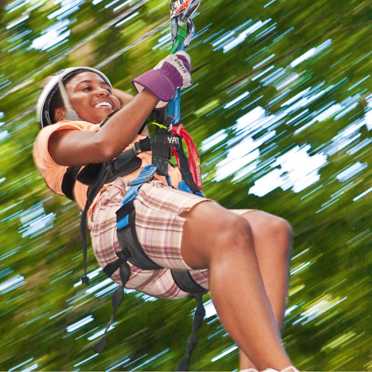
Rain Forest Adventures ziplining
Chris Huxley/Rain Forest Adventures
EAST OF CASTRIES
East of Castries is the north’s picturesque rural interior that stretches across to the rugged Atlantic coast. The land is largely given over to agriculture and small village communities. If you are starting from Rodney Bay, turn off the Castries-Gros Islet Highway north of Choc Bay and the Bois d’Orange district. The Allan Bousquet Highway leads to the village of Monchy, Babonneau, Fond Assau and Desbarra.
South of Monchy, through winding roads, is Babonneau in the heart of farmland and plantations. The area around Babonneau and Fond Assau is thought to be the place to which the last group of African-born enslaved people were transported, which probably accounts for the strong African tradition that has been retained.
Fond Latisab Creole Park 9 [map] (Sun-Fri, tours by appointment; tel: 758-450 5461) is a few miles south east of Babonneau via narrow country lanes in the small farming community of Fond Assau. The 4-hectare (11-acre) working farm cultivates nutmeg, cocoa and cinnamon and produces its own honey. Fond Latisab maintains many aspects of traditional St Lucian culture, some of which stem back to when Amerindians inhabited the land, and practises farm techniques that have been passed on from father to son. For example, local guides are summoned by drumbeat. Even though there is a phone on the farm, much communication is done using the ancient art of drumming. Visitors can watch log sawing done to the beating of drums accompanied by a chak chak band (named after the sound made by a local instrument). Log sawing by traditional method requires two men with skill rather than brute force to work the 3kg (6lb) tool. While sawing, the men sing Kwéyòl folk songs, accompanied by the band and the drum beats, which help to maintain rhythm. You can also see local people crayfishing, using traditional bamboo pots, and making cassava bread and farine - a flour produced from cassava grown on the estate. Cassava bread is on sale when there is a tour, and home-grown nutmeg and cinnamon can also be purchased.
Crayfish
A traditional crayfish pot is made of strips of bamboo lashed together, forming a tube that is laid on the river bed. One end is sealed while the other has a flap to allow access to the creatures caught in the pot. Bait can include fresh coconut.
Down the road from Fond Latisab, in Chassin, at the foot of La Sorcière hill, is the popular Rain Forest Adventures ) [map] (Dec-May Tue-Sun; entrance fee; tel: 758-458 5151; www.rainforestadventure.com). During a 2-hour tour, visitors are transported high above the forest in an aerial tram, which provides a bird’s eye view of the landscape. Each gondola carries eight seated people and a guide to point out the different plants and trees as you glide through the forest canopy. After the ride you can buckle up to zip line through the forest, an adrenaline rush which is hugely enjoyable and great fun, with only basic levels of fitness and health required. You can also take a guided nature walk. The Jacquot Trail up Mount La Sorcière starts from here, and guides are available for birdwatching hikes up the mountain at sunrise to try to spot the St Lucia parrot, which few visitors see in the wild.
Northwest of Babonneau, the winding Allan Bousquet Highway follows the Choc River, eventually leading to the Union Nature Trail ! [map] (daily 9am-4pm; no guided tours at the weekend; entrance fee) on an outpost of the Forestry and Lands Department. The trail loop begins on a path near the ranger station and can be covered in about an hour. It is a short walk (1.6km/1 mile) through dry forest with a few small hills, and can be enjoyed by any relatively fit visitor.
The collection of wildlife on the property is small, but includes native species such as agouti, iguana and the St Lucia parrot. There is also a herb garden growing plants with medicinal properties, that are used as traditional cures.
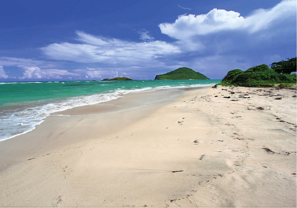
Waves crash at Grand Anse Bay
Corbis
Grand Anse
East of Desbarra stretches the beautiful beach at Grande Anse @ [map], best known as a seasonal nesting site for the endangered leatherback turtle (Demochelys coriacea) as well as the hawksbill and green turtles. The village of Desbarra is perched on top of a mountain. The paved road stops here and a 4WD is essential unless you want a very long walk downhill. The beach can be seen in the distance just after the track passes the football field.
The secluded 2km (1.2-mile) strip of sand has reportedly been the target of illegal sand-miners. There have also been attempts to take valuable nesting turtles and their eggs. From March to August the beach is monitored by the Desbarra Grande Anse Turtle Watch Programme, a community group that works in conjunction with the Ministry of Agriculture, Forestry and Fisheries. There are organised guided patrols of the beach to monitor the turtles and their nests during the nesting season. The turtle watch patrols begin in the early evening and continue until the following morning. The tours, which are part of the St Lucia Heritage Tourism Programme (HERITAS; tel: 758-458 1454; www.heritagetoursstlucia.org), are led by guides from the local community and welcome visitors from home and abroad.
The beach lies at the edge of the Grande Anse Estate, formerly a vast plantation spanning 810 hectares (2,000 acres). Today, much of the estate lands are uncultivated with cacti and dry forest peppering the hills and cliffs, providing a habitat for rare birds that include the St Lucia wren, the St Lucia oriole and the white-breasted thrasher. Snakes, such as the poisonous fer-de-lance and boa constrictor, and the protected iguana also form part of the estate’s endemic wildlife.
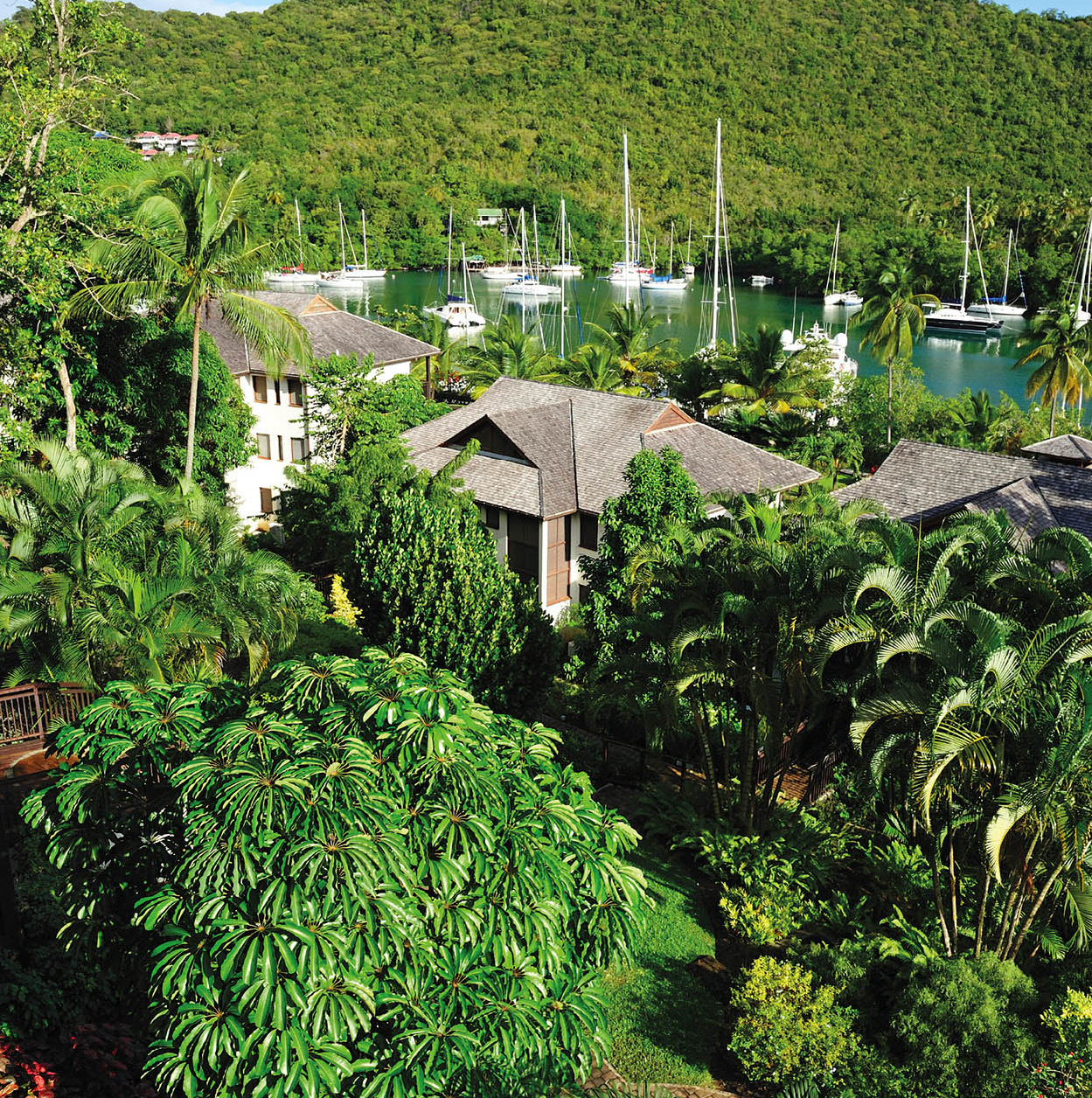
Marigot Bay’s greenery
iStock
MARIGOT BAY AND ROSEAU VALLEY
South of Castries, the verdant St Lucian countryside opens up with wide expanses of farmland bordered by dense forest and laced by rivers. The Millennium Highway leads south out of Castries and towards the West Coast Road.
Within minutes, the beginning of the semi-industrial area of the Cul de Sac Valley appears. At the side of the highway is a green space known as the Millennium Park, used as an open-air venue for a variety of festivities including New Year celebrations. In Grande Cul de Sac Bay beyond the park is a natural deep harbour and a large terminal and storage facility for Hess Oil.
Roseau Valley
At the end of the Millennium Highway the West Coast Road starts to climb past the Lucelec power station, which provides the main electricity supply to the greater part of the island. A little further on is the small village of La Croix on the edge of the rainforest. From this village, plantation land stretches away into the distance - this is the Roseau Valley. The sprawling Roseau Plantation once extended over both the Roseau and the Cul de Sac valleys.
Yachts at anchor beyond
the small coconut palm tree-lined beach of the Marigot Beach Club
Robert Harding
Marigot Bay
The picturesque harbour of Marigot Bay £ [map] is off the West Coast Road. There is a small palm-fringed beach and a sheltered natural harbour, which includes a yacht and sailing base, making the bay a popular choice among local sailors and visitors who spend the winter in the Caribbean. On the south side of the bay is a luxury resort and marina, which can accommodate the mega-yachts of the wealthy. The north side of the bay is accessible only by boat, but that small detail doesn’t appear to put people off: Marigot Bay is well known for its lively nightlife. As the evening descends the traffic across the bay increases with boats sailing to-and-fro. An inexpensive and regular ferry (water taxi) service operates 24 hours per day. The water around the Marigot Beach Club Hotel and Dive Resort is ideal for swimming and the resort also fronts the area’s best beach. The hotel’s restaurant, Dolittle’s, is named after the film that was shot here in the 1960s.
Talk to the animals
Marigot Bay was immortalised on the silver screen when it was used as a location for the 1967 Hollywood film, Dr Dolittle, starring Rex Harrison.
The eastern part of the lagoon has a small mangrove swamp, a natural site that has been protected with reserve status. A boardwalk runs through the mangrove linking the dock where the water taxis are to the St Lucian-owned and operated JJ’s Paradise Resort.
At the heart of the Roseau Valley plantation area is the small village of Roseau which stands near farmland once owned by Geest before it was broken up and taken over by individual farmers. Today many of the farms form part of an agricultural collective providing bananas for European supermarkets. This is one of St Lucia’s main banana producing regions and contains the largest banana plantation on the island.
Sugar cane
Before bananas, sugar was the agricultural mainstay and it is this crop that transformed the lush river valleys in the 18th century. The demand for sugar and its by-products, especially rum, from Europe and further afield prompted St Lucian farmers to import enslaved men and women from West Africa to carry out the back-breaking work on the land until slavery was abolished in the 19th century.
Successful for a time, St Lucia was forced to diversify in the mid-20th century following the introduction to Europe of cheaper sugar produced from sugar beet and fierce competition from high-volume sugar producers elsewhere in the Caribbean. The Roseau sugar refinery struggled on but eventually it too gave up; it was one of the last sugar factories to close in 1963.
Rum distillery
Cane sugar production fuelled the rum industry on the island but by the 1970s sugar cane was no longer being grown here. The Barnard family estate, which operated a distillery in Dennery, entered into a joint venture with Geest and moved to the Roseau Valley. Molasses, the raw material for rum production, are now shipped in from Guyana and today the St Lucia Distillers $ [map] (Mon-Fri 9am-3pm; entrance fee; reservations essential 24 hrs in advance, call for tour times; tel: 758-456 3148; www.saintluciarums.com) produces a wide selection of rums and liqueurs. Among the dark rums, look for the award-winning Admiral Rodney, an aged rum which should be drunk neat, or the Chairman’s Reserve, also good on the rocks. Bounty is the dark rum you will see most commonly on the island, while Crystal is the white rum used in cocktails.
The distillery is signposted from the West Coast Road. Travelling from north to south, pass the Marigot Bay turn and Marigot school, and continue until you reach a junction. Take a right along a rough, pot-holed access road (muddy in the rain). At the end is the rum factory, with a visitors’ centre, a shop and a warehouse. This was also the site of a 19th-century, steam-powered sugar mill, with a narrow-gauge railway and steam engine used to transport the cane and molasses. The distillery organises lively guided tours, which reveal how rum was made in the past and how it is produced today. The tour ends with a rum buffet where you can try the 20 or so products they make, from sweet flavoured rums (peanut, coconut, cocoa) to the Denros 160° proof firewater.
Religious art
The small hill community of Jacmel, which lies east of the Roseau Valley, has a church with a striking painting of a black Madonna and child and other St Lucian figures by the artist Dunstan St Omer. It is best visited with a local guide, as even in daylight the winding, narrow roads are difficult to negotiate.
Anse La Raye village
iStock
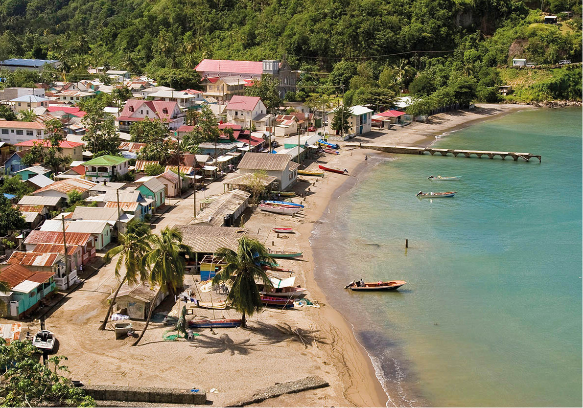
Anse La Raye
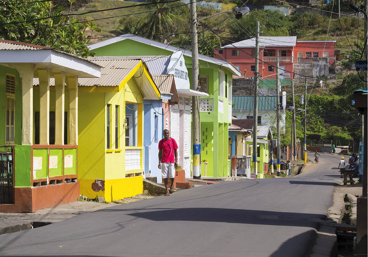
The West Coast Road weaves through the historically important village of Massacré and descends to sleepy Anse La Raye % [map]. At first glance there isn’t much to recommend the village; its narrow streets are lined with nondescript small shops and residences. Along the sea front small, brightly painted fishing boats bob in the water and fishermen’s huts on the beach provide shelter and shade for repairing a seine (net). The pace is relaxed and as people go about their business visitors can get a sense of the real St Lucia without the tourist gloss.
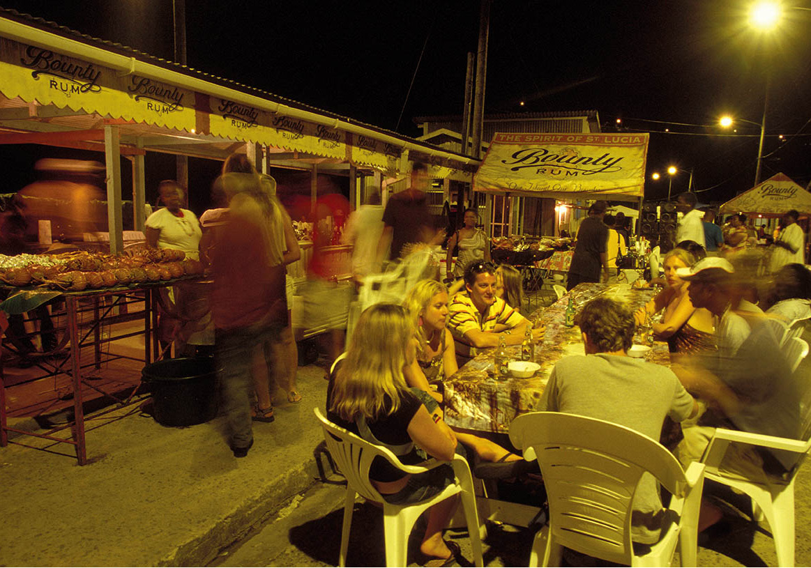
Friday evening is a different story altogether, for this is when the village wakes up and comes alive with a Friday fish fry. In the early evening the road is blocked off as stallholders set up coal pots and barbecues in front of the fishermen’s huts and lay out tables so that people can enjoy their meal in the open air while they soak up the atmosphere. By 9pm the place is packed and loud music punctuates the air while locals and visitors alike walk the length of the road to see what’s on offer. On sale are fish most likely caught that day, such as red snapper, kingfish and dolphin (dorado or mahi-mahi), and lobster when in season, along with potfish, conch salad, breadfruit salad and floats and bakes (similar to fried dumplings), washed down with a Piton beer or soft drink. The village bars are also busy with the usual end-of-the-week crowd swelled by people at the fish fry. Some very basic public facilities are available near the fishermen’s huts.
Friday fish fry in Anse La Raye
Alamy
SOUFRIÈRE AND THE SOUTHWEST COAST
Though tiny, even by Caribbean standards, the island encompasses a wide variety of landscapes from open plains to rolling hills and valleys, ragged mountain ranges and lush rainforest. In places you can see that the road has been literally cut through the hills and is shaded by mature trees and vegetation, while farms and fishing villages dot the panorama below. The journey from Castries to Soufrière takes about an hour and a quarter, even though the distance between the two places is only about 32km (20 miles). You must have your wits about you if you intend to drive yourself because these winding mountain roads can be unforgiving, with steep drops down to the valley below and often mudslides after heavy rain. In places there are stunning views of the coast and the Pitons - Gros Piton and Petit Piton - as the road skirts along the cliffs.
Where the road widens in a curve in the road, opposite a stand of trees at Anse La Verdure, is Plas Kassav ^ [map] (daily 8.30am-7 or 8pm; tel: 758-459 4050). This family bakery uses traditional methods and some innovative equipment to produce farine (from cassava) and a mouth-watering variety of (gluten-free) cassava bread that is popular with local workers, especially at lunchtime. Several cruise ships and organised tours make this a regular stop, providing people with an opportunity to taste one of the island’s specialities. Attached to the bakery is a small shop that sells refreshments and cassava bread in a choice of flavours including coconut, peanut butter, cherry and raisin, cinnamon, salt, saltfish and smoked herring. The bread makes a hearty snack or can be used as an accompaniment to a meal. Other local products such as dried bananas, pepper sauces and honey are also sold in the shop.
A few minutes drive from Anse La Verdure is Canaries (pronounced can-ar-ees), a small village where most families eke out a living from the fruits of the sea. The name originates from an Amerindian pot (called a kannawi) used by the people who settled here. The Canaries River flows through the forest and out to sea here, supporting a handful of waterfalls to the south of the village. Most are hard to find without a guide and require a 30-minute hike, at the very least, to reach them.
A few minutes south of Canaries, off the West Coast Road is Anse La Liberté. The land, which is managed by the St Lucia National Trust, extends 56 hectares (138 acres) into the forest. It has around 6km (4 miles) of walking trails, a good beach and some basic visitor facilities. You can also reach it by water taxi from Canaries. Anse La Liberté is thought to have historical significance. It is believed that enslaved African men and women living and working on the island celebrated their emancipation here in 1834, hence the name - Anse La Liberté (Bay of Freedom).
As the road snakes through the hills you can enjoy stunning views of the sea and the spectacular western landscape backed by the magnificent Pitons, which dominate the area, lying just beyond the centre of Soufrière. Before that, Mount Tabac comes into view, rising high above the hills and forests to its 678m (2,224ft) peak.
Hurricane Tomas
The hilly terrain of the west coast of St Lucia means it is particularly susceptible to mudslides caused by torrential rain, which often lead to fatalities and huge farming losses. In 2010, landslides caused by rain associated with Hurricane Tomas killed 14 people.
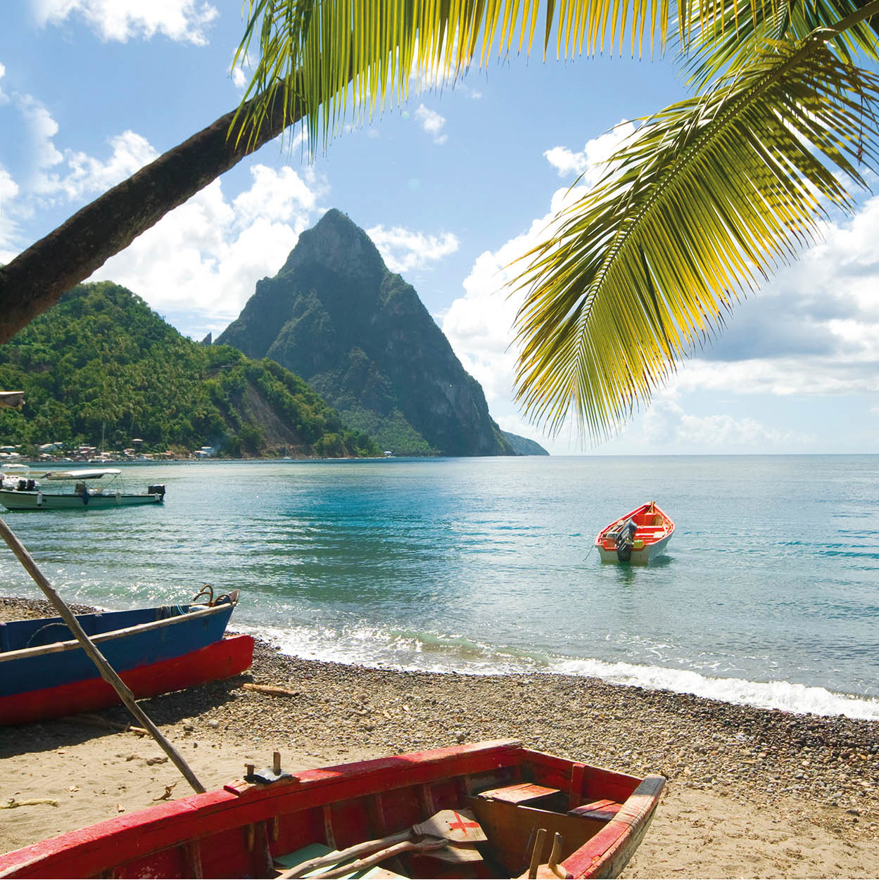
The famous twin Piton mountain peaks, from Soufrière beach
iStock
Soufrière
For many years after the country was ceded to the British, Soufrière & [map] remained little more than a small fishing village, but today it is expanding. The population of the village proper and its environs is now believed to be close to 8,000. Soufrière can be easily explored on foot; there are few sights, and most are within a few minutes’ walk of the water. Most of the area’s attractions are either on, or underneath the water, or in and around the rainforest. To the east is Mount Gimie, which at more than 950m (3,145ft) high stands above both of the better-known peaks of the Pitons.
Soufrière is St Lucia’s oldest town and was the capital when France controlled the island. It stands in the shadow of the island’s most striking and best-known landmark - the twin peaks of the Pitons rising majestically out of the sea. Louis XIV of France granted around 809 hectares (2,000 acres) of land to the Devaux family, who ran a successful plantation growing sugar, cocoa, tobacco and cotton on the estate. Descendants of the family still own land and property in the area today.
Enter the village via a small bridge over the Soufrière River, which flows to the sea just to the west. On the left is a petrol station, to the right is the town hall and after that, business and residential properties line both sides of Bridge Street, the main road. Modern and colonial buildings stand side by side; painted in pastels, many have pretty balconies with gingerbread fretwork. Most notable is the Old Courthouse constructed of stone in 1898 at the southern end of the waterfront.
The waterfront has a small paved area with seats looking out across the harbour, which is often dominated by the sail-assisted cruise ships that frequent the port for a few hours. The deep harbour drops to 60m (200ft) close to shore so large yachts can dock right at the pier.
At the northern end of the pier is another jetty, the Soufrière Marine Management Area (SMMA) office, a water taxi station and tour office where you can book transport around the coast. Visitors can go to places that are difficult to reach by road, and also to some of the island’s best dive sites, as well as join boat trips around the Pitons.
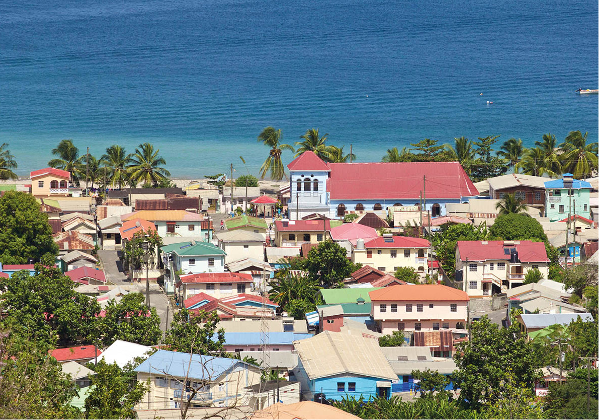
Colourful Soufrière rooftops
Dreamstime
Marine protection
The Soufrière Marine Management Area (SMMA), extending from Anse Jambon to Anse L’Ivrogne almost at the foot of Gros Piton, protects the unique marine habitat along the west coast of St Lucia, monitors the coral reefs and water quality, and carryies out scientific research in an attempt to prevent damage to reefs, fish stock, beaches and vegetation.
Its four main protected Marine Reserve Areas (MRAs), for which you will require a permit to dive, are: Anse Chastanet, Rachette Pointe, Petit Piton, Gros Piton (restricted access). Permits can be purchased on an annual or daily basis and are available from the SMMA (tel: 758-459 5500) and authorised dive operators.
To protect the reefs:
Do not damage or touch the coral while you are snorkelling or diving.
Do not remove any plants, animals, fish or even shells from the sea.
Do not feed the fish.
Tie up only to mooring buoys or anchor at official sandy areas.
Do not buy souvenirs made from coral; it is illegal to remove it from St Lucia.
Do not buy souvenirs or other items made from turtle shells.
Do not litter; dispose of waste in the appropriate bins.
The airy Lady of Assumption Church, built in the 1950s, stands at the corners of Henry Belmar, Sir Arthur Lewis and Boulevard streets. It has a simple design with the lovely altar and pulpit made from dark tropical wood. Above the main doors is a magnificent pipe organ.
Just in front of the church steps is the town square where a guillotine was erected by the Brigands (for more information, click here) during the French Revolution. If you wander through the small square be aware that this is one place where there is relatively high unemployment. You may be solicited for money or be approached by an unofficial (and unwanted) guide offering to show you around the church; a guide is not necessary, so a firm but polite refusal should suffice. On the north side of the square, on Henry Belmar Street, you will find buses for Castries and on the south side, on Sir Arthur Lewis Street, are buses for Vieux Fort and the south.
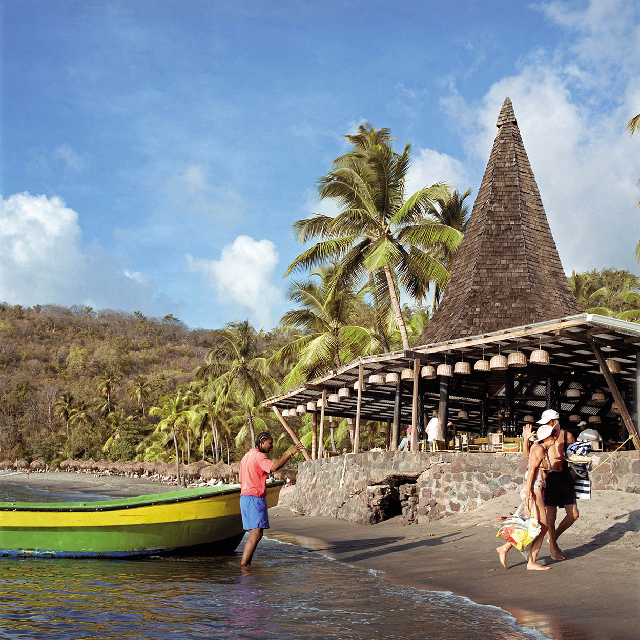
Mooring up at Anse Chastanet beach
Getty Images
Anse Chastanet
Anse Chastanet * [map] is a national marine park and well-known dive area just north of Soufrière, but the access road is potholed and narrow so you would be best advised to take a water taxi around the bay. The Anse Chastanet Resort and its sister property, Jade Mountain, dominate the beaches and 243 hectares (600 acres) of verdant hillside here. Spacious and luxurious tree-house style, open-air rooms built in to the hillside look out to the Pitons, and a dive operation, Scuba St Lucia, rents snorkelling and scuba-diving equipment. PADI and NAUI scuba courses are available for everyone, from beginners to the more experienced.
Volcanic black sand fronts the hotel, while the Anse Chastanet reef, with a host of colourful marine life, offers the opportunity to walk to a dive site within a few metres of the shore, where there are bright displays of coral, sponges, angelfish, parrot fish and seahorses. North of Anse Chastanet are two fine golden sand beaches, Anse Mamin and Anse Jambon. Anse Mamin is ideal for a picnic or a day spent relaxing on the beach and its clear waters. The beach is backed by forest and former plantation land from where Bike St Lucia (tel: 758-459 2453; www.bikestlucia.com) organises energetic cycling trips, known as jungle biking, along 19km (12 miles) of bike trails through the 18th-century plantation.
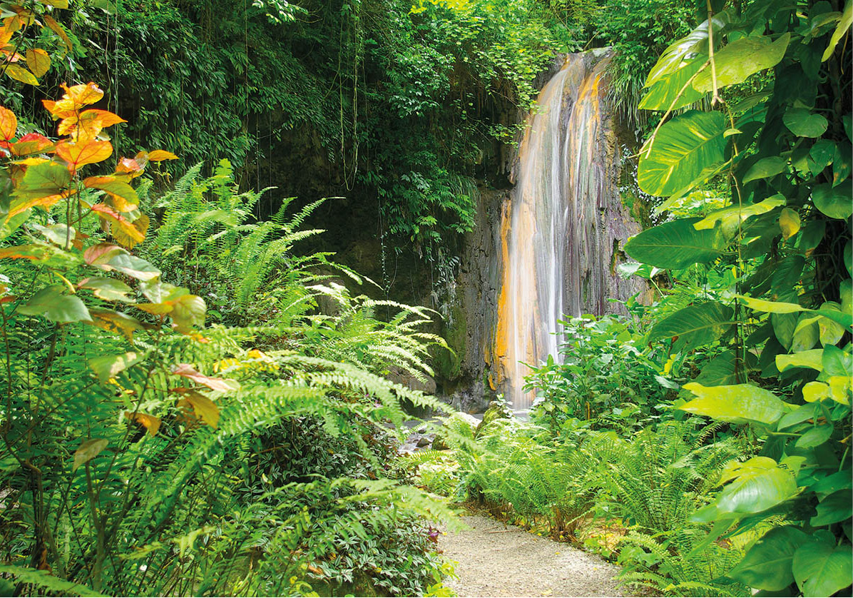
The spectacular Diamond waterfall
iStock
Diamond Botanical Gardens
South of Soufrière, old estate houses and hotels populate the hillsides, mostly shielded from the road by magnificent trees and bordered by fertile farmland. Head east out of town on Sir Arthur Lewis Street and a few kilometres along a good road you will reach the Diamond Botanical Gardens, Mineral Baths and Waterfall ( [map] (Mon-Sat 10am-5pm, Sun and public hols 10am-3pm; entrance fee; tel: 758-459 7565; www.diamondstlucia.com). The gardens were originally part of the Soufrière Estate, awarded to the Devaux family in the early 18th century by King Louis XIV of France. The original baths were built in 1784 by the Governor of St Lucia, Baron de Laborie, after it was discovered that water from the sulphur springs was mineral rich and therefore an effective treatment for rheumatism and other ailments. The baths were financed by King Louis XVI for his troops on the island, but they were destroyed during battles with the Brigands around the time of the French Revolution. The bathing pools were restored in 1925, while the garden and other facilities were expanded later to provide bathing in a communal outdoor pool or individual baths, for an additional fee. Beyond the baths is the waterfall.
A short trail snakes through the gardens and useful and descriptive signs identify tropical flora such as fragrant frangipani, red ginger, vibrant hibiscus and a variety of trees laden with coconut, cocoa or other local staples, so a guide is not necessary. A longer and more strenuous hike, which crosses over the Diamond River, leads to the old mill and a working waterwheel.
A horse-drawn sugar mill at Morne Coubaril Estate
Alamy
Morne Coubaril Estate
Morne Coubaril Estate , [map] (daily 9am-4pm; entrance fee; guided tours; tel: 758-459 7340; www.stluciaziplining.com) lies less than 1km (0.6 mile) from Soufrière on the Soufrière-Vieux Fort Road, almost opposite the slip road leading to the Sugar Beach (also known as Jalousie Plantation) resort. The 113-hectare (280-acre) working plantation is one of the oldest on the island. It was owned by the Devaux family until 1960 when it was taken over by Donald Monplaisir. The Monplaisir family have attempted to restore and preserve the property and its agricultural traditions. The great house with lovely wrap-around verandas is not open to the public because it remains a family home.
Colourful flora and trees heavy with fruit such as papaya, banana, cocoa, coconut, orange and grapefruit grow in abundance. At the Copra House, coconuts are prepared for sale to the St Lucia Coconut Growers Association, which produces coconut oil, and there is a lovely view over the deep bay nearby. You can also see a fully operational sugar mill where a mule is used to turn the wheel that grinds the sugar cane and produces the juice to make sugar and rum.
Replica wooden slave quarters reveal how people were forced to live in basic and cramped conditions. The huts have been reconstructed using traditional methods, with mud and paper on the walls and palm thatch on the roof.
An added extra is the opportunity to experience the adrenaline rush of zip-lining in full view of Petit Piton along eight zip lines through the estate and a canopy of fruit trees. Morne Coubaril also organises trekking expeditions on horseback (by appointment) and a choice of rainforest hikes (up to 3 hours) that visit the Coubaril waterfall, which is fed by the Sulphur Springs. Though strenuous, the walks are fun with an informative guide and reach a lookout point that provides a panoramic view over Soufrière.
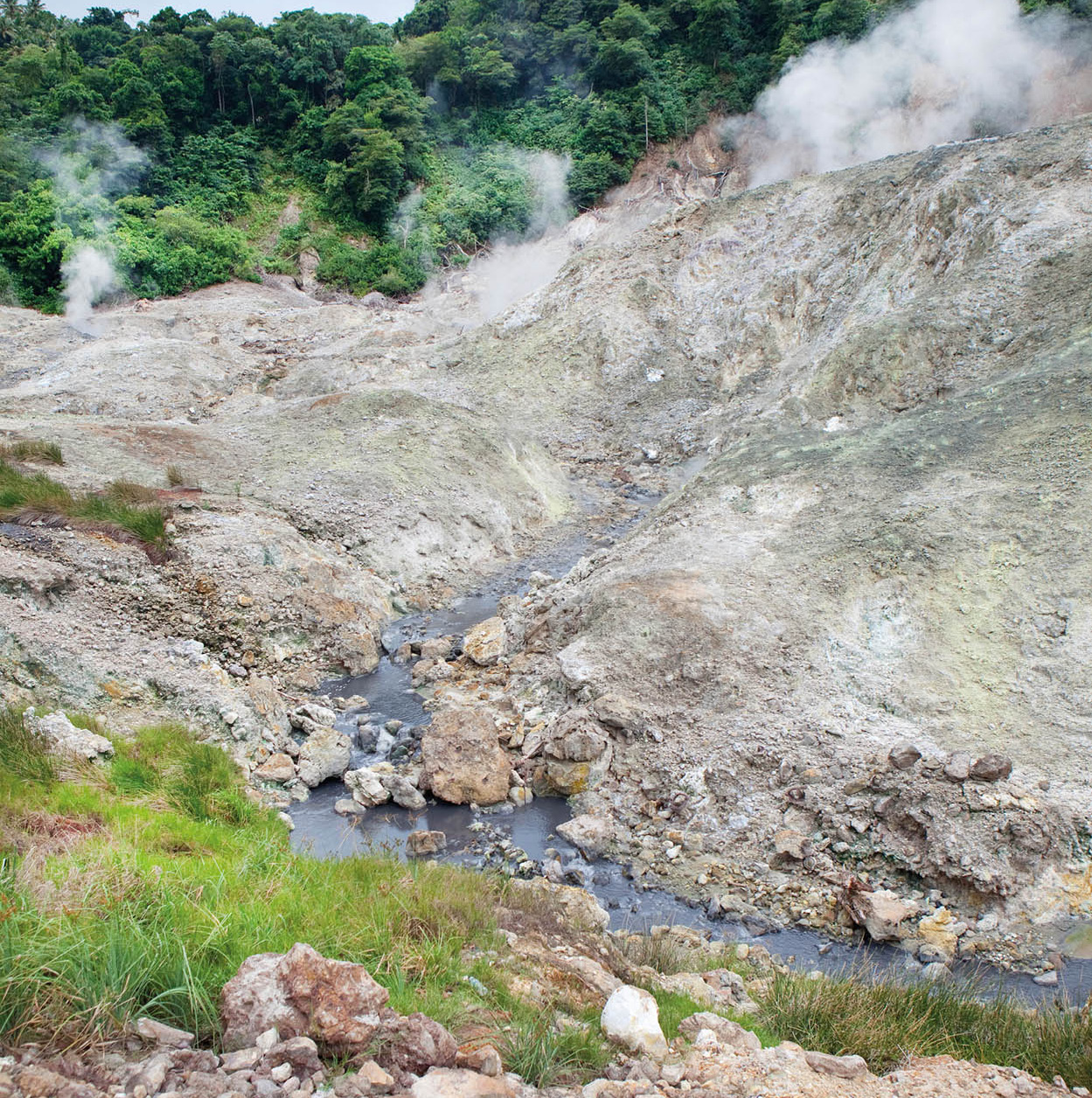
La Soufrière Sulphur Springs
iStock
Sulphur Springs Park
Off the Soufrière-Vieux Fort Road are La Soufrière Sulphur Springs ⁄ [map] (daily 9am-5pm; entrance fee), notable for the pungent odour (hydrogen sulphide), not dissimilar to rotten eggs. The Park contains the most active and hottest geo-thermal area in the Lesser Antilles and there are plans for the energy to be harnessed to produce electricity.
La Soufrière volcano collapsed more than 40,000 years ago and now produces only the foul-smelling gases and hot water that can reach temperatures of 170°C (338°F), but it is known as a ‘drive-in’ volcano. The rocky landscape of the geothermal field looks like something from a science-fiction movie, with springs and grey-brown mud bubbling up sporadically.
At the ticket booth, be prepared for vendors who congregate here to offer their wares; official guides also wait to escort visitors, for an additional fee, down a wooden pathway and along some uneven ground. He or she will give you a rundown of the site and its history. Tour operators offer a package of a visit to the springs, a mud bath and natural spa in a warm waterfall. The concrete bath can get very crowded when a tour party is in, so it is best to go early. Be aware that the mud will stain your clothes.
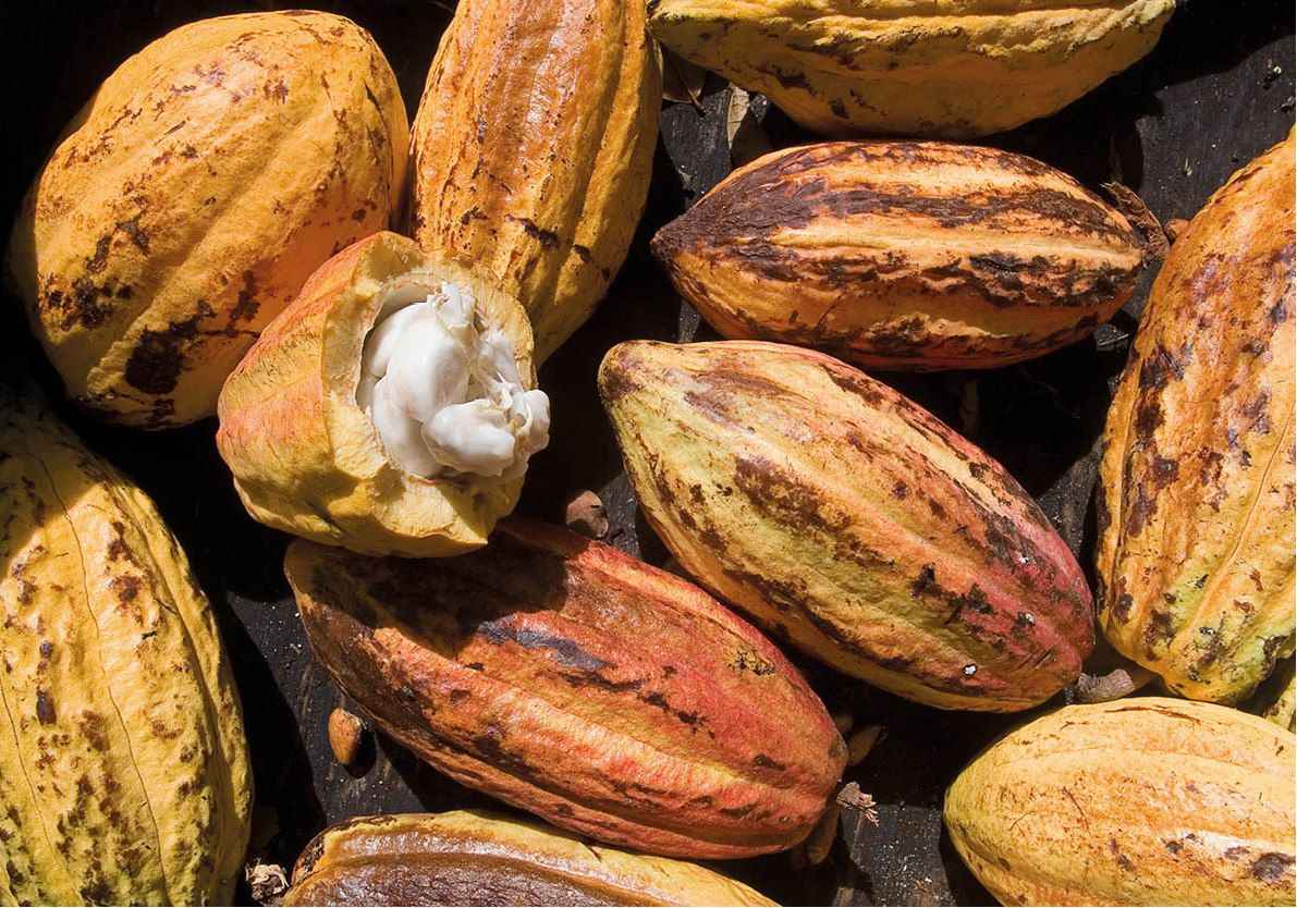
Ripe cocoa pods
iStock
Rabot Estate
At the turn off for the volcano is the entrance for the Rabot Estate ¤ [map] (tel: 758-457 1624; www.thehotelchocolat.com), a recently rehabilitated 56-hectare (140-acre) cocoa plantation owned by the British chocolatiers, Hotel Chocolat. The plantation dates back to 1745 and is the oldest on the island, with some very rare old trees of scientific and chocolate interest. This is a true bean-to-bar experience, as they grow their own cocoa before making it into their own delicious St Lucia chocolate in the UK. Local cocoa farmers also benefit as the estate buys their quality cacao pods at premium prices and guarantees a market for their product while also supplying them with young trees to improve their stock.
In 2012, a hotel was opened on the estate with luxury cottages and villas in view of the Pitons, together with the Boucan restaurant which specializes in all things chocolate, both savoury and sweet (for more information, click here). You can walk to the site of the 1795 Battle of Rabot, stroll through the plantation tasting the fruits of the mango, guava, soursop and papaya trees, then relax with a cocoa massage using the cacao nibs, oil and butter.
Amerindian heritage
The area around Soufrière has been an important settlement for centuries, long before the French or British arrived. The Amerindian settlers were in awe of the volcano, where the Island Arawaks thought their god, Yokahu, slept and the Kalinago (Caribs) named it Qualibou, or the place of death. Archaeological evidence of their presence can still be found on the ground.
There are petroglyphs along paths on both the Jalousie and Stonefield Estates. The former Jalousie Plantation hotel (now Sugar Beach) was built amid a wave of controversy when local people, environmentalists and archaeologists objected to its location due to its proximity to the Pitons, now a UNESCO World Heritage Site, and also because it was built on an important Amerindian burial ground, which is now under the tennis courts.
Fond Doux Estate
South of Rabot Estate is the Fond Doux Estate ‹ [map] (daily 8am-4pm for tours, until 10pm for dinner; entrance fee; tel: 758-459 7545; www.fonddouxestate.com), a working plantation. An inexpensive guided tour includes a look at the original plantation house, built in 1864 and renovated in the 1990s, which is currently occupied. Adjacent to the estate house is a colonial-style restaurant, which serves a buffet lunch for tour groups, a bar and a souvenir shop. The grounds, which extend over 55 hectares (135 acres), are planted with coffee, banana, mango, citrus fruits and coconut. Surplus spices, fruit and vegetables are sold in the owners’ supermarket in Soufrière. There is still an original worker’s house, store house, copra house and coffee-drying area on the property, as well as cottages available to rent.
Cocoa grown here is shipped to the UK and to the United States for use in chocolate produced by the Hershey Food Corporation. The drying racks are still in operation and you will be shown how cocoa sticks are made. These are available to buy in the shop. A leisurely walk through the estate reveals an abundance of bright and fragrant flora such as heliconia, ginger lilies and anthuriums. Trails through the estate lead past ruined military buildings built by French engineers in the 18th century, while up on the hill is an old Brigands’ hideout.
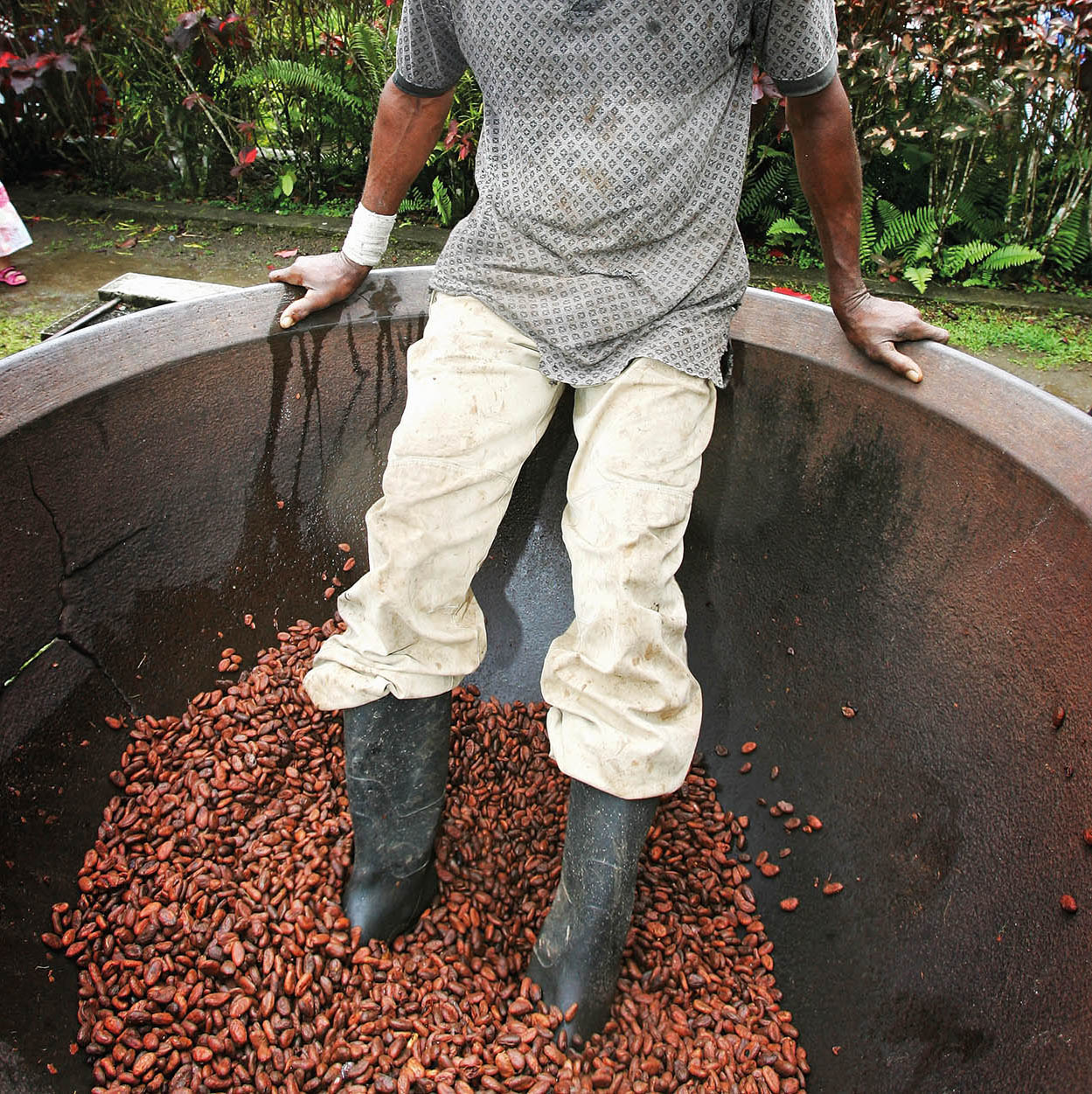
A cocoa farmer polishes the beans at Fondoux Plantation
iStock
Rainforest Mountain Reserves
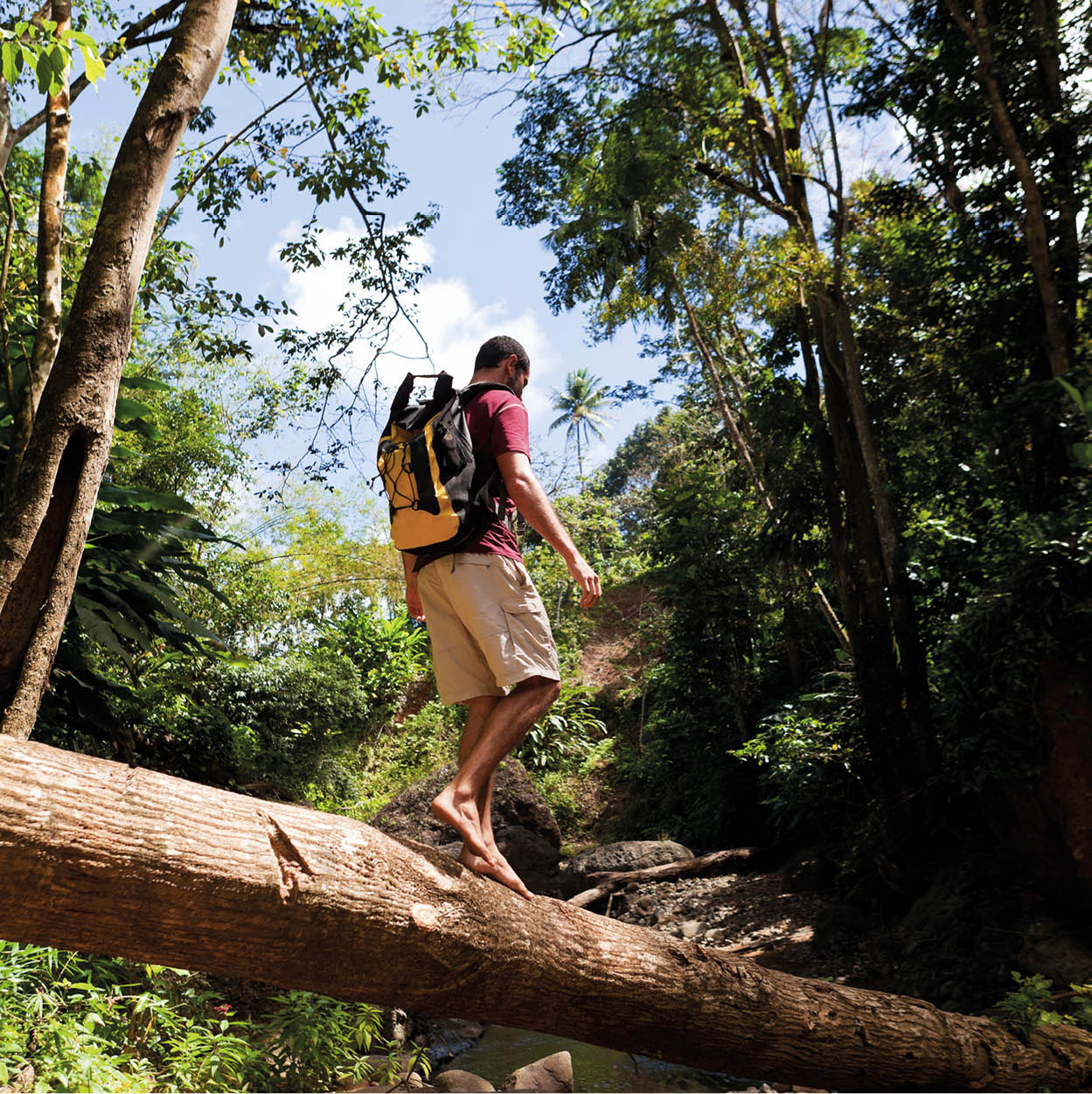
Most of the mountainous heart of St Lucia has been declared forest reserve, partly to protect wildlife and partly to preserve water supply for the settlements around the coast of the island. In some areas there are trails through the forest, maintained by the Forestry Department (tours Mon-Fri 8.30am-3pm; entrance fee; tel: 758-468 5649 or 450 2231; http://malff.com; for more information, click here), and it is possible to hike from west to east coasts starting from Soufrière.
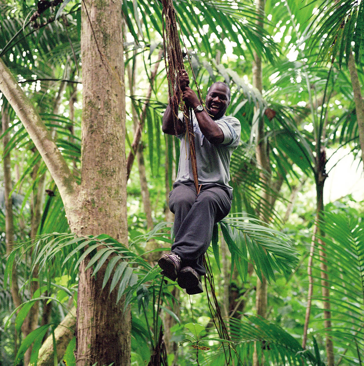
A guide swinging from vines in the Edmund Forest Reserve
Getty Images
A simple walk in the rainforest is a rewarding experience, preferably with a Forest Ranger to guide you. Six miles (10km) east of Soufrière lies the village of Fond St Jacques, where there are paintings by Dunstan St Omer in the church. From the village, there is a poor road leading up to a Rangers’ station. To reach it, either use a four-wheel drive vehicle or walk.
With advance notice, the rangers will escort you through the Edmund Forest Reserve to the Quilesse Forest Reserve and down to the Rangers’ station on the Des Cartiers Rainforest Trail, near Mahaut and to Micoud on the east coast. Alternatively, for a shorter excursion, follow the Enbas Saut Trail › [map] from the Rangers’ station above Fond St Jacques. This steep but exhilarating trail winds down 2,112 steps cut in the hillside to the Troumassée River, providing an opportunity to see elfin woodland, cloud forest and rainforest, depending on your altitude. You will be able to see the peaks of Piton Canarie, Piton Troumassée and Morne Gimie and you will hear the St Lucian parrot in the trees above you. At the bottom there are a couple of river crossings before you reach a pool with a little waterfall, where you can cool off before the arduous hike back up. Expect to get wet and muddy, especially after rain, which is frequent.
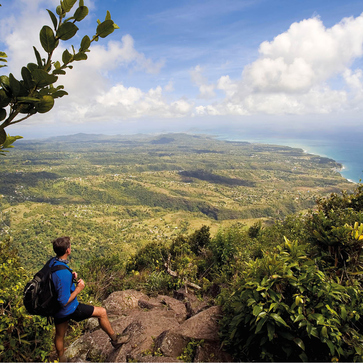
A hiker at the summit of Grande Piton
Getty Images
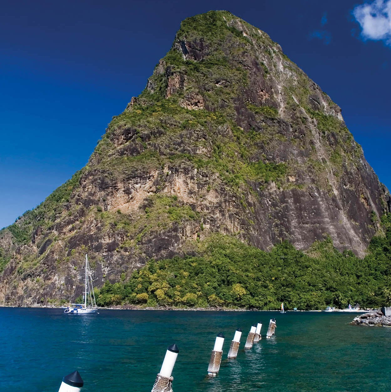
The Pitons
The Pitons dominate the southwestern landscape around Soufrière. Petit Piton (743m/2,438ft) is to the north of Soufrière harbour, while Gros Piton (798m/2,618ft) is on the south side of the bay near the L’Ivrogne River. The tall volcanic cones, which are covered in rich vegetation, are undoubtedly the most photographed rocks in St Lucia. A UNESCO World Heritage Site, their image appears on everything from postcards to T-shirts and art.
For many people the Pitons offer pleasure simply for their sheer beauty. However, more adventurous spirits want to get to the top. Though Petit Piton is the smaller of the two, it is more difficult to climb because of its steep sides, making climbing ropes essential. A relatively easier option is the trail up Gros Piton, although this isn’t a walk in the park either. It is not a pursuit to be tackled alone and you will need to employ the services of a local guide. Contact the Soufrière Regional Development Foundation (tel: 758-459 5500; http://soufrierefoundation.org), or the Gros Piton Guides Association (Fond Gens Libre Interpretative Centre, 40 mins from Soufrière, tel: 758-459 3492; open daily 8am-3pm). Be prepared for a very early start - most guides recommend setting off and reaching your goal early in the morning before it gets too hot.
Scaling the peak can be hot and thirsty work, so remember to carry plenty of water, sunblock and a hat. The time taken to complete the climb can vary; it is generally between three and six hours each way depending on the hiker’s level of fitness. From the summit you will be rewarded with sweeping panoramic views over the island, north and south, and on a clear day as far as neighbours Martinique and St Vincent.
The Tet Paul Trail is an easy alternative for those not fit enough to scale Gros Piton. This 45-minute walk begins in the Chateau Belair community in 2.4 hectares (6 acres) of lush vegetation between Fond Doux and the Gros Piton Trail. Head for Fond Doux and you will see the sign at the entrance to the Plantation. You walk through a variety of fruit trees and medicinal plants and can enjoy views of the Pitons, Jalousie beach, the coastline to the south and the neighbouring islands.
Petit Piton peak
iStock
VIEUX FORT AND THE SOUTH
The road south from Soufrière to Vieux Fort dips and rises through the hills and valleys, skirting forest and farmland, eventually passing the small fishing hamlets that dot the southwestern coast. It takes less than an hour to reach Vieux Fort.
Choiseul
Choiseul is a good-size town with a developed centre that has a town hall, a church, several schools, a post office and petrol station. The ruins of Fort Citreon, a fortress which protected Choiseul Bay, still stands guard over the area, but Choiseul is best known for La Fargue Craft Centre fi [map] (tel: 758-454 3226), south of the village. This is where local artisans sell their work, such as clay pots, for which the area is well known, basketwork, woodcarvings, local spices, seasonings and sauces. The centre is on the main road and has plenty of parking space. The centre can direct you to craftsmen’s workshops if you want something a bit different which is not in stock.
A bedroom seen through shuttered windows at Balenbouche Estate
Getty Images
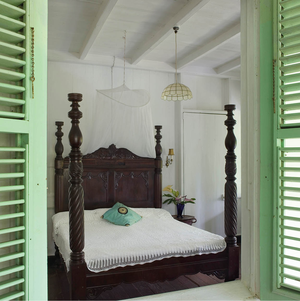
Balenbouche Estate
A few miles down the road is the Balenbouche Estate fl [map] (daily; entrance fee; guided tours by appointment; tel: 758-455 1244; www.balenbouche.com), which stands proudly on 30 hectares (75 acres) between the Balenbouche and Piaye rivers. It is close to some important historical and archaeological sites, and nearby Morne le Blanc has a good lookout point. The first European settlement at Balenbouche was established in the mid-18th century.
Today, the great house stands on the site of two previous estate houses. It dates from the mid-19th century and is furnished with antiques from that period. There are cottages to rent, a restaurant, nature trail and pretty gardens as well as ruins such as the slave quarters and the old plantation’s sugar mill and water wheel with mechanical works that were shipped from England.
There have been several significant archaeological discoveries made on the estate, including pre-Columbian petroglyphs, ceramics and stone tools.
Two dark-sand, rough beaches are Balenbouche Bay, just a five-minute walk through the estate, and Anse Touloulu, a ten-minute walk.
White sand on Anse de Sables beach
Dreamstime
Laborie
The journey continues southeast skirting round and above Laborie ‡ [map], a small fishing community with wooden colonial buildings in its centre and some modern fishing huts on the edge of the water. The village also has the best beach in the area, pretty but quiet, populated by a handful of local fishermen. Laborie has a small selection of accommodation for visitors who prefer to stay away from the crowds and several good local restaurants.
Vieux Fort
Vieux Fort ° [map], considered to be St Lucia’s second city, is one of the oldest settlements at St Lucia’s most southerly tip 67km (42 miles) from Castries, with a developing industrial centre and a population of 15,000. Hewanorra International Airport is located here, on the plains that open out to the sea. There are a few hotels, mainly B&Bs, not far from the airport, and some developed industry around the large port area, such as oilstorage, warehouses and grain stores, and a wharf lined with shipping containers. Here, too, is one of the Eastern Caribbean’s commercial free-zone centres and a large fisheries complex, along with a busy, if slightly haphazard, shopping area. Modern villas rub shoulders with fading French colonial-style buildings, reflecting the historical origins of the town’s first French settlers. The older part of town is full of small grocery stores, typical Caribbean shops, takeaways and bakeries.
In the beginning
Hewanorra International Airport is named after an Amerindian word meaning ‘land of the iguana’. There have been significant archaeological finds in the south of the island, where the airport is located.
Anse de Sables is a beautiful strip of white-sand beach on the east coast of the island. The waters just offshore are popular with windsurfers and kitesurfers who come to take advantage of the trade winds that bless this coast. There is a little bar and restaurant and a surf centre, where boards and equipment can be rented. A little further north is an all-inclusive resort.
Cap Moule à Chique’s lighthouse
Corbis
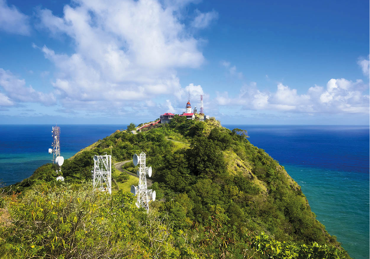
Cap Moule à Chique
Cap Moule à Chique · [map] is a rocky outcrop with dry forest and a tall lighthouse that towers high above the town and is as far south as you can get on the mainland. The drive up to a lookout is twisting and narrow, bordered by vegetation and sheer cliffs. Several residences dot the winding landscape and the peak.
Standing 223m (730ft) above sea level, the 9m (29ft) lighthouse tower is believed to be the second highest in the world, because of its location perched on Cap Moule à Chique. Painted white with a red lantern at the top, the tower itself is closed to the public but the lighthouse site is not. From this vantage point the view is spectacular: to the northwest, beyond Vieux Fort, are the rolling hills and valleys of southern St Lucia, including the Pitons in the far distance, and Morne Gomier, a 313m (1,028ft) -high peak closer to town. To the northeast, just off the coast, you will see the rocky Maria Islands Nature Reserve poking out of the sea like seals. Here, too, are sweeping views up around the East Coast, where the waves of the Atlantic Ocean buffet the land and the rocks below. On a clear day you can see the north coast of St Vincent.
Maria Islands
Maria Islands Nature Reserve º [map] (closed during the summer breeding season mid-May to end of July) lies 1.5km (1 mile) east of Vieux Fort, across a narrow ocean channel. The two largest islets, Maria Major and Maria Minor, form the main part of the nature reserve, which covers 12 hectares (30 acres) of dry scrubland and rocky outcrop.
These compact islands on St Lucia’s windward side have been shaped by the rough waves of the Atlantic, and are home to an array of rare bird and plant life. Noddies and terns have protected nesting sites here. Look out for the endemic St Lucia whiptail lizard (Cnemidophorus vanzoi) scuttling under bushes (the male has the colours of the national flag), and the non-poisonous kouwess grass snake (dromicus ornatus).
Access to the nature reserve is restricted to guided tours run by the St Lucia National Trust Southern Regional Office (tel: 758-454 5014; www.slunatrust.org) (for more information, click here) and to reach it visitors will need to take a small boat across the channel. Take your swimsuit and snorkelling gear as there is a small beach and plenty of underwater life.
Preserving the whiptail lizard
The St Lucia whiptail lizard (Cnemidophorus vanzoi) is not only endemic to St Lucia but is the only whiptail found in the Eastern Caribbean. The males sport the colours of the St Lucian flag: black, white, blue and yellow. Cats, rats and mongooses decimated the population until by the 1960s only a few lizards remained on the Maria Islands offshore.
In the 1990s the Forestry Department and the Durrell Wildlife Conservation Trust began a programme to introduce the whiptail to other predator-free offshore islands. A satellite colony on Praslin Island was hugely successful and this was followed in 2008 by introducing whiptails to Rat Island, on the west coast off Castries, in order to widen the gene pool. A further colony on Dennery Island is planned.
Barefoot hiking in the rainforest
iStock
THE EAST COAST
The East Coast Road from Vieux Fort follows a scenic route along the coastline of the windward side of the island. This is the less commercial part of St Lucia with fewer large resorts and hotels than on the west coast, but with a wealth of nature reserves and walking trails through the rainforest, gardens and fishing hamlets.
Savannes Bay
North from Vieux Fort is the Savannes Bay Nature Reserve ¡ [map], a protected wetland, the second-largest mangrove swamp in St Lucia, the first being the nearby Mankoté Mangrove ™ [map], which lies a little further south. An extensive reef system runs from near the Maria Islands (for more information, click here) to the north end of the Savannes reserve. The protective reef allows for the cultivation of sea moss, which is grown on ropes under the water, suspended by hundreds of plastic bottles. A wealth of bird life, such as herons, terns and egrets, inhabit the rich mangrove swamp.
Until the 1960s the Mankoté Mangrove and forest were part of a US military base that stretched across more than 1,200 hectares (3,000 acres). Due to restricted access to the land, the mangrove swamp suffered little or no damage caused by development elsewhere. However, once the US vacated the land, the swamp was opened up to commercial fishermen and hunters, until it was granted reserve status by the government in 1986.
Nearby Scorpion Island, lying in the Savannes Bay, also contains red and black mangroves.
Around 16km (9 miles) from Vieux Fort is Micoud, a small coastal village and an ideal place to visit during two of the island’s biggest religious festivals, La Rose in August and La Marguerite in October. They are both celebrated with church services, street parades, delicious food and fun events.
Inland is the starting and ending point for hikers attempting the walking trail that runs across the island through the Quilesse Forest and Edmund Forest reserves to Fond St Jacques, just outside Soufrière (for more information, click here). Alternatively, the circular Des Cartiers Rainforest Trail, at the start of the route, is about 4km (2.5 miles) and takes 2 hours to complete. There are no steep hills, but the path can be muddy and slippery after rain. Guides at the Rangers’ station can escort you. Parrot watching is good here in the early morning, but you must make arrangements with the Forestry Department (tours Mon-Fri 8.30am-3pm; entrance fee; tel: 758-468 5649; http://malff.com) beforehand.
West of Micoud and north of the Troumassée River is Latille Waterfall # [map] (entrance fee), which has 6m (20ft) cascades that descend into a pool below; bring your swimsuit.
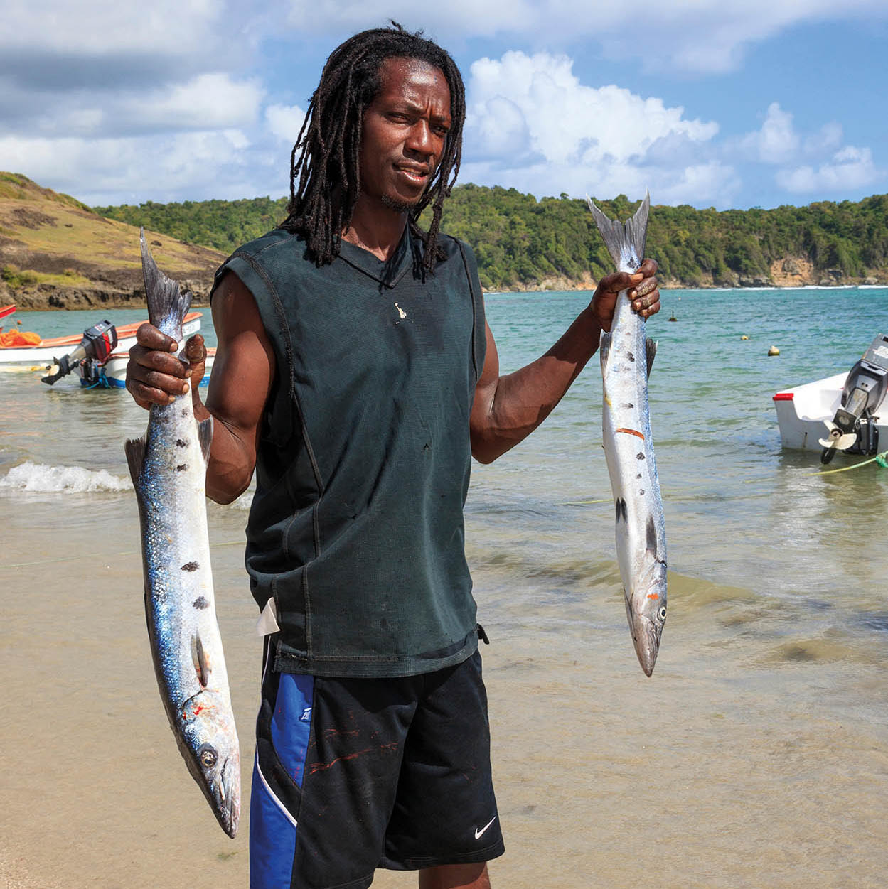
The freshest fish at Savannes Bay
Alamy
Mamiku Gardens
Mamiku Gardens ¢ [map] (daily 9am-5pm; entrance fee; tel: 758-455 3729; www.facebook.com/pages/Mamiku-Gardens) has 5 hectares (12 acres) of grounds surrounding an old estate house. It is located off the main road just north of Mon Repos in the Micoud Quarter, not far from Praslin Bay. In the 18th century Mamiku Estate was home to a French governor of the island; it later became a British military outpost during the tussle for ownership. Visitors to the tropical gardens can explore a series of self-guided walking trails lined with orchids, heliconia and hibiscus and shaded by trees, including the gommier, which is still used to make dug-out canoes. A small herb garden includes plants used in bush medicine introduced to the island by enslaved West Africans. Also on the site are ruins and archaeological artefacts. There is parking, a snack bar and a gift shop, and the ticket booth has trail maps.
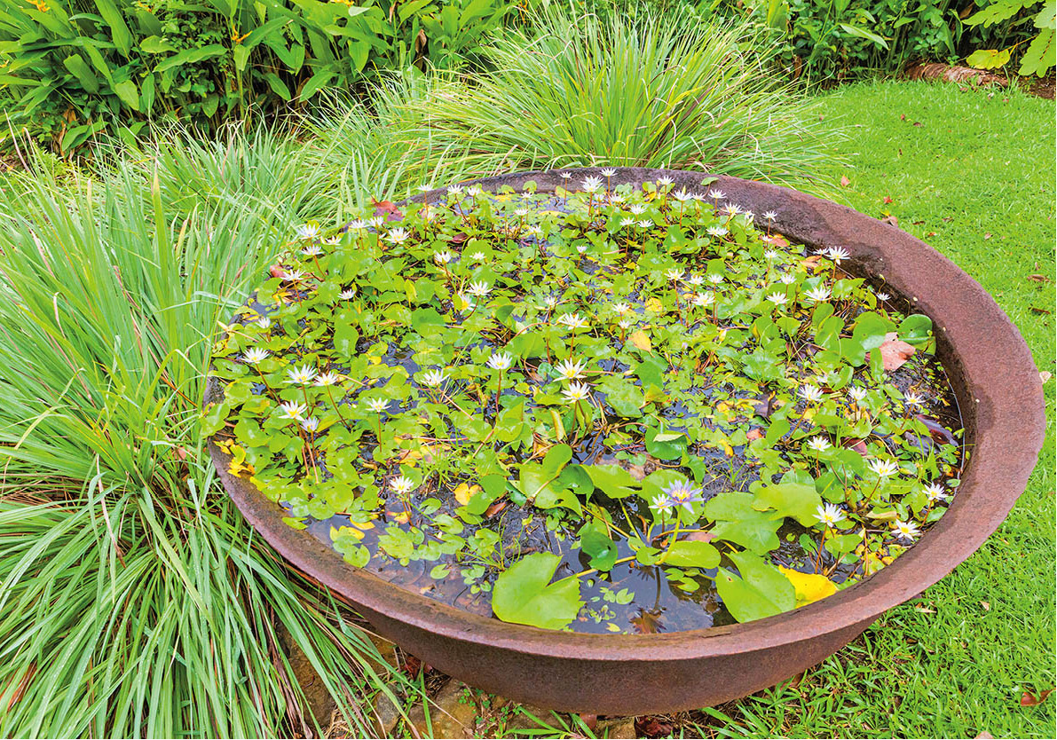
Water lilies at Mamiku Gardens
iStock
Praslin Bay
Praslin Bay ∞ [map] is a beautiful deep bay divided into two sections by a small promontory which stretches out like a finger towards the tiny Praslin Island offshore. The St Lucian whiptail lizard was introduced here from the Maria Islands in 1995 to conserve the species.
In the southern part of the bay, the village of Praslin maintains the fishing tradition on which it grew, and boat builders construct canoes from gommier trees using ancient techniques believed to have been imported by the first Amerindian settlers.
The area’s extensive red mangroves and mature trees are the habitat of the harmless endemic boa constrictor, a snake that can grow to over 3.5m (12ft). More than 30 species of bird live here and on the islands, such as the St Lucian oriole, the great white heron and the red-billed tropic bird.
Beyond the mangroves and dry forest is a cave network with evidence of an Amerindian settlement. Petroglyphs and remnants of ceramics and tools have been discovered along these parts.
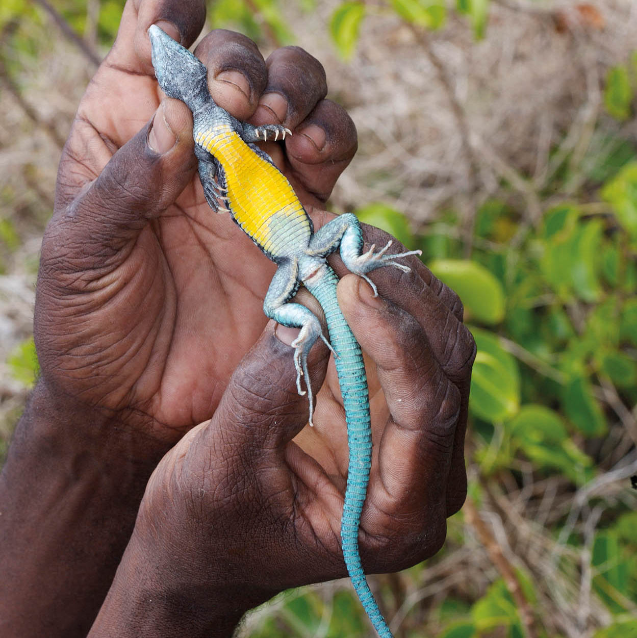
Whiptail lizard
FLPA
Fregate Islands
Just off the coast at the northern perimeter of Praslin Bay is the Fregate Islands Nature Reserve § [map]. The two small islands that form the reserve, Fregate Island Major and Fregate Island Minor, have a combined size of less than 0.5 hectare (1 acre). The islands are named after the frigate bird (fregata magnificens), which nests and roosts here, migrating from Cape Verde in Africa, but unfortunately their numbers have dropped dramatically. The islands are covered mostly in xerophytic vegetation, cacti, mangrove forest and grass. The National Trust manages this reserve and Praslin Island, but there are no tours.
Dennery bay
iStock
Dennery
The East Coast Road soon reaches Dennery ¶ [map], notable for its fishing industry. This is another village with a lively seafood fiesta (Sat 4pm) held on the beachfront with lots of children’s activities as well as food, drink and music.
Inland, along the Dennery River, is the Rainforest Canopy Adventure ✵ [map] (Errard Road, daily 10am-4pm; reservations essential; tel: 758-458 0908; www.adventuretoursstlucia.com). Instructors strap you into a harness and you descend the hillside on zip lines through the forest. Also on offer are bike tours along forest trails to the waterfall for bathing, offshore kayaking and a jeep safari, all with knowledgeable guides.
Bright houses in Dennery
SuperStock
Fond D’Or Bay
About 1.6km (1 mile) from Dennery, where the main road turns west into the Mabouya Valley, is Fond D’Or Bay. This crescent-shaped bay has a beach of white sand, backed by sheer cliffs and a rugged landscape. Swimming is not recommended because of the rough sea, but the beach is lovely.
Driving from Dennery, the view of the bay from the roadside lookout point is spectacular. Nearby, an old fort and plantation ruins have been developed as Fond D’Or Nature Reserve and Historical Park ª [map] (daily; entrance fee; tel: 758-453 3242), with a wooded canopy of coconut palms, an estuarine forest and mangrove wetlands. Visitors can hike along the forest trails and tour the estate that contains the remnants of the sugar mill, windmill and the old planter’s house, which is now an interpretation centre. From one of the trails on the edge of the estate, walkers might spot the hill known locally as Mabouya or La Sorcière (the sorceress), which stands almost 7km (4 miles) away in the Castries Waterworks Forest Reserve.
Transinsular Road
The road now leaves the coast behind and heads inland and uphill into the forest before climbing over the Barre de l’Isle, the ridge which divides the island. At the high point is a stall where Forestry Department guides meet hikers. You can do the short Barre de l’Isle trail q [map] on your own, or hire a guide for the longer Mount La Combe hike. As you emerge from the forest the landscape becomes progressively more built up until the smell from the coffee-roasting factory notifies you that you have arrived on the outskirts of Castries again.