Dive Atlas Of The World: An Illustrated Reference To The Best Sites - Jack Jackson (2016)
MELANESIA
by Andy and Angie Belcher
MELANESIA ENCOMPASSES THE ISLANDS OF the western Pacific Ocean, beginning at Papua New Guinea and then flowing in a great crescent shape to include the Solomon Islands, Vanuatu, New Caledonia and Fiji. It is a region of widely scattered archipelagos - over two thousand splinters of land that, if placed together, would cover an area barely the size of the smallest European province.
The islands of Melanesia reflect the area’s geological diversity, ranging from low-lying coral atolls with necklaces of reef to slabs of volcanic rock with mountains that spit flame.
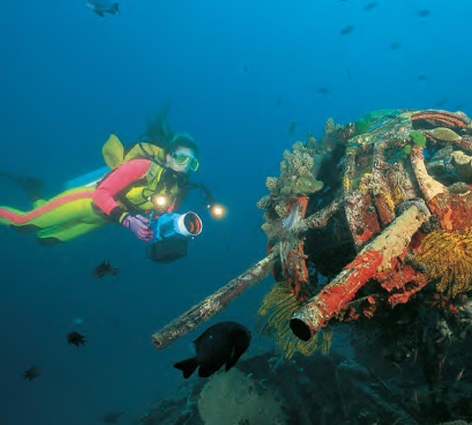
Melanesia straddles the Pacific Rim, a volcanic chain created by the collision of the Pacific and Australian plates, and as a result is often at the receiving end of seismic activity. But volcanic action is not all that has rocked these islands. During World War II the region was the battle ground between Japanese and American forces, and wreckage from that time still lies in the now-peaceful waters, creating a submarine war museum for visiting divers.
The word Melanesia derives from the Greek word melas for black, (the inhabitants had darker skins than the Polynesians to the east) and nesos for islands. Early migratory waves across the Pacific and later colonization have resulted in a rich diversity of cultures.
Fiji has an established dive infrastructure, a range of accommodation and package deals. New Caledonia and Vanuatu, formerly known as the New Hebrides, blends French flair with Melanesian magic, while the Solomon Islands are the dream realm of the wreck diver.
FIJI
If there is one word that sums up Fiji it is friendliness. And the one word you will repeatedly hear when you visit these islands is Bula, a hearty and genuine greeting that will be offered by nearly everyone you encounter. Fiji consists of two major islands, Viti Levu and Vanua Levu, surrounded by more than three hundred smaller islands and atolls within a complex system of barrier reefs. Located on Melanesia’s eastern boundary, Fiji is the meeting place of Melanesia and Polynesia. It also has a large Indian population originally brought in by the British to work on the sugar cane plantations. Fiji’s central position in the Pacific has made it a focal point for travellers and trading.
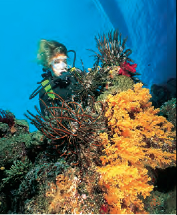
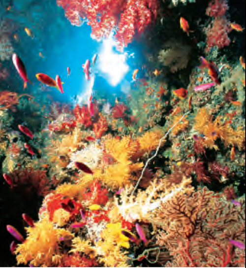
Fiji’s well-known dive sites are all grouped in clusters, usually because they share under-sea plateaus or atoll formations. There are more than 1000 recorded species of fish, several hundred types of coral and sponges and an infinite array of crustaceans, molluscs, anemones, worms and other invertebrates. The diving is varied. Some sites, with their sheer deep walls and wild currents are best left to experienced divers, but there are endless shallow fringing reefs and protected lagoons suitable for beginners.
RESEARCH AND CONVERSATION
Many of Fiji’s dive operators are involved with marine research and conservation programmes. Some assist by measuring water temperatures, salinity and current. Others collect reef specimens for analysis for medical uses. Beqa Divers is monitoring the proposed Namosi copper mine’s plan to deposit tailings in the Beqa channel (this is only a plan and no effluent pipeline has yet been built). They monitor existing effluent pipelines in the Suva/Levuka area for leaks or damage. Dive operators participate in ongoing discussions with marine biologists of the University of the South Pacific, the Department of Fisheries and fishermen on sustainable fish farming and any changes to reef structure or animals.
On Kadavu, there are also projects under way to establish three marine parks. These are planned for the areas around Namalatta, Astrolabe and Cape Washington.
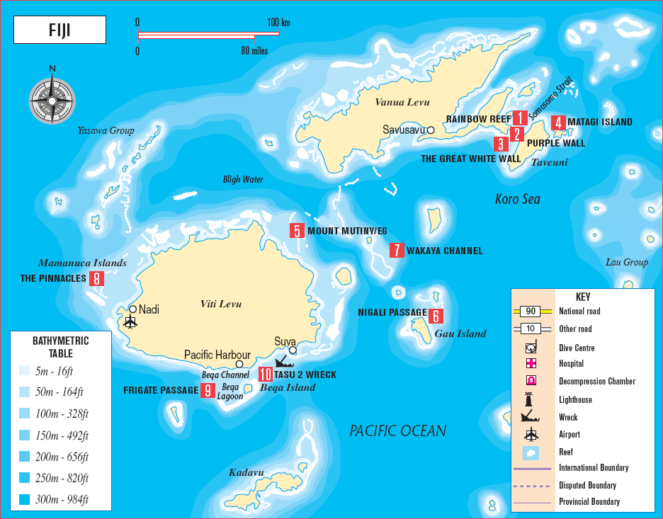
NORTHERN FIJI
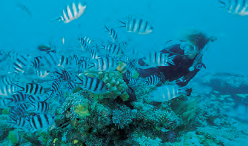
The colour, size and profusion of soft corals are sensational - the result of fierce, nutrientrich currents which sweep in and around the Somosomo Strait between Vanua Levu and Taveuni, giving Fiji the reputation of soft coral capital of the world. The Rainbow Reef, Purple Wall 2 and The Great White Wall are all accessible by boat from shore bases.
Divers, especially underwater photographers, are drawn to Taveuni by nature’s colourful landscaping. The island, Fiji’s third largest, is 40km (25 miles) long, and also known as The Garden Island. And lives up to its name as home to most of Fiji’s bird species and the Tagimaucia flower. Matagi Island 4, a five-minute boat ride from Taveuni, is a favoured land-base for divers.
Rainbow Reef 1 is about 20 minutes by boat from Taveuni. It can have current, but good snorkelling is possible. The 30-km (20-mile) reef extends into the Somosomo Strait between Taveuni and Vanua Levu.
The Great White Wall 3 is a drift dive with strong currents and immediate descent is required. Visibility is about 20-30m (65-100ft) and the average depth 30m (100ft). The wall drops to between 60m (200ft) and 80m (260ft), way beyond the maximum recommended sport diving depths.
The Somosomo Strait narrows abruptly and the water moving through this gap at speeds of up to 6km/h (3 knots) is further constricted by a number of reefs, one of which is Rainbow Reef. After descending about 10m (33ft) divers swim through a reef-top-tunnel decorated with luminous soft white corals, gorgonias, crinoids and clouds of tiny orange anthias (fish). As they emerge from the passageway at 24m (80ft) the reason for the dive’s reputation is revealed. The current carries divers along a vertical wall smothered in white soft corals. The trick is to start the dive just as the current turns, so that divers can be carried gently along the wall and then fin back to the dive boat without undue exertion.
Kadavu’s garden grottos are for those who love beauty. Walls, drop-offs and reef passages provide limitless choices.
The bommies of Beqa Lagoon (pronounced Benga) are riddled with tunnels and openings smothered in every conceivable colour and class of coral.
CENTRAL FIJI
The deep, rich, ocean channel between Fiji’s two main islands is separated by two separate barrier reefs. Trade winds, currents and a rich nutrient flow make the diving wild and dynamic. Pinnacles, current-flushed reef passages and bommies submerged in small lagoons, are just part of what is still largely an unexplored reef system. Mount Mutiny, Nigali Passage and the Wakaya Channel 7 are just some of the top sites.
Mount Mutiny 5, also known as E6, is situated in Bligh Water between Viti Levu and Vanua Levu. This is a seamount rising from 914m (3000ft), with the tip just breaking the surface at low tide. It is an open-water dive, accessible by live-aboard, with some current and excellent visibility. The average depth is 20m (65ft). It involves a swim-through of a crescent-shaped passage adorned with gorgonias and soft corals, leading to The Cathedral, or the Sistine Chapel as it is sometimes called. Depending on the time of day, shafts of light filter through holes in the coral formations bathing the passage in an almost spiritual glow. The area is favoured by photographers for its wide-angle, colourful images. Hammerheads, tuna and other pelagics scour the perimeter of the E6 seamount.
The Yasawa Group in the west and Lau Group in the east of this area are the great underwater playgrounds for live-aboard dive vessels. Divers enjoy vast unexplored territories and visits to traditional village communities, where they are given the opportunity to participate in local rituals, in particular the kava ceremony. To visit Fiji and not experience kava is unthinkable. This local drink, made from the crushed roots of the kava plant, has been described as ‘looking like dirty water and tasting like dirty socks.’ It has a narcotic effect and can leave the mouth slightly numb. The bizarre mushroom-shaped islets and crystal clear waters of Fulaga Lagoon in the Lau Group have been known to make visiting divers wonder if they are experiencing the hallucinating effects of a kava overdose.
Nigali Passage 6 is just off Gau Island, and access is by live-aboard boat. There is some current depending on the tide. It is a drift dive with an average depth of 24m (80ft). The passage carries water from deep ocean into a shallower lagoon. The stronger the current the more prolific the fish life. It is best as a drift dive with the current taking divers out into deeper, calmer waters. Here you will find the Cabbage Patch, a huge area of stony corals named after the leafy appearance and colour of the coral. Barracuda, Grey Reef, Whitetip and Blacktip Sharks are all resident.
Gotham City, just a short boat ride from Plantation Island swarms with an assortment of reef fish following divers in the feverish expectation of being fed.
SOUTHERN FIJI
Beqa Lagoon (pronounced Benga), off the south coast of Viti Levu, is one of the best-known dive areas in Southern Fiji. Strong currents rush through the passages, carrying with them schools of large pelagics. The lagoon itself has lots of big bommies (coral heads) riddled with tunnels that are festooned with a tremendous display of soft corals.
The Tasu 2 10, a scuttled trader, lies 48km (30 miles) west of Suva. Dive operators launch from Pacific Harbour. The site offers sheltered, shallow waters, good visibility and little current. The average depth is 15m (50ft). This wreck rests in about 20m (65ft). Although stripped of much of its original fittings, the rails and rungs make great photographic subjects, as do the prop and rudder which lie wedged in the white sands of the ocean floor.
The Pinnacles 8 is situated near the Mamanuca Islands. Access is by dive boat from one of several resorts on Plantation Island, Castaway, or Musket Cove. It is diveable in most conditions. There can be some current on the surface and visibility averages 15m (50ft). The average depth of the dive is 15-20m (50-65ft), with a maximum of 24m (80ft). It is a bommie rising up to within 6m (20ft) of the surface. The top is jam-packed with anemones and resident clownfish. A small swim-through near the base is a novelty for newer divers.
Frigate Passage 9 is at the southwest entrance to Beqa Lagoon. Access is by dive boat from shore bases at Beqa Island or Pacific Harbour. Visibility is often more than 20m (65ft). Two large coral heads in the entrance of the passage are riddled with small tunnels and caves which are fun to explore. Active and plentiful supplies of pelagic species pass through the passage.
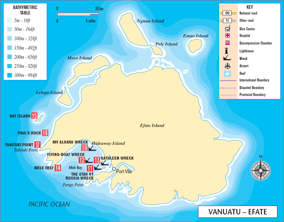
VANUATU
Vanuatu, formerly known as the New Hebrides, consists of four main islands and a string of smaller ones. The total land mass of around 13,000 sq km (5000 sq miles) ranges from towering volcanic cones clad in dense rainforest to low-lying coral islands with deep natural harbours. It is recognised as one of the most culturally diverse countries in the world. While both French and English are spoken, the majority of Ni-Vanuatu speak Bislama, a quirky rendition of English. ‘Mi laikem daiva long Vanuatu tumas!’ translates as ‘I like diving in Vanuatu very much!’
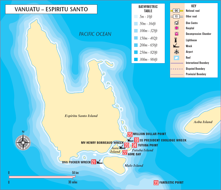
Diving is still confined to two of the largest islands, Espiritu Santo and Efate, where the sleepy capital of Port Vila is located. Despite the often-limited visibility in Port Vila’s harbour, there are three regularly visited wrecks there. The Star of Russia 11 is an easily penetrated three-masted ship built in 1875. It now lies in 30m (100ft) of water. There is a Sandringham flying-boat 12 at 40m (130ft) and the scuttled trader Kathleen 13 lies at a depth of 35m (115ft).
Several buoyed sites at Mele Reef 14 less than half an hour from Port Vila, are well protected in most weather conditions. The plate and staghorn coral formations make it a popular site for novice divers and photographers alike. Better visibility and more spectacular terrain can be found closer to the entrance of the bay around Pango Point. For advanced divers the waters surrounding North Efate’s offshore islands hide an intact corsair fighter, anti-submarine nets, buoys and boom gates. Hat Island 15 and Paul’s Rock (one of Vanuatu’s best marine reserves) are also popular dives.
Paul’s Rock 16 is a seamount rising from 70m (230ft) to within 1m (3ft) of the surface, 800m (880yd) offshore from North Efate. Access is by boat and it is diveable in most conditions with a visibility of 10-20m (33-65ft). The average depth is 20m (65ft) and the maximum 70m (230ft). It offers gorgonia tunnels, swim-throughs and interactive fish life.
Corals hang seductively beneath the shaded bow of the SS President Coolidge, which rests off the island of Espiritu Santo.
Million Dollar Point is the historian’s paradise. Acres of discarded war machinery litters the coastline both above and below the water.
A diver swims over the top of Paul’s Rock. This solitary seamount rising 800m (2600ft) offshore, is regarded as one of Vanuatu’s best marine sanctuaries.
The MV Aloara 18 is situated 550m (1805ft) offshore from Hideaway Island, Port Vila, Efate. This 30m (100ft) former island trader was sunk in November 2001 to create an artificial reef. The boat lies on its side near the edge of a reef. Access is possible by small boat in most conditions. Visibility is 20-30m (65-100ft) and there may be a slight current. The average depth is 20m (65ft) and the maximum 25m (80ft).
Tukituki Point 17 offers a labyrinth of canyons which are pierced at midday by the sun, creating shimmering curtains of light.
Dive operators in Port Vila go to great lengths in their effort to manage the reefs. They have, for instance, designated special areas as unofficial marine sanctuaries - a concept which is paying big dividends in terms of increased marine life.
Most diving visitors to Vanuatu are lured north to the archipelago’s largest island, Espiritu Santo. It was here that author James A Michener was stationed during World War II and from which he drew inspiration for his book Tales of the South Pacific.
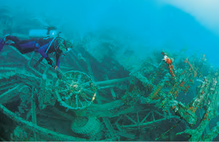
The main attraction of Espiritu Santo is the wreck of the SS President Coolidge 19 the largest, easily accessible shipwreck in the world. The 200m (654ft), 22,350-tonne luxury liner had a beam of 25m (80ft). She was converted to a troop ship during the war and run ashore after hitting two American mines while negotiating the channel in an attempt to reach the sheltered harbour. Moorings have been placed at regular intervals along the wreck to allow for quick and easy access. This wreck is huge.
It is recommended that divers prepare for deep and wreck dives before arriving in Santo. The wrecks of the MV Henry Bonneaud 20 and the USS Tucker 21 as well as many lovely stony coral reefs - Aore Bay 22, Fantastic23 and Tutuba Point 24 - ensure variety.
The President Coolidge 19 in Santo Harbour was declared a Vanuatu Marine National Park in 1983. Access is possible from shore and by boat. It is diveable in most conditions, but silts easily. The average depth is 35-45m (115-150ft). The maximum depth is 60m (200ft) as per code of practice.
There is plenty to see outside the wreck, but most divers like to do at least one penetration dive. The most popular choices are to view The Lady at 45m (150ft), a beautiful porcelain wall plaque which once graced the smoking room, the engine room at 48m (158ft) or the swimming pool at 56m (184ft).
The ship lies on her port side. The bow rests in about 20m (65ft) of water while the stern drops away to 70m (230ft). Like any penetration dive, silt-outs are always a possibility. The wreck is a complex structure with a maze of passageways and compartments that can confuse even the most experienced diver. The majority of diving takes place between the bow and the bridge area at around 40m (130ft). The promenade deck is still littered with war debris. Rifles, bayonets, helmets and gas masks rest where they fell more than half a century ago. Trucks, jeeps, anti-aircraft guns and shells lie abandoned in the holds. The President Coolidge is advanced diving and diving with a guide is mandatory.
Million Dollar Point 25 is situated in Santo Harbour and is accessible from shore. It is diveable in most conditions and visibility averages 10-15m (33-50ft). The average depth is 10m (33ft) and the maximum 40m (130ft). There are trucks, bulldozers, boats, surplus army equipment and many small, exotic marine creatures have made their home in the wreckage.
At the conclusion of World War II millions of dollars worth of surplus army equipment was scuttled, driven or dropped off a jetty in Santo Harbour. The rusted remains can be seen on the beach and continue below the surface to 40m (130ft), spreading over a wide area. Great for fossicking and photography, especially macrophotography.
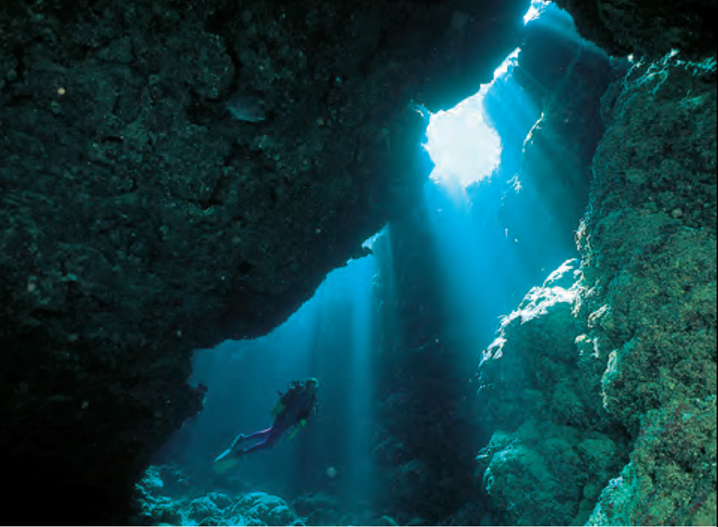
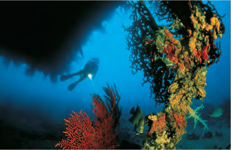
At midday curtains of light fall through reef-top openings illuminating the interiors with magical light. This is a common sight throughout the Solomons and Vanuatu.
SOLOMON ISLANDS
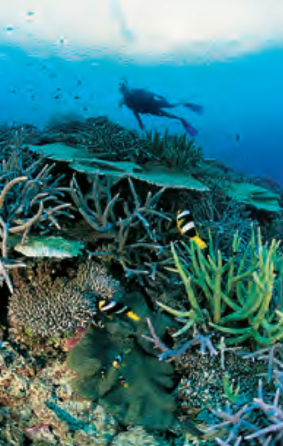
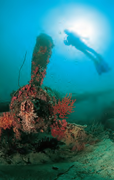
The Solomon Islands comprise a volcanic and densely forested group of six main islands surrounded by more than 800 smaller islands, of which only about one third are populated. American and Japanese war veterans know the Solomon Islands well. During World War II, Guadalcanal, the main island, was a strategic point in the bitter struggle by American forces to repel the Japanese in the Pacific. The ensuing naval and air battles left hundreds of planes and ships wrecked on land and in the ocean. Some of the best wreck dives are conveniently close to shore and have attracted masses of fish and an incredible variety of coral life. Many wrecks start in depths shallow enough for snorkelling and then plummet down well past the limit for safe sport diving.
Tragically, parts of the Marovo lagoon are under threat from logging companies which are clear-felling to extract rosewood and ebony timbers. As well as depleting the resource, heavy run-off during the rainy season creates tides of red silt into the lagoon smothering mangroves and corals. In another area, foreign tuna boats haul in huge catches of baitfish depleting the food source of the larger species. On a more positive note, ecotourism is being encouraged, using local resources and knowledge.
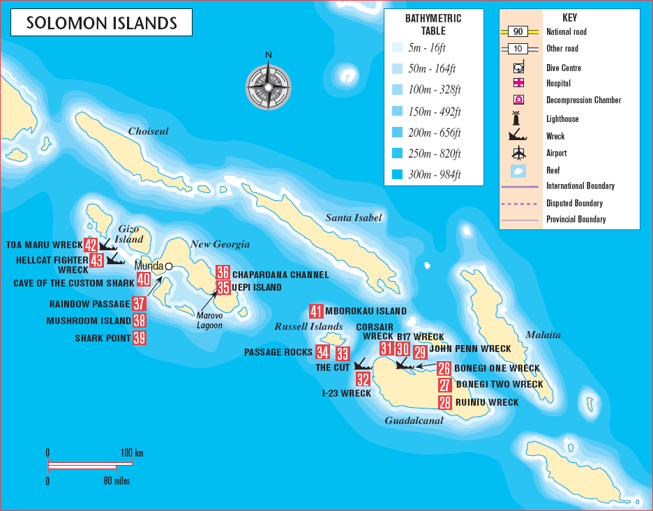
The most accessible diving is in three main areas: Guadalcanal, Marovo Lagoon and Gizo.
GUADALCANAL
Due to land issues all diving around Guadalcanal has been put on hold. When they are accessible, the dives around Guadalcanal suit both novice and experienced divers. Bonegi One 26, Bonegi Two (Kinugawa Maru) 27 and the Ruiniu 28 are a trio of Japanese transporters bombed and then run ashore in an attempt to salvage supplies. Their bows are in shallow water - as little as 3m (10ft) - and their sterns lie at between 30m (100ft) and 40m (130ft). The fantastic fish life and prolific coral growth on these war relics provide a thought-provoking juxtaposition of life and, sometimes violent, death.
A shroud of pastel-coloured corals covers this P-38 fighter which lies in 10m (33ft) of water off the end of the Seghe Airport runways at Marovo Lagoon.
Riddled with bullets, this B17 bomber was ditched in the shallow waters offshore of Honiara. Her heavily-armed 50-calibre machine guns still aim at a silent enemy.
Serious technical divers can now access some of the deeper wrecks lying in Iron Bottom Sound, renamed as a result of the graveyard of wrecks sunk during the Guadalcanal Campaign. Many of these wrecks exceed sport diving depth limits, but others like the troopship John Penn 29, which is 36m (118ft) at its shallowest point, can be dived with guides supplied by local operators. A heavily armed B17 30, a corsair 31 and a I-23 submarine 32, which can be accessed from shore, as well as the potential to discover undiscovered wrecks make Guadalcanal a wreck diver’s dream.
RUSSELL ISLANDS/MAROVO LAGOON
The Russell Islands are a compulsory stop for live-aboard boats heading for Marovo Lagoon, the second-largest lagoon in the world. These volcanic islands, accessible only by boat, are covered in thick, verdant tropical growth and rise straight out of the deep. At some sites the boat can tie up to vegetation and hang back, at others diving is done from tenders. Some islands have a ‘lip’ where the boat can anchor while the stern hangs over the deep.
The diving is exciting and diverse. There are cuts, canyons, custom caves and currents. Custom caves, above or below water, belong to a village and are controlled by customary laws. Currents encourage coral growth to delight wide-angle photographers, while the seemingly uninspiring coral rubble with siltcoated war wreckage (like that at White Beach) are home to the type of bizarre marine life that delights macrophotographers.
Visibility can be exceptional although there is some variation according to season, coral spawning or plankton blooms. Fish life is prolific with great schools of swirling barracudas and jacks. Highlighting the best dives around these islands is nearly impossible.
The Cut 33, a crevice 5m (16ft) wide, carved about 100m (330ft) into Leru Island, is accessible by live-aboard. It is best dived at midday when shafts of sunlight stream through the openings above, bathing divers in an almost spiritual light. At the end of the corridor you surface into a jungle to be serenaded by the calls of birds and insects. This is a sheltered site with visibility of 15-30m (50-100ft). The average depth is 10-12m (33-40ft), with a maximum of 16m (52ft).
Uepi Island 35 (pronounced Ooo-pee), a raised coral reef situated within Marovo Lagoon, has a diverse marine ecosystem and provides an idyllic land-based dive operation. There are plenty of coral gardens, drop-offs, ledges and gullies. The Chaparoana Channel 36, running between Uepi and a smaller island is a highway for sharks, rays, turtles and even the occasional whale. The Marovo area is also renowned for its exquisite ebony woodcarvings known as Spirit of Solomon.
Further to the west in the Roviana Lagoon is Munda. This was once the home of the head-hunting Roviana people and there are still many remnants and artefacts. The names of the dive sites around this region describe what you can expect to see: Rainbow Passage 37, Mushroom Island 38, and Shark Point 39.
The Cave of the Custom Shark 40 is at Dnokendnoke Island, Roviana Lagoon, and can be reached in 30 minutes by small boat from Munda. Visibility at the sinkhole can deteriorate after heavy rain. The average depth is 15m (50ft) and the wall drops away to around 800m (2625ft) at the cave’s ocean exit.
It is a penetration dive through a freshwater sinkhole out into the ocean on the other side of the island. Divers descend 15m (50ft) down a crystal clear freshwater pool on the island. The shaft widens and turns a bend just wide enough to negotiate the odd stal ag mite which obstructs the path. Just as you lose all light and get that claustrophobic feeling, a layer of transparent blue light, the exit point, comes into view.
Mborokau Island 41, also known as Mary Island, is situated between the Russell Islands and Marovo Lagoon. Visibility can be exceptional and the sites are diveable in most conditions. The average depth depends on the actual site, but is usually between 5m (16ft) and 15m (50ft).
Fish life is prolific, with swirling jacks and schooling barracuda. There is an assortment of macro life, such as Harlequin Ghost Pipefish and camouflage crabs.
Passage Rocks 34, in the Russell Islands, is accessible by live-aboard boat. It can have strong currents and it is best to dive on the leeward side. The average depth is 20m (65ft).
These two tiny islets rest on a 10m (33ft) deep volcanic tabletop. At 25m (80ft) giant pink gorgonias and yellow soft corals cover the overhanging walls. Rays, sharks and massive schools of fish are always in residence. Thousands of tiny blue and yellow fusiliers hang around the bommies on the plateau.
GIZO
The excitement at Gizo starts when you land on a small narrow island consisting of nothing but its small, narrow runway, and doesn’t finish until you’ve sat on a natural bench in 18m (60ft) of water at Grand Central Station. There divers can witness the hurried comings and goings of sharks, rays, and amberjacks in a frenetic underwater city. Situated in the Western Province, Gizo is surrounded by endless lagoons, volcanic islands and crystal bays and offers excellent and easy diving on wrecks, reefs and drop-offs. Nearly all the dive sites are 15-20 minutes from the wharf. The marine life is busy and unspoiled, but the wrecks of the Toa Maru 42 and the tiny Hellcat fighter are the most popular.
Toa Maru can be reached from Gizo by boat and lies in a sheltered bay diveable all year round. Visibility averages 15-20m (50-65ft). The average depth is 20-25m (65-80ft), with a maximum of 37m (121ft).
This 140m (460ft), 6990 tonne Japanese transporter lies on her starboard side with her bow in 12m (40ft) and stern in 37m (121ft). There are saki urns, gas masks, bayonets and even a tank lying upside down outside the main hold. We returned from one photographic trip to realize that the model had been elegantly perched on top of a pile of live mortars! Guided penetration dives take divers through the bridge, past the galley with its huge woks and ovens, into the massive engine room and its tangle of cables and valves and into the crockery room where sacks of plates and cups now hold easily disturbed layers of silt.
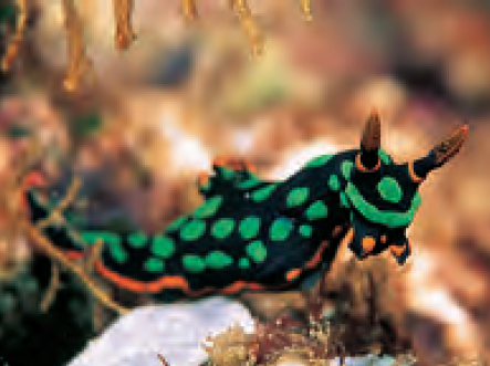
This colourful nudibranch (Nembrotha kubaryana)has many colour variations.
This crab, (Hoplophrys oatesii), mimics the colours and lines of the pink soft coral growing on war debris at White Beach, Marovo Lagoon.
The Hellcat Fighter 43 lies in shallow water near a small island. It is accessible by boat, and is about one hour from Gizo. Visibility averages 10m (33ft). The average depth is 10m (33ft), with a maximum of 12m (40ft).
Still intact, this fighter was ditched after being shot down by a compatriot in 1943. It is an easy and fun dive and can be snorkelled. Divers enjoy being photographed sitting in the cockpit. It is surrounded by patches of cabbage and staghorn coral. The excitement of visiting Melanesia is not in what you know, but in what awaits discovery. Unexplored reefs, undiscovered wrecks and unrecorded marine life await the adventurous diver.
Milne Bay. Fringing reefs in this region often have deep water close by and mild currents parallel to shore.
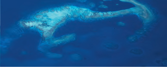
Offshore reefs such as this one in Milne Bay, can have complex channels and dropoffs. These fascinating dives often involve encounters with sharks and pelagics.