Caribbean: The Lesser Antilles - Insight Guides (2016)
DOMINICA
Untamed and beautiful, this lush volcanic island has jungle trails, sulfurous pools, and coral reefs. Above and below sea level it is a magnet for nature lovers, from birdwatchers to whale spotters.
Main Attractions
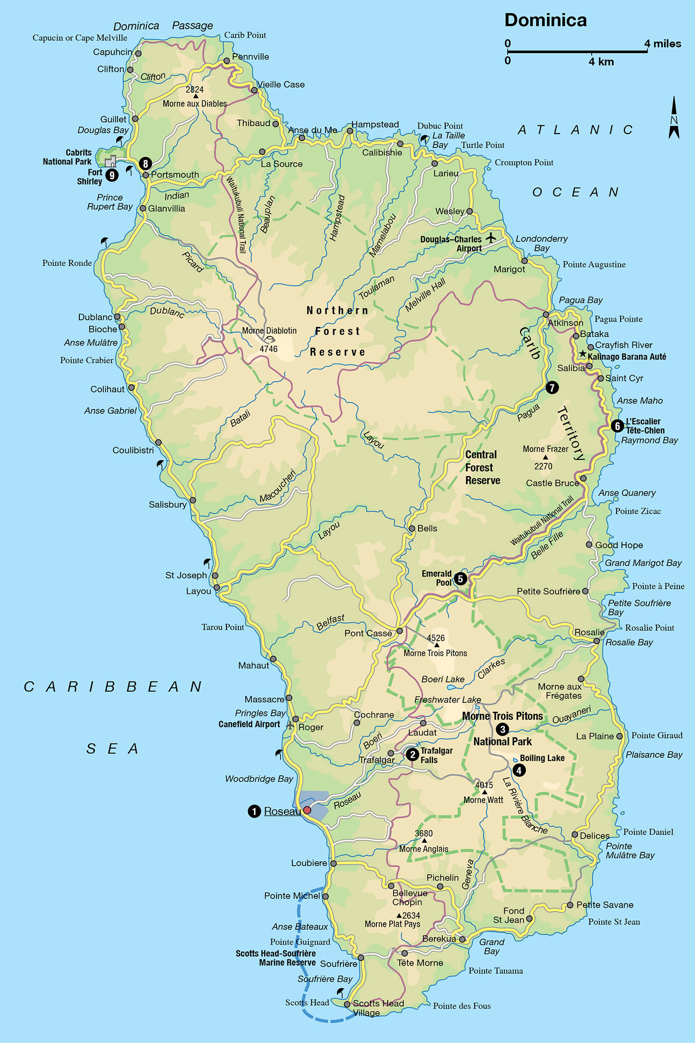
Roseau
Trafalgar Falls
Papillote Wilderness Retreat
Morne Trois Pitons National Park
Waitukubuli National Trail
Kalinago Barana Auté
Cabrits National Park
Fort Shirley
Whale watching
As Mr Rochester, the hero of Jean Rhys’s novel, Wide Sargasso Sea, toiled up the path toward his honeymoon home halfway up a Dominican mountainside, he lamented: “Too much blue, too much purple, too much green. The flowers too red, the mountains too high, the hills too near.” It is not only fictional characters who have been overwhelmed by the physical presence of Dominica (pronounced Dom-in-eeka). From Columbus, who sailed into Prince Rupert Bay in 1493, to the 19th-century British imperialist J.A. Froude and the 20th-century travel writer Patrick Leigh Fermor, all have been somewhat in awe of the rugged island of Dominica.
At the Roseau Botanical Gardens.
Discover Dominica Authority
The largest of the Windward Islands (15 by 29 miles/25 by 46km), Dominica lies between Guadeloupe and Martinique. From the air, it has a dark presence: volcanic mountains disappearing into its dense, cloud-covered spine, forested ribs of ridge and valley, carved out by the numerous rivers rushing down to the sea, while a road hugs the coastline. With much of its surface still covered in some of the finest rainforest and cloudforest in the region, its 72,000 people live in scattered communities beside the sea, mainly on the sheltered leeward side, or along the ridges.
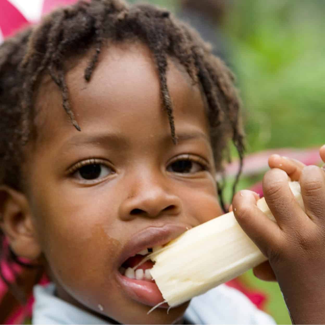
Dominican sugarcane is a popular delicacy.
Discover Dominica Authority
A protecting environment
The magnificent environment of this “Nature Island” has been both a protection and a constraint. In the past, it protected the island from total exploitation by even the most grasping of European adventurers and settlers as, with only small patches of flat land, there were no great riches to be made.
Although the colonizers managed to drive the resident Caribs - or Kalinago, as they called themselves - from the leeward coast into the mountain fastnesses and to the remote northeast, they were not entirely wiped out. The environment protected them. Again in the 18th century, the forests provided a sanctuary for the maroons (escaped slaves), and it also enabled a strong-minded independent peasantry to develop, cultivating “gardens,” as they still do, in forest clearings.
The early settlers, at the end of the 17th century, were small-timers, Frenchmen from Martinique, who traded with the Kalinago, cultivated tobacco, and later coffee and cocoa, on estates whose names alone - Temps Perdu or Malgré Tout - evoke a sense of loss and resignation.
When the British finally took control in 1783, wresting the island from the French (who continued to skirmish with the British through the Napoleonic Wars), sugar, then limes, and eventually, in the 1930s, bananas became the main crops. The banana industry grew spectacularly in the 1960s, becoming known as “green gold” (see box). Now challenged by the large Latin American competitors, modern Dominica, independent from Britain since 1978, is looking to tourism as a main provider of income and source of employment.
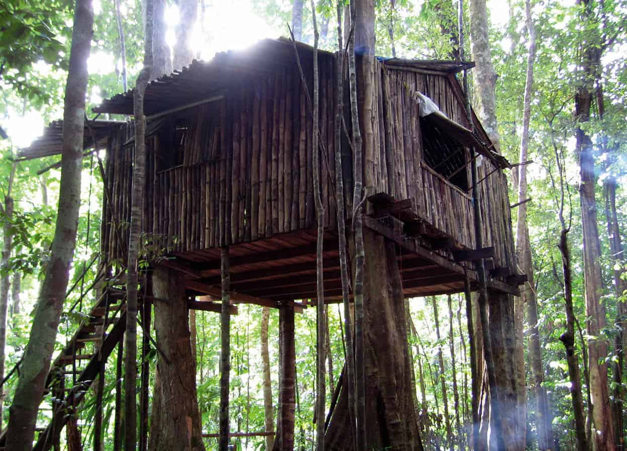
A tree house at Rosalie Forest, part of the Three Rivers Eco-Lodge accommodations.
Discover Dominica Authority
Tip
For a scuba site with a difference, head for Champagne by Scotts Head in the southeast, where you can swim through underwater hot-spring bubbles and watch myriad sea life - it’s even better at night.
Island pursuits
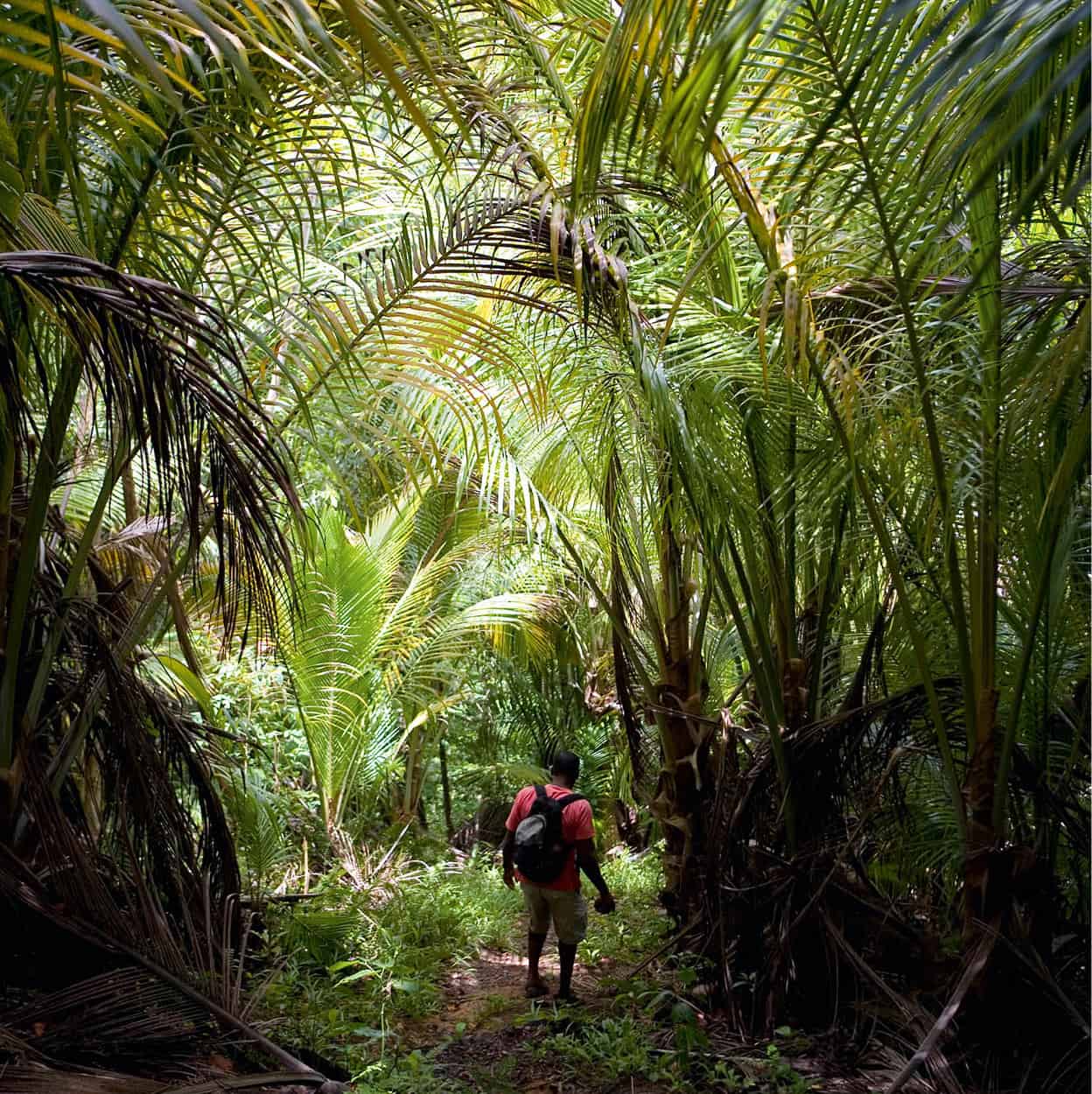
There is no mass tourism in Dominica, partly because of the small airport, and no long-distance direct flights. Visitors who make the effort to get here are active, inquisitive, and hardy. They bathe in rivers whose cliffs are smothered in vines, giant ferns, and the yellow-red claws of the dramatic heliconia plant. They hike into the forests, up trails that are still used by Dominicans to reach their forest “gardens,” past the buttressed trunks of great trees, such as the chatanier, or the giant of the forest, the gommier, from which the Kalinago still make their canoes.
They explore the seabed, where there are majestic underwater seascapes, from submerged pinnacles to corals and sponges populated by reef fish. Despite run-off from the 365 rivers on the island, due to steep drop-offs the sediment falls away and visibility is excellent in the unpolluted water. Whale and dolphin watching are other popular activities, and boats with sonar equipment have a remarkable success rate in locating a number of species living in or migrating through Dominica’s waters. As well as all these activities, there is kayaking, canyoning, canopy tours, birdwatching, or even relaxing on a beach.
Tropical storm Erika
In August 2015, Dominica was badly hit by tropical storm Erika which caused massive landslides and rock falls, burying villages and blocking roads; many bridges were taken out and services (telecommunications, electricity etc) cut off. At least 31 people were killed; around 900 homes were destroyed; 14,000 people were temporarily left homeless; and the total damage amounted to CA$482 million. The village of Petite Savane suffered the most severe devastation in the country. Fortunately, the top Dominican sites were unaffected by Erika. Following the storm, Dominica has been rapidly recovering, in part due to considerable international assistance; as of December 2015, most accommodations are operational and all major roads passable. The restoration of access to some segments of the Waitukubuli Trail was still under way at the end of 2015.
On the banks of the Roseau River
Not even Roseau 1 [map] (pronounced Ro-zo) - with its department stores and supermarkets - can escape the impact of the island’s hinterland, the essentially agricultural base of Dominican society. For every Saturday - from before first light until mid-morning - the capital (pop. 16,000) hosts market day. There, beside the mouth of the Roseau River with its backdrop of mountain and forest, is laid out the bounty of the land. From armfuls of ginger lilies to sacks of yams, from coffee beans to avocados, watercress to coconuts, all are gathered into this place of plenty, an endlessly festive endorsement of Dominica’s national motto: Apres Bondie Cest La Ter (After God it is the land).
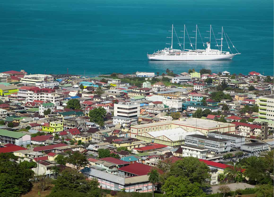
Roseau, capital of Dominica.
iStock
The capital is squeezed between the sea and the mountains, with outlying villages running up the valleys and along the coastal road. Slightly ramshackle, with narrow streets, it has a small, 18th-century French quarter, with additional 19th-century buildings, their wood and stone houses with tin roofs supporting overhanging verandahs and gingerbread fretwork. Now that middle-class Dominicans (known in the old days as the gros bourg) prefer to live in the cooler suburbs up in the hills, many of the old town houses have been replaced by somewhat charmless concrete buildings. The once narrow waterfront has been extended to create the Bay Front, which includes the cruise ship pier.
The small Dominica Museum (Bayfront; closed until further notice) is housed in the old post office, and covers everything from island geology and economy to the history of the slave trade. Behind it is the Old Market Plaza, still used by vendors of crafts and souvenirs, containing the old, red market cross. A walk up King George V Street will lead you to the Botanical Gardens, the main recreational park, used for cultural events. In 1979, Hurricane David devastated the vegetation, leaving uprooted trees that are still visible, including an African baobab tree. There is still a varied collection of tropical trees, however, proof that everything in Dominica grows at a rapid rate and there is an aviary for Dominica’s endangered sisserou and jacquot parrots.
Island gardens
All Dominicans are wedded to the land, from the first Amerindians, who brought with them many of the fruits and vegetables now native to the island; the maroons, who survived in the forests; and the slaves, with their provision grounds; to the colonizers, who saw that plants from other parts of the world could flourish in the Caribbean.
Dominicans welcome visitors to their lovingly tended patches, whether they be the market gardens of Giraudel or the botanic gardens of Papillote Wilderness Retreat, near Trafalgar Falls (tel: 767-448 2287; www.papillote.dm; daily; garden tour charge), where an array of tropical flowers complements the natural contours and vegetation of the rainforest. “They blend from nurtured collections into wilderness,” says creator Anne Jno Baptiste.
Volcanic wonders
Heading inland up the Roseau Valley for 5 miles (8km) past the Botanical Gardens, you will reach Trafalgar Falls 2 [map] (daily), two spectacular waterfalls. They are a 10-minute walk from the tropical gardens and inn at Papillote Wilderness Retreat (see box). You may be besieged by guides here but you will only need to engage one if you want to go farther than the viewing platform.
More active and intrepid visitors may prefer to try canyoning (also called rappeling or abseiling) in the river gorges, or wading, swimming, jumping over cascades, climbing or rappeling through waterfalls. The island is beginning to receive international attention - in 2015, Dominica was rated third in a ranking of islands for Best Caribbean Destination for Adventure in USA Today’s 10 Best Reader’s Choice Awards.
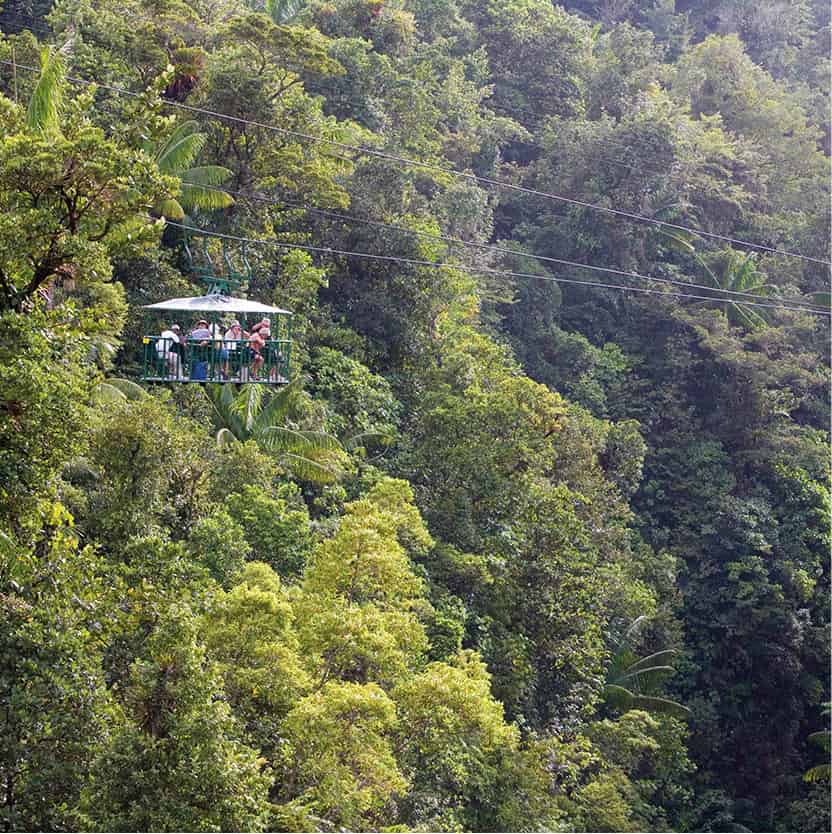
Tour the rainforest canopy by aerial tram.
Getty Images
Tip
Hikers in the Central Forest Reserve may hear the sound of a squeaking gate. It is, in fact, the melancholic call of the rufous-throated solitaire (sifflé moutayn), believed locally to be a magical spirit whose call tempts travelers farther and farther into the forest. It is one of 172 species of birds on Dominica, a reflection of the island’s biodiversity.
The experienced and caring staff at Extreme Dominica (tel: 767-295 7272; www.extremedominica.com) will make sure everyone achieves their goal. Dominica’s volcanic origins and numerous rivers make this one of the best canyoning destinations in the Caribbean for both beginners and experienced abseilers - you can even rappel down waterfalls onto beaches.
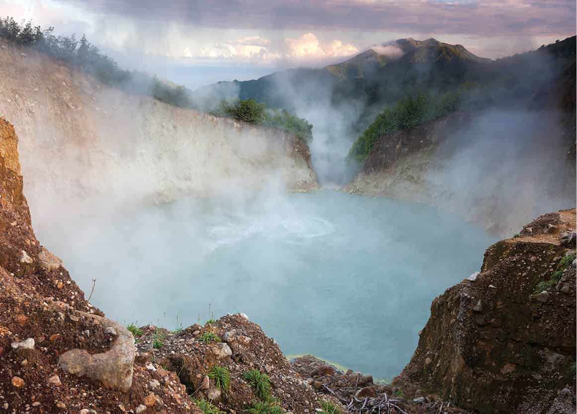
The magnificent Morne Trois Pitons National Park 3 [map], a Unesco World Heritage Site, covers 17,000 acres (6,800 hectares) of the southern central part of the island. Those with more than an average dose of energy can hike to the Boiling Lake 4 [map], the second-largest cauldron of bubbling hot water (220ft/66 meters wide) in the world, which lies in the heart of the park. This geological phenomenon is, in fact, a flooded fumarole, from where hot gases escape through vents in the earth’s molten crust. It’s a tough but extraordinary journey (an 8-hour round trip), which starts at Titou Gorge, close to the village of Laudat, 6 miles (10km) northeast of Roseau. The track plunges and rises, crosses streams and climbs up to narrow ridges opening up into a lunar landscape of steaming vents and geysers, hot pools of boiling mud, and mineral streams streaked with blue, orange, black, and yellow. This is the Valley of Desolation - and beyond that the Boiling Lake itself.
Fact
Dominica’s two endangered parrots, the sisserou and red-necked jacquot, live on the slopes of Morne Diablotin in the north. You may spot one with the help of the Forestry Division (tel: 767-448 2401), who can provide a guide.
Waitukubuli National Trail
The Kalinago called the island Waitukubuli, meaning “how tall is her body,” and this name has been adopted for the new Waitukubuli National Trail (www.dominica.dm/index.php/waitukubuli-national-trail), opened in 2011, which runs 115 miles (184km) from the far south at Scotts Head to the far north at Capucin, touching both east and west coasts, going up and down mountains, across rivers, and through forest reserves. The trail is divided into 14 segments, and local communities have been involved in clearing their own sections, renovating old slave roads, smugglers’ trails, Kalinago paths, and donkey tracks, installing steps, bridges, and handrails. You can walk just one segment or the whole lot, and accommodation can be arranged in small village bed-and-breakfast places, in homestays, or on campsites.
From west to east
The road north out of Roseau goes past Woodbridge Bay and the deep-water harbour to Canefield, where there is a small airport for local flights. You can either keep on the Leeward Coast road up to Portsmouth, or turn inland. This road, known as the Transinsular Road, is the main route to the international Douglas-Charles airport. At the Pont Cassé roundabout, take the second exit to continue on the Transinsular Road, or the third exit to skirt the northern edge of the Morne Trois Pitons National Park.
On the Waitukubuli Trail.
Discover Dominica Authority
At the next junction you can turn right for Rosalie Bay, where there is a turtle-watch program. Green, hawksbill, and leatherback turtles all nest on the black-sand beach here, right in front of a luxury hotel.
If you turn left instead, heading for Castle Bruce, you will come to the pretty Emerald Pool 5 [map], in the heart of lush green rainforest, where you can have a picnic, then stand behind the 40ft (12-meter) waterfall, and cool off with a dip.
Castle Bruce, on the Atlantic coast, on a lovely bay with good views from the hills around, marks the start of Carib Territory. L’Escalier Tête-Chien 6 [map] (The Snake’s Staircase), farther north along this dramatic coastline, a rock formation that looks like a stone serpent slithering up out of the ocean, features extensively in Kalinago folklore.
A Carib settlement
Today, the surviving 2,200 Caribs/Kalinago live along the northeastern seaboard in the Carib Territory 7 [map] between Castle Bruce and Atkinson, on land set aside for them in 1903 by a well-meaning British administrator called Hesketh Bell, who thought they would die out unless they were guaranteed a “reservation” of their own. Today, the area is not in itself distinctive but you will see houses built on stilts, and roadside stalls display the unique basketwork of the Kalinago (finely woven in three colors from a forest reed) and other handicrafts, the lingering legacy of an ancient culture. As well as growing coconuts and bananas, and making these lovely baskets, the Kalinago survive on fishing and carving.
In the Carib Territory is a model village, Kalinago Barana Auté (Crayfish River; tel: 767-445 7979; www.kalinagobaranaaute.com; charge), where guides explain the culture and history of the people, and you can watch women weaving baskets, before a singing and dancing folklore troupe bids visitors a traditional farewell.
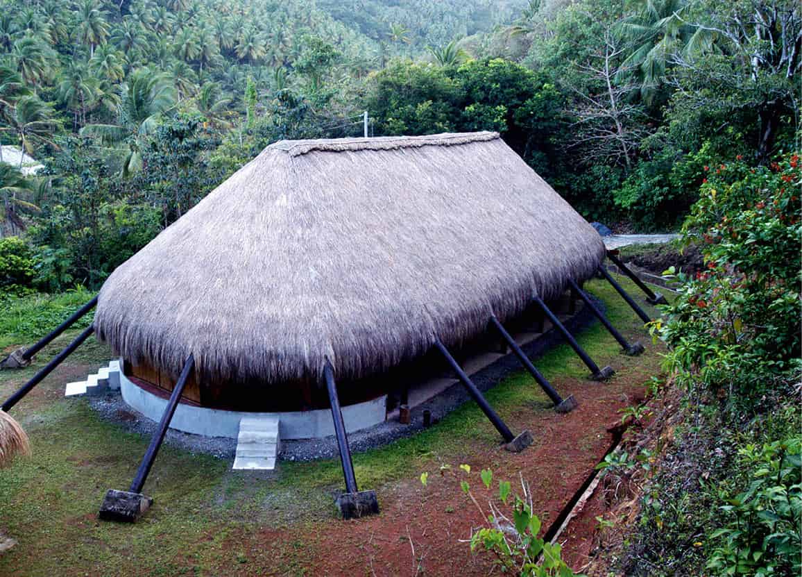
Village hut in Carib territory.
Discover Dominica Authority
The north coast
The Transinsular Road joins the coast road at Atkinson, on Pagua Bay, the northern boundary of the Carib Territory. Continue to head north, past Douglas-Charles airport, to the lovely beaches in the Calibishie area, with a view of Marie-Galante. Sandstone cliffs and pale sand characterize this north-facing coast. It is not so battered by the Atlantic as the eastern seaboard because of protective reefs and islands, but you still need to take care on rough days. There are several small and pleasant places to stay around here.
Cabrits National Park
The spectacular headland of the Cabrits National Park, 25 miles (40km) north of Roseau and close to the second town of Portsmouth 8 [map], is covered with dry tropical forest that is typical of the Caribbean coast: bay, mahogany, sandbox, white cedar, and logwood. And there in the heat among the silent trees are the lovingly restored buildings of the 18th-century British fortifications, Fort Shirley 9 [map] (daily), one of the most important military sites in the West Indies, complete with gun batteries, storehouses, and officers’ quarters. During the colonial wars, it housed up to 600 men, protecting both the north of the island and Prince Rupert Bay to the south. The Cabrits peninsula has the added attraction of being surrounded by a marine park, rich in underwater life and excellent for snorkeling and diving.
The town of Portsmouth is of little tourist interest, but is busy with hundreds of students from the Ross University Medical School campus. South of town are the wetlands around the Indian River. It was into this bay that Columbus sailed on November 3, 1493, the day he first sighted Dominica, and it was the Kalinago of the Indian River area who provided subsequent European sailors with water and shelter, pineapples and cassava. The boat trip from the coastal road at the river mouth up this haunting gray-green waterway follows the route European sea captains took to greet the Carib chief. More recently the swamps and forests were used as film locations for the movie Pirates of the Caribbean.
South to Soufrière
The road south out of Roseau hugs the coastline, past the dive lodges of Castle Comfort to the villages of Soufrière and Scotts Head at the tip of the island. The area from Anse Bateaux to Scotts Head peninsula encompasses the Scotts Head-Soufrière Marine Reserve. Brightly painted fishing boats are hauled up on shore and the scene, with its mountain backdrop and Martinique in the distance, is picturesque. There are plenty of buses from the capital to this area and several informal places to eat fresh fish; just ask around and you’ll be directed to an unmarked hut where you can get a cheap meal.
Boiling Lake, Morne Trois Pitons National Park, Dominica.
Getty Images
Soufrière Bay is an extinct volcano and the lava chute plummets down, providing scuba divers with fascinating sites such as Crater’s Edge, Scotts Head Pinnacles, and the amazing sulfur springs where the rising bubbles have been named Champagne. On Scotts Head point is an old gun emplacement where a battalion of Scots Guards used to fire warning cannon when French ships approached. This is the starting point for the Waitukubuli Trail.
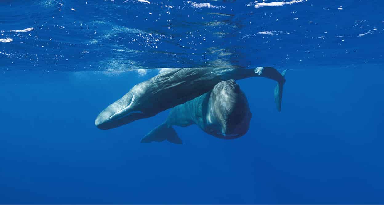
Sperm whales (Physeter catodon).
Getty Images
Whale-watching trips
Dominica is known as the whale watching capital of the Caribbean: 22 species have been spotted and some of them are residents.
One of the features of Dominica’s underwater landscape is the steep drop-off very close to the shore, which provides deep water and feeding grounds for whales. Dominica is the ideal place to spot pilot whales, pygmy whales, melon-headed whales, false-killer whales, mixed pods of sperm whales and spotted whales, as well as Atlantic spinner, spotted, Rissoís, Fraser, and bottle-nosed dolphins. Between November and March, a classic whale and dolphin safari offers a 90 percent success rate in spotting whales and dolphins, and the island has become known as the whale-watching capital of the Caribbean. While six species are seen on a regular basis, 22 of the 33 species known to frequent Caribbean waters have been spotted off Dominica. Sperm whales are resident in Dominican waters and can be seen at any time of year, although November to March is best, when there are more adult males present. Scotts Head, at the southern tip of the island, is a good place to spot them from land. A bull sperm whale can grow to 67ft (20 meters); it is the largest toothed animal in the world and has the largest brain of any animal. Researchers have monitored the females and young males and have built up a picture of their family life and social interaction. They can recognize individual family members and know how they relate to each other.
The skippers have boats equipped with sonar, backed up by a lookout scanning the surface for telltale signs, including the distinctive musky, oily scent of a sperm whale. The boats head along the west coast, stopping regularly to take soundings and listen for each creature’s signature tune, from the singing of humpbacks and the clicking of sperm whales to the pinging of pilot whales and the whistling of dolphins. The humpback whale is more often heard than seen, but the flipping of any great black fin tail creates a frisson of excitement, particularly as a whale can dive as deep as 6,000ft (2,000 meters). The pilot whale prefers to travel in pods of 60 while the sperm whale might be accompanied by 20ft (6-meter) calves. As for dolphins, acrobatic spotted and spinner dolphins love to surf the wake of the boat and provide ample consolation for any missed whale sightings. You may also see turtles, fish, and lots of seabirds and you get a wonderful view of the rugged beauty of the island, making the boat trip rewarding on many levels.
Choosing a trip
Whale-watching trips of 3-4 hours are offered by several of the dive operators, including Dive Dominica (Castle Comfort Lodge; tel: 767-448 2188; www.divedominica.com; trips Sun 2pm; US$50 per person), Anchorage Dive Center (Anchorage Hotel, Castle Comfort; tel: 767-448 2638; www.anchoragehotel.dm; trips Wed, Sat 2pm, and Sun by reservation; US$50 per person), and JC Ocean Adventures (Mero Beach; tel: 767-449 6957; www.jcoceanadventures.com; trips on demand, US$50 per person for four to six people, US$100 per person for two to three people on the boat). There is also a fishing charter boat offering whale watching for small groups. Contact Captain Jerry of Island Style Fishing (tel: 767-265 0518; www.islandstylefishing.com; US$65 per person, minimum four people) for a personal and informative tour. Customized tours can be arranged, but if you want to get in the water with the whales you will have to obtain a permit from the Dominica Fisheries Division first.