Caribbean: The Lesser Antilles - Insight Guides (2016)
SINT MAARTEN/ST-MARTIN
A busy island shared between the Netherlands and France, it is a haven for shoppers and sunseekers. While the French side excels in gourmet restaurants, the Dutch part is a gambler’s delight.
Main Attractions
Philipsburg
Baie Longue
Marigot
On the Trail of the Arawaks museum
Loterie Farm
Butterfly Farm
According to legend, the border of Sint Maarten/St-Martin was defined when a Dutchman and a Frenchman stood back to back, then walked around the island until they met face to face. The Dutch side is smaller, supposedly because the Dutchman was fat, or slow, or drinking gin as he walked, or all three. Crossing the border today is an affair of total informality, quite in keeping with the character of this tiny “freeport” island, with nothing but a monument erected in 1948 to commemorate the 1648 Treaty of Concordia which divided the island between the two nations. Despite such informality, the border holds great symbolic value to the islanders, marking peaceful co-existence and distinguishing two communities which are the same and yet different.
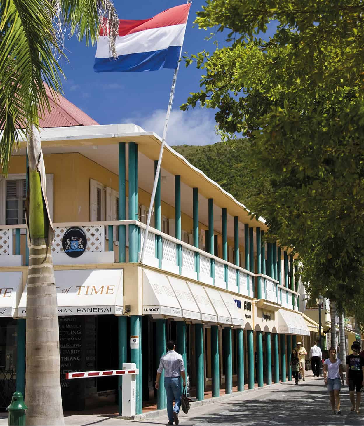
Colonial buildings in Phillipsburg.
Getty Images
Sint Maarten/St-Martin’s border bisects the smallest landmass - 37 sq miles (96 sq km) - in the world shared by two countries. The smaller southern half - Sint Maarten - has been one of the four constituent countries of the Kingdom of the Netherlands since “independence” in 2010. Sint Maarten had long resented being governed from Curaçao when it was part of the Netherlands Antilles, and now benefits from greater self-government while still under the protection of the mother country. The northern side of the island constitutes the French overseas collectivity of St-Martin. As of 1946, French St-Martin was technically an arondissement of Guadeloupe, which is a département of France (in the same way that Hawaii is a state of the US), but in 2007 (after a referendum in favor of secession in 2003), St-Martin gained COM status and a local assembly was elected. The difference between the two nations is immense: St-Martin is quintessentially French in style, developed on a small scale but including Parisian shopping and gourmet food, whereas Sint Maarten has large resorts, casinos, and fast-food chains.
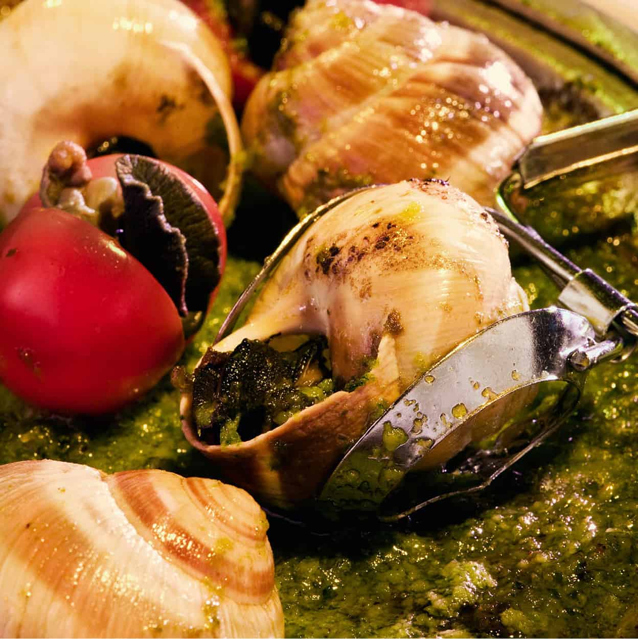
A dish of snails - St-Martin’s cuisine is typically French.
Getty Images
Contrasting landscapes
The west end of the island is an atoll of low land surrounding a lagoon, while the east end consists of a range of conical hills, the highest being Pic du Paradis (1,390ft/420 meters). Dotted around are a number of salt ponds. There is no drama here. The hills are low and easy to climb, the beautiful white beaches are sheltered. It’s a fertile landscape of soft hills and pasture, cattle and horses. Green and hawksbill turtles nest on the shores and the fishing is good.
A sharing mentality
French colonists arrived in the north of the island in 1629 and in 1631 the salt ponds in the south attracted Dutch settlers. The two groups lived amicably apart. Holland was at war with Spain, and Spain had a monopoly on European salt, an essential commodity for the preservation of food in the days before refrigeration. Spain reconsidered its earlier decision not to colonize the island and occupied it from 1633 to 1648. It was while the Dutch were trying to recapture the island in 1644 that the young Peter Stuyvesant, then governor of Curaçao, lost his leg to a Spanish cannonball at Cay Bay (3 years later he became governor of the Dutch colony on present-day Manhattan). The Spanish abandoned the island 4 years later, and the Dutch moved back with the French, dividing the territory between them. The border has survived unchanged to this day, despite several armed incursions in both directions and persistent attempts by the Dutch in the 18th century to buy the French side outright. The island has changed hands 16 times, including brief occupations by the British, and the last Dutch-French accord was in 1839, since when peace has reigned.
At the height of colonialism, sugar and salt became the island’s most important exports, until slavery was abolished and the plantations went into decline. Salt was shipped to the US and to Holland where it was used in the herring industry until that too ground to a halt in 1949.
Philipsburg - the Dutch capital
In 1733, a town was founded on the sandbar that separates the Great Salt Pond from Great Bay. It was named Philipsburg 9 [map], in honor of John Philips, the Scotsman who did so much for the early development of Sint Maarten. The sand is still very much in evidence; all over town there are unobtrusive welcome mats to keep as much of it outdoors as possible. But what’s left of the pond is easy to ignore - a stretch of stagnant water with some long-term plans to clean it up and make it a bird sanctuary - so who would realize that when Back Street takes a strange course, it’s avoiding the ghost of a huge storage pile of salt?
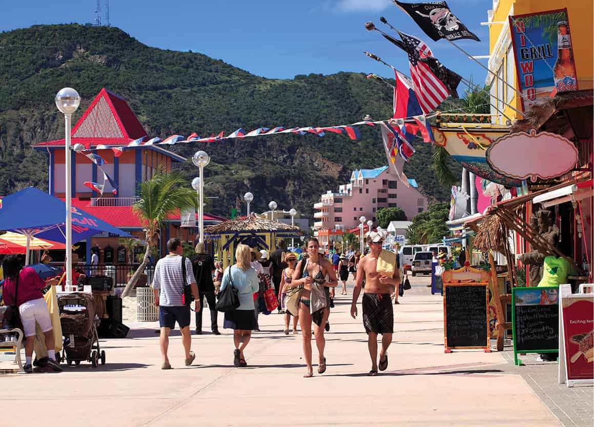
The promenade at Philipsburg.
Getty Images
A cosmopolitan stew
The relative prosperity of the island over the last few decades has attracted thousands of immigrants to work in construction and the hotel industry, mostly on Sint Maarten. While the French side is decidedly French, the Dutch side is a more cosmopolitan mix in which Dutch, American, Caribbean, and Asian segments play equally important roles.
In St-Martin, everyone speaks French, creole, and often English, whereas in Sint Maarten, although Dutch is the official language and taught in schools, everyone speaks English and signposts and notices are all in English too. Papiamentu has been spoken on the island since 1960 when it arrived as the language of an imported labor force from other Dutch islands, and Spanish is often heard, too.
By day, Philipsburg is a lively, crowded, commercial town, usually packed with cruise ship visitors. Its two main roads, the parallel Front Street (Voorstraat) and Back Street (Achterstraat), are linked by a series of narrow alleys (steegjes) running down to the beach, crammed with duty-free shops: “the shopping center of the Leewards.” In the middle of everything is the Courthouse, built on Wathey Square in 1793, and still in use. This was the venue for Sint Maarten’s independence celebrations on 10.10.10, when the Netherlands Antilles were disbanded and Sint Maarten became an independent country within the Kingdom of the Netherlands. A whole book has been written about its history, but now this is the place to pose for photos and pay parking tickets. The square is lined with former merchant residences that became shops as the population moved out of the developing town. Directly in front of the square, the town’s characteristic excitement begins as cruise ships’ tenders, sometimes four at a time, unload crowds of passengers onto the pier, all bent on the task of spending money for pleasure.
Fact
Tourism in Sint Maarten/St-Martin took off after World War II as the island had been left with a ready-made airport. Juliana airport was built as a military airfield by the US in 1943 while the island was occupied by the Allies, during the Occupation by Germany of France and the Netherlands.
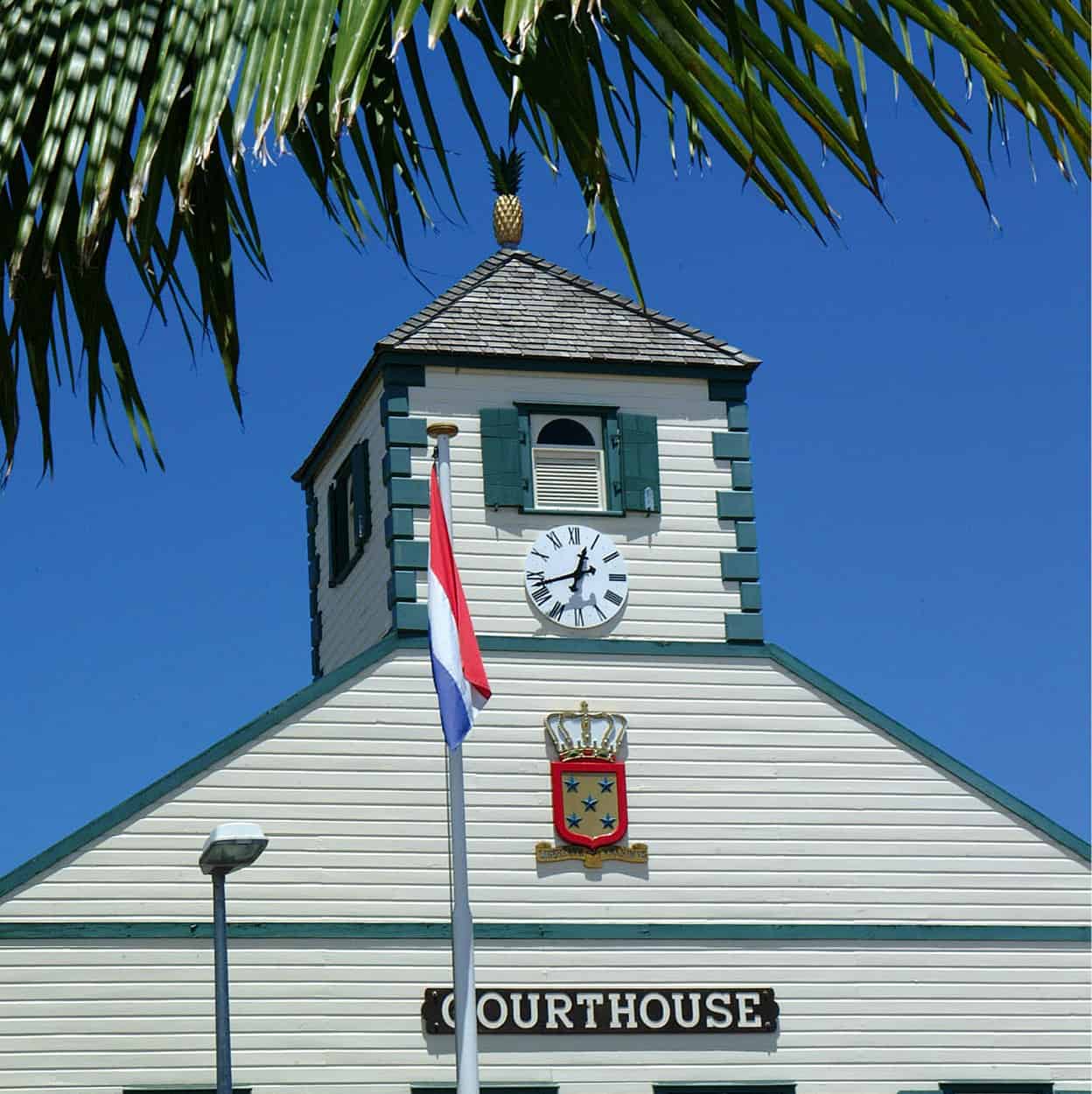
The Courthouse in Philipsburg.
St Maarten Tourist Bureau
The main shopping area, Front Street, has undergone a beautification program including tree-planting and benches for weary shoppers. The duty-free shops are stocked with designer goods such as Gucci, Kohinoor, and Little Switzerland, but soon buildings with ornamental fretwork known as West Indian “gingerbread” (for more information, click here) come into view. The characteristic architecture that developed in the 18th and 19th centuries is still evident in a few two-story structures around Wathey Square, with a warehouse or shop below, living quarters above, and steps from the street up to a front gallery or verandah. But since Hurricane Luis swept through in 1995 there are not many left.
Fact
Seashells found only in the deepest waters were discovered on beaches after Hurricane Luis struck the island in 1995. The storm closed the island to tourists for 3 months and wrecked many livelihoods.
A fascinating video showing the devastating effects of the hurricane can be seen at the small Sint Maarten Museum (Museum Arcade, 7 Front Street; tel: 590-599-542 4917; www.museumsintmaarten.org; Mon-Fri 10am-4pm; donations welcome), upstairs at the eastern end of Front Street, and you can stop off for a drink at the Pasanggrahan, originally a government guesthouse, and now the oldest inn on the island, which has an atmosphere of disheveled charm (www.pasanhotel.net). The name comes from the Indonesian word for “guesthouse”.
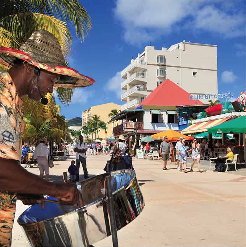
A man playing his steel drum, Philipsburg.
Getty Images
Queen Wilhelmina and her daughter, the future Queen Juliana, stayed here during World War II and their bedroom is now the Sydney Greenstreet Bar. While relaxing with a drink, perhaps the island’s famous Guavaberry liqueur - a rum-based cocktail mixed with the wild red berries that grow wild on the hills - you can watch the boats going in and out of the marinas on trips around the island and to St-Barths, St Eustatius, and Saba.
Great Bay Beach is a wonderful place with an attractive boardwalk that stretches along the entire length of the sand. Restaurants, bars, and stalls entice promenaders to pause and take in the view. While the tiny Wathey Square cannot match Marigot’s wide-open waterfront, efforts to make it more “people-friendly” have been successful and have given Philipsburg a much-needed focal point.
Fortress viewpoints
The historical sites around Philipsburg are only worth visiting for their views: from Fort Hill, the site of Fort Willem to the west, you can look over the capital below; Fort Amsterdam commands Great Bay from the west, looking across to the Old Spanish Fort on Pointe Blanche, and over Little Bay on the other side.
The forts guarded the earliest Dutch settlements, which were located on the sand bar and around Little Bay ) [map]. Now sprawling along the peninsula in direct contrast to the historic ruins of Fort Amsterdam is the modern 220-room Divi Little Bay Resort (www.diviresorts.com).
Around the popular west coast
Getting in and out of Philipsburg and Marigot, the capital of the French side, at rush hour, or traveling the main routes between Philipsburg, Simpson Bay, and Marigot can be nothing short of a bother. The road from Philipsburg climbs to the brow of Cole Bay Hill from where there is a justly famous vista of Simpson Bay Lagoon and neighboring islands. Beyond, the road drops to Simpson Bay and to the hotels and white beaches that circle the west end. Alternatively, another road heads up the east side of Simpson Bay Lagoon direct to Marigot, passing the international border monument.
Simpson Bay Lagoon is bisected by the international boundary and has an outlet to the sea on either side. The road from Philipsburg to the airport crosses the bridge over the southern outlet, and this can become a bottleneck for traffic. The bridge opens three times a day to allow large boats into the lagoon, where there is a harbor for mega-yachts.
Tip
Out of the 14 casinos in Sint Maarten, the Casino Royale in Sonesta Maho Beach Hotel (www.playmaho.com) is the largest, with 21 gaming tables and 450 slot machines. There is also a private “high roller” area with the highest limits on Sint Maarten.
Past Juliana airport the road reaches the built-up resorts of Maho - famous not only for its casinos and Sunday beach parties but also for the location of the beach at the end of the runway, tempting sunbathers to duck as the planes swoop down to land. Hang on to your towel or it will be blown into the sea. Mullet is the most popular beach, although it can get very crowded at weekends. Surfing is good here if the swell comes from the north, and you can rent beach chairs, sunshades, etc. Limestone and marl sediment laid in nearly horizontal beds has created low, richly colored cliffs along the shore of the quieter Cupecoy Beach, the most westerly beach on the Dutch side, where clothes are optional.
Across the border, beaches are unspoiled and secluded with sandy Baie Longue stretching for 1 mile (1.5km) along the south coast, graced by just one small, up-market hotel, La Samanna. Round Pointe du Canonnier, the western tip of the island, is Baie aux Prunes (Plum Beach), which is good for snorkeling at the points at each end and for surfing in the center. Baie Rouge is a long sweep of sand with cliffs at the eastern end. Baie Nettlé is another good beach but access to it is difficult because of the hotels built along it. At its eastern end, at Sandy Ground, as you approach Marigot, there is a bridge over the second outlet from Simpson Bay Lagoon to the sea, but this is only used by fishing boats and other small craft.
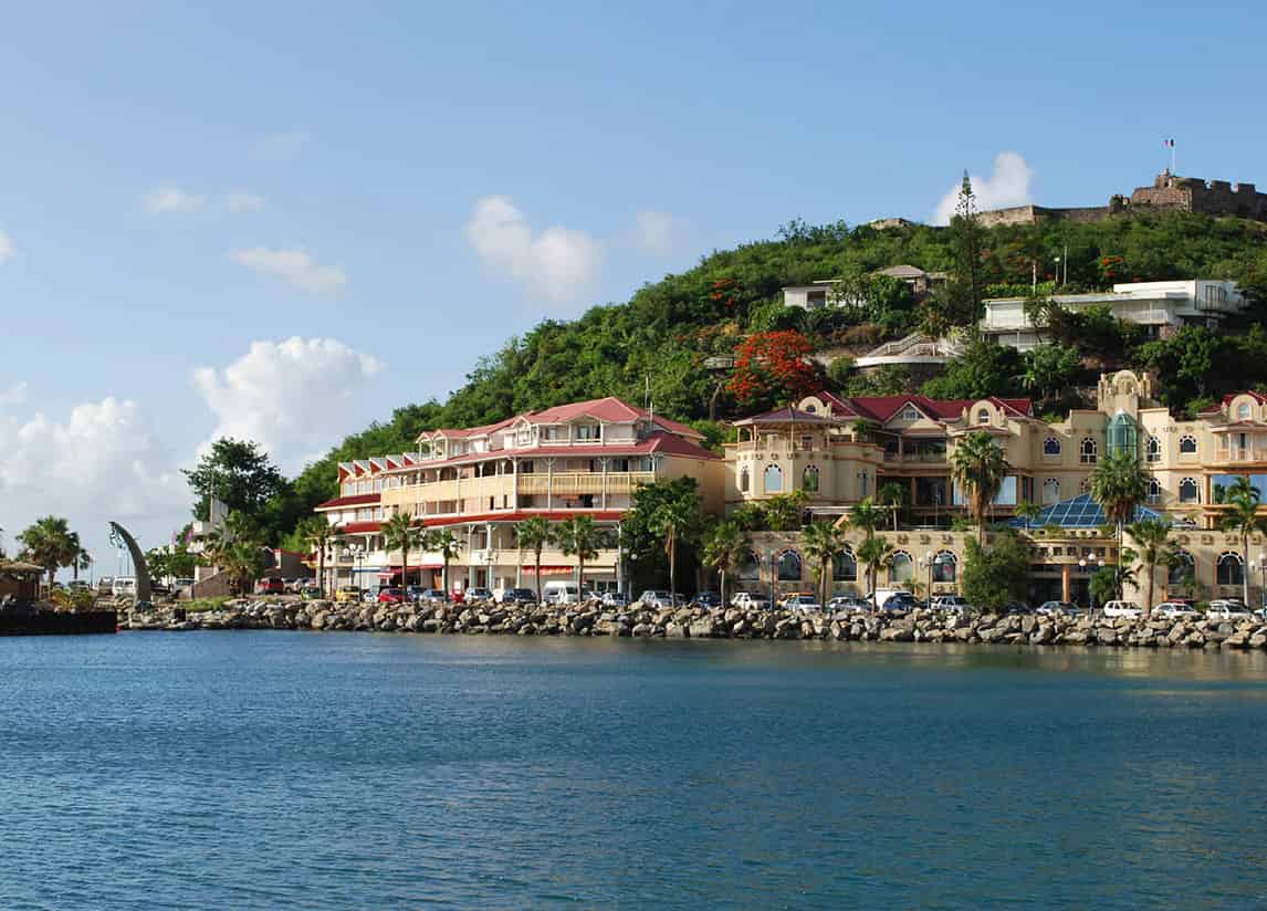
Marigot, with its southern French overtones.
iStock
Marigot - a touch of southern France
After the sometimes crass commercialism of Philipsburg, Marigot ! [map] seems both more European and more Caribbean at the same time; more appealing, more colorful, and equally lively. There is more than a touch of southern France here, especially in the morning fruit and vegetable market (best on Wednesday and especially Saturday) on the quay. Wide open to the sea, the quay is a welcoming recess where, unlike its Dutch counterpart, it invites you to stop and sit in the cafés, bars, and excellent restaurants that spill out onto the streets. It seems entirely right to sit and watch the ferries loading for Anguilla while eating chicken barbecued over a halved oil drum, salt cod (once the food of slaves) served with rice and peas, or fresh fish with lime and garlic and spices - delicious Caribbean fare.
Or, if you prefer, you can survey the market square over an espresso and pâtisserie in a café like La Vie en Rose, opposite the harbor. It is then a 15-minute walk (or a short car journey) up to the ruins of Fort St-Louis for some magnificent views of the town and Anguilla, 5 miles (8km) away.
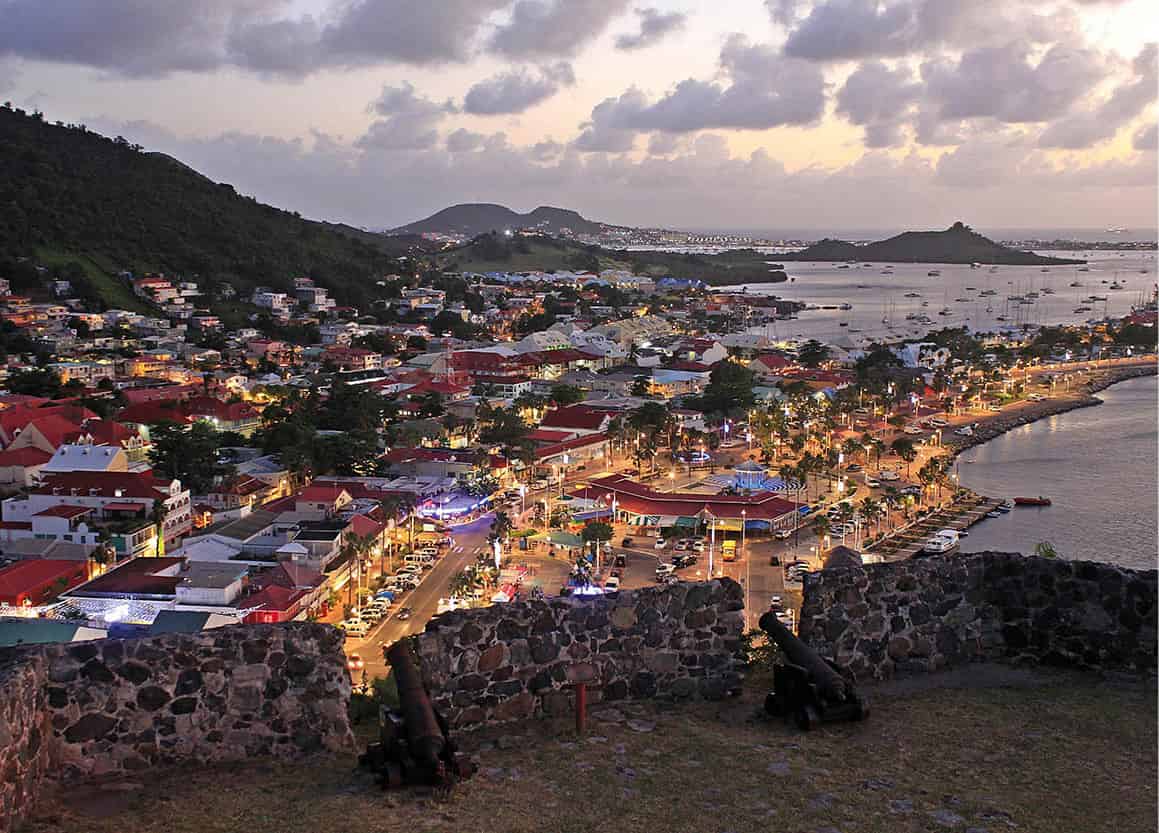
Looking out over Marigot from Fort St-Louis.
iStock
There is fine shopping to be done along rue de la République and in the chic boutiques around the Marina Port La Royale, which embraces the boat-filled northernmost finger of Simpson Bay Lagoon with elegant shops and cafés. On Thursday nights a carnival atmosphere pervades as shops stay open late, bands play, and the restaurants fill up with onlookers and satisfied shoppers. Those too busy to sit down and eat can grab a barbecued snack at one of the many lolos (food stalls) scattered around the town. Significantly, much of the town still takes a siesta from noon until 2 or 3pm, unthinkable among the driven merchants of Philipsburg, where midday belongs to the cruise ships.
On the way up to Fort St-Louis, St-Martin’s museum, On the Trail of the Arawaks (7 rue Fichot, Place de l’Eglise Catholique; tel: 590-690-871 499; www.stmartinisland.org; Mon-Fri 9am-1pm, 3-5pm), includes exhibits from pre-Columbian times up to the 20th century and provides excellent information about the island. Ceramics and figurines in the museum have been dated as far back as 550 BC, the oldest so far discovered in the Caribbean. Remains of a half dozen or so Amerindian camps have been unearthed to date, especially around the beaches of Terres Basses, on the southwestern shore of Simpson Bay Lagoon, revealing that the island was used as a resort or hunting ground. They referred to the island as Sualiga, “a place to get salt” and Oualichi, “a place to get women.” The arrival of Amerindians on the island is believed to date back to 3350 BC, but the island was uninhabited when the French and Dutch arrived. The museum’s curator, Christophe Henocq, leads tours to the archeological dig at Hope Estate, where many of the relics were found.
Into the hills
Leaving Marigot to the north, the road skirts past the central hills where there is a network of hiking trails punctuated by viewing points. Several lead to the Pic du Paradis, which is densely wooded and alive with colorful forest birds. The country to the north, around Grand Case, supported many of the sugar plantations in the 18th century and it is apparent that cane was planted virtually on the hilltops. It ushered in a long period of prosperity, which lasted until slavery was abolished in 1848 on the French side, and 15 years later in the south, causing a lot of grief, especially where several plantations straddled the border.
Loterie Farm (tel: 590-590 878 616; www.loteriefarm.net; daily sunrise-sunset) is a former sugar plantation on the slopes of Pic du Paradis. Now a tourist attraction with a nature reserve, it offers activities for all the family: hiking trails through the forest, zip-lining for children or adults, a restaurant using home-grown fruits and vegetables, a tapas bar, and a huge, free-form swimming pool with cascades.
Grand Case - the gastronomic capital
It has been said of the little town of Grand Case @ [map] that its only industry is eating, but there are also art galleries here and, of course, a beach. The most touted creole creativity in St-Martin is culinary, and this village alone offers dozens of choices, lined up along the beachfront road.
Tourists at the Les Mardis du Grand Case Festival, Saint Martin.
iStock
The sand at Grand Case and Friar’s Bay, just to the south, is golden, not white, and the light seems different in this part of the island, with tones of ochre and gold. The road leads round to the east, south of the salt pond, which attracts an abundance of bird life, through the rolling countryside and mangrove swamps of Cul-de-Sac, where there are boats that go over to Ilet Pinel £ [map] an offshore island that offers excellent snorkeling and a choice of places for lunch. Sheltered Anse Marcel to the northwest is a favorite spot with yachties who take advantage of the large Radisson resort there, the shopping mall, and the marina.
St-Martin Nature Reserve
Much of the north of the island is a protected nature reserve where fishing and hunting are forbidden. The Réserve Naturelle de St-Martin (St-Martin Nature Reserve; Anse Marcel; tel: 590-590 290 972) covers more than 7,400 acres (3,000 hectares) of sea and 370 acres (150 hectares) of land, including the islands off the east coast: Pinel, Petite Clef, Caye Verte, Tintamarre, the small islets off the Baie de l’Embouchure, and Créole Rock overlooking Baie de Grand Case, as well as reefs lying within 200yds/meters of shore. The marshlands and mangroves on the east coast at Etang aux Poissons and the Salines d’Orient at Baie Orientale are also protected.
Quiet beaches
Along the rough Atlantic shores of the east coast, there are several isolated beaches off the road to Orléans, and windsurfing and kitesurfing are popular here. At Baie Orientale, a lively place with bars, restaurants, and small hotels, you should take care when swimming as there is a powerful undertow. The Club Orient is a naturist resort at the east end of the beach for those who wish to acquire an all-over tan. On the bandstand next to the club, calypso and reggae bands play in the afternoon, creating a party mood.
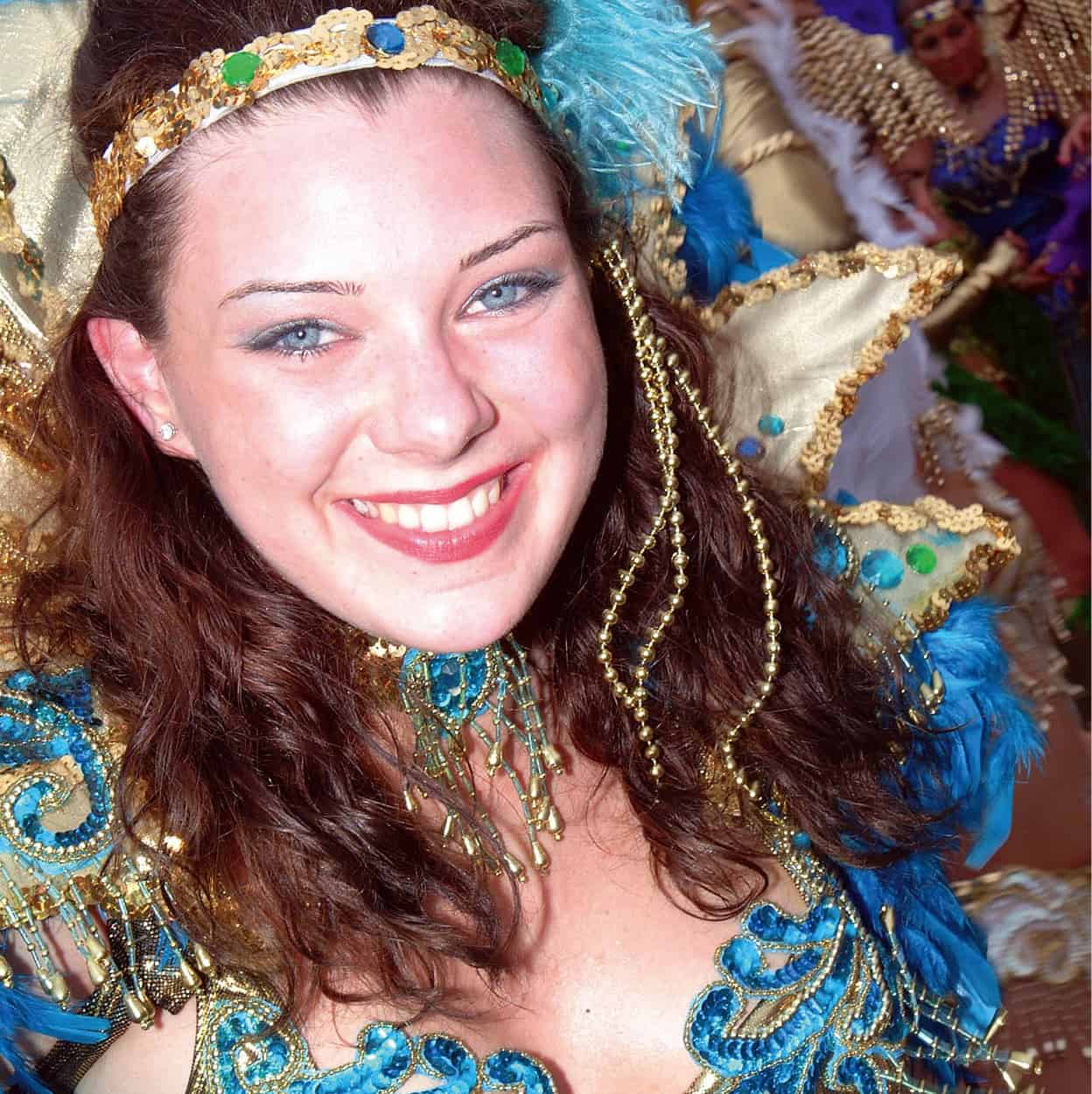
A reveler at St Maarten Carnival.
St Maarten Tourist Bureau
On the western bank of the Etang aux Poissons is La Ferme des Papillons $ [map] (Butterfly Farm; tel: 590-590-873 121; www.thebutterflyfarm.com; daily 9am-3.30pm), which has a fascinating collection of butterflies and caterpillars. The best time to visit is in the morning when they are most active. Orléans % [map], farther south, was the capital of French St-Martin until 1768, but only graves and a dueling ground recall those days. Local artist Roland Richardson lives here. He has a gallery in the former mairie (town hall), a restored West Indian building on the rue de la République in Marigot.
Beyond are the beaches of Oyster Pond, and reefs that lure scuba divers to their caves and cliffs. Oyster Pond is also home to a yacht club and the bay is busy with boats. The coast itself is wild, with windswept scrub and cacti, including the striking Pope’s Head, growing around Guana Bay (named for the iguanas once found here); the beach here is where body-surfers come for the best rides.
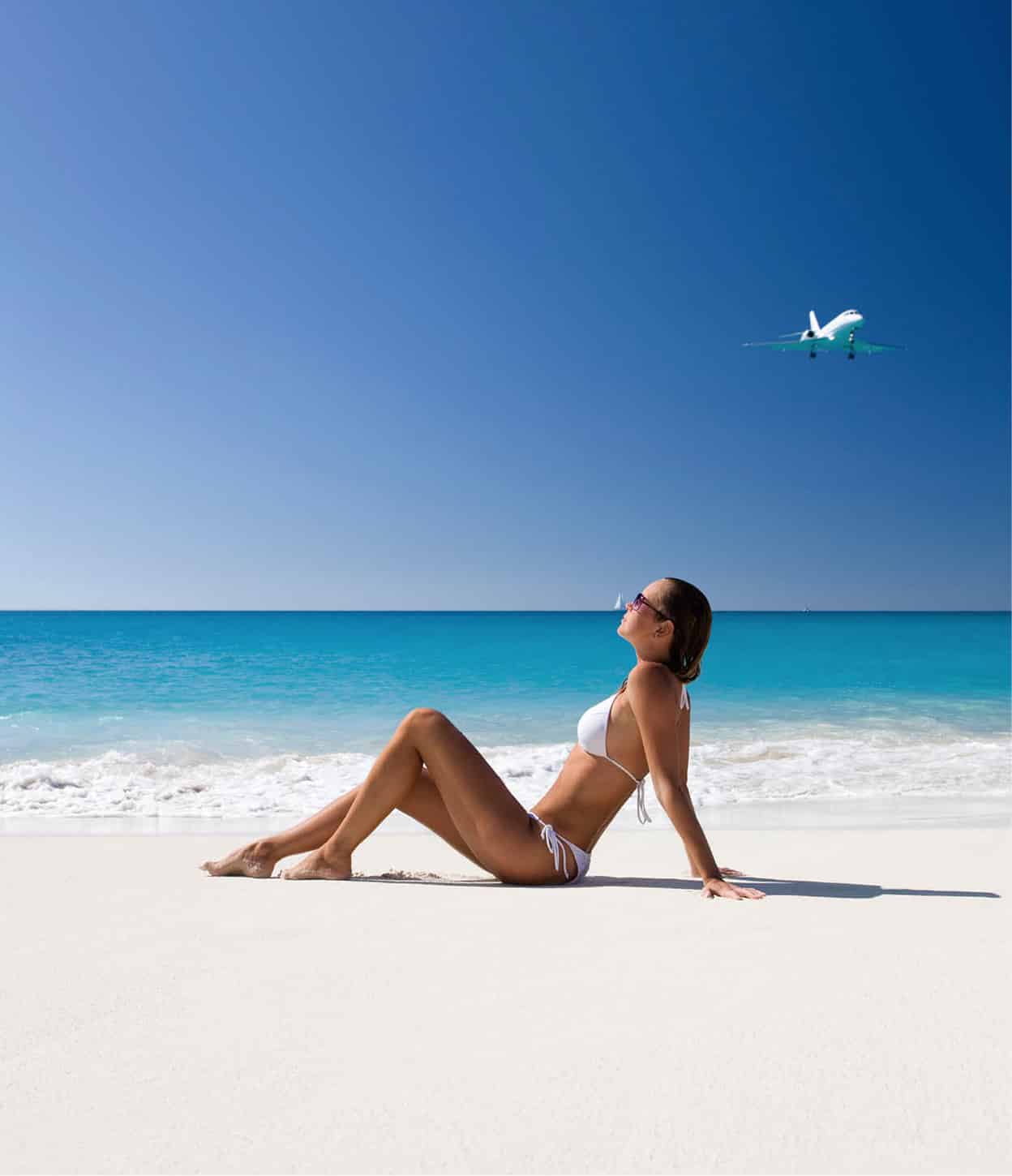
Soaking up the rays - but don’t forget the sunscreen.
iStock