Krakatoa: The Day the World Exploded: August 27, 1883 - Simon Winchester (2003)
Chapter 1. ‘AN ISLAND WITH A POINTED MOUNTAIN’
Volcanic Eruption Area: Owing to volcanic eruption this area is considered unsafe for shipping…
Pulau Anakrakata: (6°06'S, 105°25'E), an islet, appearing midway between Pulau Sertung and Pulau Rakata Kecil in 1928, where formerly a bank with a depth of 27m was charted. In 1929, this islet disappeared again, but resurfaced by eruptions in 1930, and after heavy eruptions in February 1933, appeared to have increased in size. In 1935 this islet was almost circular in shape, with a diameter of about 1200m, and a height of 63m, and in 1940 it was 125m high. In 1948 there were a few casuarina trees on the N extremity of the islet; in 1955 the islet had an elevation of 155m and, viewed from the S, was devoid of vegetation. In 1959 it was in eruption and emitted thick black smoke to a height of 600m. Volcanic activity on Pulau Anakrakata was last observed in 1993.
Danger Signal: In the event of threatened eruption within the Krakatau area, Jakarta Radio will broadcast the necessary warning in Indonesian and English. (See Admiralty List of Radio Signals.)
- from ‘Admiralty Sailing Directions’, NP 36, Indonesia Pilot,
Volume 1, London, 1999,1
Though we think first of Java as an eponym for coffee (or, to some today, a computer language), it is in fact the trading of aromatic tropical spices on which the fortunes of the great island's colonizers and Western discoverers were first founded. And initially supreme among those spices was the one rather ordinary variety that remains the most widely used today: pepper.
Piper nigrum, Syzygium aromaticum* and Myristica fragrans - pepper, clove and nutmeg - were the original holy trinity of the Asian spice trade. Each was familiar to, and used by, the Ancients. Two hundred years before the birth of Christ, for instance, the Chinese of the Han Dynasty demanded that their courtiers address their emperors only when their breath had been sweetened with a mouthful of Javanese cloves, the ‘odoriferous pistils’, as they were later more widely known. There is some vague evidence that Roman priests may have employed nutmeg as an incense; it was definitely in use as a flavouring in ninth-century Constantinople, since the terrifyingly Orthodox St Theodore the Studite - the scourge of the image-smashing Iconoclasts - famously allowed his monks to sprinkle it on the pease pudding they were obliged to eat on days when monastery meat was forbidden. And in Elizabethan times a nutmeg pomander was an essential for keeping foul ailments at bay: the notion that nutmeg could ward off the plague survived longer than many another old wives' tale.
Pepper, though, was of infinitely more moment to the Ancients than to be merely a topping, nostrum or cachou. The Romans used it in abundance: Gibbon wrote of pepper being ‘a favourite ingredient of the most expensive Roman cookery’ and added his authority to the widely held idea that Alaric, the rambunctious king of the Visigoths, had demanded more than a ton of it from the Romans as ransom when he laid siege to the city in AD 410. The aureus and the denarius, the gold and silver coins of the Empire, became the preferred currency of the Spice Route, and the Indian pepper merchants of Cochin and Malacca and the ports of southern Ceylon were said to be impressed that the denomination of coins was indicated by the number engraved upon them, not by their size.
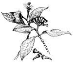
Syzygium aromaticum, the clove.
However they may have been denominated, the coins must have been paid out in enormous numbers. Pepper was so precious and costly and so much in demand that the cost of it all had Pliny the Elder fulminating. ‘There was no year in which India’ - and by this he meant the Indies, since pepper traded came both from the Malabar Coast and from western Java - ‘does not drain the Roman empire of fifty million sesterces.’ So dearly, he added drily, ‘do we pay for our luxury and our women.’
(There is a pleasing symmetry about Pliny's involvement in this part of the story of Krakatoa, even if he appears in only a walk-on role. Although this rich and well-connected former soldier - he was a cavalry officer in Roman Germany - happily took on a variety of official duties on behalf of his emperors, Pliny was above all else a naturalist. He was a savant, or a student as he once famously put it, of ‘the nature of things, that is, life’. His reputation is based largely on his 37-volume Natural History, an immense masterpiece in which, among countless other delights, is the first use of the word from which we derive today's encyclopedia.
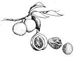
Nutmeg and mace.
It was during the late summer of AD 79, while pursuing his official task of investigating piracy in the Bay of Naples, that Pliny was persuaded to explore a peculiar cloud formation that appeared to be coming from the summit of the local mountain, Vesuvius. He was duly rowed ashore, visited a local village to calm the panicked inhabitants and was promptly caught up in a massive eruption. He died of asphyxiation by volcanic gases on 24 August, leaving behind him a vast reputation and, as memorial, a single word in the lexicon of modern vulcanology, Plinian. A Plinian eruption is now defined as an almighty, explosive eruption that all but destroys the entire volcano from which it emanates. And the most devastating Plinian event of the modern era occurred 1,804 years, almost to the day, after Pliny the Elder's death: at Krakatoa.)
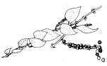
Piper nigrum, pepper.
Pepper has a confused reputation. There is no truth, for example, in the widely held belief that it was once used to hide the taste of putrefying meat; this charming thought perhaps derives from the equally delightful notion, still recognized by pharmacists today, that pepper can be used as a carminative, a potion that expels entrapped flatulence. But it was very much used as a preservative, and more commonly still as a seasoning. By the tenth century it was being imported into England; the Guild of Pepperers, one of the most ancient of London's city guilds, was established at least before 1180, which was when the body was first recorded (they were in court for some minor infraction); by 1328 the Guild had been formally registered as an importer of spices in large, or gross, amounts: its members were called grossarii, from which comes the modern word ‘grocer’. Joseph Conrad caught the obsession, in Lord Jim:
The seventeenth-century traders went there for pepper, because the passion for pepper seemed to burn like a flame of love in the breast of Dutch and English adventurers about the time of James the First.* Where wouldn't they go for pepper! For a bag of pepper they would cut each other's throats without hesitation, and would forswear their souls, of which they were so careful otherwise: the bizarre obstinacy of that desire made them defy death in a thousand shapes; the unknown seas, the loathsome and strange diseases; wounds, captivity, hunger, pestilence, and despair. It made them great! By heavens! it made them heroic…
The Western appetite for the trinity of flavourings increased almost exponentially during the fourteenth and fifteenth centuries - the trade being dominated, at least after the Papal Donation of 1493, by the only serious maritime power of the day in the Orient, the Portuguese.* Vasco da Gama, who opened up the East and made it as far as Calicut, was said to be exultant at finding out that the pepper he knew would sell for eighty ducats a hundredweight back in Venice (which was the European centre for the trade) could be bought in India for only three. A steady stream of Portuguese merchantmen and explorers promptly left the Tagus for the Orient - one of them, Pedro Alvarez Cabral,
The very vague placement of the antimeridian of the Tordesillas Line essentially allowed the Portuguese free rein over the entire Indian Ocean - their possessions are marked. The line snakes around the eastern Pacific margin of the map, with the islands to the north-east of Borneo - the Philippines - by papal right Spanish.
discovering and then claiming Brazil on the way - and for a while the Portuguese entirely dominated the business. The ancient overland route, ships to Arabia, camels to the Mediterranean, was utterly changed; now it was massive sailing ships all the way, via West Africa and the Cape. And in just the same way as Roman currency became the common coin of the old route, so the Portuguese language became the lingua franca of the new.
But slowly time and technology intervened: by the sixteenth century the Dutch and the English, now with all the skills for shipbuilding finely tuned, with all the oak they needed for their hulls and all the flax they wanted for their sails and all the cannonry their foundries could produce and the navigating wherewithal for making long journeys fast and safely, found they could outrun and outgun the fine vessels from Lisbon. More than a few Dutch ships, flagged with the Portuguese bandhera to get around the royal prohibition on non-Iberians trading in the Orient, were now coming home and whetting the appetites of the Amsterdam merchants for pepper and for profit. And so slowly, under the force of these various imperatives, the balance of maritime power in the East started to change. The Portuguese from the warm and lazy south were slowly driven out and replaced by doughty Europeans from the cold and more ruthless north.
The change began somewhat inauspiciously in late June of 1596, when a ragged flotilla of four Dutch vessels dropped anchor in the roads off the north-western Javanese pepper port of Banten and invited the Portuguese spice merchants, whose godowns had long lined the shore, to come aboard. The voyage had been sponsored by the nine merchant-adventurers of the Compagnie van Verre of Amsterdam - in translation simply ‘The Long Distance Company’ - who had been inspired by the idea of blazing a spice trade-route to the Indies. It had not gone at all well.
Cornelis de Houtman, who commanded the venture, turned out to be both an inept navigator and a cantankerous martinet. Not that he had been wanting of preparation: along with his brother Frederik he had already spent two years in Lisbon gathering intelligence on the Portuguese operations in the East.* His expedition was grandly titled Eerste Scheepvart, ‘The First Ship Sailing’. It excited much attention as, with 249 men aboard, it swept out into the Zuider Zee and, after provisioning at the merchant docks inshore of Texel, fell away from the roads on the morning of 2 April 1595. It promptly ran into a whole sea of troubles.
The provisioning had been too hasty. After a matter of only a few weeks scurvy broke out, with sailors suffering such rending stomach pains among their other symptoms that the Dutch still have a word for it, scheurbuik, ‘tearing-belly’. Disputes raged between the on-board merchants and the ships' masters: one merchant was locked in his cabin in chains for the entire voyage, another was poisoned in India, a master fell victim to a mutiny. De Houtman proved himself to be no more than ‘a boaster and a ruffian’. A short stopover in Madagascar for the convoy to catch its breath turned into a six-month death-watch, during which so many crewmen died that there is still a Madagascan bay called the Dutch Cemetery. By the time the venture reached Banten* only a hundred Dutchmen were still alive.
The surprised Portuguese at first made them welcome, probably assuming that so wretched a gaggle of starving men could hardly pose much of a challenge to the might of Lisbon. The head of the entrepôt sent a message to his immediate superior in Goa, on the Indian coast, though more for reasons of diplomatic propriety than of disquiet. He then introduced the visitors to the local Banten sultan, who was sufficiently impressed with them to enter into a treaty: the first formal document between Dutchmen and Javanese, whose relationship of three and a half centuries would prove to be one of repression, exploitation and too often most cruel colonization. ‘We are well content,’ the sultan wrote, ‘to have a permanent league of alliance and friendship with His Highness the Prince† and with you, gentlemen.’
The contentedness would not long survive. Some indication of what would evolve into a deeply unhappy relationship between the Dutch and their soon-to-be subject people came good and early, during the subsequent sojourn of the de Houtman expedition.
Much of Sumatra and Java had already become widely Islamicized (the earliest-known Muslim grave on Java dates from 1419, after which the creed took hold rapidly), and the local people and their leaders were acutely sensitive to the strange ways of the European infidels. The Portuguese had seemingly shown a measure of tact; the Dutch, on the other hand, had a reputation for being crass and insensitive in their dealings with the ‘primitives’ they met. Cornelis de Houtman himself insulted the Banten sultan - contemporary accounts are not specific and speak only of de Houtman's ‘rude behaviour’ - and was ordered to leave port.
De Houtman's flotilla sailed east. It was then attacked by pirates off Surabaya, a dozen more of his crew were killed, and one of the ships had to be abandoned and set ablaze because there were too few hands to work it. In retribution for the piracy he ordered a brief campaign of systematic rape and pillage off the coast of Madura. But by the time he reached Bali he had calmed, just as many others find themselves similarly soothed.
He found that the king of Bali was ‘a good-natured fat man who had two hundred wives, drove a chariot pulled by two white buffalos and owned fifty dwarves’. He was, perhaps understandably given his location, not the best informed of monarchs. When de Houtman, keen to impress him with Holland's importance, drew him a map of Europe showing the Dutch borders lying improbably close to Venice and Moscow, the old man did not for a moment even raise a sceptical eyebrow.
The crew liked the place hugely; only one sailor deserted. But there were yet more rows, and before they left an ill-tempered de Houtman almost had to be forced to accept a cargo of a few pots of peppercorns, which the expedition took back to Amsterdam. Their return voyage, by way of Java's south coast, was every bit as miserable, and almost as time-consuming, as the outbound. And seven more sailors dropped dead almost as soon as they reached home, their stomachs reacting violently to the change back to civilized rations.
But for all the blundering tragedy of that first Dutch expedition, the achievement could hardly be gainsaid: for it did bring back those few pots of precious black Java pepper. And that, it seemed to the nine sponsoring merchants of Amsterdam, was all that really counted. The Portuguese stranglehold on Oriental spice trading could in theory at long last be broken. Other, better-furnished expeditions could now venture out and obtain more pepper, clove and nutmeg (and its attendant aril, called mace, as well as the cinnamon that grew close by) and thus help make the mercantile barons of Holland richer than could be imagined.
One might have expected a spirited reaction from the Portuguese. They did indeed react - but then managed to blunder even more calamitously than had the Dutch. The Portuguese ran their Estado da India from Goa, on the western coast of India. Their viceroy there had received news of the de Houtman expedition from his agents and promptly decided he would see to it that no such impertinence happened again. He dispatched a specially built fleet*south to Banten, but the admiral he chose for the mission, a still-infamous-in-Lisbon figure named Don Lourenzo de Brito, took such a long time to get there that the Dutch whom he had planned to confront had already upped and sailed back to (and at the time were in fact comfortably ensconced in) Amsterdam.
So the admiral, apoplectic, turned his fury on the Bantenese - despite his chief in Goa having ordered him specifically to do no such thing. He tried to teach them a lesson for having dared to be hospitable to his masters' rivals - and was promptly outfoxed by the Javanese sailors' battling techniques. He lost two of his four ships and withdrew, humbled, to Malacca to lick his wounds.
No one - not the admiral or the viceroy or King Philip back home - recognized the import of the moment: that the skirmish between the Bantenese and the tiny fleet from Goa marked the beginning of the end for Portugal's imperial role in the East. It took a while for it to be wholly extinguished (the reversion of Macau from Portuguese to Chinese rule in 1999 marked the final drawing-down of blinds); but the lights began to go out from that time. ‘Look at the Portuguese,’ noted the British ambassador to India, Sir Thomas Roe. ‘In spite of all their fine settlements they are beggared by the maintenance of military forces; and even their garrisons are only mediocre.’ Within half a century only Goa, Macau, Mombasa, the ports of Mozambique and, in the Indies, Flores and Timor remained. The power of the old Iberian empires was suddenly waning; new trading empires, directed by men from the chilly north European capitals of Amsterdam and London, were about to be born.
From the moment of the return of that first unhappy excursion to Java and beyond, shoals of Dutch fleets, each backed by packs of excited adventurers, began coursing across the ocean, bound for Banten and the fast-opening Oriental universe beyond. In May 1598 a fleet twice the size of de Houtman's, under the command of the more competent and distinguished sea-captain Jacob van Neck, left Texel for Banten, reached there in half the time and sailed away with enough pepper for its backers to realize no less than a 400 per cent return on their investment. The floodgates then opened, once and for all.
Before the end of 1601 fourteen fleets had gone East - a total of sixty-five vessels. Most had passed along the conventional route via the Cape of Good Hope. Others, keen to be first to reach the spice-rich islands on the eastern side of the archipelago, took the much riskier path south-westwards across the open Atlantic, through the newly discovered, but windy and reef-strewn, Strait of Magellan and then across the entire Pacific Ocean. It was an extraordinary, boisterous, devil-may-care time, and the docks in Hoorn and Enkhuizen and Amsterdam were frantic with shipping, always leaving, leaving, leaving. Some of the more sobersided Hollanders sniffed over their glasses of genever and accused the adventurers of indulging what they termed the wild navigation. And wild it may well have been - but the commercial results were obvious. The Hollanders were on to something big.
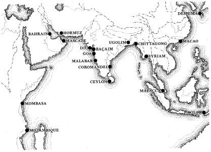
Banten itself - though it was once the largest city in South-East Asia and one of the most famous of the world's seventeenth-century's ports - is these days anything but big. The garrison that the local sultan permitted the Dutch to build, Fort Speelwijk, still stands: with its ten-foot-thick walls, its worn machicolations and breastworks, its muddy tunnels and embrasures now greasy with tropic mould, it is a melancholy reminder of how mighty and ambitious the Dutch had once been. The sea that their vigilant sentries scanned for approaching enemy sails now laps a full mile away beyond the fort's curtain-walls: silt oozing from the river started to choke the estuary in the nineteenth century, and before long had rendered Banten port unusable for vessels much larger than whalers and large canoes. Its rise was spectacular; its fall - like the fall of empires more generally - slow and inevitable. It has long since been abandoned as a port; nowadays Banten is little more than a collection of shanties and ruins, with a lane of shops selling Muslim caps and boxes of locally grown dates. There are no local pepper plantations: western Java has turned its plantations to tapioca and coffee, and it is Sumatra that now produces about a sixth of the world's 200,000 yearly tons of Piper nigrum.
Yet Banten still makes its own contribution to the economic well-being of the islands, Just beside the old Dutch fort, at the entrance to the maze of lanes that lead to the former sultan's ruined palace, stands a curious trio of immense and very ugly cement towers. They look mysterious and rather sinister. They are formidably well guarded with razor-wire, attack dogs and civilian guards (one of them a young woman who contentedly suckled her infant when I inquired - in vain - if I might go inside). They look as if they might be kin to Fort Speelwijk, fortresses of a kind too, a protection for a population fretful about some nameless and more contemporary disaster.
In fact they are nothing of the kind. The towers are man-made homes for the local birds called swiftlets, members of the genus Collocalia, whose saliva is the basis for that most celebrated Cantonese aphrodisiac, bird's nest soup. The towers' owner is a Chinese restaurateur from Jakarta. He thinks it most unlikely that any client would ever realize that the soup he serves comes not from nests plucked in the traditional manner from dangerous clifftops in Thailand, but from those farmed weekly inside a cement blockhouse in a former Dutch pepper port. He is reputed to be one of the wealthiest Chinese in all of modern Java. He remains blissfully unaware that he made his fortune in the town that had once made other outsiders, the entirely dissimilar burghers of seventeenth-century Amsterdam, extremely wealthy too.
With the advent of those Dutch, whose maritime traditions had already spawned legions of cartographers, came maps: good, beautiful, accurate and before too long utterly magnificent maps. With the making of maps came the observed and calculated details of place. With details of place came names - and among them, quite early in the process, the first naming of the tiny island that is the subject of this story.
For 1,500 years the notion of the great Greek astronomer Ptolemy, published in his definitive Geography, was that Africa and Asia were one, connected by a land-bridge across the southern Indian Ocean. It took a very long while to discredit this idea. But by the fourteenth century, on the basis of reports from early explorers (such as Marco Polo) and intelligence gathered from Arab travellers and traders, cartographers in Europe began to suppose the existence of a number of peninsulas and discrete islands littering the ocean between China and Africa. The dangling appendages of India and the Malayan peninsula began to appear on maps first; and then three of the largest supposed islands, today's Borneo, Sumatra and Java, started to be depicted on charts printed in the sixteenth century (though there was a long period when lozenge-shaped Sumatra was confused with its not-too-distant neighbour, pearl-drop-shaped Ceylon).
Martin Behaim's globe of 1492 - his erdapfel, or ‘earth-apple’, as this solid wooden sphere was charmingly called - shows painted on its surface the islands of Java and Sumatra, part of a ragged chain of land between a quite distinct Malayan peninsula and a body of vaguely determinate shape that is just recognizable as Borneo. And Martin Waldseemüller, the German mapmaker who, in 1507, was the first to put the name America on to a world map, clearly indicates on one of the same woodcut's dozen sheets an island, to which he gives the name Java Minor, quite separate from another island to its west.
And even before these, there were prescient maps made elsewhere. Early Thai, Indian and Korean maps, often delightfully fanciful, indicate bodies of land that could well be the two huge islands. There is also a copy of a fourth-century Roman road map from England to India (with the distances variously measured out in Roman miles, Gallic leagues and Persian parasangs) showing Ceylon as a decidedly insular insula Taprobane at its bottom right-hand corner, but which could, from its size and familiar shape, easily be mistaken for Sumatra.
Once the Italian, Spanish and Portuguese sailor-adventurers began to penetrate to the east of Malacca, this imprecision vanished. Sumatra and Java are by then named and shown to exist, most assuredly, separated by a body of water called the Strait of Sunda. Far to their east the nutmeg island of Banda* finds its way on to a map of 1516, as well as a proper (and more or less properly spelled) Borneo, located five years before Magellan's expeditions reached it on history's first (and for Magellan, tragic and fatal) circumnavigation. The Moluccas, Timor, the Celebes and the Philippines likewise all begin to appear on maps and portolanos and charts as well, their positions and their dimensions depicted ever more accurately - such that by the end of the sixteenth century, when the Dutch were poised to sail in from Texel to try to wrest the spice monopoly from the stranglehold of the Mediterranean powers, every major island between the Maldives and the coast of China was illustrated, reasonably correct in outline, place and size.
And then, with the turn of the century, and as those first commercial fleets began their laborious voyages out from Texel, so along with the merchants went the Dutch cartographic masters. These were men possessed of formidable naval knowledge, great artistic brilliance and still unrivalled mapmaking skills, who would push back the boundaries of world cartographic knowledge further and even further, and also add to their newly developed picture of the planet a wonderful measure of beauty and style. Their maps are treasures, awesome in both utility and aspect. And it was one of these mapmakers, Jan Huyghen van Linschoten, who was to make the first positive identification of the volcano-island that would cause such mischief in the years ahead.
Van Linschoten was a curious and energetic traveller, a man afflicted by wanderlust centuries before the ailment was properly known. ‘My heart is longing day and night for voyages to faraway lands,’ his journals note in an entry for 1587. His travels were prodigious. He was keenly interested in the Arctic, and his numerous journeys there - to the lonely supra-Russian island of Novaya Zemlya, for example, to which he went with the Dutchman who named the Barents Sea - were recounted in a hugely popular book that inspired both the English and the Dutch to try to forge a sea-route through the ice to India (they never did).
But it was for the maps he created as a by-product of his six years in service to the Portuguese that he remains best known today. He had travelled East via Africa and the Cape across to the administrative capital of Goa, in western India, working as bookkeeper to the Portuguese Catholic archbishop. He spent the six years from 1583 in the immense province, travelling with the divine, noting furiously details of every place and peoples he visited (though we do not know if he actually visited Java and the islands to its east). In 1595 he published his account of it all - the Itinerario, one of the most detailed travel guides ever known. Bound into the volume were a number of remarkable maps - some by Portuguese mapmakers, some by Spaniards, and one exquisite map of the Far East drawn by van Linschoten himself.
The map itself has a curious history: it was executed by a Dutchman, based on information that van Linschoten admits was ‘from the most correct charts that the Portuguese pilots nowadays make use of and later handed over and republished for the English. The custom was for these four powers jealously to guard such information; yet in the case of this one beautiful creation - with great cartouches, sea-monsters, rhumb lines, the arms of Portugal and a flourish of compass roses - it was allowed to be seen by the navigating hierarchs of all four competing nations.
On the map much is recognizable - China, the Mekong, Malaya, Luzon. The islands of Java and Sumatra are also named and shaped more or less as they should be (though the island of Sulawesi near by is a strange ‘paramecium’ shape, according to one critic). Between Sumatra and what van Linschoten called Java Major is a narrow strait, and within it a tangled mess of unnamed islands. But though they are anonymous on the map, there is, and crucially for this story, the text from the Itinerario, which acts as vade mecum for any Java-bound navigators using this map, whom it duly advises:
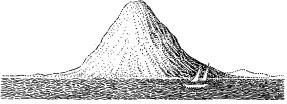
to reach the mouth of the Sunda Strait stay close to the mainland of Sumatra, always keeping a good eye out for the mountains and cliffs, of which there are many ahead, for one does not know where one will find the mouth of the Strait except only by the knowledge of the islands; look for a high island located straight across from the land tip on the north side of Sumatra, which with the island of Java Major forms the Strait that ends here. On the northwest side of the coast are two or three small islands about one mile away from land. On the island closest to land a ship with Frenchmen was run aground once. Its guns went to the king of the Island Bantam, and the one from Calapa. And a mile from land towards the south is an island with a high top or pointed mountain.
There can be no doubt at all, despite van Linschoten's failure to name the island on either his chart or in the Itinerario, that this is Krakatoa.
He probably never saw it; though he travelled widely from Goa, there is no certainty that he visited the archipelago itself; all his reports come from his immense network of Portuguese pilots. But there simply is no other island in the Strait that fits his description (or, rather, until 1883 there was no other such island in the Strait, for since that August morning the original island has essentially not existed at all). There is no ‘pointed mountain’ in van Linschoten's reported position at the northern end of the Strait or, for that matter, anywhere else near by.
Other early Dutch cartographers are revered along with van Linschoten: Blaeu, Lodewijcksz, Hondius, Visscher and, equally important in this one context, Lucas Janszoon Waghenaer. For though van Linschoten writes briefly of his island with its pointed
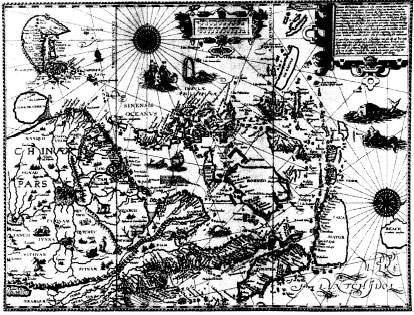
Jan Huyghen van Linschoten's 1595 map of the Far East, which shows a dusting of islets and skerries in the strait between Sumatra and Java Mayor.Krakatoa - seen for the first time ever on a European chart - is probably the large island marked opposite Palimbam.
summit in 1595, and though a year later Willem Lodewijcksz records so many small islands in the Strait that one crew said they had difficulty finding a channel along its western side, it was the Waghenaer map that first depicted the island and properly captioned it with an approximation of a soon-to-be-familiar name.
Lucas Janszoon Waghenaer was a Dutch pilot who almost single-handedly revolutionized the entire business of sea-borne maps. Until his publication in 1583 of a rutter, a mass-produced collection of navigational notes and charts that a mariner might use to help plan a voyage in unfamiliar waters, such maps as a ship's captain had taken on board were hand-made, singly produced and often ultra-secret. Waghenaer decided instead that ships' charts should be printed, using wooden or engraved metal blocks. They should be made by the hundreds, the better to encourage men to sail, to explore and to discover.
His maps are many, and among the finest ever made. They are colourful, filled, like van Linschoten's, with elaborate cartouches, ships in full sail, fabulous sea-monsters and a host of devices - compasses, scales, indications of deeps and shallows - that are still in use on charts today. His name was Anglicized to Waggoner, and so popular and respected did his works become that the word is still heard in some of the older chandleries and appears in recent dictionaries of the sea; Dalrymple's famous chart-book was once known colloquially as The English Waggoner.
His exquisite chart of the Sunda Strait was published in 1602, seven years after the Itinerario. Engraved on the map, halfway between the immense body ofland called Suma. Pars. and its equally immense eastern neighbour, Javae Pars., is a group of what appear to be four small islands - a trinity of larger bodies, partially enclosing a fourth. The inscription says simply Pulo Carcata.
It was half a century before the island was named in a prose work. In October 1658 a Dutch doctor, Wouter Schouten, noted in his travelogue that he passed the ‘high tree-covered island Krakatau’ - the first mention of the island by its currently accepted name.
As to the origin of this name, it sometimes seems that there are almost as many theories as there are geographers. The word Pulau that appeared on the Waghenaer chart remains,, since it is the modern bahasa Indonesia for ‘island’. But Carcata? Or Krakatau? Or something in between? Both the idea of what should be the spelling and the etymologies of its various names are an enduring mystery.
There is an early and linguistically alluring report by a French Jesuit priest, Guy Tachard, suggesting that it was an onomatopoeia. Tachard passed the island eighty years after the Dutch cartographers, and wrote in his log that ‘we made many Tacks to double the island of Cacatoua, so-called because of the white Parrots that are upon that Isle, and which incessantly repeat the name’. It sounds improbable, not least because of the difficulty that any mariner might experience trying to hear the call of land-based birds from high on the windy deck of a passing ship.
Others subsequently thought that Krakatoa, or the more common local form Krakatau, derives essentially from one of three words, karta-karkata, karkataka or rakata, which are the Sanskrit and, according to some, the Old Javan words meaning ‘lobster’ or ‘crab’. Then there is a Malay word, kelakatoe, which means ‘flying white ant’. Since crabs and parrots belong on the island - or since they did, at least, until that dire August morning in 1883 - any one of the two last lexical explanations seems reasonably acceptable.* White ants only occur in the eastern part of the archipelago, rendering this theory rather less credible; though perhaps rather more credible than the notion, briefly popular in Batavia, that an Indian ship's captain had asked a local boatman what name was given to the pointed mountain he could see, prompting the local to reply Kaga tau, meaning ‘I don't know’.†
*
The effect of the eastward onrush of armadas of Dutch sailing vessels, their captains now well equipped with their bound collections, their rutters, of the region's new-printed charts, was immediate and profound. Such Portuguese as remained were soon overwhelmed and dismissed. They were eventually and officially sent packing from the Banten pepper port in 1601. In 1605 the Dutch seized all the eastern islands of the Moluccas, which included the nutmeg and clove islands of the Banda Sea. The fort at Solor fell in 1613, and Malacca, the great trading station on the western side of the Malay peninsula, passed from the control of Goa to that of Amsterdam in 1641. The Dutch speedily assumed power across fully forty-five degrees of eastern longitude, and before long effective control of what were to be called the East Indies was almost (aside from tenacious Portuguese holdouts on the islands of Flores and Timor, and fast-fading competition from the British in a variety of tempting places) entirely theirs.*
In 1602 the Dutch took a step of profound importance. It was a move that, as well as hugely improving their own merchants' fortunes in the East, helped to create a business model for the foundations of all of modern capitalism. The government formally chartered a company, the Vereenigde Oost-Indische Compagnie, known to this day as the VOC, to act in concert, and as a monopoly, in all trading matters to the east of the Cape of Good Hope. And not just trading: the VOC was given exclusive and quasi-sovereign rights to enter into treaties with local princes, to build forts, to maintain armed forces and to set up administrative systems of government whose officials pledged loyalty to the government of the Netherlands.
The idea of officially sanctioned trading cooperatives was far from new. The British had had the Merchant Adventurers and the Merchant Staplers; they had created the Muscovy Company in 1555 and the Turkey Company in 1583. The Plymouth Company and the Massachusetts Bay Company were established at the beginning of the seventeenth century, to settle colonists. The Hudson's Bay Company, set up half a century later solely to trade, remains today: the Bay, its flagship department stores, can be found in all of Canada's cities (and in not a few more isolated Arctic settlements), and its owner, a cheerfully eccentric peer called Ken Thomson, lives modestly and happily in a suburb of Toronto.
But there was a difference about the VOC. Right from its beginnings, it was cleverly constructed as a joint-stock company. The good burghers of Holland who had initially sent out their own small fleets decided to band together to back a much larger, much more ambitious company, with each backer owning a ‘share’ of this company's value, with the value of each share depending on the amount by which each shareholder backed it. This new concept, of a joint-stock company, with in this case a start-up capital of six and a half million guilders, was to become the model for all the thousands upon thousands of publicly traded firms that are listed on the world's bourses and stock exchanges today, and whose raison d'être, the sharing of risk and sharing of reward, lies now at the beating heart of the modern capitalist system.
The ‘Gentlemen Seventeen’ who were the directors of the VOC may have been ultimately responsible to the Dutch parliament; but they were also financially responsible to those who bought shares in the Compagnie, to the merchants and the bankers who had taken the bold and revolutionary view that such a costly undertaking - impossibly expensive for any one Dutch company to afford - might, in time, win vast profits for them if they supported it collectively and backed it in concert. The VOC may be best known to historians for having ruled most of the East Indies for two centuries, from 1602 until its collapse in a welter of ignominy and corruption in 1799; but students of finance know it best for its seminal effect on the making of the model for an institution that underpins much of the prosperous West's current way of economic life.
The first steps were modest enough: a renewal of the pepper treaty with the sultan of Banten; the takeover of spice factories on the Banda Islands, in Aceh, in central Sumatra and at a number of small ports on the Malay peninsula; the rebuilding of a conquered Portuguese fort in Ambon in the Spice Islands that was to become the first permanent Dutch military base in the region and that would protect (from the newly predatory English, mainly) their fleets, which were now carrying cinnamon, cloves and nutmeg home in enormous tonnages.
Before long, however, it became evident to the stockholders back in the Netherlands that there might be much more money to be made if at least some of the ships stationed out East began actually to trade within the East - taking goods not just from Java to Holland but from Java to Sumatra, say, or from Galle in Ceylon to Macassar in the Celebes. The local people weren't fully exploiting their potential for trading, so why shouldn't the Dutch - who had the ships and the growing navigational knowledge, confidence and skill - trade for themselves? And so the practice known as ‘country trading' began, with skippers from faraway Holland sailing along the immense coastlines of an archipelago that is now known to embrace more than 17,000 islands, bringing cargoes from merchant to merchant and carrying not a small tonnage of their own goods, by the sale of which some became extremely wealthy men.
Just one warning was sounded during those early, braggartly, optimistic days. It was a warning that would sound intermittently through all the succeeding years of Dutch rule in the East, that would find echoes in the rule of other European powers beyond Europe, that would extend past and become surprisingly important locally immediately after the explosion of Krakatoa, and that would reverberate across the world, with varying intensity and degree, right through to modern times.
And this tocsin note was the suspicious and on occasion the openly hostile relationship that developed between the Dutch and those local people who were, and already for the two past centuries had been, as the papers of the day called them, Muham-madans.
From the very moment the Dutch admirals met with the sultans of Ambon and Banda, the easy-going arrogance of the visiting Christian Dutch sat uneasily with the rigid formalisms of Islamic belief. An entire spectrum of antipathy developed: almost from the beginning there was a suspicion, disdain and contempt felt and expressed on both sides. Relations between Muslim and Christian, in the East Indies and throughout the Eastern world, presents a discordant continuo in the telling of the tale of Krakatoa.
Surviving portraits usually show Jan Pieterszoon Coen hatless and crop-headed, with a menacingly thin moustache and goatee, and invariably dressed in the frills and furbelows of the time: a soft lace millstone ruff, a heavily embroidered black doublet, an elaborate system of belts and buckles holding up a silver-handled Toledo sword. He never smiles, or looks in any way genial.
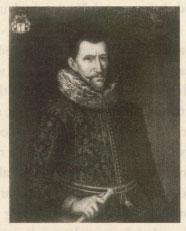
Jan Pieterszoon Coen.
To those who painted him he seemed always stern, forbidding, ruthless. Whether he did indeed look that way, or whether the portraitists simply reflected the abiding perception of the man, we cannot know. But everyone in the Netherlands and in the East seemed to know only too well that Coen, the founding father of the Dutch empire in the Orient, was not by any stretch of the imagination a kindly man.
No doubt his Calvinist roots - he was born in the small, religious and conservative fishing-town of Hoorn on the Zuider Zee - had much to do with his attitude. The fact that he witnessed an early slaughter of Dutchmen at the hands of Spice Islanders - the admiral in command of his first voyage to the East and fifty of his men were killed in the Banda group in a massacre that Coen long vowed he would avenge - was maybe of even more influence. Whatever the roots of his disdain, by the time the ‘Gentlemen Seventeen’ saw fit, in 1618, to promote him as the fourth and most famous of their governors-general of the East Indies, Coen was a man in a mood to go out East only to enforce, expand, discipline and punish. And to lay the foundations for what would in due course become a world-class trading empire - an empire that would have at its epicentre a world-class capital city, as Rome and Athens and Venice had in their turn been before.
The directors back in Amsterdam recognized early on the need for a regional headquarters - a place from where they might administer their Indies,* somewhere where they might victual and water and rest their imperial adventurers, somewhere where they might repair their warships or build new trading sloops, somewhere from where they might pause to reflect on the vast territory they were fast acquiring and learn about its subtleties and plan its future course. The existing major centres, Malacca and Banten, had problems, Malacca still being run by the Portuguese and Banten ruled by a sultan whose congeniality was capricious, to say the least.
The only site that tempted Coen, when he became governor-general in 1618, was the tiny fort that the Banten sultan had allowed the Dutch to build on the right bank of a greasy and slow-flowing river called the Ciliwung, on Java's north coast, opposite a village called Jayakarta. The only obvious disadvantage was the local presence of a fair number of British adventurers and would-be colonizers. Ever since Sir Francis Drake, on his great circumnavigation, had arrived in the Moluccas in 1579, there had been a British presence, and men like Sir Thomas Cavendish and James Lancaster had enjoyed some success with the local chiefs, presenting themselves as potential enemies of the Portuguese. The British colonial intentions for Java and Sumatra were formless and lacked direction; but British engineers had built a fort on the left bank of the Ciliwung River, beside Jayakarta, at least to protect their traders. Coen, aware of their potential rivalry and sure that they meant, in time, to become a local imperial power, decided to toss them out.
It looked likely to be a tougher task than he at first supposed. The British Army garrison was larger than his, and the Royal Navy squadron had fourteen vessels, while Coen had only eight. He wrote beseechingly to the directors in Amsterdam, asking for reinforcements. His request was ignored. He promptly left town in high dudgeon - ‘I swear to you that… the Company has no enemies who more hinder and harm it here than the ignorance and thoughtlessness which reigns among Your Excellencies and defies understanding' - and sailed off to the Dutch fort in Ambon, hoping that he. might find reinforcements there.
By doing so he missed such action as then took place - which wasn't much, and most of which descended rapidly into farce. The British laid half-hearted siege to the tiny Dutch fort, irritating the Dutch storekeeper, a Mr van den Broecke, by forcing him to build barricades out of the very costly bolts of silk and batik cloth he had waiting for export. Then a row broke out between the Britons and a local junior sultan, over how the spoils of the coming fight, if won, would be divided. Next the sultan of Banten brought in his fleet, to make sure that neither the British nor the junior sultan should benefit from Dutch weakness. The upshot of all this noise and tumult was the opening of four-way negotiations, the sudden abandonment of the scene by the British and the overthrow of the junior sultan by the sultan of Banten.
All of a sudden, by dint less of savage and courageous fighting than of unseemly argument among their many foes, the Dutch found that they had won. Their fort was unscathed and secure. Mr van den Broecke could take down his precious bolts and bales and send them back to the godown. And when Jan Pieterszoon Coen returned home from the Moluccas, shipless and much delayed - but that is quite another story - he found to his surprise and (considering he was such a bellicose man, always spoiling for a fight) some small dismay that his men and his little fortress were all safe and sound. He also discovered that in a moment of relief, celebration and sentimental rapture the men he had left behind him had on 12 March 1619 realized they were now free to transform their fortress into their planned regional headquarters, and so they had given their tiny settlement what they considered a properly dignified Dutch name: Batavia.
Jan Pieterszoon Coen, the founder of the Dutch East Indies, can take credit for much. But the naming of the capital that he founded is an honour that belongs to an unsung and quite forgotten soldier, and decidedly not to Coen. And yet to whomever the glory of foundation belongs, the coming role of this city is undeniable: a great Oriental conurbation was soon to be in the making here, a headquarters for a gathering of Europeans that would all be key to the enginework of a great colonial capital. There would soon be small armies of Dutchmen working in Batavia as merchants, traders, bankers, surveyors, soldiers, farmers, engineers, tax-collectors, teachers, accountants, spies, philosophers, historians and scientists, and in a whole host more of other professions and trades.
It was the particular concentration in the city of scientists, however, that is most important to this story. For there would soon be men, institutes and laboratories dotted around Jan Pieterszoon Coen's capital specifically charged with keeping under close scrutiny the East's manifest natural peculiarities peculiarities that included on more than one occasion the spectacularly unpredictable nature of her geology, especially that which was readying itself to erupt so terrifyingly in the narrow body of water that lay quietly off to the west, less than a hundred miles away.